Горное образование

Горообразование относится к геологическим процессам, лежащим в основе образования гор . Эти процессы связаны с масштабными движениями земной коры ( тектонических плит ). [1] Складчатость , разломы , вулканическая активность , магматические интрузии и метаморфизм — все это может быть частью орогенического процесса горообразования. [2] Образование гор не обязательно связано с геологическими структурами . обнаруженными на них [3]
С конца 18 века до замены тектоникой плит в 1960-х годах теория геосинклинали использовалась для объяснения большей части горообразования. [4] Понимание особенностей ландшафта с точки зрения лежащих в его основе тектонических процессов называется тектонической геоморфологией , а изучение геологически молодых или продолжающихся процессов — неотектоникой . [5] [ нужны разъяснения ]
Виды гор
[ редактировать ]Выделяют пять основных типов гор: вулканические , складчатые , плато , разломно-глыбовые и купольные . Более подробная классификация, полезная в местном масштабе, предшествует тектонике плит и дополняет эти категории. [6]
Вулканические горы
[ редактировать ]

Движения тектонических плит создают вулканы вдоль границ плит, которые извергаются и образуют горы. Система вулканических дуг — это серия вулканов, которые образуются вблизи зоны субдукции , где кора тонущей океанической плиты плавится и увлекает воду вниз вместе с погружающейся корой. [9]
Most volcanoes occur in a band encircling the Pacific Ocean (the Pacific Ring of Fire), and in another that extends from the Mediterranean across Asia to join the Pacific band in the Indonesian Archipelago. The most important types of volcanic mountain are composite cones or stratovolcanoes and shield volcanoes.[10][11]
A shield volcano has a gently sloping cone because of the low viscosity of the emitted material, primarily basalt. Mauna Loa is the classic example, with a slope of 4°-6°. (The relation between slope and viscosity falls under the topic of angle of repose.[12]) A composite volcano or stratovolcano has a more steeply rising cone (33°-40°),[13] because of the higher viscosity of the emitted material, and eruptions are more violent and less frequent than for shield volcanoes. Examples include Vesuvius, Kilimanjaro, Mount Fuji, Mount Shasta, Mount Hood and Mount Rainier.[14]
Fold mountains
[edit]
When plates collide or undergo subduction (that is, ride one over another), the plates tend to buckle and fold, forming mountains. Most of the major continental mountain ranges are associated with thrusting and folding or orogenesis. Examples are the Balkan Mountains, the Jura and the Zagros mountains.[15]
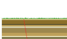
Block mountains
[edit]
When a fault block is raised or tilted, a block mountain can result.[17] Higher blocks are called horsts, and troughs are called grabens. A spreading apart of the surface causes tensional forces. When the tensional forces are strong enough to cause a plate to split apart, it does so such that a center block drops down relative to its flanking blocks.
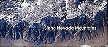
An example is the Sierra Nevada range, where delamination created a block 650 km long and 80 km wide that consists of many individual portions tipped gently west, with east facing slips rising abruptly to produce the highest mountain front in the continental United States.[18][19]
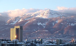
Another example is the Rila–Rhodope massif in Bulgaria, including the well defined horsts of Belasitsa (linear horst), Rila mountain (vaulted domed shaped horst) and Pirin mountain—a horst forming a massive anticline situated between the complex graben valleys of the Struma and Mesta rivers.[20][21][22]
Uplifted passive margins
[edit]Unlike orogenic mountains there is no widely accepted geophysical model that explains elevated passive continental margins such as the Scandinavian Mountains, eastern Greenland, the Brazilian Highlands, or Australia's Great Dividing Range.[23][24]Different elevated passive continental margins most likely share the same mechanism of uplift. This mechanism is possibly related to far-field stresses in Earth's lithosphere. According to this view elevated passive margins can be likened to giant anticlinal lithospheric folds, where folding is caused by horizontal compression acting on a thin to thick crust transition zone (as are all passive margins).[25][26]
Models
[edit]Hotspot volcanoes
[edit]Hotspots are supplied by a magma source in the Earth's mantle called a mantle plume. Although originally attributed to a melting of subducted oceanic crust, recent evidence belies this connection.[27] The mechanism for plume formation remains a research topic.
Fault blocks
[edit]Several movements of the Earth's crust that lead to mountains are associated with faults. These movements actually are amenable to analysis that can predict, for example, the height of a raised block and the width of an intervening rift between blocks using the rheology of the layers and the forces of isostasy. Early bent plate models predicting fractures and fault movements have evolved into today's kinematic and flexural models.[28][29]
See also
[edit]- 3D fold evolution
- Continental collision – Phenomenon in which mountains can be produced on the boundaries of converging tectonic plates
- Cycle of erosion – Model of geographic landscape evolution
- Inselberg – Isolated, steep rock hill on relatively flat terrain
- Seamount – Mountain rising from the ocean seafloor that does not reach to the water's surface
References
[edit]- ^ Steven M. Stanley (2004). "Mountain building". Earth system history (2nd ed.). Macmillan. p. 207. ISBN 978-0-7167-3907-4.
- ^ Robert J. Twiss; Eldridge M. Moores (1992). "Plate tectonic models of orogenic core zones". Structural Geology (2nd ed.). Macmillan. p. 493. ISBN 978-0-7167-2252-6.
- ^ Ollier, Cliff; Pain, Colin (2000). The Origin of Mountains. Routledge. p. 1. ISBN 978-0-415-19890-5.
- ^ "Geosynclinal Theory". publish.illinois.edu. University of Illinois at Urbana-Champaign. Retrieved March 8, 2018.
The major mountain-building idea that was supported from the 19th century and into the 20th is the geosynclinal theory.
- ^ Kurt Stüwe (2007). "§4.5 Geomorphology". Geodynamics of the lithosphere: an introduction (2nd ed.). Springer. p. 178. ISBN 978-3-540-71236-7.
- ^ Andrew Goudie (2004). Encyclopedia of geomorphology; Volume 2. Routledge. p. 701. ISBN 978-0-415-32738-1.
- ^ NASA - Activity at Kliuchevskoi
- ^ Victor Schmidt; William Harbert (2003). Planet Earth and the New Geoscience (4th ed.). Kendall Hunt. pp. 46–47. ISBN 978-0-7872-9355-0.
- ^ Stephen D Butz (2004). "Chapter 8: Plate tectonics". Science of Earth Systems. Thompson/Delmar Learning. p. 136. ISBN 978-0-7668-3391-3.
- ^ John Gerrard (1990). "Types of volcano". Mountain environments: an examination of the physical geography of mountains. MIT Press. p. 194. ISBN 978-0-262-07128-4.
- ^ Robert Wayne Decker; Barbara Decker (2005). "Chapter 8: Hot spots". Volcanoes (4th ed.). Macmillan. p. 113 ff. ISBN 978-0-7167-8929-1.
- ^ Arthur Holmes; Donald Duff (2004). Holmes Principles of Physical Geology (4th ed.). Taylor & Francis. p. 209. ISBN 978-0-7487-4381-0.
- ^ Transactions of the American Society of Civil Engineers, Volume 39. American Society of Civil Engineers. 1898. p. 62.
- ^ James Shipman; Jerry D. Wilson; Aaron Todd (2007). "Minerals, rocks and volcanoes". An Introduction to Physical Science (12th ed.). Cengage Learning. p. 650. ISBN 978-0-618-93596-3.
- ^ Michael P Searle (2007). "Diagnostic features and processes in the construction and evolution of Oman-, Zagros-, Himalayan-, Karakoram-, and Tibetan type orogenic belts". In Robert D Hatcher Jr.; MP Carlson; JH McBride & JR Martinez Catalán (eds.). 4-D framework of continental crust. Geological Society of America. p. 41 ff. ISBN 978-0-8137-1200-0.
- ^ Chris C. Park (2001). "Figure 6.11". The environment: principles and applications (2nd ed.). Routledge. p. 160. ISBN 9780415217705.
- ^ Scott Ryan (2006). "Figure 13-1". CliffsQuickReview Earth Science. Wiley. ISBN 978-0-471-78937-6.
- ^ John Gerrard (1990-04-12). Reference cited. p. 9. ISBN 978-0-262-07128-4.
- ^ Lee, C.-T.; Yin, Q; Rudnick, RL; Chesley, JT; Jacobsen, SB (2000). "Osmium Isotopic Evidence for Mesozoic Removal of Lithospheric Mantle Beneath the Sierra Nevada, California" (PDF). Science. 289 (5486): 1912–6. Bibcode:2000Sci...289.1912L. doi:10.1126/science.289.5486.1912. PMID 10988067. Archived from the original (PDF) on 2011-06-15.
- ^ Мичев (Michev), Николай (Nikolay); Михайлов (Mihaylov), Цветко (Tsvetko); Вапцаров (Vaptsarov), Иван (Ivan); Кираджиев (Kiradzhiev), Светлин (Svetlin) (1980). Географски речник на България [Geographic Dictionary of Bulgaria] (in Bulgarian). Sofia: Наука и култура (Nauka i kultura). p. 368.
- ^ Димитрова (Dimitrova), Людмила (Lyudmila) (2004). Национален парк "Пирин". План за управление [Pirin National Park. Management Plan] (in Bulgarian). и колектив. Sofia: Ministry of Environment and Water, Bulgarian Foundation "Biodiversity". p. 53.
- ^ Дончев (Дончев), Дончо (Дончо); Каракашев, Христо (2004). Темы физической и социально-экономической географии Болгарии [ Темы по физической и социально-экономической географии Болгарии ] (на болгарском языке). София: Сиела. стр. 128–129. ISBN 954-649-717-7 .
- ^ Боноу, Йохан М. (2009). «Атлантические прибрежные горы и высокогорья – старые или молодые?» (PDF) . www.geografitorget.se (на шведском языке). Национальная ассоциация учителей географии.
- ^ Грин, Пол Ф.; Лидмар-Бергстрем, Карна ; Япсен, Питер; Боноу, Йохан М.; Чалмерс, Джеймс А. (2013). «Стратиграфический ландшафтный анализ, термохронология и эпизодическое развитие возвышенных пассивных континентальных окраин» . Бюллетень Геологической службы Дании и Гренландии . 30:18 . дои : 10.34194/geusb.v30.4673 .
- ^ Япсен, Питер; Чалмерс, Джеймс А.; Грин, Пол Ф.; Боноу, Йохан М. (2012). «Поднятые, пассивные континентальные окраины: не плечи разломов, а проявления эпизодических пострифтовых захоронений и эксгумации». Глобальные и планетарные изменения . 90–91: 73–86. Бибкод : 2012GPC....90...73J . дои : 10.1016/j.gloplacha.2011.05.004 .
- ^ Лёсет и Хендриксен 2005 г.
- ^ Ю Ню и МДж О'Хара (2004). «Глава 7: Мантийные плюмы НЕ происходят из древней океанической коры» . У Роджера Хекиняна; Питер Стофферс и Жан-Луи Шемини (ред.). Океанические горячие точки: внутриплитный подводный магматизм и тектонизм . Спрингер. п. 239 и далее . ISBN 978-3-540-40859-8 .
- ^ АБ Уоттс (2001). «§7.2 Тектоника растяжения и рифтогенез» . Изостазия и изгиб литосферы . Издательство Кембриджского университета. п. 295. ИСБН 978-0-521-00600-2 .
- ^ Дж. Д. Карнер и Н. В. Дрисколл (1999). «Стиль, время и распределение тектонических деформаций на плато Эксмут, северо-запад Австралии, определенные на основе пластовой архитектуры и количественного моделирования бассейна» . В Коналле Мак Ниокейле и Поле Десмонде Райане (ред.). Континентальная тектоника . Геологическое общество. п. 280. ИСБН 978-1-86239-051-5 .
