Облачная формация

| Облачная формация | |
|---|---|
| Стратиграфический диапазон : арминский - кунгурийский Обычно Артинский ~ | |
| Тип | Геологическое образование |
| Единица | Группа "ECCA" |
| Лежит в основе | Гай-как формация |
| Совпадения | Подвал |
| Область | От Атлантического побережья до Твиффилфонтейна |
| Толщина | 75–190 м (246–623 футов) |
| Литология | |
| Начальный | Сланец , известняк |
| Другой | Песчаник , конгломерат , строматолит , уголь |
| Расположение | |
| Location | Damaraland |
| Coordinates | 21°12′S 14°06′E / 21.2°S 14.1°E |
| Approximate paleocoordinates | 51°00′S 30°30′W / 51.0°S 30.5°W |
| Region | Kunene & Erongo Regions |
| Country | |
| Extent | Huab Basin |
| Type section | |
| Named for | Huab River |
 Geologic map of Namibia with the Huab Formation partly cropping out in the northwestern area (orange) | |

- Формирование Huab это ранняя пермская ( арминская и кунгурская ) геологическая формация, коррелирующая с группой ECCA и обозначенной группой «ECCA», потому что она не принадлежит Кару , в юго -западном регионе Кунене и северном регионе Эронго Северо -Западной Намибии . Формирование Huab представляет собой самую старую осадочную единицу бассейна Хуаба , заканчивая подвалом . Нефтяные сланцы в рамках формирования были отложены в мелкой озерной среде , а формация отмечает переход от наземных отложений в ледниковых климатических обстоятельствах к более теплой речной и морской дельтовой среде.
Формирование Huab коррелирует с серией образований в Пелотас и бассейнах Парана на юго-востоке Бразилии, внесенных в более крупную базитурную зону, за 150 миллионов лет до распада Пангеи . Обилие глоссоптерисов и окаменелостей мезозавра являются характерными для корреляции Гондванан в современной Южной Америке, Африке, Антарктиде и Австралии.
Description
[edit]The Huab Formation is a lithological unit with an approximate maximum thickness of 190 metres (620 ft), deposited in the eponymous basin where it underlies the Gai-As Formation, separated by a significant hiatus,[1] and overlies the basement.[2] The formation crops out south of the Huab River,[3] extending from the Atlantic coast to Twyfelfontein. The thickness in the coastal area is about 75 metres (246 ft).[4]
Lithologies
[edit]Part of the formation in the west is composed of carbonates (domal stromatolites with an east to west orientation and thin laminae of less than 1 millimetre (0.039 in)). The stromatolites occur in a 35 kilometres (22 mi) wide zone, reaching from 3 kilometres (1.9 mi) east of the Uniab Fault to 2 kilometres (1.2 mi) east of the Bergsig Fault system.[5] The eastward sections comprise oolitic conglomeratic horizons of up to 50 centimetres (1.6 ft) thick. The carbonates (mudstones and marls) are overlain by silty, partly calcareous shales. The shales interfinger with sandstones and in certain parts coal beds are found. In the eastern domain around the Doros crater, dark iron-oxide cements occur in the upper conglomerate horizons.[5] In virtually all lithological units, bones of the amphibious reptile Mesosaurus tenuidens can be encountered in concretions.[6] The laminated mudstones and marls contain a diverse ichnofauna including Skolithos, Planolites, and large exemplars of Rhizocorallium irregulare.[7]
Depositional environments
[edit]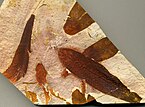

The depositional environment is interpreted as ranging from glacial (tillite) at the very base,[2] followed by a glacio-fluvial setting, and a warmer climate fluvial environment.[8] The sequence higher up is formed by a fan deltaic setting,[9] with a lateral shallow lake with increased salinity where stromatolite bioherms were formed.[6][10][11] The uppermost section of the Huab Formation, underlying the Gai-As Formation, was deposited in an estuarine environment.[12]
The depositional environments have been described in detail by Wanke in 2000 as follows:[13]
- Western and central domain
Stromatolitic bioherms acted as a barrier towards the open sea in the west. Their preferred E-W orientation coincides with tidal- and wave induced currents perpendicular to the palaeo-coastline. Lagoonal environments were established landwards of the bioherm belts, in which laminated shales developed. The lamination is due to suspension fallout in slightly agitated water. Erosive based interbeds of coarse to gritty sandstones formed during storm events and are therefore interpreted as tempestites. West of the bioherm belts, the fair weather wave basis reached the ground, expressed in oscillation-rippled surfaces.
Channels between bioherm ridges have been interpreted as tidal channels. They host flat-pebble conglomerates, which are characterized by a high ooid content. These ooid bearing flat-pebble conglomerates support the facies concept of shallow, wave dominated water in the vicinity of the bioherms: Ooids form in very shallow, fairly agitated, carbonate saturated water probably under warm climate. The flat pebbles derived from desiccated layers of unlithified cohesive fine clastics that had been reworked, preferentially under the influence of storm waves. Tidal flats or lagoons provide the conditions for the generation of both, ooids and flat-pebble conglomerates.
- Eastern domain

Shales and mudstones besides algal laminites represent deposition in a slightly agitated, shallow water body with relatively intensive carbonate production. Oscillating water-levels resulted in the formation of paleosols, which were reworked in flat pebble conglomerates after flooding. Autochthonous breccias give clear evidence for frequent sea level fluctuations, that refer to palustrine soils, which underwent periodically subaerial exposure. Coarse sandstones, partly channelized, reveal fluvial influence. The coarser material was probably sourced by a nearby delta that was temporarily flooded during storm events. The dominance of those coarse sandstones towards the top of the eastern flat-pebble facies association might indicate delta progradation. The iron-oxide cements are interpreted as ferricretes, that either formed autochthonous or derived from adjacent reworked ferricrete crusts. An early uplift of the eastern hinterland might be indicated by coarse, westwardly prograding deltaic deposits of the upper Huab Formation in the eastern Huab area.[14]
Correlations
[edit]The upper part of the formation is correlated with the Irati Formation of the Paraná and Pelotas Basins in Rio Grande do Sul, Brazil, and with the Whitehill Formation in the Karoo Basin of southern Namibia and the Eastern, Northern and Western Cape, South Africa.[6] The lower section correlates with the Palermo and Rio Bonito Formations of the Paraná Basin and the Prince Albert Formation of the Karoo.[15] The Permian sequence in the Huab Basin is much thinner than those of the Paraná and Karoo Basins.[16] The fossil assemblages of Glossopteris and Mesosaurus are known from other parts of Gondwana; the Vryheid Formation of South Africa and coal deposits of the Lower Permian in Australia.[8]
See also
[edit]- List of fossiliferous stratigraphic units in Namibia
- Geology of Namibia
- Ganigobis Formation
- Gondwanide orogeny
References
[edit]- ^ Wanke, 2000, p.25
- ^ Jump up to: a b Horsthemke et al, 1990, p.68
- ^ Duncan et al., 1989, p.5
- ^ Wanke, 2000, p.20
- ^ Jump up to: a b Wanke, 2000, p.21
- ^ Jump up to: a b c Section 2, Cycle 2, Unit 5 at Fossilworks.org
- ^ Wanke, 2000, p.23
- ^ Jump up to: a b Horsthemke et al., 1990, p.69
- ^ Horsthemke et al., 1990, p.70
- ^ Horsthemke et al., 1990, p.72
- ^ Stromatolitic bioherm of the Huab Formation
- ^ Horsthemke et al., 1990, p.73
- ^ Wanke, 2000, pp.22–23
- ^ Wanke, 2000, p.38
- ^ Horsthemke et al., 1990, p.74
- ^ Holzförster et al., 2000, p.255
Bibliography
[edit]- Дункан, Ар; Ньютон, SR; Ван ден Берг, C.; Рейд, Д.Л. (1989), «Геохимия и петрология долеритовых подоконников в долине реки Хуаб, Дамараленд, северо-западную Намибию» (PDF) , Связь Геологической службы Намибии , 5 : 5: 18 , получено 2018-08-08 26
- Хольцфёрстер, Фрэнк; Столлхофен, Харальд; Stanistreet, Ian G. (2000), «Ранние пермские месторождения в районе Huab Namibia: континентальный к морскому переходу» (PDF) , Связь Геологической службы Намибии , 12 : 247–257 , извлечен 2018-08-26
- Horthemke, E.; Ledendecker, S.; Porada, H. (1990), «Осадочная среда и стратиграфическая корреляция последовательности кару в северо-западе Дамараланда» (PDF) , связь геологической обследования Намибии , 6 : 67–77 , извлеченные 2018-08-26
- Wanke, Angsar (2000), Plan-Etendeka несоответствия в северо-западе Намибии и их тектонические последствия (PDF) , Юлиус-максимилианцы-универсальные Вурцбург , стр. 1–114 , получен 2018-08-2
- Геологические образования Намибии
- Пермская система Африки
- Артинская сцена
- Кунгуриан
- Сланцевые образования
- Нефтяные сланцы
- Формирования песчаника
- НАЗНАЧЕНИЕ ФОРМАЦИИ
- Угольные формирования
- Уголь в Намибии
- Дельтовые месторождения
- Речные отложения
- Ледяные отложения
- Озерные месторождения
- Пермский южный палеотемперационный отложения
- Палеонтология в Намибии
- География региона Эронго
- География региона Кунена