Ringebu
Ringebu Municipality
Ringebu kommune | |
|---|---|
 | |
|
| |
 Innlandet within Norway | |
 Ringebu within Innlandet | |
| Coordinates: 61°32′8″N 10°18′29″E / 61.53556°N 10.30806°E | |
| Country | Norway |
| County | Innlandet |
| District | Gudbrandsdal |
| Established | 1 Jan 1838 |
| • Created as | Formannskapsdistrikt |
| Administrative centre | Vålebru |
| Government | |
| • Mayor (2015) | Arne Fossmo (Ap) |
| Area | |
| • Total | 1,247.58 km2 (481.69 sq mi) |
| • Land | 1,221.33 km2 (471.56 sq mi) |
| • Water | 26.25 km2 (10.14 sq mi) 2.1% |
| • Rank | #85 in Norway |
| Population (2023) | |
| • Total | 4,416 |
| • Rank | #195 in Norway |
| • Density | 3.6/km2 (9/sq mi) |
| • Change (10 years) | |
| Demonym | Ringbygging[1] |
| Official language | |
| • Norwegian form | Neutral |
| Time zone | UTC+01:00 (CET) |
| • Summer (DST) | UTC+02:00 (CEST) |
| ISO 3166 code | NO-3439[3] |
| Website | Official website |
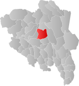
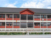
is a municipality in Innlandet county, Norway. It is located in the traditional district of Gudbrandsdal. The administrative centre of the municipality is the village of Vålebru (the village is also known as Ringebu).
The 1,248-square-kilometre (482 sq mi) municipality is the 85th largest by area out of the 356 municipalities in Norway. Ringebu is the 195th most populous municipality in Norway with a population of 4,416. The municipality's population density is 3.6 inhabitants per square kilometre (9.3/sq mi) and its population has decreased by 1.8% over the previous 10-year period.[4][5]
General information
[edit]The prestegjeld of Ringebu was established as a municipality on 1 January 1838 (see formannskapsdistrikt law). In 1864, the northern part of Ringebu (population: 386) was separated to become the new municipality of Sollia. (In 1890, Sollia switched from Oppland county to Hedmark county.) On 1 January 1899, an unpopulated part of Ringebu (in Oppland county) was transferred to the neighboring municipality of Sollia (in Hedmark county).[6]
Name
[edit]The municipality (originally the parish) is named after the old Ringebu farm (Old Norse: Ringabú or Hringabú) since the old Ringebu Stave Church was built there. The first element was probably derived from the word ringr which means "ring" (but in what context is unknown). The last element is bú which means "farm", "estate", or "rural area".[7]
Coat of arms
[edit]The coat of arms was granted on 24 April 1992. The official blazon is "Gules, a three-tongued flame Or" (Norwegian: I rødt en oppvoksende tretunget gull flamme). This means the arms have a red field (background) and the charge is a three-tongued flame of fire. The charge has a tincture of Or which means it is commonly colored yellow, but if it is made out of metal, then gold is used. This represents the municipality's three valleys and three parishes: Ringebu, Fåvang, and Venabygd. Fire was chosen to represent the need for heat and light by all people. The arms were designed by Inge Rotevatn. The municipal flag has the same design as the coat of arms.[8][9][10][11]
Churches
[edit]The Church of Norway has three parishes (sokn) within the municipality of Ringebu. It is part of the Sør-Gudbrandsdal prosti (deanery) in the Diocese of Hamar.
| Parish (sokn) | Church name | Location of the church | Year built |
|---|---|---|---|
| Fåvang | Fåvang Stave Church | Fåvang | 1630 |
| Fåvangfjellet Chapel | Gulhaugsætra | 1974 | |
| Ringebu | Ringebu Stave Church | Vålebru | c. 1220 |
| Venabygd | Venabygd Church | Venabygd | 1780 |
| Venabygd Chapel | Venabu | 1979 |
History
[edit]| Ancestry | Number |
|---|---|
| 109 | |
| 41 | |
| 38 | |
| 38 | |
| 29 |

The stave church at Ringebu was built around the year 1220 and it is one of fewer than 30 surviving stave churches in Norway and is one of the largest.
About 15 kilometres (9.3 mi) north of the church lies the old Hundorp farm which is the legendary home of Dale-Gudbrand. Dale-Gudbrand is mentioned in the Heimskringla (English: The Chronicle of the Kings of Norway) by Snorri Sturluson. The account of King Olaf's (A.D. 1015-1021) conversion of Dale-Gudbrand to Christianity is popularly recognized.
Geography
[edit]
Ringebu is bordered to the west by Sør-Fron municipality, to the southwest by Gausdal municipality, to the southeast by Øyer municipality, and to the east and north by Stor-Elvdal municipality.
The administrative center of Ringebu municipality is the village of Vålebru which is located at an elevation of 182 metres (597 ft) above sea level in the valley along the river Gudbrandsdalslågen, but 50% of the area within the municipal borders lies at an elevation greater than 900 metres (3,000 ft) above sea level. From Ringebu, two mountain passes provide road access into the Østerdal valley to the northeast; one of these is closed during the winter. Because these mountain areas reliably provide good snow conditions, the area is a popular tourist destination. The Kvitfjell ski area in Ringebu was expanded to serve as a downhill venue for the 1994 Winter Olympics.
Government
[edit]Ringebu Municipality is responsible for primary education (through 10th grade), outpatient health services, senior citizen services, welfare and other social services, zoning, economic development, and municipal roads and utilities. The municipality is governed by a municipal council of directly elected representatives. The mayor is indirectly elected by a vote of the municipal council.[13] The municipality is under the jurisdiction of the Vestre Innlandet District Court and the Eidsivating Court of Appeal.
Municipal council
[edit]The municipal council (Kommunestyre) of Ringebu is made up of 21 representatives that are elected to four year terms. The tables below show the current and historical composition of the council by political party.
| Party name (in Norwegian) | Number of representatives | |
|---|---|---|
| Labour Party (Arbeiderpartiet) | 12 | |
| Green Party (Miljøpartiet De Grønne) | 1 | |
| Conservative Party (Høyre) | 1 | |
| Centre Party (Senterpartiet) | 6 | |
| Cross-party list (Tverrpolitisk liste) | 3 | |
| Total number of members: | 21 | |
Mayors
[edit]The mayors (Norwegian: ordfører) of Ringebu:
- 1838–1853: Vilhelm Fegth
- 1854–1871: Nils Iversen Elstad
- 1872–1873: Nils Johannessen Jevne
- 1874–1877: John Kristiansen Mæhlum
- 1878–1881: Ole Christian Elstad
- 1882–1883: Nils Iversen Elstad
- 1884–1893: Ole Christian Elstad (H)
- 1894–1897: Simen Kolstad (V)
- 1898-1899: Ole Christian Elstad (H)
- 1899–1910: Simen Kolstad (AD)
- 1911–1913: Jon Nordrum (H)
- 1914–1925: Simen Kolstad (AD)
- 1926–1928: Einar Vestad (Sp)
- 1929–1934: Johan Hustveit (AD)
- 1935–1937: Einar Vestad (Sp)
- 1938–1941: Johan Hustveit (AD)
- 1942–1945: Sigurd Mytting (NS)
- 1945–1959: Asbjørn Haug (Ap)
- 1960–1967: Ole Ringen (V)
- 1968–1985: Birger Sæther (Ap)
- 1985–1995: Erik S. Winther (Ap)
- 1996–2007: Anders A. Fretheim (Sp)
- 2007–2011: Arnhild Baukhol (Ap)
- 2011–2015: Erik Odlo (Sp)
- 2015–present: Arne Fossmo (Ap)
Sister cities
[edit]Ringebu has sister city agreements with the following places:[35]

Notable people
[edit]- Frederik Petersen (1759 in Ringebu – 1825), a Norwegian painter of portraits
- Jehans Nordbu (1768 in Ringebu — ca.1860), a Norwegian-American immigrant to the USA and an early settler in Texas
- Hans Engen (1912 in Ringebu – 1966), a Norwegian journalist, diplomat and politician, Norwegian ambassador to the United States from 1963 to 1966
- Emil Nyeng (born 1991), a Norwegian cross-country skier
References
[edit]- ^ "Navn på steder og personer: Innbyggjarnamn" (in Norwegian). Språkrådet.
- ^ "Forskrift om målvedtak i kommunar og fylkeskommunar" (in Norwegian). Lovdata.no.
- ^ Bolstad, Erik; Thorsnæs, Geir, eds. (26 January 2023). "Kommunenummer". Store norske leksikon (in Norwegian). Kunnskapsforlaget.
- ^ Statistisk sentralbyrå (2021). "Table: 06913: Population 1 January and population changes during the calendar year (M)" (in Norwegian).
- ^ Statistisk sentralbyrå (2021). "09280: Area of land and fresh water (km²) (M)" (in Norwegian).
- ^ Jukvam, Dag (1999). "Historisk oversikt over endringer i kommune- og fylkesinndelingen" (PDF) (in Norwegian). Statistisk sentralbyrå. ISBN 9788253746845.
- ^ Rygh, Oluf (1900). Norske gaardnavne: Kristians amt (in Norwegian) (4 ed.). Kristiania, Norge: W. C. Fabritius & sønners bogtrikkeri. p. 137.
- ^ "Civic heraldry of Norway - Norske Kommunevåpen". Heraldry of the World. Retrieved 17 April 2023.
- ^ "Ringebu, Oppland (Norway)". Flags of the World. Retrieved 17 April 2023.
- ^ "Godkjenning av våpen og flagg". Lovdata.no (in Norwegian). Norges kommunal- og arbeidsdepartementet. 24 April 1992. Retrieved 17 April 2023.
- ^ "Ringebu kommune, våpen". Digitalarkivet (in Norwegian). Retrieved 17 April 2023.
- ^ "Immigrants and Norwegian-born to immigrant parents, by immigration category, country background and percentages of the population". ssb.no. Archived from the original on 2 July 2015. Retrieved 29 June 2015.
- ^ Hansen, Tore; Vabo, Signy Irene, eds. (20 September 2022). "kommunestyre". Store norske leksikon (in Norwegian). Kunnskapsforlaget. Retrieved 14 October 2022.
- ^ "Kommunestyrevalg 2023 - Innlandet". Valgdirektoratet. Retrieved 12 January 2024.
- ^ "Kommunestyrevalg 2019 - Innlandet". Valgdirektoratet. Retrieved 16 June 2022.
- ^ "Kommunestyrevalg 2015 - Oppland". Valgdirektoratet.
- ^ Jump up to: a b c d "Table: 04813: Members of the local councils, by party/electoral list at the Municipal Council election (M)" (in Norwegian). Statistics Norway.
- ^ "Kommunestyrevalg 2011 - Oppland". Valgdirektoratet.
- ^ Kommunestyrevalget 1999 (PDF) (in Norwegian). Oslo-Kongsvinger, Norge: Statistisk sentralbyrå. 2000. ISBN 8253748531. ISSN 0332-8023.
- ^ Kommunestyrevalget 1995 (PDF) (in Norwegian). Oslo-Kongsvinger, Norge: Statistisk sentralbyrå. 1996. ISBN 8253743351. ISSN 0332-8023.
- ^ Kommunestyrevalget 1991 (PDF) (in Norwegian). Oslo-Kongsvinger, Norge: Statistisk sentralbyrå. 1993. ISBN 8253737939. ISSN 0332-8023.
- ^ Kommunestyrevalget 1987 (PDF) (in Norwegian). Oslo-Kongsvinger, Norge: Statistisk sentralbyrå. 1988. ISBN 8253726325. ISSN 0332-8023.
- ^ Kommunestyrevalget 1983 (PDF) (in Norwegian). Oslo-Kongsvinger, Norge: Statistisk sentralbyrå. 1984. ISBN 8253720378. ISSN 0332-8023.
- ^ Kommunestyrevalget 1979 (PDF) (in Norwegian). Oslo, Norge: Statistisk sentralbyrå. 1979. ISBN 8253710836. ISSN 0332-8023.
- ^ Kommunevalgene 1975 (PDF) (in Norwegian). Oslo, Norge: Statistisk sentralbyrå. 1977. ISBN 8253705646.
- ^ Kommunevalgene 1972 (PDF) (in Norwegian). Vol. I. Oslo, Norge: Statistisk sentralbyrå. 1973. ISBN 8253701144.
- ^ "Kommunevalgene 1967" (PDF) (in Norwegian). Oslo, Norge: Statistisk sentralbyrå. 1967.
- ^ "Kommunevalgene 1963" (PDF) (in Norwegian). Oslo, Norge: Statistisk sentralbyrå. 1964.
- ^ "Kommunevalgene og Ordførervalgene 1959" (PDF) (in Norwegian). Oslo, Norge: Statistisk sentralbyrå. 1960.
- ^ "Kommunevalgene og Ordførervalgene 1955" (PDF) (in Norwegian). Oslo, Norge: Statistisk sentralbyrå. 1957.
- ^ "Kommunevalgene og Ordførervalgene 1951" (PDF) (in Norwegian). Oslo: Statistisk sentralbyrå. 1952.
- ^ "Kommunevalgene og Ordførervalgene 1947" (PDF) (in Norwegian). Oslo: Statistisk sentralbyrå. 1948.
- ^ "Kommunevalgene og Ordførervalgene 1945" (PDF) (in Norwegian). Oslo: Statistisk sentralbyrå. 1947.
- ^ "Kommunevalgene og Ordførervalgene 1937" (PDF) (in Norwegian). Oslo: Statistisk sentralbyrå. 1938.
- ^ "Våra vänorter" (in Swedish). Filipstad kommun. Archived from the original on 1 August 2012. Retrieved 4 January 2009.
External links
[edit]- Municipal fact sheet from Statistics Norway (in Norwegian)
 Oppland travel guide from Wikivoyage
 Gudbrandsdalen travel guide from Wikivoyage
 Kvitfjell travel guide from Wikivoyage
- Frya Leir Motel


