Мартон сперма Графтон

| Мартон сперма Графтон | |
|---|---|
| Гражданский приход | |
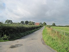 Фермерская дорога в Пристакар Лодж Ферма | |
 Мартон сперма Графтон Location within North Yorkshire | |
| Population | 510 (2015)[1] |
| OS grid reference | SE416633 |
| Unitary authority | |
| Ceremonial county | |
| Region | |
| Country | England |
| Sovereign state | United Kingdom |
| Post town | YORK |
| Postcode district | YO51 |
| Police | North Yorkshire |
| Fire | North Yorkshire |
| Ambulance | Yorkshire |
| UK Parliament | |
Мартон Керн Графтон - гражданский приход в районе Харрогит из Северного Йоркшира , Англия. В приходе есть только два поселения ( Мартон и Графтон ), и имеет магнезийский известняк и география песчаника, которая использовалась для карьера. Рельеф в целом плоская, хотя есть несколько небольших холмов, а Мартон и Графтон разделяют на 98 футов (30 м), несмотря на то, что составляют всего 0,5 мили (0,8 км) друг от друга.
История
[ редактировать ]Археологические данные показывают, что к югу от Графтона был форт железного века . Тем не менее, карьер и установка выделения и современных структур привели к тому, что сайт разместился в качестве древнего памятника. [ 2 ] [ 3 ] В 1835 году население было 482, [ 4 ] который поднялся до 499 к 1851 году. [ 5 ] Однако к 1901 году население было на 299 человек, и к 1911 году набрал 50 человек. [ 6 ] В переписи 2001 года в приходе было население 516, которое упало до 503 к переписи 2011 года. [ 7 ] [ 8 ] В 2015 году, Совет графства Северного Йоркшира , оценил население прихода 510. [ 1 ] In 1872, the parish covered an area of 1,198 acres (485 ha), and in 1901, covered 2,167 acres (877 ha), but at the 2011 Census, it was 2,470 acres (998 hectares).[9][8]
The parish is connected to York and Boroughbridge by bus.[10] The modern parish has the B6265, Boroughbridge to Kirk Hammerton road in the east (the route of Dere Street), and the western border is the A168 road, adjacent to the A1(M) (the old Great North Road).[11][12]
The two settlements of Grafton and Marton are contiguous, and since 1979, they have been formed into one conservation area.[13] Besides agriculture, the other major source of employment in the area has been quarrying, with gravel pits still in evidence across the parish.[3] The former Allerton Park Quarry, now the Allerton waste recovery park, was historically in the township of Marton.[14] The geology of the parish is largely of a magnesian limestone ridge, with Sherwood sandstone to the east of the ridge. The earth has been described as being "slightly acid loamy, and clayey soils, with impeded drainage."[15] The land is capped with sands and gravels, which has led to large-scale quarries in the parish.[16] The land is fairly flat given over to agriculture, but the parish has some hills; despite being only 0.5 miles (0.8 km) apart, Grafton is 125 feet (38 m) above sea level, whereas Marton is 202 feet (61.7 m).[17][18][19][20]

The original church in the parish was located some 0.5 miles (0.8 km) south of the village of Marton.[21] It was built in the 12th century and repaired after being sacked by the Scottish in 1318. It again fell into disrepair (c. 1540), until being rebuilt in 17th and 18th centuries. It was given after the Dissolution to St John's College in Cambridge, and its dedication was unknown, but after 1692, it is thought to have been the Church of St John after is benefactors, in the College of St John.[22][23][24] Until it closed, the church was a prebendal peculier in the Deanery of Boroughbridge and the Diocese of Chester.[25][26] In 1876, a new church, with a dedication of Christ Church, was built with stones from the former ruined church; Pevsner states the doorway re-erected inside the church is Norman.[27] This structure is now grade II listed.[28]
For a survey of burials in the churchyard see 'External Links' below.
| 1801 | 1811 | 1821 | 1831 | 1841 | 1851 | 1861 | 1871 | 1881 | 1891 | 1901 | 1911 | 1921 | 1931 | 1951 | 1961 | 2001 | 2011 | 2015 |
|---|---|---|---|---|---|---|---|---|---|---|---|---|---|---|---|---|---|---|
| 393[29] | 384[29] | 464[29] | 482[29] | 514[29] | 472[29] | 454[29] | 424[29] | 365[29] | 320[29] | 298[29] | 349[30] | 361[30] | 321[30] | 362[30] | 344[30] | 516[7] | 503[8] | 510[1] |
Governance
[edit]Historically, the ecclesiastical parish was known as Marton-in-Burghshire (or Marton-in-Burgheshire).[31] Sometimes the parish name is spelled with hypens (Marton-cum-Grafton).[32][33] The parish was formerly in the Great Ouseburn Rural District, in the wapentake of Claro, in the West Riding of Yorkshire; but since the 1974 boundary changes, it has been in North Yorkshire.[34][35][36] It is in the Harrogate and Knaresborough Constituency.[37]
Notable people
[edit]- David Bairstow, cricketer and footballer, lived in the parish[38]
References
[edit]- ^ Jump up to: a b c "2015 Population Estimates Parishes" (PDF). northyorks.gov.uk. December 2016. p. 13. Archived from the original (PDF) on 4 June 2022. Retrieved 20 May 2022.
- ^ Alison Clarke, Archaeological Consultant (1993). "Grafton Hills Iron Age Hillfort, Marton cum Grafton, North Yorkshire". Alison Clarke, Archaeological Consultant Unpublished Report Series: 2. doi:10.5284/1036897.
- ^ Jump up to: a b MCG 2011, p. 3.
- ^ Liber Ecclesiasticus. An authentic statement of the revenues of the Established Church compiled from the report of the Commissioners appointed to inquire into the Revenues and Patronage of the established Church in England and Wales. London: Hamilton, Adams & Co. 1835. p. 134. OCLC 1064949647.
- ^ Yorkshire returns of the 1851 census of religious worship. York: University of York, Borthwick Institute of Historical Research. 2000. p. 57. ISBN 1904497101.
- ^ Census of England and Wales, 1911 : (10 Edward 7 and 1 George 5, ch. 27): Administrative Areas. London: HMSO. 1912. p. 389. OCLC 40808794.
- ^ Jump up to: a b UK Census (2001). "Local Area Report – Marton cum Grafton Parish (36UD083)". Nomis. Office for National Statistics. Retrieved 8 August 2022.
- ^ Jump up to: a b c UK Census (2011). "Local Area Report – Marton cum Grafton Parish (E04007385)". Nomis. Office for National Statistics. Retrieved 7 August 2022.
- ^ "Marton-cum-Grafton". visionofbritain.org.uk. Retrieved 7 August 2022.
- ^ "Bus services in York Marton cum Grafton Map" (PDF). getdown.org.uk. Retrieved 20 May 2022.
- ^ "Magic Map Application Marton cum Grafton and surrounding area". magic.defra.gov.uk. Retrieved 26 May 2022.
Zoom out and click on "Administrative Geographies" and "Parishes" to active layer with parish boundaries
- ^ MCG 2011, p. 4.
- ^ MCG 2011, p. 1.
- ^ Ross, S (2009). "Allerton Park Quarry, North Yorkshire: Post-Excavation Assessment Report". Northern Archaeological Associates Unpublished Report Series: 4. doi:10.5284/1029276.
- ^ Talbot, A (2018). "Land at Yew Tree Farm, Marton cum Grafton". Solstice Heritage Report Series: 6. doi:10.5284/1096193.
- ^ MCG 2011, p. 6.
- ^ "299" (Map). Ripon & Boroughbridge. 1:25,000. Explorer. Ordnance Survey. 2015. ISBN 978-0-319-24551-4.
- ^ "Grafton". getoutside.ordnancesurvey.co.uk. Retrieved 9 August 2022.
- ^ "Marton". getoutside.ordnancesurvey.co.uk. Retrieved 9 August 2022.
- ^ "Marton cum Grafton undulating farmland". harrogate.gov.uk. February 2004. Retrieved 9 August 2022.
- ^ "Marton cum Grafton". maps.nls.uk. Retrieved 8 August 2022.
- ^ Howard, Henry Fraser (2010) [1935]. Account of the Finances of the College of St John the Evangelist in the University of Cambridge 1511-1926. Cambridge: Cambridge University Press. p. 117. ISBN 978-1108012225.
- ^ Whellan, T (1871). History and Topography of the Wapentake of Claro. Beverley: Longman Green. p. 295. OCLC 504016489.
- ^ Kelly, E. R., ed. (1881). Kelly's Directory of West Riding of Yorkshire, 1881. [Part 2: Places L-Y]. London: Kelly & Co. p. 854. OCLC 1131686669.
- ^ "Genuki: Marton parish registers: Dates and current locations etc., Yorkshire (West Riding)". www.genuki.org.uk. Retrieved 8 August 2022.
- ^ Page, William, ed. (1907). The Victoria history of the county of York. vol 3. London: Constable & Co. p. 88. OCLC 500092527.
- ^ Pevsner, Nikolaus, Sir (2003) [1959]. Yorkshire The West Riding (2 ed.). London: Yale University Press. p. 362. ISBN 0-300-09662-3.
{{cite book}}: CS1 maint: multiple names: authors list (link) - ^ Historic England. "Christ Church (Grade II) (1174037)". National Heritage List for England. Retrieved 8 August 2022.
- ^ Jump up to: a b c d e f g h i j k Page, William, ed. (1907). The Victoria history of the county of York. vol 3. London: Constable & Co. p. 531. OCLC 500092527.
- ^ Jump up to: a b c d e "Administrative unit Marton Cum Grafton CP/AP Parish-level Unit". visionofbritain.org.uk. Retrieved 8 August 2022.
- ^ Reports and papers of the architectural and archaeological societies of the counties of Lincoln and Northampton. York: Yorkshire Architectural and York Archaeological Society. 1879. p. 236. OCLC 3896686.
- ^ "Marton-cum-Grafton: Christ Church". www.achurchnearyou.com. Retrieved 9 August 2022.
- ^ "Marton-cum-Grafton Village Design Statement". harrogate.gov.uk. Retrieved 9 August 2022.
- ^ "Descriptive Gazetteer Entry for OUSEBURN (Great)". visionofbritain.org.uk. Retrieved 7 August 2022.
- ^ Chrystal, Paul (2017). The Place Names of Yorkshire; Cities, Towns, Villages, Rivers and Dales, some Pubs too, in Praise of Yorkshire Ales (1 ed.). Catrine: Stenlake. p. 100. ISBN 9781840337532.
- ^ Гледхилл, Рэймонд (1 апреля 1974 г.). «Белые розовые галстуки держатся быстро, несмотря на ампутации и встряхивание границ». Время . № 59053. С. 31. ISSN 0140-0460 .
- ^ «Мартон сперма Графтон» . www.ordnancesurvey.co.uk . Получено 7 августа 2022 года .
- ^ "Дэвид Барстоу". Время . № 66092. 7 января 1998 г. с. 19. ISSN 0140-0460 .
Источники
[ редактировать ]- Marton Cum Grafton Conservation Area Оценка персонажа (PDF) . Harrogate.gov.uk (отчет). Харрогейт окружной совет. Ноябрь 2011 . Получено 7 августа 2022 года .