Бремангер

Бремангер муниципалитет
Бремангер муниципалитет | |
|---|---|
 Вид на район Гротро -Бич в Бреманжере | |
 Флаг | |
 Vestland within Norway | |
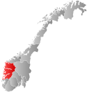
 Bremanger within Vestland | |
| Coordinates: 61°48′31″N 05°25′15″E / 61.80861°N 5.42083°E | |
| Country | Norway |
| County | Vestland |
| District | Nordfjord |
| Established | 1 Jan 1866 |
| • Preceded by | Kinn |
| Administrative centre | Svelgen |
| Government | |
| • Mayor (2019) | Anne Kristin Førde (Ap) |
| Area | |
| • Total | 833.13 km2 (321.67 sq mi) |
| • Land | 786.43 km2 (303.64 sq mi) |
| • Water | 46.69 km2 (18.03 sq mi) 5.6% |
| • Rank | #138 in Norway |
| Population (2023) | |
| • Total | 3,482 |
| • Rank | #215 in Norway |
| • Density | 4.4/km2 (11/sq mi) |
| • Change (10 years) | |
| Demonym | Bremangar[1] |
| Official language | |
| • Norwegian form | Nynorsk |
| Time zone | UTC+01:00 (CET) |
| • Summer (DST) | UTC+02:00 (CEST) |
| ISO 3166 code | NO-4648[3] |
| Website | Official website |

Bremanger - муниципалитет в Вестленд округе , Норвегия . Деревня Швелгена является административным центром муниципалитета. Другие деревни включают Bremanger , Berle , Davik , Isane , Kalvåg , Svelgen , Rugsund и Ålfoten . Bremanger - единственный муниципалитет в Вестленде, который расположен в двух районах. Северные и восточные части, входящие в деревни Олдэйд, Берл, Коврик, Давик, Исан и Алфотен, расположены в регионе Нордфьорд , в то время как деревни Бремангер, Калвог, Свгген, Соргулен и Ботнан находятся в регионе Суннфьорд . Политически муниципалитет работает с регионом Нордфьорда в Совете муниципалитетов Нордфьорда.
У Бремангера есть много туристических направлений , таких как Калвог, у которого есть одна из крупнейших и наиболее важных набережной в графстве, на пляже Гротролесандена Океана, гора Хорнлен , с самой высокой морской скалой в северной Европе, каменными резьбами в Вингене и Старые торговые станции Rugsund и Smørhavn. Туннель Bortne был завершен в 2013 году, чтобы более легко соединить внешние острова Бремангер с муниципальным центром Швелгена . Туннель мост коврика и и мост с ковриком соединяет острова с материком.
The 833-square-kilometre (322 sq mi) municipality is the 138th largest by area out of the 356 municipalities in Norway. Bremanger is the 215th most populous municipality in Norway with a population of 3,482. The municipality's population density is 4.4 inhabitants per square kilometre (11/sq mi) and its population has decreased by 11.7% over the previous 10-year period.[4][5]
General information
[edit]

The parish of Kinn was established as a municipality on 1 January 1838 (see formannskapsdistrikt law). The northern district of Kinn was established as the parish (prestegjeld) of Bremanger within the municipality of Kinn in 1864. On 1 January 1866, the parish of Bremanger was established as a separate municipality with a population of 1,852. The Bremanger parish was sub-divided into new sub-parishes in the early 1900s. Midtgulen sub-parish was created in 1903 and Bremangerpollen in 1908.[6]
During the 1960s, there were many municipal mergers across Norway due to the work of the Schei Committee. On 1 January 1964, the Husefest and Breivik farms were transferred from Bremanger to the neighboring municipality of Flora. On 1 January 1965, the neighboring municipality of Davik was dissolved and most of it was transferred to Bremanger. All of Davik south of the Nordfjorden and all the islands except Husevågøy, Grindøy, Gangsøy, and Risøy were merged into Bremanger. This added 1,567 residents to the population of Bremanger, bringing the new total to 5,600.[6][7]
On 1 January 2020, the municipality became part of the newly created Vestland county after Sogn og Fjordane and Hordaland counties were merged.
Name
[edit]The municipality (originally the parish) is named after the local Bremangerpollen fjord (Old Norse: Brimangr). The first element is brim which means "breaker wave" or "heavy sea". The last element is angr which means "bay" or "inlet".[8]
Coat of arms
[edit]The coat of arms was granted on 24 October 1986. The official blazon is "Quartered embowed azure and argent" (Norwegian: Firedelt av blått og sølv med virvelsnitt). This means the arms have are divided into four embowed waves. The field (background) alternates between the four waves. The top and bottom waves have a tincture of blue and the other two waves have a tincture of argent which means they are commonly colored white, but if the arms are made out of metal, then silver is used. The arms symbolize the sea and hydro-electric power, both of which are of great economic importance to the municipality. The arms were designed by Inge Rotevatn. The municipal flag has the same design as the coat of arms.[9][10][11]
Churches
[edit]The Church of Norway has seven parishes (sokn) within the municipality of Bremanger. It is part of the Nordfjord prosti (deanery) in the Diocese of Bjørgvin.
| Parish (sokn) | Church name | Location of the church | Year built |
|---|---|---|---|
| Berle | Berle Church | Berle | 1977 |
| Bremanger | Bremanger Church | Bremanger | 1914 |
| Davik | Davik Church | Davik | 1886 |
| Frøya | Frøya Church | Frøya | 1865 |
| Midtgulen | Midtgulen Church | Midtgulen | 1904 |
| Rugsund | Rugsund Church | Rugsund | 1838 |
| Ålfoten | Ålfoten Church | Ålfoten | 1600 |
Government
[edit]Bremanger Municipality is responsible for primary education (through 10th grade), outpatient health services, senior citizen services, welfare and other social services, zoning, economic development, and municipal roads and utilities. The municipality is governed by a municipal council of directly elected representatives. The mayor is indirectly elected by a vote of the municipal council.[12] The municipality is under the jurisdiction of the Sogn og Fjordane District Court and the Gulating Court of Appeal.
Municipal council
[edit]The municipal council (Kommunestyre) of Bremanger is made up of 23 representatives that are elected to four year terms. The tables below show the current and historical composition of the council by political party.
| Party name (in Nynorsk) | Number of representatives | |
|---|---|---|
| Labour Party (Arbeidarpartiet) | 6 | |
| Conservative Party (Høgre) | 3 | |
| Industry and Business Party (Industri‑ og Næringspartiet) | 3 | |
| Christian Democratic Party (Kristeleg Folkeparti) | 1 | |
| Centre Party (Senterpartiet) | 4 | |
| Socialist Left Party (Sosialistisk Venstreparti) | 1 | |
| Liberal Party (Venstre) | 5 | |
| Total number of members: | 23 | |
Mayors
[edit]The mayor (ordførar) of a municipality in Norway is a representative of the majority party of the municipal council who is elected to lead the council. The mayors (Nynorsk: ordførar) of Bremanger:[32]
- 1866-1869: Rasmus Andreas Lexau
- 1870-1871: Gullak Vindspoll
- 1872-1873: Nils Øvrebotten
- 1874-1875: Absalon Gulestøl
- 1876-1879: Nils Øvrebotten
- 1880-1880: Eilert O. Nøttingnes
- 1881-1881: Didrik Lexau
- 1882-1890: Eilert O. Nøttingnes
- 1891-1891: Anders Hauge
- 1892-1896: Abraham N. Øvrebotnen
- 1897-1898: Didrik Lexau
- 1898–1913: Kristofer Indrehus (V)
- 1913-1913: Didrik Værøy
- 1914-1914: Augustinus Nordbotten
- 1915-1916: Didrik Værøy
- 1917-1919: Augustinus Nordbotten
- 1920-1928: Henrik Grotle
- 1929-1941: Alf Torvanger
- 1945-1951: Alf Torvanger
- 1952-1959: Reidar Torvanger
- 1960–1965: Mons Monsen (Ap)
- 1966–1967: Alf Bakke (LL)
- 1968–1979: Abraham Øvrebotten (Ap)
- 1980–1981: Bjarne Haugland (V)
- 1982–1988: Svein Kåre Senneset (Ap)
- 1988–1996: Roar Førde (H)
- 1996–2004: Einar Kjerpeset (Sp)
- 2004–2011: Kåre Olav Svarstad (Ap)
- 2011–2015: Karl Vidar Førde (Sp)
- 2015–2019: Audun Åge Røys (H)
- 2019–present: Anne Kristin Førde (Ap)
Geography
[edit]


Bremanger is located along the south side of the Nordfjorden. Most of the municipality is on the mainland, but there are many islands that are also part of the municipality including Bremangerlandet, Rugsundøya, and Frøya, the three largest. These islands are separated from the mainland by the Frøysjøen strait.
Bremanger is bordered to the north by the municipalities of Vågsøy and Eid (across the fjord), to the east by Gloppen, to the south by Flora, and to the west by the North Sea. The Frøysjøen is the sea between the mainland and the main islands of Bremangerlandet and Frøya. The Gulen fjord branches off of the Frøysjøen, and that fjord splits off into the Nordgulen, Midtgulen, and Sørgulen. On the east end of the municipality is the Isefjord and Ålfotfjorden. Valleys in the municipality include the Førdedalen.[33]
Industry
[edit]Elkem Bremanger is the largest company in Bremanger. The company's own port facility provides good and regular connections with the main ports of Norway and the rest of Europe. Elkem Bremanger has specialized in the manufacturing of silicon metal, ferrosilicon, and specialty inoculants. Silicon metals are primarily used in electronics, solar, and aluminium industries.
The variety of Elkem Bremanger's operations shows the importance it places on both tradition and looking toward the future. The expansion of hydropower resources began in 1917, while the first pig iron production began in 1928. The company then developed and patented several of its production processes, and today manufactures metallurgic products and chemicals for the world market. Much has happened since 1917, but the company is still known for its developmental know-how and state-of-the-art technology.[34]
Attractions
[edit]Tongane Coastal Fortress
[edit]Tongane Coastal Fortress lies on the western end of the island of Rugsundøya near the mouth of the Nordfjorden. This is one of the largest German fortifications which was built in Norway during World War II. The coastal fort was attacked under the well-known Måløy raid, Operation Archery, during Christmas 1941. The majority of the fortification still remains, among other the main cannons and soldier's barracks. The fort at Rugsundøy is situated with a good view over the approach to the town of Måløy and the entrance to Nordfjorden.[35]
Ålfotbreen Glacier
[edit]The Ålfotbreen glacier, the westernmost glacier in Norway, is located at an elevation of 1,682 metres (5,518 ft) above sea level. Ålfotbreen Glacier can be reached by foot on marked footpaths or walking with a guide. Ålfotbreen Glacier can be seen from the road in the village of Ålfoten. The Gjegnalundsbreen glacier lies northeast of the Ålfotbreen glacier.[35]
Hornelen
[edit]The legendary mountain cliff Hornelen is situated straight across the fjord from Vingen rock carving site. Many legends are linked to this mountain which is Europe's tallest sea cliff. It raises 860 metres (2,820 ft) over the sea and is a good landmark for ships. Over the centuries, it has been a well-known sailing mark. The trip to the top of Hornelen takes approximately 3 hours from Hunskår, or 4 hours from Berleneset.[35]
Kalvåg
[edit]The fishing village of Kalvåg is the largest and best preserved fishing village in Western Norway. In 1860, there were thousands of people working in the large herring fisheries. Today, approximately 500 people live there.
Vamråkbuene is situated in Kalvåg. During the large herring fisheries in the middle of the 18th century, thousands of fishermen visited Kalvåg. Vamråkbuene represents one part of the trading life that the herring fisheries created, and today it is part of the Coastal museum in Vestland.[35]
Myklebust Farm
[edit]At the Myklebust hill farm, there is still a working hill farm. The hill farm in Ålfoten is authentic and unique in this part of Norway. Many of the local hill farms have stopped running and following the tradition of moving the livestock to the hill farms in the summer.[35]
Rugsund
[edit]The islands of Storøya and Litleøya (Big island and Little island) lie in the sound, providing shelter for the old trading post at Rugsund. The excellent, sheltered harbour centrally located beside the inner shipping fairway along the coast was popular with seafarers. Today, the harbour is very popular with boat tourists who have seriously begun to discover the attractions of this peaceful, idyllic harbour.
Rugsund Handelsstad is a preserved trading post dated back to the 17th century. The historical and restored buildings are clustered around the edge of the sea.[35]
Smørhavn Handelstad
[edit]Smørhamn Handelstad (Old Trading Post) is from the 16th century and has been an important junction point for clippers and cutters (sailing boats) between Nordfjord and Bergen. The trading post was important to fishermen and to local inhabitants in the area. Here you could buy everything from sharpening stones, pins, syrup to soap, together with beer and distilled spirits. In 1790, there were approximately 30 houses in Smørhamn. Today, there are a few boat houses and houses. Presently, Smørhamn Handelstad is privately owned and not open to tourists. You can see the trading post from the road and from the sea approximately 4 km from the centre of Kalvåg.[35]
Vingen
[edit]The Rock carvings at Vingen is one of the largest rock carving sites in Northern Europe. Animal carvings, human figures, and many other abstract symbols are sketched on the mountains. The oldest dates back 4,500 years. In all, more than 1,500 figures are registered. Vingen has probably been a cultist meeting place in the region for thousands of years.[35]
Botnane
[edit]If you stop at the grave mounds at Botnane you get a feeling of the Bronze Age. There are altogether 8 mounds dating back to early Stone Age and Bronze Age. Because some of them are so large, it's easy to see them from the road.[35]
Historic churches
[edit]Ålfoten Church
[edit]Ålfoten Church is the oldest wooden church in Nordfjord. The log timber church was built in 1610 on the site of an earlier stave church. In the small church, its history is still on the walls, which is a testimony to life and destiny of the remote fjord through the ages.[35]
Ковринка Церкви
[ редактировать ]Crugsund Church была построена в начале 1930 -х годов. Это очень интересная церковь и богата украшением настенными покрасками, мозаичным стеклом и резьбой. Церковь была спроектирована Гансом Дитлевом Ф. Линстоу. Часто говорят, что это самая красивая церковь в Нордфьорде. [ 35 ]

Викарий
[ редактировать ]Поэт-священник Клаус Фриманн жил и работал в Дэвике. Фриманн (1780–1822) создал читальный зал для молодых мужчин и женщин деревни. Но он не просто выполнял бескорыстные действия. В своем официальном качестве он также присматривал за большим имуществом, а также был известен как довольно усердный в сборе долга и налогов на землю. Фриманн наиболее известен как «поэт -священник», и его часто упоминали в той же связи, что и Петтер Дасс . Викарий расположен в поместье священника. Здесь вы можете увидеть памятную колонку Клаусу Фриманну в церкви. [ 35 ]
Пляжи
[ редактировать ]Grotlesanden - один из крупнейших песчаных пляжей во Внешнем Бреманжере. Здесь есть шелковистый мягкий песок , насколько видит глаз.
Ветевика расположена на северо-западной стороне острова Бремангерланд . Ветвика доступна только на лодке или ноге. У Ветевики красивый песчаный пляж и старое кладбище. Ветвика пустын с 1950 -х годов, но дома по -прежнему остаются хорошо хранящимися в праздничных домах. Крупнейшей фермой в Бреманжере в ранние времена была ферма Солхейм в Ветвике. Ферма расположена на северной стороне Ветвики. [ 35 ]
Примечательные люди
[ редактировать ]- Nikolai Astrup (1880–1928), отличительный, инновационный художник с интенсивным использованием цвета
- Арвид Эйкевик (1935–2015), норвежский художник
- Bjørg Hope Galtung (родился в 1942 году), норвежский политик и мэр Jondal с 1979 по 1993 год.
- Åge Nigardsøy (1954–2008), активист по правам на инвалидность, хобби -барабанщик и формированные фортепиано
Ссылки
[ редактировать ]- ^ "Navn På steder Og Personer: не норвежский " Распространение.
- ^ «ForScript Omnisy - это общий и графный совет» (на норвежском языке). Lovdata.no.
- ^ Болстад, Эрик; Thorsnæs, Geir, eds. "Муниципальный номер" . Большой норвежский лексикон (на норвежском языке). Издательство знаний .
- ^ СТАТИСТИСК SENTRALBYRRU . «Таблица: 06913: население 1 января и изменения населения в течение календарного года (M)» (на норвежском языке).
- ^ СТАТИСТИСК SENTRALBYRRU . «09280: площадь земли и пресной воды (км²) (м)» (на норвежском языке).
- ^ Подпрыгнуть до: а беременный Jukvam, Dag (1999). Исторический обзор изменений в муниципальном и окружном отделе (PDF) (на норвежском языке). Статистика Норвегия . ISBN 9788253746845 .
- ^ Natvik, Oddvar (9 февраля 2005 г.). «Некоторые исторические данные о 26 kommunes» . Архивировано из оригинала 13 июня 2008 года . Получено 3 августа 2008 года .
- ^ Rygh, Oluf (1919). Норвежские имена ферм: округ Нордр Бергенхус (на норвежском языке) (12 изд.). Кристиания, Норвегия: Книга WC Fabritius & Sons. П.
- ^ «Гражданская геральдика Норвегии - Норске Куммуневопен» . Вестника мира. 7 апреля 2023 года . Получено 12 мая 2023 года .
- ^ «Бремангер, Согну Ог Фьордане (Норвегия)» . Флаги мира . Получено 12 мая 2023 года .
- ^ «Авторизация оружия и флага» . Lovdata.no (на норвежском языке). Министерство местного самоуправления и труда. 24 октября 1986 г. Получено 12 мая 2023 года .
- ^ Хансен, разорван; Vabo, Signy Irene, Eds. «Муниципальный совет» . Большой норвежский лексикон (на норвежском языке). Издательство знаний . Получено 14 октября 2022 года .
- ^ «Муниципальные выборы 2023 - Вестленд» . Избирательный дирекция . Получено 21 января 2024 года .
- ^ «Муниципальные выборы 2019 - Вестленд» . Избирательный дирекция . Получено 5 октября 2019 года .
- ^ Подпрыгнуть до: а беременный в дюймовый «Таблица: 04813: члены местных советов, по партийным/избирательным списку на выборах муниципального совета (M)» (на норвежском языке). Статистика Норвегия.
- ^ «Муниципальные выборы 2011 - Sogn og fjordane» . Избирательный дирекция . Получено 19 октября 2019 года .
- ^ «Муниципальные выборы 1995 года» (PDF) (на норвежском языке). Осло Конгвингер: Статистика Норвегия. 1996 . Получено 18 февраля 2020 года .
- ^ «Муниципальные выборы 1991 года» (PDF) (на норвежском языке). Осло Конгвингер: Статистика Норвегия. 1993 . Получено 18 февраля 2020 года .
- ^ «Муниципальные выборы 1987 года» (PDF) (на норвежском языке). Осло Конгвингер: Статистика Норвегия. 1988 . Получено 18 февраля 2020 года .
- ^ «Муниципальные выборы 1983 года» (PDF) (на норвежском языке). Осло Конгвингер: Статистика Норвегия. 1984 . Получено 18 февраля 2020 года .
- ^ «Муниципальные выборы 1979 года» (PDF) (на норвежском языке). Осло: статистика Норвегия. 1979 . Получено 18 февраля 2020 года .
- ^ «Муниципальные выборы 1975 года» (PDF) (на норвежском языке). Осло: статистика Норвегия. 1977 . Получено 1 мая 2020 года .
- ^ «Муниципальные выборы 1972 года» (PDF) (на норвежском языке). Осло: статистика Норвегия. 1973 . Получено 1 мая 2020 года .
- ^ «Муниципальные выборы 1967 года» (PDF) (на норвежском языке). Осло: статистика Норвегия. 1967 . Получено 1 мая 2020 года .
- ^ «Муниципальные выборы 1963 года» (PDF) (на норвежском языке). Осло: статистика Норвегия. 1964 . Получено 1 мая 2020 года .
- ^ «Муниципальные выборы и выборы мэра 1959 года» (PDF) (на норвежском языке). Осло: статистика Норвегия. 1960 . Получено 1 мая 2020 года .
- ^ «Муниципальные выборы и выборы мэров 1955 года» (PDF) (на норвежском). Осло: статистика Норвегия. 1957 . Получено 1 мая 2020 года .
- ^ «Муниципальные выборы и выборы мэра 1951 года» (PDF) (на норвежском). Осло: статистика Норвегия. 1952 . Получено 1 мая 2020 года .
- ^ «Муниципальные выборы и выборы мэра 1947 года» (PDF) (на норвежском языке). Осло: статистика Норвегия. 1948 . Получено 1 мая 2020 года .
- ^ «Муниципальные выборы и выборы мэра 1945 года» (PDF) (на норвежском языке). Осло: статистика Норвегия. 1947 . Получено 1 мая 2020 года .
- ^ «Муниципальные выборы и выборы мэра 1937 года» (PDF) (на норвежском языке). Осло: статистика Норвегия. 1938 . Получено 1 мая 2020 года .
- ^ «Мэр Бреманжера» . Лексикон округа НРК (в норвежском новом норвеже) . Получено 14 мая 2023 года .
- ^ Бортен Мо, Оле (9 июля 2014 г.). «На курсе столкновения с народным советом» [по курсу столкновения с демократией]. Бергенс Таденде (на норвежском языке) . Получено 20 октября 2017 года .
- ^ «Элкем Бремангер» . Элкем Кремний. 6 июля 2006 года. Архивировано с оригинала 23 августа 2007 года . Получено 4 августа 2008 года .
- ^ Подпрыгнуть до: а беременный в дюймовый и фон глин час я Дж k л м «Муниципалитет Бреманжера в Норвегии» . Gonorway.com. Архивировано из оригинала 11 июля 2011 года . Получено 3 августа 2008 года .
Внешние ссылки
[ редактировать ]- Муниципальный информационный бюллетень из статистики Норвегии (на норвежском языке)
Вестерленд округ, Норвегия | |||||||||||||
|---|---|---|---|---|---|---|---|---|---|---|---|---|---|
| |||||||||||||
 | Города и поселки | ||||||||||||
| Муниципалитеты |
| ||||||||||||
| Базы данных управления авторитетом : географический |
|---|