Baikal -Amur Mainline
| Baikal -Amur Mainline | ||
|---|---|---|
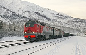 RZD 3TE25K2M Перевозка в основной линии Baikal -Amur | ||
| Обзор | ||
| Родное имя | Байкало-Амурская магистраль | |
| Статус | Оперативно | |
| Владелец | Российские железные дороги | |
| Местный | ||
| Termini | ||
| Continues from | Trans-Siberian Railway | |
| Service | ||
| Type | ||
| System |
| |
| Operator(s) | Russian Railways | |
| Technical | ||
| Line length | 4,324 km (2,687 mi) | |
| Number of tracks | 2–1 | |
| Track gauge | 1,520 mm (4 ft 11+27⁄32 in) Russian gauge | |
| Electrification | 25kV 50Hz AC overhead lines | |
| ||
The Baikal–Amur Mainline ( Russian : Байкало-Амурская магистраль , БАМ , Baikalo-Amurskaya magistral' , BAM ) is a 1,520 mm ( 4 фута 11 + 27 ⁄ 32 дюйма ) линия широкой калики железнодорожная в России . Переход Восточной Сибири и Российского Дальнего Востока , 4,324 км (2687 миль), пробегает от 610 до 770 км (от 380 до 480 миль) к северу от и параллельно Транс -Сибибирской железной дороге .
Советский Союз построил BAM как стратегический альтернативный путь к транс -сибирской железной дороге, которая рассматривается как уязвимая, особенно вдоль секций, близких к границе с Китаем . BAM стоила 14 миллиардов долларов, и он был построен с особыми, долговечными треками, так как большая часть его превышала вечная мерзлота . Из -за суровой местности, погоды, длины и стоимости советский генеральный секретарь Леонид Брежнев описал Бама в 1974 году как «строительный проект века». [ 1 ]
If the permafrost layer that supports the BAM railway line were to melt, the railway would collapse and sink into peat bog layers that cannot bear its weight. In 2016 and 2018 there were reports about climate change and damage to buildings and infrastructure as a result of thawing permafrost.[2][3]
Route
[edit]The BAM departs from the Trans-Siberian railway at Tayshet, then crosses the Angara River at Bratsk and the Lena River at Ust-Kut, proceeds past Severobaikalsk at the northern tip of Lake Baikal, past Tynda and Khani, crosses the Amur River at Komsomolsk-on-Amur and finally reaches the Pacific Ocean at Sovetskaya Gavan. There are 21 tunnels along the line, with a total length of 47 km (29 mi). There are also more than 4,200 bridges, with a total length of over 400 kilometres (250 mi).[4]
Of the whole route, only the western Tayshet-Taksimo sector of 1,469 km (913 mi) is electrified. The route is largely single-track, although the reservation is wide enough for double-tracking for its full length, in the case of eventual duplication. The unusual thing about the railway is that it is electrified with a 27.5 kV, 50 Hz catenary minimum height at 6.5 metres (21 ft 4 in) above top of the rails to suit double-stacking under the overhead wires on the Russian gauge tracks, which requires rolling stock to be modified for service on the railway.
At Tynda the route is crossed by the Amur–Yakutsk Mainline, which runs north to Neryungri and Tommot, with an extension to Nizhny Bestyakh opened in 2019.[5] The original section of the AYaM connecting the Trans-Siberian at Bamovskaya with the BAM at Tynda is also referred to as the "Little BAM".
During the winter the passenger trains go from Moscow past Tayshet and Tynda to Neryungri and Tommot and there are also a daily trains from Tynda to Komsomolsk-on-Amur and from Komsomolsk-on-Amur to Sovetskaya Gavan on the Pacific Ocean via Vanino ("Vladivostok-Sovetskaya Gavan" train No.351Э). Travel time from Tayshet to Tynda is 48 hours.[6] Travel time from Tynda to Komsomolsk-on-Amur is 36 hours.[6] Travel time from Komsomolsk-on-Amur to Sovetskaya Gavan is 13 hours.[6]
There are ten tunnels along the BAM railway, totaling 30 kilometres (19 miles) of route. They include:[7]
- Baikalsky tunnel 6,685 metres (4.154 mi)[8]
- Severomuysky Tunnel 15,343 metres (9.534 mi)
- Kodar Tunnell 1,981 metres (1.231 mi)
- Dusse Alin Tunnel 1,852 metres (1.151 mi)
- Korshunovsky tunnel 950 metres (3,120 ft)
These are among the longest tunnels in Russia.
In addition, the route crosses 11 full-flowing rivers (including the Lena, Amur, Zeya, Vitim, Olyokma, Selemdzha and Bureya).[7] In total, 2230 large and small bridges were built on it.
History
[edit]Early plans and start of construction
[edit]The route of the present-day BAM first came under consideration in the 1880s as an option for the eastern section of the planned Trans-Siberian railway.
In the 1930s, labor-camp inmates, in particular from the Bamlag camp of the Gulag system, built the section from Tayshet to Bratsk. In a confusing transfer of names, the label BAM applied from 1933 to 1935 to the project to double-track the Trans-Siberian east of Lake Baikal, constructed largely using forced labor.[9]
1945 saw the finalisation of plans for upgrading the BAM for diesel or electric instead of steam traction, and for the heavier axle-loads of eight-axle oil tankers to carry new-found oil from Western Siberia.[10] The upgrading required 25 years and 3,000 surveyors and designers, although much of the redesign work (particularly as regards the central section) took place between 1967 and 1974.[9]
Construction project of the century
[edit]
In March 1974, Soviet General Secretary Brezhnev proposed that the BAM would be one of the two major projects in the Tenth Five Year Plan (1976–80).[9] He famously stated that "BAM will be constructed with clean hands only!" and firmly rejected the suggestion to again use prison labor. A few weeks later, he challenged the Young Communist League (Komsomol) to join in "the construction project of the century".[1] The 17th Komsomol congress (held in April 1974) announced the BAM as a Komsomol shock construction project, created the central Komsomol headquarters of BAM construction, and appointed Dmitry Filippov the chief of the headquarters.
By the end of 1974, perhaps 50,000 young people of the 156,000 young people who applied had moved to the BAM service area. In 1975 and 1976, 28 new settlements were inaugurated and 70 new bridges, including the Amur and Lena bridges, were erected. And while 110 miles (180 km) of track was laid, the track-laying rate would have needed to nearly triple to meet the 1983 deadline.[9]
In September 1984, a "golden spike" was hammered into place, connecting the eastern and western sections of the BAM. The Western media was not invited to attend this historic event as Soviet officials did not want any comments about the line's operational status. In reality, only one third of the BAM's track was fully operational for civilians, due to military reasons.[11]
The BAM was again declared complete in 1991. By then, the total cost to build the line was US$14 billion (RU₽106 trillion).
Crisis
[edit]Beginning in the mid-1980s, the BAM project attracted increasing criticism for having been poorly planned. Infrastructure and basic services like running water were often not in place when workers arrived. At least 60 boomtowns developed along the route, but today many of these places are deserted ghost towns and unemployment in the area is high. The building of the BAM has also been criticised for its complete lack of environmental protection.[12]
When the Soviet Union was dissolved, numerous mining and industrial projects in the region were cancelled and the BAM was greatly underutilized until the late 1990s, running at a large operational deficit.[citation needed]
In 1996, the BAM as a single operational body was dissolved, with the western section from Tayshet to Khani becoming the East Siberian Railway and the rest transferred to the management of the Far Eastern Railway.[citation needed]
During the Russo-Ukrainian War, on November 30, 2023, an explosion occurred in the Severomuysky Tunnel. A second explosion happened soon thereafter on the bypass used as backup for the tunnel. The Security Service of Ukraine claimed responsibility for the explosions.[13]
Current situation and future prospects
[edit]This section needs to be updated. (June 2019) |
Baikal Amur Mainline extension |
|---|
Selikhino– Nakhodka line |
|---|
A major improvement was the opening of the 15.34-kilometre (9.53 mi) Severomuysky Tunnel on 5 December 2003. It is up to 1.5 kilometres (nearly 1 mile) deep. Construction took 27 years to complete. Prior to this, the corresponding route segment was 54 km (34 mi) long, with heavy slopes necessitating the use of auxiliary bank engine locomotives.
With the resources boom of recent years and improving economic conditions in Russia, use of the line is increasing. Plans exist for the development of mining areas such as Udokanskoye and Chineyskoye near Novaya Chara, as well as one of Eurasia's largest coal deposits at Elginskoye (Elga) in the Sakha Republic (Yakutia). In connection with this, a number of branch lines have been built or are under construction.
In January 2012 the Russian mining company Mechel completed the construction of the 320-kilometre-long branch line to Elginskoye, branching from the BAM station Ulak, west of the Zeya River crossing in northwestern Amur Oblast.[14][15] The branch line connects the Elginskoye coal mine to the Russian railroad network.
Currently under discussion is the construction of a bridge or tunnel under the Strait of Tartary to Sakhalin Island, with the possibility of the further construction of a bridge or tunnel from Sakhalin to Japan. A tunnel from the mainland to Sakhalin was previously begun under Joseph Stalin, but was abandoned after his death. A second attempt in 2003 was also postponed during construction. Current economic conditions make the short-term completion of the tunnel doubtful, although Russian president Dmitry Medvedev announced in November 2008 his support for a revival of this project.[16]
The BAM now also attracts the interest of Western railway enthusiasts, with some tourist activity on the line.[4]
Also, the BAM itself extension from Komsomolsk-on-Amur to Magadan (Okhotsk coastal route), full length electrification, full length track doubling, and double-stacking under the overhead wires on the Russian gauge tracks (with well cars to make 6.15m height) are proposed.
| Tayshet diversion line (Tayshet bypass) |
Severo-Sibirskaya Mainline | Lena-Kamchatka Mainline | ||||||
|---|---|---|---|---|---|---|---|---|
|
|
|
Along the BAM
[edit]

Tayshet to Lake Baikal 1,064 kilometres (661 mi):[4]
| 0 | Tayshet: about 300 kilometres (190 miles) east of Krasnoyarsk, Trans-Siberian Railway, M53 highway to Irkutsk |
| 129 | Sosnovye Rodniki: timber port; Chuna River |
| 142 | Chuna |
| 269 | Vikhorevka: railway administration |
| 282 | Anzebi: 20-kilometre (12 mi) spur line to Bratsk |
| 330 | Railway runs across the top of the Bratsk Dam |
| 463 | Vidim |
| 546 | Sredneilimskaya on the Ust-Ilimsk reservoir |
| 554 | Zheleznogorsk-Ilimsky: mining town |
| 575 | Khrebetovaya: branch line north to Ust-Ilimsk (see branches below); enters Lena basin; Kuta River |
| 715 | Ust-Kut: port on the Lena River where goods are loaded onto boats for transport north; end of the line until 1974 |
| 736 | Lena Vostochnaya: east of the Lena, start of the BAM proper from 1974; route turns east southeast |
| 786 | Zvyozdnaya: first new town built on the BAM |
| 890 | Kirenga: 12 kilometres (7.5 miles) east is the larger town of Magistralnyy; Kirenga River and bridge |
| 931 | Ul'kan: on the Ulkan branch of the Kirenga |
| 1,005 | Delbichenda: last stop before the 6.7-kilometre (4.2 mi) Baikal Mountain Tunnel (between 1979 and 1984 there was a 15-kilometre (9.3 mi) bypass over the mountain) |
| 1,014 | Daben |
| 1,064 | Lake Baikal |
Lake Baikal to Tynda 1,300 kilometres (810 mi):
| 1,064 | Severobaykalsk; four small tunnels along the lake |
| 1,104 | Nizhneangarsk; leave Lake Baikal, northeast along the Upper Angara River
valley |
| 1,257 | Novy Uoyan: there is talk of building a railroad south from here to the Trans-Siberian; enters Severomuysk Mountains; much permafrost from here to Tynda |
| 1,385–1,400 | Severomuysky Tunnel: 15.7 kilometres (9.8 mi) long, very difficult construction; leaves mountain; scenic section with mountains to north and south; much fog |
| 1,484 | Taksimo: end of electrified section; Muya River |
| 1,548 | Shivery: leaves Buryat Republic; Vitim River |
| 1,577 | Kuanda: official 'completion' of the BAM was celebrated here in September 1984; valley into mountains |
| 1,664 | Kodar: Kodar mountains, 1.9 kilometres (1.2 mi) tunnel |
| 1,734 | Novaya Chara |
| 1,879 | Khani: the only BAM town in the Sakha Republic; northernmost point on the line; route turns south-southeast along the Olyokma River; enters Amur basin |
Tynda to Komsomolsk 1,473 kilometres (915 mi):
| 2,364 | Tynda: Branch railway and highway M56 north to Yakutsk; little BAM south to the Trans-Siberian |
| 2,704 | Bridge over Zeya Reservoir; route heads southeast |
| 3,205 | Bureya River bridge |
| 3,315 | Novy Urgal: Branch south to Trans-Siberian |
| 3,403 | east to Dusse-Alin Tunnel; northeast up the Amgun River |
| 3,633 | Postyshevo: east |
| 3,697 | Evoron Lake; southeast to km 3,837: Komsomolsk-on-Amur |
Komsomolsk to Sovetskaya Gavan 486 kilometres (302 mi):
This section was completed by prisoners during World War II, except for the 19-kilometre (12 mi) section east of Komsomolsk which was completed in 1974.
| 3,819 | Komsomolsk; 1,734-metre (5,689 ft) Amur River Bridge |
| 0 | Pivan (new zero point) |
| 51 | Selikhin: Branch |
| 95–340 | Sikhote Alin Mountains |
| 403 | Mongokhto |
| 441 | Vanino: port, train ferry to Sakhalin Island, practical end of passenger service |
| 467 | Sovetskaya Gavan: naval base |
In April 2008 the state-owned Bamtonnelstroy corporation started work on the new 3.91-kilometre (2.43 mi) single-track Kuznetsovsky Tunnel to bypass an older tunnel built in 1943–1945.[17] It was opened in December 2012. The old tunnel had difficult gradients; building the new tunnel relieved a bottleneck on the BAM.[18] The 59.8 bn roubles (about $1.93 bn) project included 20 kilometres (12 mi) of new track. In 2010, Yakunin had said, the stretch between Komsomolsk and Sovetskaya Gavan was the weakest link on the BAM, which, he said, could be carrying 100 million tons of freight a year in 2050.[19]
Branches
[edit]- 575: Khrebtovaya to ust-ilimsk, 214 километров (133 миль): открытый в 1970 году, он работает на северо-востоке, чтобы служить плотине UST-Ilimsk .
- 1257: Novy Uoyan: Возможное начало линии на юге на восточной стороне до озера Байкал.
- 2364: Тинда Транс-Сибирьян в Баловиной, 180 километрах (110 миль) («Маленькая бам»): эта ветвь была построена заключенными в 1933–37 гг. 1972–75.
- 2,364: Tynda to Yakutsk: see Amur–Yakutsk Mainline .
- 3315: новичок ульгал для транс-сибирья в Извессковайе, 328 километров (204 миль): в бассейне реки Бурейя он был построен в основном японскими военнопленными. Существует отделение 32 километра (20 миль) к северу от Новий Ургал до угольных полей Чегдон .
- 3837: Комсомольский юг до Хабаровска, 374 километров (232 миль); на восточной стороне (пойм) Амур. 99 километров (62 мили) на юг: озеро Болон .
- 51 (Линия Км перезапуск в Комсомольске): Селихин в Черни Майс, 122 километра (76 миль): север вдоль амур. Построенный в 1950–53 годах, планировалось расширить это на туннель до острова Сахалин. Есть разговоры о его перезапуске.
Бэм -роуд
[ редактировать ]Приблизительно на железнодорожной дорожке находится железнодорожная дорожка Bam Road, железнодорожная дорожка. Говорят, что он находится в очень плохом состоянии, с разрушенными мостами, опасными перекрестками реки, тяжелыми выбоинами и «неумолимыми энергосберегающими болотами». Узкий, ветхие мост реки Витим (он же Куэндинский мост) [ 20 ] Это пересекает реку Витим , привлекла внимание с момента ее первого появления в социальных сетях в 2009 году. [ 21 ] Прохождение моста запрещено с 2016 года, но остается общей дорогой для людей, чтобы добраться до города Коанда. [ 22 ]
Дорога проходима только самыми экстремальными внедорожными автомобилями и мотоциклами приключений . В 2009 году группа из трех опытных мотоциклетных гонщиков потребовалась целый месяц, чтобы отправиться из Комсомольска (на востоке) на озеро Байкал . [ 23 ] [ 24 ]
Награды
[ редактировать ]Главный ремень Астероид 2031 Бэм , обнаруженный в 1969 году Советским астрономом Людмилой Черних , назван в честь строителей БАМ. [ 25 ]
Галерея
[ редактировать ]-
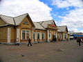
 вокза Железнодорожный
 -
 Железнодорожная станция в Вихревке
 -
 Железнодорожный вокзал в Февральске
 -
 Здание старого станции в Тайшете
 -
 Железнодорожные войска на строительстве BAM-2. Июль 2022 года


Ссылки
[ редактировать ]- ^ Подпрыгнуть до: а беременный Браун, Дейл М.; Манн, Мартин, ред. (1985). Библиотека наций: Советский Союз . Александрия, Вирджиния : книги о жизни . ISBN 0-8094-5327-4 .
- ^
«Медленные крушения: как оттаивание вечной мерзлоты разрушает арктические города» . Хранитель . 14 октября 2016 года . Получено 18 октября 2019 года .
Valery Grebenets из кафедры криолитологии и гляциологии Московского государственного университета учит его учеников 13 «ужасных историй» о оттаивании вечной мерзлоты, включая дороги и железные дороги [...]
- ^ «Оттаивание вечной мерзлоты угрожает миллионам жителей Арктики и их инфраструктуре» . Арктика сегодня . 14 декабря 2018 года . Получено 18 октября 2019 года .
Исследование показало, что в длинном списке уязвимых искусственных сооружений железные дороги несут некоторые из самых высоких рисков для повреждения от оттаивания вечной мерзлоты.
- ^ Подпрыгнуть до: а беременный в Йейтс, Атол; Zvegintzov, Nicholas (1995). Сибирский гид BAM: Rail, Rivers & Road (см. Выдержка) (2, 2001 изд.). Англия: Публикации первопроходцев. ISBN 1-873756-18-6 .
- ^ «Удивительная новая железная дорога Сибири -« Exprest Express » - открывается для пассажиров в этом месяце» . Сибирские времена. 22 июля 2019 года . Получено 25 января 2023 года .
- ^ Подпрыгнуть до: а беременный в «Новостные компании» [Новости компании] (на российском языке). Архивировано из оригинала 2012-12-25 . Получено 2014-02-05 .
- ^ Подпрыгнуть до: а беременный «Основная линия Бакал-Амура | Российские железные дороги» . Архивировано из оригинала 2017-04-18 . Получено 2020-05-01 . [ мертвая ссылка ]
- ^ «Бам! Как получить максимальную отдачу от пути по другой железной дороге Сибири» . www.rbth.com . 15 января 2016 года . Получено 6 декабря 2023 года .
- ^ Подпрыгнуть до: а беременный в дюймовый Шабад, Теодор; Моте, Виктор Л. (1977). Ворота в сибирские ресурсы (BAM) . Нью -Йорк: Halstead Press/John Wiley. С. 71–73. ISBN 0-470-99040-6 .
- ^
Сравнивать:
Gaidar, Yegor (2010). Крышка империи: уроки современной России Перевод Антонины В. Буиса. Брукингс Институт Пресс. П. 100. ISBN 9780815731153 Полем Получено 2015-12-05 .
Первая нефтяная скважина в Западной Сибири была открыта в сентябре 19530 года.
- ^ Уорд, CJ (2001). «Продажа« Проект века »: восприятие железной дороги Бакал-Амура Майнлайн (БАМ) в Советской Прессе, 1974–1984 гг.». Канадские славянские документы . 43 : 75–95. doi : 10.1080/00085006.2001.11092272 . S2CID 129139539 .
- ^ Виктор Л. Моте (1990). «Бэм после фанфары: невыносимый экумен». В Джоне М. Стюард (ред.). Советская среда: проблемы, политика и политика . Кембридж. С. 40–54. ISBN 9780521414180 .
- ^ «Служба безопасности Украины выбивает железную дорогу, связывающую Россию и Китай» . Укранска Правда . 2023-12-01 . Получено 2023-12-01 .
- ^ «Mechel сообщает о завершении прокладок железнодорожных путей в угольный комплекс Elga» . www.mechel.com . Получено 16 августа 2017 года . [ Постоянная мертвая ссылка ]
- ^ «Mechel Reports, получая одобрение Федерального железнодорожного транспортного агентства на эксплуатацию депозитной железной дороги Elga» . www.mechel.com . Получено 16 августа 2017 года . [ Постоянная мертвая ссылка ]
- ^ PrimaMedia : Президент России хочет остров Сахалин соединить с материком (Russian)
- ^ Строительство нового туннеля Кузнетсовского , пресс-службы Bamtonnelstroy, недатированного архивирования 2014-03-06 на The Wayback Machine . Получено: 31 марта 2011].
- ^ «Туннель Kuznetsovsk укорачивает коридор BAM» . Железнодорожный газетт International . Получено 2 февраля 2013 года .
- ^ Объемные объемы через BAM, достигая 100 млн. Тонн в год, к 2050 году , Portnews.ru, Сент -Петербург, 24 марта 2010 года . Получено: 31 марта 2011].
- ^ Маронцы, Николас (2018-01-25). «Наблюдение за тем, как внедорожник пересекает этот узкий мост без газетчиков, нервирует» . Rival.ca . Постмедиа -сеть . Получено 2022-01-14 .
- ^ Holderith, Peter (2021-07-16). «Этот гниющий сибирский мост является одним из самых защепленных речных переходов в мире» . Thedrive.com . Brookline Media . Получено 2022-01-14 .
- ^ Вода из реки, отопление дровами, самый опасный мост в России Archived 2024-02-13 at the Wayback Machine , novayagazeta.eu, 13 February 2024
- ^ "McN Adventure" . Август 2011 . Получено 6 декабря 2023 года .
- ^ «Бэм -роуд - окончательный тест на человека и машины - приключенческий гонщик» . www.advrider.com . Получено 16 августа 2017 года .
- ^ Smunded, Song D. (2003). Словарь незначительных имен планеты (5 -е изд.). Нью -Йорк: Springr Publisher. п. 164. ISBN 3-540-00238-3 .
Внешние ссылки
[ редактировать ] Baikal-Kamur Mainline Travel Guide от Wikivoyage
 - История строительства BAM
- Частная домашняя страница о BAM (раздел на английском языке) Архивировал 2011-02-12 на The Wayback Machine
- БАМ: Советский строительный проект столетия
- Bam Guide on Trailblazer Publications сайт
- Nytimes 2012 Prounting Feature
- Baikal Amur Mainline - популярный маршрут путешествий на мотоцикле приключений