Санкувасабха район

Эта статья , возможно, содержит оригинальные исследования . ( Март 2019 ) |
Санкувасабха район
Загряченный район | |
|---|---|
 Йангл Харка, место в Санкувасабхе | |
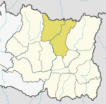
 Location of Sankhuwasabha in province | |
| Coordinates: 27°06′N 86°57′E / 27.100°N 86.950°E to 27°55′N 87°40′E / 27.917°N 87.667°E | |
| Country | |
| Province | Koshi Province |
| Established | 1962 |
| Admin HQ. | Khandbari |
| Municipality | List |
| Government | |
| • Type | Coordination committee |
| • Body | DCC, Sankhuwasabha |
| • Head | Mahesh Thapaliya |
| • Parliamentary constituencies | 1 |
| • Provincial constituencies | 2 |
| Area | |
| • Total | 3,480 km2 (1,340 sq mi) |
| Highest elevation | 8,463 m (27,766 ft) |
| Lowest elevation | 457 m (1,499 ft) |
| Population (2011) | |
| • Total | 158,742 |
| • Density | 46/km2 (120/sq mi) |
| • Households | 34,615 |
| Demographics | |
| • Ethnic groups (2011) [1] | 18%Chhetri 11%Rai 10%Tamang 6%Kulung 6%Sherpa 5%Yakkha 5% Limbu 5%Gurung 34%Others |
| • Female ♀ | 53% |
| Human Development Index | |
| • Income per capita (US dollars) | $1,193 |
| • Poverty rate | 21% |
| • Literacy | 69% |
| • Life Expectancy | 68.4 |
| Time zone | UTC+05:45 (NPT) |
| Postal Codes | 56900..., 56913 |
| Telephone Code | 029 |
| Main Language(s) | Nepali, Yakkha, Kulung, Limbu |
| Website | ddcsankhuwasabha |
Санкхувасабха искажает ( Непали : Санкхувасабха район ) является одним из 14 районов провинции Коши Восточной Непал . Район районов составляет 3480 км 2 с населением 159 203 в 2001 году и 158 742 в 2011 году. Административный центр - Хандбари .
Ограничивающими районы являются Bhojpur , Tehrathum , Dhankuta , Solukhumbu и Taplejung в провинции Коши . округа Тингри в Префектура Сигацзе в автономном регионе Китая Тибетском граничит с севером.
География и климат
[ редактировать ]| Климатическая зона [ 2 ] | Диапазон высоты | % площади |
|---|---|---|
| Нижний тропический | ниже 300 метров (1000 футов) | 0.4% |
| Верхний тропический | От 300 до 1000 метров От 1000 до 3300 футов. |
10.0% |
| Субтропический | От 1000 до 2000 метров От 3300 до 6600 футов. |
24.8% |
| Умеренный | От 2000 до 3000 метров От 6400 до 9800 футов. |
23.3% |
| Субальпина | 3,000 to 4,000 meters От 9 800 до 13 100 футов. |
12.8% |
| Alpine | 4,000 to 5,000 meters 13,100 to 16,400 ft. |
8.4% |
| Nival | above 5,000 meters | 20.4% |
The Arun River enters from Tibet at an elevation of about 3,500 meters (11,500 feet) and flows south across the district, forming one of the world's deepest valleys relative to 8,481 meter Makalu to the west and 8,586 meter Kangchenjunga to the east.
Demographics
[edit]| Year | Pop. | ±% p.a. |
|---|---|---|
| 1981 | 129,414 | — |
| 1991 | 141,903 | +0.93% |
| 2001 | 159,203 | +1.16% |
| 2011 | 158,742 | −0.03% |
| 2021 | 159,046 | +0.02% |
| Sources:[3] | ||
At the time of the 2011 Nepal census, Sankhuwasabha District had a population of 158,742.
As their first language, 46.1% spoke Nepali, 8.8% Tamang, 8.0% Sherpa, 6.6% Kulung, 5.0% Limbu, 4.3% Yakkha, 3.2% Yamphu, 2.9% Gurung, 2.3% Magar, 2.2% Rai, 1.9% Newar, 1.8% Lohorung, 1.6% Mewahang, 1.1% Khaling, 0.9% Chamling, 0.6% Thulung, 0.4% Lhomi, 0.3% Maithili, 0.2% Bantawa, 0.2% Nachhiring, 0.1% Bahing, 0.1% Bhujel, 0.1% Dumi, 0.1% Jerung, 0.1% Koi, 0.1% Sampang, 0.1% Sindhi and 0.5% other languages.[5]
Ethnicity/caste: 18.3% were Chhetri, 10.7% Rai, 10.5% Tamang, 6.2% Kulung, 5.8% Sherpa, 5.5% Limbu, 5.4% Gurung, 5.3% Hill Brahmin, 4.8% Kami, 4.7% Newar, 4.5% Yakkha, 3.3% Magar, 2.7% Yamphu, 2.2% Bhote, 2.2% Damai/Dholi, 1.4% Mewahang Bala, 1.3% Sarki, 0.7% Sanyasi/Dasnami, 0.6% Kumal, 0.6% Lohorung, 0.5% Gharti/Bhujel, 0.5% Lhomi, 0.4% Thulung, 0.3% Khaling, 0.2% Chamling, 0.1% Kayastha, 0.1% Majhi, 0.1% Marwadi, 0.1% Nachhiring, 0.1% Thakuri and 0.5% others.[6]
Religion (2011)[7]: 42.7% were Hindu, 28.8% Kirati, 26.6% Buddhist, 1.5% Christian, 0.1% Prakriti and 0.3% others.[8]
Literacy: 69.3% could read and write, 2.8% could only read, and 27.8% could neither read nor write.[9]
Divisions
[edit]Sankhuwasabha District is divided into the following subdivisions:[10]
| Local Body | Nepali | Type | Population (2021) |
|---|---|---|---|
| Bhotkhola | भोटखोला | Rural municipality | 6,438 |
| Chainpur | चैनपुर | Municipality | 26,799 |
| Chichila | चिचिला | Rural municipality | 6,477 |
| Dharmadevi | धर्मदेवी | Municipality | 16,053 |
| Khandbari | खाँदबारी | Municipality | 35,565 |
| Madi | मादी | Municipality | 13,273 |
| Makalu | मकालु | Rural municipality | 13,424 |
| Panchkhapan | पाँचखपन | Municipality | 16,348 |
| Savapokhari | सभापोखरी | Rural municipality | 9,970 |
| Silichong | सिलीचोङ | Rural municipality | 10,296 |
See also
[edit]References
[edit]- ^ "Sankhuwasabha District Profilecbs.gov.np" (PDF).
- ^ The Map of Potential Vegetation of Nepal - a forestry/agroecological/biodiversity classification system (PDF), Forest & Landscape Development and Environment Series 2-2005 and CFC-TIS Document Series No.110., 2005, ISBN 87-7903-210-9, retrieved Nov 22, 2013
- ^ "Nepal: Provinces and Districts". www.citypopulation.de.
- ^ "NepalMap profile: Sankhuwasabha". NepalMap. Retrieved 17 July 2022.
- ^ NepalMap Language [1]
- ^ NepalMap Caste [2]
- ^ "NepalMap profile: Sankhuwasabha". NepalMap. Retrieved 17 July 2022.
- ^ NepalMap Religion [3]
- ^ NepalMap Literacy [4]
- ^ "Nepal: Municipal Division (Districts and Local Units) - Population Statistics, Charts and Map". www.citypopulation.de. Retrieved 2023-03-28.
External links
[edit]- "Districts of Nepal". Statoids.
- "Sankhuwasabha District". Sankhuwasabha.com. Retrieved 4 January 2013.
Места примыкают к Санкаувастистическому району |
|---|
27 ° 27 ° 227 ° 13'E / 27,367 ° с.ш. 87,217 ° E
Эта статья о месте в районе Санкхувасабха в Непале является заглушкой . Вы можете помочь Википедии, расширив ее . |