Виго округ, штат Индиана

Округ Виго | |
|---|---|
 Здание суда округа Виго в Терре Хут | |
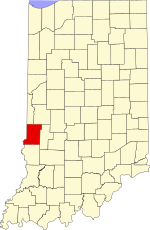 Location within the U.S. state of Indiana | |
 Indiana's location within the U.S. | |
| Coordinates: 39°26′N 87°23′W / 39.43°N 87.39°W | |
| Country | |
| State | |
| Founded | February 1, 1818 |
| Named for | Francis Vigo |
| Seat | Terre Haute |
| Largest city | Terre Haute |
| Area | |
| • Total | 410.45 sq mi (1,063.1 km2) |
| • Land | 403.31 sq mi (1,044.6 km2) |
| • Water | 7.14 sq mi (18.5 km2) 1.74% |
| Population (2020) | |
| • Total | 106,153 |
| • Density | 263.0/sq mi (101.5/km2) |
| Time zone | UTC−5 (Eastern) |
| • Summer (DST) | UTC−4 (EDT) |
| Congressional district | 8th |
| Website | www |
| Indiana county number 84 | |
Округ Виго ( / ˈ v iː ɡ ɡ oʊ / vee -goh ) -это графство на западной границе США штата Индиана . Согласно переписи США в 2020 году , в ней было 106 153 населения. [ 1 ] Его место в округе - Терре Хут . [ 2 ]
Округ Виго включен в столичный район Терре .
Округ содержит четыре включенных поселения с общим количеством населения почти 63 000, а также несколько некорпоративных сообществ. Он разделен на двенадцать поселков , которые предоставляют местные услуги жителям. [ 3 ]
Округ был когда -то считается одним из лучших регионов проголосования на президентских выборах в США; Он проголосовал за победившего кандидата на всех выборах с 1956 по 2016 год [ 4 ] и на всех выборах, кроме трех, с 1888 года. [ 5 ] До тех пор, пока полоса не закончилась в 2020 году, только один округ в Соединенных Штатах, округ Валенсия, штат Нью -Мексико , дольше проголосовал за победившего кандидата. [ 6 ] [ 7 ]
History
[edit]In 1787, the fledgling United States defined the Northwest Territory, which included the area of present-day Indiana. In 1800, Congress separated Ohio from the Northwest Territory, designating the rest of the land as the Indiana Territory.[8] President Thomas Jefferson chose William Henry Harrison as the territory's first governor, and Vincennes was established as the territorial capital.[9] After the Michigan Territory was separated and the Illinois Territory was formed, Indiana was reduced to its current size and geography.[8] By December 1816 the Indiana Territory was admitted to the Union as a state.
Starting in 1794, Native American titles to Indiana lands were extinguished by usurpation, purchase, or war and treaty. The United States acquired land from the Native Americans in the 1809 treaty of Fort Wayne, and by the treaty of St. Mary's in 1818 considerably more territory became property of the government. These two treaties resolved the occupation issue for the future Vigo County. Whites had been living in the area since 1811, when General Harrison erected a fort north of present-day Terre Haute. After the Indian skirmishes were resolved, settlers arrived in significant numbers beginning 1815.[10]
The area in present-day Vigo County was first placed under local jurisdiction in 1790, when Knox County was created. This all-encompassing county was repeatedly subdivided as its lands were occupied − on December 30, 1816, a portion was partitioned to create Sullivan County, and on January 21, 1818, the northern portion of Sullivan was partitioned off to create Vigo County. The first county commissioners organized the government in 1818, including naming Terre Haute as its seat. The county's borders changed several times; in 1821, part of the county was formed into Parke County, and later that year Putnam County was formed which also affected Vigo's borders. The final change came in 1873 when the present boundaries were defined.[11] The county is named for Colonel Francis Vigo, of Italian heritage but a citizen of Spain due to residence in St. Louis. He is credited with assisting George Rogers Clark, both in financing Clark's exploration and American Revolutionary War efforts, and in service as an agent obtaining military information for Clark against British campaigns on the then frontier.[12]
Geography
[edit]
To the north of Vigo County, the Wabash River defines the boundary between Vermillion and Parke counties; the river then enters Vigo County and winds to the south-southwest, defining the southern portion of the county's western border with Illinois before continuing south along Sullivan County's western border. Vigo County is thus the southernmost county in Indiana on the right bank of the Wabash. The county's low hills are devoted to agriculture or urban development; only the drainages and river-adjacent areas are still wooded.[13] Its highest point (680 feet (210 meters) ASL) is Sanford Hill, one mile (1.6 km) west of Paint Mill Lake, south of Terre Haute.[14]
According to the 2010 census, the county has a total area of 410.45 square miles (1,063.1 km2), of which 403.31 square miles (1,044.6 km2) (or 98.26%) is land and 7.14 square miles (18.5 km2) (or 1.74%) is water.[15]
Adjacent counties
[edit]- Vermillion County - north
- Parke County - northeast
- Clay County - east
- Sullivan County - south
- Clark County, Illinois - southwest
- Edgar County, Illinois - northwest
Cities
[edit]- Terre Haute (county seat)
Towns
[edit]- West Terre Haute
- Seelyville
- Riley (or Lockport)
Census-designated places
[edit]- Dresser (or Taylorville)
- Fontanet
- New Goshen
- North Terre Haute
- Shepardsville
- Tecumseh
- Toad Hop
Unincorporated communities
[edit]- Allendale
- Atherton
- Barnhart Town
- Blackhawk
- Brown Jug Corner
- Burnett
- Cherryvale
- Coal Bluff
- Cobb
- Dewey
- Duane Yards
- East Glenn
- Ehrmandale
- Ferguson Hill
- Glenn Ayr
- Gospel Grove
- Grange Corner
- Harrison
- Hickory Island
- Hutton
- Keller
- Larimer Hill
- Lewis
- Libertyville
- Liggett
- Marion Heights
- Markles
- Otter Creek Junction
- Parkview
- Pimento
- Pine Ridge
- Prairie Creek
- Prairieton
- Preston
- St. Mary-of-the-Woods
- Sandcut
- Sandford
- Shirkieville
- Southwood
- Spelterville
- Spring Hill
- State Line
- Swalls
- Tabertown
- Taylorville
- Terre Town
- Twelve Points
- Vigo
- West New Goshen
- Whitcomb Heights
- Woodgate
- Youngstown
Townships
[edit]The year after it was authorized, Vigo County was divided into four townships: Honey Creek Wabash, Harrison, and Independence. Prairie Creek Township was formed later that year. Otter Creek, Raccoon, and Sugar Creek townships were created in 1820, and Independence Township was renamed as Paris Township. Raccoon and Wabash townships became part of Parke County when it was partitioned from Vigo County in 1821. Nevins and Riley townships were formed in 1822. In 1824, Paris Township was renamed again to Fayette Township. Pierson Township was created in 1829; Lost Creek in 1831; Linton in 1841; and Prairieton Township in 1857.[16]
Highways
[edit]Interstate 70 passes through the southern part of Terre Haute from east to west on its way from Indianapolis to Saint Louis, Missouri;[17] U.S. Route 40 roughly parallels Interstate 70 and passes through the middle of the city.[18] Both highways intersect U.S. Route 41, coming from Chicago to the north;[19] U.S. Route 150 enters from Paris, Illinois to the northwest and joins U.S. Route 41 in downtown Terre Haute, and both continue south toward Vincennes and Evansville.[20]
 State Road 42
 State Road 46
 State Road 63
 State Road 159
 State Road 246
 State Road 340
 State Road 641
Rail
[edit]Several CSX Transportation railroad lines meet in Terre Haute; one enters from the north, another from the Indianapolis area, and another from Vincennes; and two others enter from Illinois. An Indiana Rail Road line runs southeast from Terre Haute toward Bedford.[21]
Airports
[edit]The following public-use airports are located in the county:[22]
- Terre Haute Regional Airport (HUF) in Terre Haute
- Sky King Airport (3I3) in North Terre Haute
Education
[edit]The public schools in the county are part of the Vigo County School Corporation. During the 2009–10 school year, the schools served a total of 16,014 students.[23]
Vigo County is served by the Vigo County Public Library.[24]
Colleges in Vigo County include Indiana State University and Rose-Hulman Institute of Technology. For a fuller list, see the List of schools in metropolitan Terre Haute.

Climate and weather
[edit]| Terre Haute, Indiana | ||||||||||||||||||||||||||||||||||||||||||||||||||||||||||||
|---|---|---|---|---|---|---|---|---|---|---|---|---|---|---|---|---|---|---|---|---|---|---|---|---|---|---|---|---|---|---|---|---|---|---|---|---|---|---|---|---|---|---|---|---|---|---|---|---|---|---|---|---|---|---|---|---|---|---|---|---|
| Climate chart (explanation) | ||||||||||||||||||||||||||||||||||||||||||||||||||||||||||||
| ||||||||||||||||||||||||||||||||||||||||||||||||||||||||||||
| ||||||||||||||||||||||||||||||||||||||||||||||||||||||||||||
In recent years, average temperatures in Terre Haute have ranged from a low of 18 °F (−8 °C) in January to a high of 87 °F (31 °C) in July, although a record low of −24 °F (−31 °C) was recorded in January 1977 and a record high of 104 °F (40 °C) was recorded in September 1954. Average monthly precipitation ranged from 2.13 inches (54 mm) in January to 4.46 inches (113 mm) in May.[25]
Government
[edit]The county government is a constitutional body, and is granted specific powers by the Constitution of Indiana, and by the Indiana Code. The county council is the fiscal body of the county government and controls spending and revenue collection in the county. Representatives, elected to four-year terms from county districts, are responsible for setting salaries, the annual budget, and special spending. The council has limited authority to impose local taxes, in the form of an income and property tax that is subject to state level approval, excise taxes, and service taxes.[26][27]
A board of commissioners is the executive and legislative body of the county. Commissioners are elected county-wide to staggered four-year terms. One commissioner serves as president. The commissioners execute the acts of the county council, and manage the county government.[26][27]
The county maintains a small claims court that handles civil cases. The judge on the court is elected to a term of four years and must be a member of the Indiana Bar Association. The judge is assisted by a constable who is also elected to a four-year term. In some cases, court decisions can be appealed to the state level circuit court.[27]
The county has other elected offices, including sheriff, coroner, auditor, treasurer, recorder, surveyor, and circuit court clerk. These officers are elected to four-year terms. Members elected to county government positions are required to declare party affiliations and to be residents of the county.[27]
Politics
[edit]The county has been regarded as one of the best bellwether regions in U.S. presidential elections.[28] Between 1888 and 2016, it voted for the winning candidate in every election in all but two instances: 1908 and 1952. In 2020, its bellwether status came to an end when national winner Joe Biden lost the county by nearly 15 points to Donald Trump.[4][5][29]
The results in the county have often mirrored the nationwide popular vote. In every presidential election from 1960 to 2012, the county voted less than five percentage points from the national result. In 2020, Donald Trump received 56.3 percent of the vote which was the best result for a Republican since Ronald Reagan in 1984 who received 58.4 percent of the vote.
In statewide races for governor and the U.S. Senate, Vigo County has in recent years become more receptive to candidates from the Democratic Party, even when the county had simultaneously voted for a Republican presidential victor in question. The county has gone Democratic in 9 of the last 10 gubernatorial races since 1980, and in 8 of the last 13 Senate races since that timeframe also.
Vigo is part of Indiana's 8th congressional district, which is held by Republican Larry Bucshon.
| Year | Republican | Democratic | Third party(ies) | |||
|---|---|---|---|---|---|---|
| No. | % | No. | % | No. | % | |
| 2020 | 24,545 | 56.17% | 18,123 | 41.47% | 1,030 | 2.36% |
| 2016 | 21,937 | 54.67% | 15,931 | 39.70% | 2,259 | 5.63% |
| 2012 | 19,369 | 48.42% | 19,712 | 49.27% | 924 | 2.31% |
| 2008 | 18,121 | 41.29% | 25,040 | 57.06% | 723 | 1.65% |
| 2004 | 20,988 | 52.81% | 18,426 | 46.36% | 330 | 0.83% |
| 2000 | 18,021 | 49.74% | 17,570 | 48.50% | 637 | 1.76% |
| 1996 | 15,751 | 40.91% | 17,974 | 46.69% | 4,774 | 12.40% |
| 1992 | 15,834 | 37.56% | 18,050 | 42.81% | 8,277 | 19.63% |
| 1988 | 21,929 | 53.11% | 19,192 | 46.48% | 172 | 0.42% |
| 1984 | 26,259 | 58.39% | 18,429 | 40.98% | 285 | 0.63% |
| 1980 | 24,133 | 51.87% | 19,261 | 41.40% | 3,133 | 6.73% |
| 1976 | 23,555 | 48.46% | 24,684 | 50.78% | 371 | 0.76% |
| 1972 | 29,730 | 60.73% | 18,898 | 38.60% | 329 | 0.67% |
| 1968 | 20,814 | 44.60% | 20,328 | 43.56% | 5,522 | 11.83% |
| 1964 | 19,001 | 40.64% | 27,606 | 59.05% | 144 | 0.31% |
| 1960 | 24,940 | 49.70% | 25,105 | 50.03% | 133 | 0.27% |
| 1956 | 25,253 | 50.44% | 24,680 | 49.29% | 135 | 0.27% |
| 1952 | 25,806 | 49.74% | 25,841 | 49.81% | 231 | 0.45% |
| 1948 | 19,049 | 41.81% | 25,906 | 56.86% | 609 | 1.34% |
| 1944 | 21,493 | 46.50% | 24,649 | 53.33% | 81 | 0.18% |
| 1940 | 23,177 | 43.99% | 29,308 | 55.63% | 199 | 0.38% |
| 1936 | 17,278 | 34.05% | 33,018 | 65.08% | 442 | 0.87% |
| 1932 | 18,310 | 40.52% | 25,886 | 57.29% | 991 | 2.19% |
| 1928 | 22,962 | 54.71% | 18,509 | 44.10% | 497 | 1.18% |
| 1924 | 19,545 | 52.74% | 12,999 | 35.08% | 4,515 | 12.18% |
| 1920 | 18,668 | 50.30% | 15,739 | 42.41% | 2,707 | 7.29% |
| 1916 | 8,934 | 39.71% | 11,165 | 49.63% | 2,397 | 10.66% |
| 1912 | 3,103 | 17.18% | 7,256 | 40.18% | 7,701 | 42.64% |
| 1908 | 10,223 | 45.76% | 10,685 | 47.82% | 1,434 | 6.42% |
| 1904 | 10,327 | 56.33% | 6,625 | 36.14% | 1,380 | 7.53% |
| 1900 | 7,992 | 49.88% | 7,472 | 46.63% | 559 | 3.49% |
| 1896 | 8,020 | 51.17% | 7,558 | 48.23% | 94 | 0.60% |
| 1892 | 6,159 | 47.64% | 6,599 | 51.04% | 170 | 1.31% |
| 1888 | 6,273 | 49.84% | 6,102 | 48.48% | 212 | 1.68% |
Demographics
[edit]| Census | Pop. | Note | %± |
|---|---|---|---|
| 1820 | 3,390 | — | |
| 1830 | 5,766 | 70.1% | |
| 1840 | 12,076 | 109.4% | |
| 1850 | 15,289 | 26.6% | |
| 1860 | 22,517 | 47.3% | |
| 1870 | 33,549 | 49.0% | |
| 1880 | 45,658 | 36.1% | |
| 1890 | 50,195 | 9.9% | |
| 1900 | 62,035 | 23.6% | |
| 1910 | 87,930 | 41.7% | |
| 1920 | 100,212 | 14.0% | |
| 1930 | 98,861 | −1.3% | |
| 1940 | 99,709 | 0.9% | |
| 1950 | 105,160 | 5.5% | |
| 1960 | 108,458 | 3.1% | |
| 1970 | 114,528 | 5.6% | |
| 1980 | 112,385 | −1.9% | |
| 1990 | 106,107 | −5.6% | |
| 2000 | 105,848 | −0.2% | |
| 2010 | 107,848 | 1.9% | |
| 2020 | 106,153 | −1.6% | |
| 2023 (est.) | 106,153 | [32] | 0.0% |
| US Decennial Census[33] | |||
2010 census
[edit]As of the 2010 United States Census, there were 107,848 people, 41,361 households, and 25,607 families in the county.[34] The population density was 267.4 inhabitants per square mile (103.2/km2). There were 46,006 housing units at an average density of 114.1 per square mile (44.1/km2).[15] The racial makeup of the county was 88.3% white, 6.9% black or African American, 1.7% Asian, 0.3% American Indian, 0.6% from other races, and 2.2% from two or more races. Those of Hispanic or Latino origin made up 2.3% of the population.[34] In terms of ancestry, 22.6% were German, 20.2% were American, 12.2% were Irish, and 10.3% were English.[35]
Of the 41,361 households, 30.2% had children under the age of 18 living with them, 43.9% were married couples living together, 13.1% had a female householder with no husband present, 38.1% were non-families, and 30.6% of all households were made up of individuals. The average household size was 2.38 and the average family size was 2.95. The median age was 36.1 years.[34]
The median income for a household in the county was $47,697 and the median income for a family was $50,413. Males had a median income of $42,014 versus $30,217 for females. The per capita income for the county was $20,398. About 13.3% of families and 19.5% of the population were below the poverty line, including 27.5% of those under age 18 and 9.5% of those age 65 or over.[36]
See also
[edit]- List of public art in Vigo County, Indiana
- National Register of Historic Places listings in Vigo County, Indiana
- Vigo County Courthouse
References
[edit]- ^ "Vigo County QuickFacts". US Census Bureau. Retrieved May 18, 2022.
- ^ "Find a County". National Association of Counties. Archived from the original on May 31, 2011. Retrieved June 7, 2011.
- ^ "Indiana Township Association". Retrieved September 12, 2010.
- ^ Jump up to: a b David Leip (2003). "Bellwether States and Counties". Retrieved May 17, 2008.
- ^ Jump up to: a b David Leip (2013). "Vigo County Extends Bellwether Streak". Retrieved October 26, 2015.
- ^ "Indiana Election……………Results". The New York Times. 2020. Retrieved November 8, 2020.
- ^ "Vigo County loses its bellwether status after 16 presidential elections". MyWabashValley.com. November 8, 2020. Retrieved November 9, 2020.
- ^ Jump up to: a b "Government at Crossroads: An Indiana chronology". The Herald Bulletin. January 5, 2008. Retrieved July 22, 2009.
- ^ Brill, Marlene Targ (2005). Indiana. Marshall Cavendish. p. 35. ISBN 978-0-7614-2020-0.
- ^ "Vigo County Indiana County and Court Records". Indiana Genealogy Trails. 2020. Retrieved September 19, 2020.
- ^ Bradsby (1891). pp. 285–289.
- ^ Бейкер, Рональд Л.; Кармони, Марвин (1975). Индиана поместите имена . Блумингтон, Индиана: издательство Университета Индианы. п. 173.
- ^ Округ Виго в (Google Maps, доступ к 19 сентября 2020 года)
- ^ Санфорд Хилл, штат Индиана (Peakbagger.com, доступ к 19 сентября 2020 года)
- ^ Jump up to: а беременный «Население, жилищные единицы, площадь и плотность: 2010 - округ» . Бюро переписей США. Архивировано из оригинала 10 февраля 2020 года . Получено 10 июля 2015 года .
- ^ Брэдсби (1891). С. 647–649.
- ^ "Межгосударственный 70" . Шоссе. Исследователь. Архивировано из оригинала 9 марта 2012 года . Получено 22 декабря 2010 года .
- ^ "US Route 40" . Шоссе. Исследователь. Архивировано из оригинала 7 октября 2011 года . Получено 22 декабря 2010 года .
- ^ "US Route 41" . Шоссе. Исследователь. Архивировано из оригинала 7 декабря 2010 года . Получено 22 декабря 2010 года .
- ^ "US Route 150" . Шоссе. Исследователь. Архивировано из оригинала 5 июня 2010 года . Получено 22 декабря 2010 года .
- ^ «Железные дороги Индианы» (PDF) . Департамент транспорта Индианы. 2008. Архивировано из оригинала (PDF) 18 ноября 2009 года . Получено 22 декабря 2010 года .
- ^ Государственные и частные аэропорты, округ Виго, штат Индиана
- ^ «Зачисление по классу, Виго округа Школа Корпорации» . Департамент образования Индианы. Архивировано с оригинала 3 апреля 2012 года . Получено 23 декабря 2010 года .
- ^ «Домашняя страница» . Публичная библиотека округа Виго . Получено 27 июля 2014 года .
- ^ Jump up to: а беременный «Ежемесячные средние значения для Terre Haute In» . Канал погоды . Получено 27 января 2011 года .
- ^ Jump up to: а беременный Индиана код . «Раздел 36, статья 2, раздел 3» . In.gov . Получено 16 сентября 2008 года .
- ^ Jump up to: а беременный в дюймовый Индиана код. «Раздел 2, статья 10, раздел 2» (PDF) . In.gov. Архивировано (PDF) из оригинала 27 декабря 2004 года . Получено 16 сентября 2008 года .
- ^ Дэвид Вассерман (6 октября 2020 г.), «10 округов Беллеров, которые показывают, как у Трампа серьезные проблемы» , «Нью -Йорк Таймс»
- ^ Маккормик, Джон (13 ноября 2020 г.). «Страны Беллеров чуть не уничтожили к выборам в 2020 году» . Wall Street Journal . ISSN 0099-9660 . Получено 17 ноября 2020 года .
- ^ Лейп, Дэвид. «Атлас президентских выборов в США» . uselectionatlas.org . Получено 20 мая 2018 года .
- ^ Ведущий «другой» кандидат, прогрессивный Теодор Рузвельт , получил 4988 голосов, в то время как кандидат социалистов Юджин Дебс получил 1862 голоса, от запрета кандидат Юджина Чафина получил 707 голосов, а от социалистического труда кандидат Артур Реймер получил 144 голоса.
- ^ «Ежегодные оценки населения резидентов для округов: с 1 апреля 2020 года по 1 июля 2023 года» . Бюро переписи Соединенных Штатов . Получено 2 апреля 2024 года .
- ^ «Общая перепись десятилетия» . Перепись.gov . Получено 31 июля 2013 года .
- ^ Jump up to: а беременный в «Профиль общего населения и характеристик жилья: данные демографического профиля 2010 года» . Бюро переписей США. Архивировано из оригинала 13 февраля 2020 года . Получено 10 июля 2015 года .
- ^ «Избранные социальные характеристики в США-2006-2010 обследование американского сообщества 5-летние оценки» . Бюро переписей США. Архивировано из оригинала 14 февраля 2020 года . Получено 10 июля 2015 года .
- ^ «Избранные экономические характеристики-2006-2010 гг. Обследование американского сообщества 5 лет» . Бюро переписей США. Архивировано из оригинала 14 февраля 2020 года . Получено 10 июля 2015 года .
Библиография
[ редактировать ]- Брэдсби, HC (1891). История округа Виго, штат Индиана, с биографическими выборами . Чикаго: С.Б. Нельсон и Компания . Получено 20 декабря 2010 года .
Дальнейшее чтение
[ редактировать ]- Пикетт, Уильям Б. (председатель). Программа устной истории округа Виго (1980–81) . Терре Хаут, Индиана: Коллекции: Политика и правительство, Публичная библиотека округа Виго. 820128a.
Внешние ссылки
[ редактировать ]Места рядом с округом Виго, штат Индиана |
|---|
Муниципалитеты и общины округа Виго, штат Индиана , США. |
|---|
