Albuquerque–Santa Fe–Los Alamos combined statistical area
 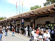     (top) Panorama of the city of Albuquerque; (middle, left-to-right) Palace of the Governors, Santa Fe Depot in Santa Fe; (bottom, left-to-right) Plaza Hotel in Las Vegas, Los Alamos National Laboratory in Los Alamos, Pueblo Revival and Territorial Revival architectural traditional door styling in Española | |
 | |
| Country | |
| State | |
| Largest city | - Albuquerque |
| Other cities |
|
| Area | |
| • Total | 26,421 sq mi (68,430 km2) |
| Population (2020) | |
| • Total | 1,162,523 |
| • Density | 44/sq mi (17/km2) |
| Time zone | UTC-7 (MST) |
| • Summer (DST) | UTC-6 (MDT) |
The Albuquerque–Santa Fe–Los Alamos combined statistical area[1] (known as the Santa Fe–Española combined statistical area until 2013) is made up of eight counties in north central New Mexico. The combined statistical area consists of the Albuquerque and Santa Fe metropolitan statistical areas, and the Las Vegas, Los Alamos, and Española micropolitan statistical areas. The 2013 delineations included the Grants micropolitan statistical area, but it was removed in the 2018 revisions. As of the 2020 census, the CSA had a population of 1,162,523.[2] Roughly 56% of New Mexico's residents live in this area. Prior to the 2013 redefinitions, the CSA consisted only of the Santa Fe metropolitan statistical area and the Española micropolitan statistical area. The total land area of the Albuquerque–Santa Fe–Las Vegas combined statistical area in the 2013 definition is 26,421 sq mi (68,430 km2).
Counties
[edit]- Bernalillo County
- Los Alamos County
- Rio Arriba County
- Sandoval County
- San Miguel County
- Santa Fe County
- Torrance County
- Valencia County
Communities
[edit]Bernalillo County
[edit]- Albuquerque (Principal city)
- Carnuel
- Cedar Crest
- Chilili
- Isleta Pueblo
- Isleta Village Proper
- Los Ranchos de Albuquerque
- Laguna Pueblo
- North Valley
- San Antonito
- South Valley
- Tijeras
- Zuzax
- Barton ( SW corner overlaps with Santa Fe County)
Los Alamos County
[edit]- Los Alamos (City)
- White Rock
Rio Arriba County
[edit]Sandoval County
[edit]San Miguel County
[edit]- Conchas Dam
- Las Ruedas
- Las Vegas (Principal city)
- Montezuma
- Mosquero
- North San Ysidro
- Pecos
- Ribera
- Rowe
- South San Ysidro
- Valles de San Geronimo
- Villanueva
Santa Fe County
[edit]- Agua Fria
- Cañada de los Alamos
- Cedar Grove
- Chimayó
- Chupadero
- Cuartelez
- Cundiyo
- Cuyamungue
- Edgewood
- El Rancho
- El Valle de Arroyo Seco
- Eldorado at Santa Fe
- Española (Part of)
- Galisteo
- Glorieta
- Jaconita
- La Cienega
- La Puebla
- Lamy
- Los Cerrillos
- Nambé Pueblo
- Madrid
- Pojoaque
- Rio Chiquito
- Rio en Medio
- San Ildefonso Pueblo
- Santa Cruz
- Santa Fe (Principal city)
- Seton Village
- Sombrillo
- Stanley
- Tesuque
- Waldo
Torrance County
[edit]Valencia County
[edit]See also
[edit]- List of metropolitan areas in New Mexico
- List of micropolitan areas in New Mexico
- List of cities in New Mexico
References
[edit]- ^ "OMB Bulletin No. 23-01, Revised Delineations of Metropolitan Statistical Areas, Micropolitan Statistical Areas, and Combined Statistical Areas, and Guidance on Uses of Delineations of These Areas" (PDF). United States Office of Management and Budget. July 21, 2023. Retrieved April 11, 2024.
- ^ Population Change for Metropolitan and Micropolitan Statistical Areas in the United States and Puerto Rico (February 2013 Delineations): 2000 to 2010

State of New Mexico |
|---|
- Metropolitan areas of New Mexico
- Santa Fe County, New Mexico
- Rio Arriba County, New Mexico
- Bernalillo County, New Mexico
- Sandoval County, New Mexico
- San Miguel County, New Mexico
- Cibola County, New Mexico
- Los Alamos County, New Mexico
- Valencia County, New Mexico
- Torrance County, New Mexico
- Combined statistical areas of the United States