Mungyeong

Mungyeong
Mungyeong -si | |
|---|---|
| Корейская транскрипция (ы) | |
| • Hangul | Mungyeong -si |
| • Ханджа | Венцинг Сити |
| • Пересмотренная романизация | Mungyong-si |
| • McCune-Freischauer | Mun'gyŏng-sey |
 Мэрия Мангейонг (2015) | |
 Flag Emblem of Mungyeong | |
 Location in South Korea | |
| Country | |
| Region | Yeongnam |
| Administrative divisions | 2 eup, 7 myeon, 5 dong |
| Government | |
| • mayor | Shin Hyun-kook (신현국) |
| Area | |
| • Total | 911.73 km2 (352.02 sq mi) |
| Population (November 2022) | |
| • Total | 70,645 |
| • Density | 84.79/km2 (219.6/sq mi) |
| • Dialect | Gyeongsang |
| Time zone | UTC+9 (Korea Standard Time) |
| Area code | +82-54 |
Mungyeong ( корейский : Mungyeong ; Корейское произношение: [mun.ɡjʌŋ] ) - город в северной провинции Гёнсанг , Южная Корея . Местные правительство, экономика и транспортные сети сосредоточены на Jeomchon , главном городе. Mungyeong имеет длинную историю и сегодня известен своими различными историческими и живописными туристическими достопримечательностями. Имя города означает примерно «слышать хорошие новости». В последнее время развитие было несколько натяженным с упадком в угольной промышленности. С 1990 -х годов доля людей, которые полагаются на туристическую индустрию через Mungyeong Saejae, постепенно увеличивалась.
Город Мангейонг был создан после того, как в 1995 году были объединены Джеомчон -Сити, а сельское округ Мангейонг была объединена. [ 1 ] В настоящее время это городской сельский комплекс, аналогичный 53 другими небольшими и средних городами с населением менее 300 000 человек в Южной Корее. [ 2 ] [ 3 ]
История
[ редактировать ]The Mungyeong area is believed to have been controlled by a mixture of Jinhan and Byeonhan states during the Samhan period in the first centuries of the Common Era. The Jinhan state of Geungi-guk may have been located near Sanyang-myeon. Byeonhan states such as Sabeol-guk and Gosunsi-guk, which probably controlled the Hamchang area of Sangju, may also have extended their control over adjacent areas that are now part of Mungyeong. However, this stage of local history is almost entirely hypothetical, since very little evidence of any kind remains.
At any rate, the rising power of Silla controlled the area by 505. Capitalizing on the territory's strategic potential, Silla set up various mountain fortresses in the area to control movement in and out of western Korea. Control of transit through the area would have gained even greater importance after Silla's 553 seizure of the Han River valley on the western side of the mountains. At this time the low Haneuljae pass near Poam Mountain was probably the favored crossing, in contrast to the higher Mungyeong Saejae pass which came into favor in the Joseon period.
As Silla reorganized its administrative structure under King Seongdeok in 757, the Mungyeong area was placed under the province of Sangju, and divided among various hyeon, or local districts. During this Unified Silla period the temple of Gwaneumsa, of which all but a few traces have vanished, was constructed near Haneuljae in present-day Mungyeong-eup.
In the early Goryeo period, in 983, King Seongjong reorganized local government yet again. Most of Mungyeong remained divided into assorted hyeon, under the central jurisdiction of Sangju. In 1390, Mungyeong-gun (Mungyeong County) begins to appear in the records, although not with its current boundaries.
In the Joseon period, the Eight Provinces were laid out and thus Mungyeong became part of Gyeongsang, which it remains. During later Joseon times, the road from Seoul to Busan was established running over Mungyeong Saejae. Beginning in the 18th century, gates were erected on the road to control traffic and protect travelers from brigandage. These gates are still preserved today.
The first railroads were constructed in the area during the period of Japanese occupation. Jeomchon Station was opened on December 25, 1924. However, the pace of resource extraction did not accelerate greatly until the post-war period, under the first South Korean government led by Syngman Rhee. Construction on the Gaeun Line, with the goal of improving access to the coal deposits around Gaeun, began on January 18, 1953, before the official end of the Korean War (the line was completed in 1955).
Local self-governance was established in the early years of the Republic of Korea, but abruptly cancelled following the military coup of 1961. After the end of military dictatorship, local representative government was reinstituted in 1991. At that time, the present-day territory of Mungyeong was divided between Jeomchon City and Mungyeong County. The city acquired its present-day borders on January 1, 1995, when the two former units were merged to form Mungyeong City.
Geography and climate
[edit]Geography
[edit]
Mungyeong extends a total of 40 km (25 mi) from west to east, and 37 from north to south. Its shape very roughly approximates a right triangle, with the hypotenuse corresponding to the peaks of the Sobaek mountains. The northern tip is in Dongno-myeon, at 36°52'10'' N latitude. The southern extremity lies in Nongam-myeon, at 36°41'40'' N. The easternmost edge of the city can also be found in Dongno-myeon, at 128°22'42'' E longitude. On the west, Mungyeong comes to an end in Gaeun-eup, at 127°52'48'' E.
Mungyeong City stands on the border between North Gyeongsang and North Chungcheong provinces. On its northern and western borders, it adjoins the North Chungcheong districts of Danyang County, Jecheon City, and Chungju City on the north and Goesan County on the northwest. Within North Gyeongsang province, Mungyeong adjoins Yecheon County to the east and Sangju City to the south.
The topography of Mungyeong is dominated by the Sobaek mountains, which form the line between North Gyeongsang and North Chungcheong provinces. The city's highest point lies on this line, at 1161-meter Munsu peak of Worak Mountain in Dongno-myeon. The city's terrain, cut by numerous valleys, slopes down from the Sobaek peaks toward the valleys of the Nakdong River and its tributary, the Yeong. At their meeting-point in Yeongsun-myeon, the rivers are barely 200 m above sea level. Above the valleys, the soil is thin and outcroppings of igneous or sedimentary bedrock are common. Millions of years of erosion have created spectacular cliffs and escarpments in many areas, some of which have become major attractions for local tourism.
Climate
[edit]Located in the shadow of the Sobaek mountains and west of the Taebaek Mountains, Mungyeong has a humid continental climate (Köppen: Dwa), but can be considered a borderline humid subtropical climate (Köppen: Cwa) using the −3 °C (27 °F) isotherm. The number of frost-free days is significantly lower than it is in more coastal areas of South Korea. Annual temperature fluctuates around 11 °C (52 °F), and annual rainfall around 1,300 mm (51.2 in). There are roughly 90 days of heavy rain per year, of which about 30 fall during the monsoonal rainy season in July and August.
| Climate data for Mungyeong (1991–2020 normals, extremes 1973–present) | |||||||||||||
|---|---|---|---|---|---|---|---|---|---|---|---|---|---|
| Month | Jan | Feb | Mar | Apr | May | Jun | Jul | Aug | Sep | Oct | Nov | Dec | Year |
| Record high °C (°F) | 13.8 (56.8) |
22.4 (72.3) |
26.2 (79.2) |
32.3 (90.1) |
35.2 (95.4) |
35.6 (96.1) |
37.8 (100.0) |
38.1 (100.6) |
34.4 (93.9) |
30.1 (86.2) |
27.1 (80.8) |
16.9 (62.4) |
38.1 (100.6) |
| Mean daily maximum °C (°F) | 3.4 (38.1) |
6.3 (43.3) |
12.1 (53.8) |
18.9 (66.0) |
24.0 (75.2) |
27.2 (81.0) |
28.8 (83.8) |
29.4 (84.9) |
25.3 (77.5) |
20.0 (68.0) |
12.4 (54.3) |
5.4 (41.7) |
17.8 (64.0) |
| Daily mean °C (°F) | −1.7 (28.9) |
0.6 (33.1) |
5.8 (42.4) |
12.2 (54.0) |
17.3 (63.1) |
21.3 (70.3) |
23.9 (75.0) |
24.2 (75.6) |
19.2 (66.6) |
13.0 (55.4) |
6.4 (43.5) |
0.1 (32.2) |
11.9 (53.4) |
| Mean daily minimum °C (°F) | −6.3 (20.7) |
−4.7 (23.5) |
−0.1 (31.8) |
5.4 (41.7) |
10.6 (51.1) |
15.9 (60.6) |
20.2 (68.4) |
20.3 (68.5) |
14.5 (58.1) |
7.3 (45.1) |
1.1 (34.0) |
−4.7 (23.5) |
6.6 (43.9) |
| Record low °C (°F) | −20.0 (−4.0) |
−17.0 (1.4) |
−11.0 (12.2) |
−4.2 (24.4) |
1.7 (35.1) |
4.6 (40.3) |
10.7 (51.3) |
10.4 (50.7) |
3.9 (39.0) |
−4.0 (24.8) |
−9.8 (14.4) |
−16.7 (1.9) |
−20.0 (−4.0) |
| Average precipitation mm (inches) | 18.9 (0.74) |
29.7 (1.17) |
48.7 (1.92) |
89.5 (3.52) |
108.1 (4.26) |
154.8 (6.09) |
309.5 (12.19) |
274.7 (10.81) |
138.4 (5.45) |
58.8 (2.31) |
40.9 (1.61) |
22.9 (0.90) |
1,294.9 (50.98) |
| Average precipitation days (≥ 0.1 mm) | 5.5 | 5.6 | 7.5 | 8.5 | 8.3 | 9.1 | 15.7 | 14.3 | 9.3 | 5.9 | 7.0 | 6.1 | 102.8 |
| Average snowy days | 6.7 | 5.1 | 2.8 | 0.3 | 0.0 | 0.0 | 0.0 | 0.0 | 0.0 | 0.1 | 1.4 | 4.5 | 20.7 |
| Average relative humidity (%) | 56.0 | 53.6 | 54.0 | 52.6 | 60.2 | 69.2 | 80.1 | 79.7 | 76.9 | 70.1 | 63.9 | 58.5 | 64.6 |
| Mean monthly sunshine hours | 167.6 | 183.6 | 200.4 | 220.3 | 241.7 | 198.6 | 148.9 | 163.0 | 171.2 | 201.1 | 163.4 | 161.2 | 2,221 |
| Percent possible sunshine | 58.5 | 60.4 | 56.7 | 59.8 | 57.5 | 49.6 | 37.3 | 44.8 | 50.2 | 61.5 | 55.5 | 55.5 | 53.3 |
| Source: Korea Meteorological Administration (snow and percent sunshine 1981–2010)[4][5][6] | |||||||||||||
Government
[edit]The seat of government is located in Jeomchon 4-dong. Local government is ruled by representative democracy in a parliamentary system. However, many aspects of local governance are actually under centralized provincial or national control. For example, educational affairs are overseen by the Mungyeong Office of Education, which reports not to the city government but to the North Gyeongsang provincial Office of Education. A similar situation applies to the local police.
Executive
[edit]The mayors of Mungyeong city have been elected by popular vote since 1995. Under current South Korean law, elections are held every four years. The current mayor of Mungyeong City is Shin Hyun-Kook (신현국), who prevailing in the local elections of July 1, 2022. The vice mayor is Baek Seungmo (백승모), who began serving on January 1, 2023.[7]
Legislative
[edit]The head of the Mungyeong city council is Lee Jeonggeol (이정걸), who was elected from Ra constituency (Hogye, Jeomchon 1 and 3 dong). There are a total of thirteen members altogether.[8]
Judicial
[edit]The city court of Mungyeong is located near the city hall. Along with the Yecheon city court, it is one of two courts overseen by the Sangju circuit, which in turn reports to the Daegu District Court in the provincial capital.
Administrative Districts
[edit]

It consists of 2 eup, 7 myeon and 5 dong.
| Name[9] | Hangeul | Hanja |
|---|---|---|
| Mungyeong-eup | 문경읍 | 聞慶邑 |
| Gaeun-eup | 가은읍 | 加恩邑 |
| Yeongsun-myeon | 영순면 | 永順面 |
| Sanyang-myeon | 산양면 | 山陽面 |
| Hogye-myeon | 호계면 | 虎溪面 |
| Sanbuk-myeon | 산북면 | 山北面 |
| Dongno-myeon | 동로면 | 東魯面 |
| Maseong-myeon | 마성면 | 麻城面 |
| Nongam-myeon | 농암면 | 籠岩面 |
| Jeomchon 1(il)-dong | 점촌1동 | 店村1洞 |
| Jeomchon 2(i)-dong | 점촌2동 | 店村2洞 |
| Jeomchon 3(sam)-dong | 점촌3동 | 店村3洞 |
| Jeomchon 4(sa)-dong | 점촌4동 | 店村4洞 |
| Jeomchon 5(o)-dong | 점촌5동 | 店村5洞 |
- Number of Eup, Myeon, and Dong: 14 (2 Eup, 7 Myeon, 5 Dong)
- Administrative governance: 319 (103 tong, 216 ri)
- Legal governance:130 (119 ri, 11 dong)
- Square area: 911.73 km2 Daeyasan Mountain Natural Recreation Forest
- Number of Ban (neighborhood associations): 1,560
- Number of natural settlements: 523 settlements
- Mungyeong City rural/urban municipality established: 1995. 01. 01
Demographics
[edit]The population of Mungyeong continues to fall,[10] as more people move away to major urban centers such as Daegu and Seoul. Although the city overall is losing population, there continues to be a considerable expansion in construction in the urban center of Jeomchon.
| year | total population |
|---|---|
| 1975 | 161,095 |
| 1980 | 147,242 |
| 1985 | 139,731 |
| 1990 | 119,416 |
| 1995 | 92,239 |
| 2000 | 90,846 |
| 2005 | 70,926 |
| 2010 | 69,021 |
| 2013 | 75,664 |
| 2017 | 73,294 |
The overwhelming majority of Mungyeong's people (approximately 99.7%) are ethnic Korean. Many of them are from families with long and deep roots in the area.
Economy
[edit]The Mungyeong economy during much of the 20th century was based on coal mining. However, these mines were closed in the 1980s, and since then the municipal government has focused on developing tourism, agriculture and light industry in the region.

Because of its mountainous condition, most of Mungyeong's land (roughly 75%) is unsuitable for farming. Nonetheless, the agricultural sector continues to play an important role in the local economy as well. Some local produce is sold directly in the area, but most is exported to major urban centers on South Korea. Orchard farming, particularly apple growing plays an important role, with 4.4 km2 (1.7 sq mi) of land devoted to orcharding.
The local government has set up various institutions to promote agricultural and industrial development, including "agro-industrial complexes" located around the rural districts. These efforts have met with some success, as for example the area under orchard cultivation expanded significantly in the late 1990s.
Communications and media
[edit]In terms of media it may be considered largely identical with the rest of northern North Gyeongsang. Broadcast is dominated by network outlets in Daegu or Andong, and most available newspapers are printed in Seoul, although provincial newspapers also circulate.
Local journalism, therefore, is primarily limited to local weekly newspapers such as the Saejae Sinmun. These weeklies are dominated by classified advertising, but also carry a selection of local news and commentary.
In recent years, cable television and high-speed internet service has become widespread in Mungyeong.
Divisions
[edit]Mungyeong city is divided into 2 eup, 7 myeon and 5 dongs. These are the primary divisions of the city; each is divided in turn into a large number of ri. (For more information on these terms, see Administrative divisions of South Korea). The dongs are all clustered around the town of Jeomchon. The smallest is Jeomchon 1-dong, which covers only 0.98 square kilometers and covers the traditional city center of Jeomchon. The largest is Jeomchon 4-dong northwest of town, which at 29.62 km2 (11.44 sq mi) is bigger than all the others put together. Prior to January 1, 2004, the dongs were known by individual names; for example, Jeomchon 4-dong was known as "Mojeon-dong."
Six of the myeon, or townships, form an L, with its bottom in the southeast near the confluence of the Yeong and Nakdong rivers: Yeongsun-myeon, Sanyang-myeon, Maseong-myeon, Hogye-myeon, Sanbuk-myeon and Dongno-myeon. Nongam-myeon lies south of Gaeun, at Mungyeong's southern limit.
Gaeun-eup was once an important town in its own right, but has now become largely marginalized. Mungyeong-eup, the principal center of the city apart from Jeomchon, is found in the northern area of the county. It was the seat of Mungyeong County before that entity was merged with Jeomchon City to form the modern boundaries of Mungyeong. It still retains a relatively high profile in the county, with its own library and intercity bus terminal.
People
[edit]In the late 9th century, when Mungyeong was a part of the Sangju district of Silla, a man from Gaeun-eup (then Gaseon-hyeon) named Ajagae fomented a local peasant rebellion which seized the fortress of Sangju. His son, Kyŏn Hwŏn, who was also probably born in Gaeun, ruled the kingdom of Later Baekje during the Later Three Kingdoms period.
Various literary figures of the Joseon period hailed from Mungyeong, as did heroes of the resistance against Japanese attacks in the late 16th century (the local commander Sin Gil-won, 1548–1592) and of the righteous army movement in the early 20th (the leader I Gang-nyeon, 1858–1908).
Tourism
[edit]
Numerous tourist attractions have been promoted throughout the city of Mungyeong. By far the best-known of these around the country is Mungyeong Saejae, the mountain pass where the old road from Busan to Seoul passed over the Sobaek mountains and out of the Gyeongsang region. The three gates which controlled traffic on that road are now maintained as tourist attractions.
Various other places around Mungyeong are renowned for their scenery. Among these is the Jinnam Bridge area, which a regional newspaper called the Yeongnam Ilbo once called "one of the eight wonders of Gyeongsangbuk-do." There are three museums in Mungyeong: the historical museum at Mungyeong Saejae, a ceramics museum nearby, and the Coal Museum in Gaeun-eup. Additional local tourist attractions include spas, a shooting range, a paragliding area, and the Gyeongcheon Lake reservoir in the east.
Parkland takes up a significant portion of Mungyeong's total area. The Songnisan National Park covers part of Gaeun-eup in the southwest. Mungyeong Saejae is itself a provincial park, covering a substantial area of Mungyeong-eup. Also covering part of Mungyeong-eup and a considerable chunk of Dongno-myeon is Woraksan National Park.
The municipal government has striven to convert the coal-mining tradition into a tourist attraction as much as possible. For example, a Coal Museum has been set up in Gaeun, which was once the heart of the mining district. Likewise, the former Gaeun Line railroad has been converted into a bicycle path.
In April 2020 a 1.8 kilometres (1.1 mi) cable-driven people mover - called the "Mungyeong Dansan Tourist Monorail" - opened to take people to the peak of Mount Dan (959 meters above sea level) near Mungyeongsaejae Pass. Ten 8-passenger vehicles take visitors to the summit, with a round trip time of 35 minutes. (Although the system is called a 'monorail' it runs on two rails). The summit has a number of attractions including camping sites and mountain bike trails.[11][12]
Festival
[edit]2015 Mungyeong Military World Games (세계 군인 체육 대회, 世界軍人體育大會)
In October 2015, competitions were held in various parts of North Gyeongsang Province. It was held in Mungyeong, and the match was held in Mungyeong at the stadium of the Korean Armed Forces Athletic Corps.
Transportation
[edit]
The automobile is the preferred means of transportation for most Mungyeong residents. Auto ownership is quite high, with a total of 21,687 cars owned, according to local statistics. However, because of the city's low population density, traffic congestion is rare. National highways connect Jeomchon with Sangju, Chungju and Yeongju.
Before the end of 2004, the portion of the Jungbu Naeryuk Expressway running through Mungyeong was completed. Interchanges with the expressway are located at Jeomchon and Mungyeong-eup. This has led to significant changes in local transit patterns and the local economy.
The city's public transit needs are primarily served by buses: city buses which operate locally and to neighboring Sangju and Yecheon, and intercity buses which carry passengers to more distant destinations. Bus terminals are located in Mungyeong-eup and Jeomchon. Because of low passenger traffic, most intercity buses which pass through Mungyeong City also stop in Sangju.
также обслуживается пассажирской железной дорогой через линию Gyeongbuk , которая проходит от Йонджу (где она присоединяется к Gyeongbu и останавливается на станции Jeomchon Mungyeong линии до Гимчона . и Gaeun-Eup также были пассажиры В Mungyeong- eup . дополнение к значительному грузовому трафику.
В Mungyeong не находится аэропорты, но в соседнем Йехоне работает небольшой аэропорт с пассажирским обслуживанием.
Культура
[ редактировать ]Культура Мангейонга вообще говоря, аналогичная культуре других сельских районов в провинции Гёнсанг. Это отмечено относительно сильной настойчивостью корейских конфуцианских ценностей.
Город сохраняет связи с традиционным искусством. Различные корейские народные, в том числе Mungyeong Saejae Arirang , отличительны для района. Тем не менее, наиболее интенсивной пропагандированной формой искусства в районе - это традиционное керамическое судно Mungyeong, которое датируется периодом Чосона и до сих пор практикуется многими главными гончарами в этом районе.
Город также хорошо известен своим традиционным фестивалем чая с 1999 года. [ 13 ]
Местная кухня, хотя и в целом похожа на южнокорейскую кухню в целом, содержит некоторые местные расцветы. Специальность North Gyeongsang Jjim Dalk в стиле Chuncheon , пряное куриное блюдо и блюдо с лапшой, а также курица широко доступны.
Религия
[ редактировать ]Как и везде в Южной Корее, христианство сосуществует с корейским буддизмом и шаманизмом , а большой сегмент населения не исповедует религиозных вещей. Церкви можно найти в любой значительной общине в Мангейонге. В районе вокруг горы Джорион содержится множество важных мест для шаманских практикующих или мусульманина .
Спорт
[ редактировать ]Мангейонг является домом для бейсбольной команды Sangmu Phoenix и женской футбольной команды Mungyeong Sangmu, а легкая атлетика остается очень популярной в городе. Городской стадион в Jeomchon проводит общественные спортивные соревнования, и, кроме того, для ватина в этом районе можно найти многочисленные частные заведения, такие как клетки .
В 2015 году Mungyeong организовал 6 -й Международный военный совет военного совета (CISM) . [ 14 ]
Образование
[ редактировать ]Как и везде в Южной Корее, существует трехуровневая государственная система образования: 6 лет начальной школы, 3 года средней школы и 3 года средней школы. Посещаемость школы обязательно. В Mungyeong есть 18 начальных школ, 12 средних школ и 8 средних школ, все под контролем Управления образования Mungyeong. Есть одна средняя школа и одна средняя школа исключительно для девочек; Остальные совместно. Некоторые средние школы, такие как промышленная средняя школа Mungyong и туристическая школа Mungyong, обеспечивают конкретную профессиональную подготовку.
Многие родители дополняют государственное образование своих детей частным обучением, и, следовательно, есть множество хагвонов или частных академий, как в Jeomchon, так и в отдаленных районах.
В Мунгенонге есть только одно высшее образование, а именно колледж Мун Кён в Хоге-Мине. Многие посещают университеты поблизости, такие как Национальный университет Сангджу , или в других местах страны.
| Начальная школа в Мангейонг |
|---|
| Средняя школа в Мангейонге |
|---|
| Средняя школа в Мангейонге |
|---|
Города -близнецы - Сестринские города
[ редактировать ]Mungyeong - с двойной :
Смотрите также
[ редактировать ]Ссылки
[ редактировать ]- ^ История Mungyeong -si Полем Энциклопедия корейской культуры (на корейском языке). Нейт . Архивировано из оригинала 2011-06-10.
- ^ Ли, Чже выиграл; Ли, мужчина Хен. (1997) Конфликты с городской и сельской интеграцией после реформы 1994 года в Корее [ Постоянная мертвая ссылка ] Доси Йонгу, Корейский центр исследований города и окружающей среды, Vol3. с.103-121
- ^ Юн, Даесич; Хван, Джунгун. Луна, Чанккен. (Июнь. 2008) (по корейскому языку) Исследование по анализу характеристик выбора режима и схемы путешествий в городской сельской местности, интегрированной городской архивировании 2012-01-05 в The Wayback Machine Research Institute для посещений населенных пунктов, с.118
- ^ «Климатологические нормы Кореи (1991 ~ 2020)» (PDF) (на корейском языке). Корейское метеорологическое управление. Архивировано из оригинала (PDF) 29 января 2022 года . Получено 4 апреля 2022 года .
- ^ Рейтинг стоимость -вооруженная зона (на корейском). Корейское метеорологическое управление . Получено 4 апреля 2022 года .
- ^ «Климатологические нормы Кореи» (PDF) . Корейское метеорологическое управление. 2011. Архивировано из оригинала (PDF) 7 декабря 2016 года . Получено 8 декабря 2016 года .
- ^ https://www.gbmg.go.kr/portal/contents.do?mid=0501040100 [ только URL ]
- ^ «Биография председателя> Открытый офис председателя> Городской совет Мунгейонг» .
- ^ «Общий статус | о Mungyeong | о Mungyeong | Mungyeong -si Culture Tour» . www.gbmg.go.kr. Получено 2020-09-11 .
- ^ «Южная Корея: города (население переписи)» . Городское население . Получено 21 декабря 2015 года .
- ^ «Самая длинная горная монорельс в С. Кореи открывается» . 28 апреля 2020 года . Получено 26 июня 2021 года .
- ^ "Mungyeong Dansan Monorail" . Получено 26 июня 2021 года .
- ^ Фестиваль пивоварни Mungyeongjeon 2018 Mungyeongjeon . sabal21.com .
- ^ Военные мира .
Внешние ссылки
[ редактировать ]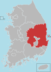
36 ° 35 ° ° ° " / 36,59389 ° NW 128. THE139 °
| Базы данных управления авторитетом : географический |
|---|