Список объектов особого научного интереса в Оксфордшире

Оксфордшир на юго-востоке Англии имеет площадь 2605 квадратных километров и население 648 700 человек. В Англии органом, ответственным за определение Участков особого научного интереса (УОНИ), является Natural England , который отвечает за защиту природной среды Англии. Уведомление в качестве УОНИ обеспечивает юридическую защиту лучших объектов дикой природы и геологии. [1] По состоянию на 2020 год в Оксфордшире насчитывается 111 УОНИ, 78 из которых представляют биологический интерес, 27 - геологический интерес и 6 - биологический и геологический интерес. [2]
Ключ
[ редактировать ]Интерес[ редактировать ]
Публичный доступ[ редактировать ]
| Другие обозначения и доверительное управление дикой природой[ редактировать ]
|
Сайты
[ редактировать ]| Название сайта | Фотография | Б | Г | Область [а] | Публичный доступ | Расположение [а] | Другой | Карта [б] | Цитирование [с] | Описание |
|---|---|---|---|---|---|---|---|---|---|---|
| Алвескот Медоуз | 3,0 га (7,4 акра) [3] | Альвескот 51 ° 44'35 "N 1 ° 36'22" W / 51,743 ° N 1,606 ° W СП 273 050 [3] | Карта | Цитирование | ||||||
| Эпплтон Лоуэр Коммон |  | 47,3 га (117 акров) [4] | ФП | Эпплтон 51 ° 42'11 "N 1 ° 23'10" W / 51,703 ° N 1,386 ° W СП 425 007 [4] | Карта | Цитирование | есть разнообразные широколиственные леса На территории Оксфорд-Клей с аттракционами и полянами. Кустарниковый ярус имеет богатое разнообразие видов, таких как примула , лютик златовласка , ранняя пурпурная орхидея , твайблейд и ветреница лесная . К беспозвоночным относятся редкие клубнехвостые стрекозы . [5] | |||
| Ардли Каттинг и Карьер |  | 40,1 га (99 акров) [6] | ПП | Ардли 51 ° 56'28 "N 1 ° 13'23" W / 51,941 ° N 1,223 ° W СП 535 272 [6] | ББОВТ , [7] ГКЛ , [8] СМ [9] | Карта | Цитирование | В результате карьера и железной дороги обнажаются породы, относящиеся к батскому ярусу средней юры , около 167 миллионов лет назад. описывает его Natural England как имеющее национальное значение для понимания юрского периода в Великобритании, поскольку позволяет сопоставить горные породы района Оксфорда с горными породами Мидлендса. На этом участке есть известняковые луга с разнообразными позвоночными животными, в том числе охраняемым международным сообществом большим хохлатым тритоном . [10] | ||
| Ардли Треквейс |  | 63,6 га (157 акров) [11] | НЕТ | Бакнелл 51 ° 55'16 "N 1 ° 12'54" W / 51,921 ° N 1,215 ° W СП 541 250 [11] | ГКЛ [12] | Карта | Цитирование | проложены тропы, проложенные стадом зауроподов (травоядных) динозавров вместе с несколькими хищными тероподами Это место имеет международное значение, поскольку вдоль береговой линии, относящейся к средней юре , около 165 миллионов лет назад, . Это единственные подобные тропы в Англии и одни из немногих в мире, датируемые средней юрой. Следы проливают свет на поведение и походку динозавров. [13] | ||
| Арнкотт Бридж Медоуз |  | 8,7 га (21 акр) [14] | НЕТ | Арнкотт 51 ° 51'43 "N 1 ° 07'05" W / 51,862 ° N 1,118 ° W СП 608 185 [14] | Карта | Цитирование | Участок примыкает к реке Рэй и находится в ее пойме. Это старые необработанные сенокосные луга, имеющие средневековые черты гребней и борозд , свидетельствующие о том, что они не распахивались веками. Он расположен на Оксфордской глине , и некоторые районы сезонно заболочены. Здесь растет большое разнообразие растений, в том числе некоторые редкие, такие как редкая в национальном масштабе узколистная капельница , а на берегу реки также растут необычные растения. [15] | |||
| Эшдаун Парк |  | 9,3 га (23 акра) [16] | ДА | Эшбери 51 ° 32'10 "N 1 ° 35'31" W / 51,536 ° N 1,592 ° W Их 284 820 [16] | Карта | Цитирование | Парк получил статус УОНИ из-за лишайников на его многочисленных сарсеновых валунах. Они расположены в парковой зоне, которую сильно выпасают, чтобы лишайники, на рост которых ушли столетия, не затенились. Заслуживающие внимания виды включают Aspicilia caesiocinerea , Buellia saxorum , Candelariella coralliza , Rinodina atrocinerea и Parmelia loxodes . [17] | |||
| Астон Ровант |  | 127,5 га (315 акров) [18] | ДА | Ширберн 51 ° 39'47 "N 0 ° 57'00" W / 51,663 ° N 0,950 ° W Их 727 966 [18] | НКР [19] ННР [20] САК [21] [22] | Карта [д] | Цитирование | На этом участке есть буковый лес, кустарник и меловые луга. К необычным растениям наземной флоры относятся древесный ячмень , а также орхидеи Фиалка и белая чемерица . Здесь обитает несколько редких видов жуков и мотыльков, а также пятьдесят видов гнездящихся птиц. [23] | ||
| Астон Ровант Каттинг |  | 3,5 га (8,6 акров) [24] | ДА | Ширберн 51 ° 39'43 "N 0 ° 56'35" W / 51,662 ° N 0,943 ° W Их 732 964 [24] | ГКЛ [25] | Карта | Цитирование | Этот разрез обеспечивает наилучшую экспозицию в центральной Англии, относящуюся к коньякскому этапу позднего мела , примерно 88 миллионов лет назад. Он является частью верхнемеловой последовательности, и в его основании находится богатый ископаемыми разрез, который важен для определения границы между коньяком и предшествующим туроном . [26] | ||
| Астон Роуэнт Вудс |  | 209,9 га (519 акров) [27] | ДА | Астон Ровант 51 ° 40'26 "N 0 ° 55'01" W / 51,674 ° N 0,917 ° W Их 750 978 [27] | НКР [28] ННР [29] САК [30] [31] | Карта [д] | Цитирование | описывает это место Natural England как «имеющее национальное значение как большую, нефрагментированную территорию древнего полуестественного леса, характерного для откоса Чилтернса». Флора включает 52 вида, характерных для древних лесов, и более 100 видов грибов. [32] | ||
| Астон Апторп Даунс |  | 38,5 га (95 акров) [33] | ДА | Астон Апторп 51 ° 32'53 "N 1 ° 13'05" W / 51,548 ° N 1,218 ° W Их 543 835 [33] | НКР [34] | Карта | Цитирование | Этот участок представляет собой набор сухих долин в Беркшир-Даунс . Большую часть территории занимают меловые луга с богатым разнообразием флоры и фауны, а также участки смешанных лесов и можжевеловых кустарников. Флора включает необычный в национальном масштабе дикий пучок свечей и единственную в округе популяцию редкого цветка паске . [35] | ||
| Ферма Барроу Фен | 6,7 га (17 акров) [36] | Маршировать 51 ° 40'26 "N 1 ° 19'30" W / 51,674 ° N 1,325 ° W Их 468 975 [36] | Карта | Цитирование | ||||||
| Медведь, Овейс и Грейт-Боттом-Вудс |  | 64,1 га (158 акров) [37] | ФП | Ротерфилд Пеппард 51 ° 32'38 "N 0 ° 59'42" W / 51,544 ° N 0,995 ° W Их 698 833 [37] | Карта | Цитирование | В этом буковом лесу обитает более 40 видов наземной флоры, которая обычно ассоциируется с древними лесами на юге Британии, в том числе чемерица широколистная , южный камыш , желтый архангел , паслен чародея , лютик златовласка , ясменник и мох Leucobryum glaucum . [38] | |||
| Беринс Хилл Банк | 2,1 га (5,2 акра) [39] | IPS 51 ° 33'40 "N 1 ° 03'32" W / 51,561 ° N 1,059 ° W Их 653 851 [39] | Карта | Цитирование | ||||||
| Беррик Тренч |  | 2,1 га (5,2 акра) [40] | ФП | Суинкомб 51 ° 35'17 "N 0 ° 59'02" W / 51,588 ° N 0,984 ° W Их 705 882 [40] | Карта | Цитирование | Это древний полунатуральный буковый лес на склоне сухой долины в Верхнем Меле . Здесь много табуретов из ясеня , дуба , бука , белого бруса , клена полевого и орешника . К лесным цветущим растениям относятся ранняя фиолетовая орхидея и ранняя собачья фиалка . [41] | |||
| Бестмур | 12,1 га (30 акров) [42] | Норт Астон 51 ° 57'50 "N 1 ° 17'06" W / 51,964 ° N 1,285 ° W ИП 492 297 [42] | Карта | Цитирование | ||||||
| Бикс Боттом | 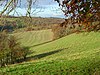 | 102,3 га (253 акра) [43] | ДА | Суинкомб 51 ° 35'06 "N 0 ° 58'05" W / 51,585 ° N 0,968 ° W Их 716 879 [43] | ББОВТ [44] | Карта | Цитирование | На этом участке есть древние леса, которые показаны на карте 1786 года, а также участки травянистых полян и кустарников. более 500 видов сосудистых растений Зарегистрировано , в том числе 18 орхидей и редкий шалфей луговой , занесенный в Британскую Красную книгу растений . Здесь обитает более 75 видов птиц и 650 грибов, многие из которых являются редкими в национальном масштабе. [45] | ||
| Бленхейм Парк |  | 224,3 га (554 акра) [46] | ДА | Вудсток 51 ° 50'10 "N 1 ° 22'12" W / 51,836 ° N 1,370 ° W СП 435 155 [46] | Карта | Цитирование | англосаксов Когда-то этот парк был местом охоты двенадцатого века , а затем оленьим парком . Сейчас здесь одни из лучших пастбищ и дубовых лесов в стране. Большие озера были созданы в восемнадцатом веке и имеют региональное значение для размножения и зимовки птиц. К беспозвоночным относятся три редких жука, занесенных в Британскую Красную книгу беспозвоночных : Rhizophagus oblongicollis , Plectophloeus nitidus и Aeletesatomarius . [47] | |||
| Боулд Вуд |  | 58,2 га (144 акра) [48] | ПП | Чиппинг Нортон 51 ° 52'59 "N 1 ° 38'02" W / 51,883 ° N 1,634 ° W СП 253 206 [48] | ББОВТ [49] | Карта | Цитирование | Этот участок представляет собой в основном древний полуестественный лес, но здесь также есть два ручья, пруд и влажный луг. Флора низших растений разнообразна. К грибам относятся трихоломные поганки и Cudoniella clavus , а также лишайники, такие как Cladonia polydactyla , Catillaria prasina и Graphis scripta . [50] | ||
| Брасенозный лес и холм Шотовер |  | 109,2 га (270 акров) [51] | ДА | Хедингтон 51 ° 45'50 "N 1 ° 11'10" W / 51,764 ° N 1,186 ° W СП 563 056 [51] | НКР [51] | Карта | Цитирование | Большая часть Брасенозного леса является остатком древнего леса Шотовер и является одним из немногих лесов, которые до сих пор обрабатываются традиционным методом подлесков со стандартами . Здесь очень разнообразна наземная флора, 221 вид сосудистых растений зарегистрирован , в том числе 46, характерных для древних лесов. На холме Шотовер есть пустоши и неулучшенные луга. описывает его Natural England как «представляющий выдающийся энтомологический интерес», здесь обитает множество редких мух, пчел, ос и муравьев. [52] | ||
| Бакленд Уоррен | 0,04 га (0,099 акра) [53] | НЕТ | Бакленд 51 ° 39'50 "N 1 ° 31'12" W / 51,664 ° N 1,520 ° W Их 333 963 [53] | Карта | Цитирование | Эта узкая полоска обрабатываемой земли между лесом и полем для гольфа обозначена как УОНИ, поскольку на ней обитает редкая в национальном масштабе сушенка широколистная , которая зарегистрирована менее чем в десяти местах в Великобритании и занесена в Британские красные данные. Книга сосудистых растений . Это однолетнее растение требует рыхления почвы вспашкой в начале-середине октября. [54] | ||||
| Кассингтон Медоуз | 6,9 га (17 акров) [55] | Уитни 51 ° 47'17 "N 1 ° 19'55" W / 51,788 ° N 1,332 ° W СП 462 101 [55] | САК [56] | Карта | Цитирование | |||||
| Дымоходные луга |  | 49,6 га (123 акра) [57] | ПП | Бэмптон 51 ° 41'53 "N 1 ° 29'31" W / 51,698 ° N 1,492 ° W ИП 352 000 [57] | ББОВТ , [58] ННР [59] | Карта | Цитирование | Этот участок, состоящий из шести богатых в ботаническом отношении аллювиальных лугов, граничит на юге с рекой Темзой . Луга пересечены рвами, большая часть которых покрыта тростниковым канареечником . Из трав наиболее распространены хвощ собачий , ползучий полевица , райграс многолетний , осока волосистая и осока сизоватая . [60] | ||
| Chinnor Chalk Pit |  | 20,4 га (50 акров) [61] | НЕТ | Чиннор 51°41′28″N 0°54′22″W / 51.691°N 0.906°W Их 757 997 [61] | ГКЛ [62] | Карта | Цитирование | описывает это место Natural England -за превосходных обнажений камня Тоттернхо », датируемого серединой сеномана мелового как «важное из периода, около 100 миллионов лет назад. Здесь обнаружено множество окаменелостей аммонитов Нижнего и Среднего Мела . [63] | ||
| Чиннор Хилл |  | 26,8 га (66 акров) [64] | ДА | Чиннор 51 ° 41'56 "N 0 ° 53'35" W / 51,699 ° N 0,893 ° W СП 766 006 [64] | ББОВТ [65] | Карта | Цитирование | На этом холме есть богатые видами известковые луга, можжевеловые кустарники, которые являются необычной средой обитания, смешанные кустарники и леса. более 300 видов сосудистых растений Зарегистрировано и 65 видов птиц. Многие воробьиные размножаются в кустарниках, а дрозды, такие как краснокрылки и рябинники, зимой питаются ягодами. [66] | ||
| Котилл Фен |  | 43,3 га (107 акров) [67] | ПП | Маршировать 51 ° 41'53 "N 1 ° 19'59" W / 51,698 ° N 1,333 ° W СП 462 001 [67] | ББОВТ , [68] [69] ГКЛ , [70] НКР , [71] ННР , [72] САК [73] | Карта | Цитирование | На этом участке расположены редкие в национальном масштабе известковые болота и болота, богатые мхом , а также богатая фауна беспозвоночных, в том числе 25 видов, занесенных в Красную книгу беспозвоночных . более 330 сосудистых растений Зафиксировано . Это объект национального значения с геологической точки зрения, поскольку отбор проб торфа дает представление о растительности в раннем голоцене , между 10 000 и 6 500 лет назад. [74] [75] | ||
| Калхэм Брейк | 1,5 га (3,7 акра) [76] | Калхэм 51 ° 39'50 "N 1 ° 16'01" W / 51,664 ° N 1,267 ° W Их 508 964 [76] | Карта | Цитирование | ||||||
| Камнор | 0,2 га (0,49 акра) [77] | Оксфорд 51 ° 43'34 "N 1 ° 20'02" W / 51,726 ° N 1,334 ° W СП 461 032 [77] | ГКЛ [78] | Карта | Цитирование | |||||
| Карьер Дитчли Роуд | 12,1 га (30 акров) [79] | Чарлбери 51 ° 52'34 "N 1 ° 27'54" W / 51,876 ° N 1,465 ° W СП 369 199 [79] | ГКЛ [80] | Карта | Цитирование | |||||
| Сухая Сэндфордская яма |  | 4,2 га (10 соток) [81] | ДА | Абингдон 51 ° 41'28 "N 1 ° 19'34" W / 51,691 ° N 1,326 ° W Их 467 994 [81] | ББОВТ , [82] ГКЛ [83] | Карта | Цитирование | Этот бывший песчаный карьер обнажает последовательность известняковых пород, отложенных на мелководье в прибрежных водах во время оксфордского этапа юрского периода , около 160 миллионов лет назад. Здесь много ископаемых аммонитов . Он имеет разнообразные известковые среды обитания, включая болота, луга, кустарники и пустоши. Это имеет национальное значение с энтомологической точки зрения, особенно для пчел и ос. [84] | ||
| Даклингтон Мид |  | 4,6 га (11 соток) [85] | НЕТ | Даклингтон 51 ° 45'58 "N 1 ° 28'30" W / 51,766 ° N 1,475 ° W СП 363 076 [85] | Карта | Цитирование | Этот традиционно управляемый луг имеет разнообразную флору, например, редкую и исчезающую змееголовую рябчику . К цветущим растениям в более засушливых местностях относятся пилолистник , падаль , подмаренник и бетония . Есть также канавы с интересной водно-болотной флорой и старинная живая изгородь с разнообразными кустарниками. [86] | |||
| Фернем Медоуз | 22,5 га (56 акров) [87] | Фарингдон 51 ° 36'50 "N 1 ° 34'37" W / 51,614 ° N 1,577 ° W Их 294 907 [87] | Карта | Цитирование | ||||||
| Фрилфорд-Хит, пруды и болота |  | 108,8 га (269 акров) [88] | ПП | Абингдон 51 ° 40'55 "N 1 ° 21'50" W / 51,682 ° N 1,364 ° W Их 441 983 [88] | ББОВТ [89] | Карта | Цитирование | Natural England описывает кислые луга, пустоши и болота в долинах этого места как уникальные для южной Англии. Зарегистрировано более 400 сосудистых растений, в том числе некоторые из них являются редкими в национальном масштабе. Есть необычные насекомые, такие как оса Microdynerus exilis , которая была признана родной для Британии только в конце двадцатого века, , занесенная в Красную книгу муха cheilosia mutabalis , и редкая на национальном уровне Epistrophe Diaphana . [90] | ||
| Глайм-Вэлли |  | 28,9 га (71 акров) [91] | ПП | Чиппинг Нортон 51 ° 55'48 "N 1 ° 30'36" W / 51,930 ° N 1,510 ° W СП 338 258 [91] | ББОВТ [92] | Карта | Цитирование | Этот линейный участок проходит вдоль двух участков долины реки Глайм , причем верхняя часть охватывает истоки реки. Разнообразные среды обитания включают реки, пруды, болота, болотистые луга, известняковые луга, кустарники и влажные леса. Здесь обитает большая колония шалфея лугового - редкого вида, занесенного в Британскую Красную книгу сосудистых растений . Есть несколько настроек барсука. [93] | ||
| Луг Графтон Лок | 10,7 га (26 акров) [94] | Фарингдон 51 ° 41'17 "N 1 ° 36'22" W / 51,688 ° N 1,606 ° W Их 273 989 [94] | Карта | Цитирование | ||||||
| Хакпен, Уоррен и Дедушка Хилл Даунс |  | 71,4 га (176 акров) [95] | ДА | Чайлдри 51 ° 33'36 "N 1 ° 29'10" W / 51,560 ° N 1,486 ° W Их 357 847 [95] | СМ [96] | Карта | Цитирование | Этот участок состоит из трех смежных участков неулучшенных меловых лугов, на которых осуществляется тесный выпас. В Уоррен-Дауне и Грампс-Хилл-Дауне преобладает кострец прямостоячий , а на большей части Хакпен-Дауна - овсяница красная . Зарегистрировано одиннадцать видов бабочек, в том числе меловая синяя , коричневая аргус и мраморная белая . [97] | ||
| Харпсден Вуд |  | 29,4 га (73 акра) [98] | ДА | Хенли-он-Темз 51 ° 31'01 ″ с.ш. 0 ° 54'22 ″ з.д. / 51,517 ° с.ш. 0,906 ° з.д. Их 760 804 [98] | Карта | Цитирование | Большая часть этой древней древесины покрыта кислой глиной с кремнем, хотя некоторые участки находятся на песчаной глине или меловом иле. участках напочвенная флора разнообразна На кислых почвах подлесок разреженный, а на известковых . К орхидеям относятся чемерица широколистная , чемерица с зелеными цветками , орхидея «птичье гнездо» и чемерица узкогубая . [99] | |||
| Замок сердца |  | 41,8 га (103 акра) [100] | ДА | Геринг-он-Темз 51 ° 30'25 "N 1 ° 06'36" W / 51,507 ° N 1,110 ° W Их 619 790 [100] | ББОВТ , [101] САК [102] | Карта | Цитирование | Этот участок на восточном берегу реки Темзы имеет разнообразную полуестественную среду обитания, в том числе богатую видами меловую низменность, древние тисовые леса, полуестественные широколиственные леса, прибрежные болота и кустарники. Хартслок-Вуд — один из объектов, внесенных в 1915 году Чарльзом Ротшильдом , основателем Фонда дикой природы , в список «достойных сохранения». В лесу растет множество пород деревьев, включая бук и тис , а также имеется большая колония барсуков . [103] [104] | ||
| Яма на ферме Хайлендс |  | 0,6 га (1,5 акра) [105] | ДА | Хенли-он-Темз 51 ° 31'34 "N 0 ° 55'48" W / 51,526 ° N 0,930 ° W Их 743 813 [105] | ГКЛ [106] | Карта | Цитирование | На этом месте обнажен гравий заброшенного русла реки Темзы до того, как английский ледниковый период сдвинул реку на юг около 450 000 лет назад. Возможно, он восходит к поздней английской террасе Блэк-Парк , что делает ее последним известным обнажением гравийного пола старого канала и, следовательно, имеет большое значение. Было обнаружено большое количество палеолитических кремней, которые являются одними из самых ранних известных представителей своего типа. [107] описывает его Natural England как «важнейшее место». [108] | ||
| Холли Корт Банк | 4,4 га (11 соток) [109] | Уитни 51 ° 49'59 "N 1 ° 26'28" W / 51,833 ° N 1,441 ° W СП 386 151 [109] | Карта | Цитирование | ||||||
| Холли Вуд |  | 25,6 га (63 акра) [110] | НЕТ | Оксфорд 51 ° 47'10 "N 1 ° 09'00" W / 51,786 ° N 1,150 ° W СП 587 100 [110] | Карта | Цитирование | лес является небольшим остатком средневекового Королевского леса Шотовер . Этот древний Это перелесок со стандартами на Оксфордской глине с разнообразной фауной беспозвоночных. Есть несколько необычных бабочек, таких как черная полоса волос и пурпурный император . [111] | |||
| Холтон Вуд |  | 50,6 га (125 акров) [112] | ФП | Оксфорд 51 ° 46'01 ″ с.ш. 1 ° 07'59 ″ з.д. / 51,767 ° с.ш. 1,133 ° з.д. СП 599 079 [112] | Карта | Цитирование | Этот древний лес раньше был частью Бернвудского леса , который был средневековым охотничьим лесом. Это полунатуральная поросль со стандартами , с прекрасными дубовыми планками разного возраста. Он имеет богатую фауну беспозвоночных, в том числе 27 видов бабочек, а также редкие виды, такие как белый адмирал и пурпурный император . [113] | |||
| Крючковый луг и территория ловушек |  | 11,9 га (29 акров) [114] | НЕТ | Оксфорд 51 ° 46'37 "N 1 ° 16'41" W / 51,777 ° N 1,278 ° W СП 499 089 [114] | Карта | Цитирование | Эти неулучшенные луга в пойме реки Темзы плохо дренированы и имеют известково-глинистые почвы. Южное поле наиболее заболочено, и его флора включает водно-болотные виды, такие как камыш остроцветковый , стрела болотная , камыш обыкновенный и орхидея болотная ранняя . [115] | |||
| Хук Нортон Каттинг и Бэнкс |  | 6,7 га (17 акров) [116] | ПП | Чиппинг Нортон 51 ° 58'55 "N 1 ° 28'48" W / 51,982 ° N 1,480 ° W СП 358 316 [116] | ББОВТ , [117] ГКЛ [118] | Карта | Цитирование | Хук-Нортон-Каттинг — природный заповедник, расположенный на двух участках заброшенной железнодорожной линии, разделенных туннелем. Большая часть территории представляет собой неулучшенные известковые луга с богатым разнообразием флоры. Это место примечательно своими видами пчел, в том числе одной, которая была зарегистрирована только на трех других участках в стране, Andrena bucephala . В разрезе обнажаются породы, датируемые средней юрой , около 167 миллионов лет назад, которые являются типичным разрезом члена Хук-Нортон формации Чиппинг-Нортон . Хук-Нортон-Бэнк — это крутые известняковые луга у реки Свере . [119] | ||
| Карьеры Хорсэй |  | 8,4 га (21 акр) [120] | НЕТ | Чиппинг Нортон 51 ° 56'28 "N 1 ° 20'17" W / 51,941 ° N 1,338 ° W СП 456 272 [120] | ГКЛ [121] | Карта | Цитирование | В этих карьерах обнаружены породы средней юры . Последовательность простирается от песчаной формации Нортгемптон ааленского периода около 172 миллионов лет назад до известняковой формации Тейнтон среднего бата около 167 миллионов лет назад. [122] | ||
| Херст Хилл |  | 20,6 га (51 акр) [123] | ДА | Камнор 51 ° 44'02 "N 1 ° 18'43" W / 51,734 ° N 1,312 ° W СП 476 041 [123] | ГКЛ [124] | Карта | Цитирование | Сайт принадлежит колледжу All Souls в Оксфорде. [125] а за мхами и печеночниками наблюдают уже более пятидесяти лет. Холм также важен с геологической точки зрения. В 1879 году на этом месте была найдена окаменелость Camptosaurus prestwichii , крупного травоядного динозавра, датируемого верхней юрой 143 миллиона лет назад. [126] Ископаемое принадлежит к типично североафриканскому роду и свидетельствует о существовании сухопутного моста через протоатлантику в поздней юре. [127] | ||
| Иффли Медоуз |  | 36,1 га (89 акров) [128] | ДА | Оксфорд 51 ° 43'48 "N 1 ° 14'38" W / 51,730 ° N 1,244 ° W СП 523 037 [128] | ББОВТ [129] | Карта | Цитирование | Эти пойменные луга между двумя рукавами Темзы традиционно используются для сена и пастбищ. Большая часть участка покрыта глиной, и каждый год во время затопления она обогащается илом. Здесь богатая луговая флора, выдающейся особенностью которой являются 89 000 рябчиков змеиной головы , которые весной дают фиолетовые цветы. Здесь имеется сеть старых речных каналов, канав и заросших живых изгородей. [129] [130] | ||
| Киртлингтонский карьер |  | 3,1 га (7,7 акров) [131] | ДА | Кидлингтон 51 ° 52'30 "N 1 ° 17'02" W / 51,875 ° N 1,284 ° W СП 494 199 [131] | ГКЛ , [132] [133] АРК [134] | Карта | Цитирование | В Британии находятся единственные средней юры в мире пять местонахождений млекопитающих , и этот заброшенный карьер дал самый богатый и разнообразный комплекс. Это датируется Верхним Батом , около 150 миллионов лет назад. Существует девять видов териан и прототерий , включая тритилодонтида . Есть также окаменелости динозавров-теропод , крокодилов , птерозавров , рыб и множество зубов акул. [135] | ||
| Найтсбридж-лейн | 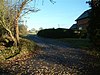 | 1,7 га (4,2 акра) [136] | ДА | Уотлингтон 51 ° 40'01 ″ с.ш. 1 ° 06'14 ″ з.д. / 51,667 ° с.ш. 1,104 ° з.д. Их 683 969 [136] | Карта | Цитирование | Этот участок представляет собой лесной массив по обочинам второстепенной дороги, где примерно одна десятая часть населения страны имеет очень редкое растение — зеленый гончий язык . Он занесен в Британскую Красную книгу и сосудистых растений встречается только в семи других местах Великобритании. Этот вид часто встречается в нарушенных почвах, и его численность, возможно, увеличилась после вырубки мертвых вязов. [137] | |||
| Карьер ягненка и флага | 0,2 га (0,49 акра) [138] | Абингдон 51 ° 40'26 "N 1 ° 27'07" W / 51,674 ° N 1,452 ° W Их 380 974 [138] | ГКЛ [139] | Карта | Цитирование | |||||
| Ламбридж Вуд |  | 74,6 га (184 акра) [140] | ДА | Хенли-он-Темз 51 ° 33'04 "N 0 ° 56'13" W / 51,551 ° N 0,937 ° W Их 738 841 [140] | Карта | Цитирование | Типы почв в лесу варьируются от известковых до очень кислых. Основными деревьями являются бук, а также дуб, ясень и вяз . Подлесок в основном состоит из ежевики, а местами из папоротника. [141] | |||
| Луг Лэнгли-Лейн | 3,3 га (8,2 акра) [142] | Уитни 51 ° 42'36 "N 1 ° 26'10" W / 51,710 ° N 1,436 ° W СП 391 014 [142] | Карта | Цитирование | ||||||
| Литтл Тью Медоуз | 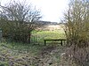 | 40,0 га (99 акров) [143] | ФП | Маленький Тью 51 ° 57'00 "N 1 ° 27'11" W / 51,950 ° N 1,453 ° W СП 377 281 [143] | Карта | Цитирование | Этот участок состоит из четырех прилегающих друг к другу неулучшенных лугов. Один используется для сена, остальные используются для выпаса скота. На двух из них есть заметные гребни и борозды, относящиеся к средневековым методам ведения сельского хозяйства. также имеются обширные промывки и обнажения известняка . Вокруг бывшего карьера [144] | |||
| Маленький Уиттенхэм |  | 68,9 га (170 акров) [145] | ДА | Дорчестер-он-Темз 51 ° 37'52 "N 1 ° 10'30" W / 51,631 ° N 1,175 ° W Их 572 928 [145] | САК [146] | Карта | Цитирование | Этот участок, находящийся под управлением Earth Trust , состоит из лесов, лугов, кустарников и прудов на склоне холма рядом с рекой Темзой . Флора включает редкую в национальном масштабе большую повилику , а также богатую популяцию земноводных, в том числе одну из крупнейших в стране популяций большого хохлатого тритона , который является приоритетным видом Плана действий по сохранению биоразнообразия . [147] | ||
| Железнодорожная резка Литтлмора |  | 0,5 га (1,2 акра) [148] | НЕТ | Оксфорд 51 ° 43'16 "N 1 ° 14'02" W / 51,721 ° N 1,234 ° W СП 530 027 [148] | ГКЛ [149] | Карта | Цитирование | На разрезе обнажены известняк и глина, отложенные в середине оксфордского периода поздней юры , около 160 миллионов лет назад. Месторождение является частью Стэнфордской формации , и глина, по-видимому, отложилась в канале между коралловыми рифами, которые затем покрывали территорию Оксфорда. [150] [151] | ||
| Кирпичная яма Литтлворта | 1,5 га (3,7 акра) [152] | Оксфорд 51 ° 44'38 "N 1 ° 08'53" W / 51,744 ° N 1,148 ° W СП 589 054 [152] | ГКЛ [153] | Карта | Цитирование | |||||
| Гравийный карьер Лонг-Ханборо | 3,7 га (9,1 акра) [154] | Уитни 51 ° 49'08 "N 1 ° 23'38" W / 51,819 ° N 1,394 ° W СП 419 136 [154] | ГКЛ [155] | Карта | Цитирование | |||||
| Щелочная долина |  | 2,3 га (5,7 акров) [156] | ДА | Оксфорд 51°44′46″ с.ш. 1°12′32″ з.д. / 51,746° с.ш. 1,209° з.д. СП 547 056 [156] | АРК [157] | Карта | Цитирование | Это известковая долина, которая является редкой и находящейся под угрозой исчезновения средой обитания в стране. Его истощает река Щелок . Существует множество видов мхов, таких как Drepanocladus revolvens и Campylium stellatum . К беспозвоночным относятся редкая на национальном уровне львинка и Vanoyia tenuicornis необычные пауки Xysticus ulmi и Anistea elegans . [158] | ||
| Карьер Лайхилл |  | 2.8 hectares (6.9 acres)[159] | НЕТ | Oxford 51°45′25″N 1°08′38″W / 51.757°N 1.144°W SP 592 068[159] | GCR[160] | Карта | Цитирование | This disused quarry exposes rocks dating to the Wheatley Limestone member of the Stanford Formation, approximately 160 million years ago during the Middle Jurassic. The deposits are limestones in an unstable reef substrate, and the only fossils are of oysters.[161] | ||
| Magdalen Grove | 0.4 hectares (0.99 acres)[162] | Oxford 51°45′18″N 1°15′00″W / 51.755°N 1.250°W SP 519 065[162] | GCR[163] | Map | Citation | |||||
| Magdalen Quarry | 0.3 hectares (0.74 acres)[164] | Oxford 51°45′36″N 1°12′11″W / 51.760°N 1.203°W SP 551 071[164] | GCR,[165] LNR[166] | Map | Citation | |||||
| Middle Barton Fen | 11.6 hectares (29 acres)[167] | Chipping Norton 51°55′59″N 1°21′22″W / 51.933°N 1.356°W SP 444 263[167] | Map | Citation | ||||||
| Moulsford Downs |  | 13.6 hectares (34 acres)[168] | NO | Moulsford 51°32′20″N 1°10′08″W / 51.539°N 1.169°W SU 577 826[168] | Map | Citation | This chalk grassland site on the Berkshire Downs has a rich wildlife. The diverse invertebrate fauna includes the uncommon robber-fly Leptarthrus brevirostris, the adonis blue butterfly, the juniper shield bug, the weevils Baris picicornis and seed beetle Phyllobius viridicollis, the leaf beetle Phyllotreta nodicornis and the Bruchus cisti.[169] | |||
| Murcott Meadows | 22.5 hectares (56 acres)[170] | Oxford 51°31′16″N 1°08′35″W / 51.521°N 1.143°W SP 592 139[170] | BBOWT[171] | Map | Citation | |||||
| Neithrop Fields Cutting |  | 1.4 hectares (3.5 acres)[172] | YES | Banbury 52°04′26″N 1°21′43″W / 52.074°N 1.362°W SP 438 419[172] | GCR[173] | Map | Citation | This site exhibits sections dating to the Early Jurassic around 190 to 180 million years ago. Its Middle Lias sediments show that it was adjacent to the "London landmass", which was then an island. The Upper Lias have a section rich in fossil ammonites. Natural England describes the site as a "key palaeogeographic and stratigraphic locality".[174] | ||
| New Marston Meadows |  | 44.7 hectares (110 acres)[175] | PP | Oxford 51°45′54″N 1°14′53″W / 51.765°N 1.248°W SP 520 076[175] | Map | Citation | These meadows in the floodplain of the River Cherwell are traditionally managed for hay or by grazing. Some plants are typical of those on ancient meadows, such as common meadow-rue, pepper-saxifrage, devil's-bit scabious, adder's-tongue fern, smooth brome and meadow barley. Snake's head fritillary, which is nationally scarce, is also found at the site.[176] | |||
| Otmoor |  | 213.0 hectares (526 acres)[177] | PP | Murcott 51°49′12″N 1°10′08″W / 51.820°N 1.169°W SP 574 138[177] | Map | Citation | This site in the floodplain of the River Ray has herb-rich damp grassland, wet sedge, coarse grassland, woodland, pools and ditches. More than sixty species of bird breed on the site, such as curlew and lapwing, while wintering birds include teal, wigeon, snipe, golden plover and short-eared owl.[178] | |||
| Out Wood |  | 19.2 hectares (47 acres)[179] | PP | Woodstock 51°52′59″N 1°24′36″W / 51.883°N 1.410°W SP 407 207[179] | Map | Citation | This semi-natural wood is a surviving fragment of the medieval Royal Forest of Wychwood. It is overgrown coppice with standards, and the standards are oaks between 30 and 150 years old. Rides have a diverse ground flora, including meadow saffron, broad-leaved helleborine and greater butterfly orchid.[180] | |||
| Pishill Woods | 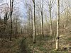 | 42.8 hectares (106 acres)[181] | PP | Henley-on-Thames 51°36′22″N 0°58′19″W / 51.606°N 0.972°W SU 713 902[181] | Map | Citation | These semi-natural woods have a rich ground flora, including 35 species associated with ancient woodland. The southern part is dominated by beech and oak coppice, whereas the north, which has been managed as high forest, has mainly mature beech trees, with smaller numbers of oak, ash, cherry, whitebeam, yew and wych elm. The southern part is common land.[182] | |||
| Pixey and Yarnton Meads |  | 86.4 hectares (213 acres)[183] | PP | Oxford 51°47′17″N 1°18′29″W / 51.788°N 1.308°W SP 478 102[183] | NCR,[184] SAC[56] | Map | Citation | These are unimproved flood meadows on the bank of the River Thames. Their management is very well recorded, and it is known that they have been grazed and cut for hay for more than a thousand years, with the result that they are botanically rich, with more than 150 species. The site has been the subject of detailed botanical and hydrological research.[185] | ||
| Port Meadow with Wolvercote Common and Green |  | 167.1 hectares (413 acres)[186] | PP | Oxford 51°46′26″N 1°17′13″W / 51.774°N 1.287°W SP 493 086[186] | NCR,[184] SAC,[56] SM[187] | Map | Citation | This site consists of meadows in the floodplain of the River Thames. It is thought to have been grazed for over a thousand years and is a classic site for studying the effects of grazing on flora. There is a low diversity compared with neighbouring fields which are cut for hay, but 178 flowering plants have been recorded, including creeping marshwort, which is a Red Data Book species not found anywhere else in Britain.[188] | ||
| Priest's Hill | 1.0 hectare (2.5 acres)[189] | Henley-on-Thames 51°34′44″N 0°59′35″W / 51.579°N 0.993°W SU 699 872[189] | GCR[190] | Map | Citation | |||||
| Reed Hill |  | 14.0 hectares (35 acres)[191] | NO | Witney 51°35′02″N 1°27′00″W / 51.584°N 1.450°W SP 380 174[191] | Map | Citation | This sheltered dry valley has unimproved limestone grassland, secondary woodland and scrub. A spring at the northern end makes the ground there seasonally damp. Invertebrates include the small blue, Duke of Burgundy and dark green fritillary butterflies, the small shield bug Neotti-glossa pusilla, the beetle Oedemera lurida and the spider Hypsosinga pygmaea.[192] | |||
| Rock Edge | 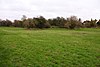 | 1.7 hectares (4.2 acres)[193] | YES | Oxford 51°45′14″N 1°12′22″W / 51.754°N 1.206°W SP 549 064[193] | GCR,[194] LNR[195] | Map | Citation | This site exposes limestone rich in coral called Coral rag, laid down when the area was under a warm, shallow sea, similar to the Bahama Banks today. It is rich in fossils derived from the coral reefs. It dates to the Upper Jurassic, around 145 million years ago.[196] | ||
| Rushy Meadows |  | 8.9 hectares (22 acres)[197] | NO | Kidlington 51°49′26″N 1°18′11″W / 51.824°N 1.303°W SP 481 142[197] | Map | Citation | This site consists of unimproved alluvial grasslands on the bank of the Oxford Canal. The species-rich sward is dominated by hard rush, and other plants include water avens, which is very uncommon in the Thames Basin, pepper saxifrage, devil's bit scabious, early marsh orchid and distant sedge.[198] | |||
| Salt Way, Ditchley |  | 2.0 hectares (4.9 acres)[199] | YES | Chipping Norton 51°52′23″N 1°26′38″W / 51.873°N 1.444°W SP 384 195[199] | LNR[200] | Map | Citation | This is a stretch of an ancient track together with its species-rich grass verges and hedges. It has been designated an SSSI because it has the largest known British colony of the very rare downy woundwort, with more than 100 seedlings and 60 flowering stems. The plant is associated with hedges along Roman roads and ancient tracks on calcareous soils, and Salt Way may date to the Roman period.[201] | ||
| Sarsgrove Wood |  | 41.9 hectares (104 acres)[202] | NO | Chipping Norton 51°54′58″N 1°33′32″W / 51.916°N 1.559°W SP 304 243[202] | Map | Citation | This ancient wood has a diverse geology resulting in a variety of soil conditions. A stream with poorly drained valley walls runs through the wood. More freely-drained areas have ground flora including early-purple orchid, primrose, bluebell, early dog-violet, sweet violet and narrow-leaved everlasting pea.[203] | |||
| Sharp's Hill Quarry |  | 2.4 hectares (5.9 acres)[204] | NO | Banbury 52°01′12″N 1°30′36″W / 52.020°N 1.510°W SP 337 358[204] | GCR[205] | Map | Citation | This is the type locality of the Sharp's Hill Formation. It is very fossiliferous and dates to the Bathonian stage of the Middle Jurassic, around 167 million years ago. It is very important for understanding the Bathonian succession in north Oxfordshire. Strata of the underlying Chipping Norton Formation are also present.[206][207] | ||
| Sheep's Banks |  | 5.1 hectares (13 acres)[208] | NO | Woodstock 51°53′06″N 1°21′32″W / 51.885°N 1.359°W SP 442 209[208] | Map | Citation | This steeply sloping site is species-rich grassland which is traditionally managed. An ancient hedge runs the length of the site and a small stream runs along the downward side. Flora include five species of orchid, including bee, pyramidal and green-winged.[209] | |||
| Shellingford Crossroads Quarry | 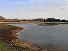 | 2.6 hectares (6.4 acres)[210] | YES | Faringdon 51°38′42″N 1°31′48″W / 51.645°N 1.530°W SU 326 941[210] | GCR[211] | Map | Citation | This site exposes rocks of the Corallian Group, dating to the Oxfordian stage of the Late Jurassic, around 160 million years ago. It has many fossils of corals and reef-dwelling bivalves, and it is also important as it provides an example of the complexity of Oxfordian stratigraphy.[212] | ||
| Shipton-on-Cherwell and Whitehill Farm Quarries |  | 27.0 hectares (67 acres)[213] | NO | Kidlington 51°51′07″N 1°18′32″W / 51.852°N 1.309°W SP 477 173[213] | GCR[214][215] | Map | Citation | This site exposes a lithostratigraphic succession dating to the Bathonian stage of the Middle Jurassic, around 167 million years ago. Shipton-on-Cherwell Quarry is described by Natural England as "of international importance as one of the best Upper Bathonian reptile sites known", and it has yielded type material for two species of crocodile. The quarry has also produced the type specimen of the dinosaur Dacentrurus vetustus.[216] | ||
| Shirburn Hill |  | 63.7 hectares (157 acres)[217] | YES | Watlington 51°39′11″N 0°58′05″W / 51.653°N 0.968°W SU 715 954[217] | Map | Citation | The hill has chalk grassland, chalk heath, scrub and broadleaved woodland. Most grasslands in the Chilterns are maintained by stock, and the site is unusual in being cropped only by rabbits. Less closely grazed areas have taller grass with species such as false oat-grass, tor-grass and red fescue. There are large areas of hawthorn and buckthorn scrub.[218] | |||
| Sidling's Copse and College Pond | 21.7 hectares (54 acres)[219] | Oxford 51°46′52″N 1°12′00″W / 51.781°N 1.200°W SP 553 094[219] | BBOWT[220] | Map | Citation | |||||
| Spartum Fen | 7.6 hectares (19 acres)[221] | Oxford 51°42′32″N 1°03′18″W / 51.709°N 1.055°W SP 654 016[221] | Map | Citation | ||||||
| Stanton Great Wood |  | 58.2 hectares (144 acres)[222] | NO | Oxford 51°46′41″N 1°08′56″W / 51.778°N 1.149°W SP 588 092[222] | Map | Citation | This coppice with standards wood is traditionally managed. The dominant trees are pedunculate oak, ash and hazel, and there is a rich flora and diverse insects. Moths include the buff footman, poplar lutestring, blotched emerald, maiden's blush and the nationally uncommon small black arches.[223] | |||
| Stanton Harcourt | 0.5 hectares (1.2 acres)[224] | Witney 51°44′35″N 1°24′07″W / 51.743°N 1.402°W SP 414 051[224] | GCR[225] | Map | Citation | |||||
| Stonesfield Common, Bottoms and Banks |  | 26.9 hectares (66 acres)[226] | PP | Witney 51°50′46″N 1°25′55″W / 51.846°N 1.432°W SP 392 165[226] | Map | Citation | This site is composed of steeply sloping valleys and banks. Most of it is unimproved limestone grassland and scrub, but there is also an area of semi-natural ancient woodland. The grass in Stonesfield Common is mainly upright brome, and herbs include field scabious, greater knapweed, lady's bedstraw and pyramidal orchid.[227] | |||
| Stonesfield Slate Mines | 0.8 hectares (2.0 acres)[228] | Witney 51°51′00″N 1°26′38″W / 51.850°N 1.444°W SP 384 170[228] | GCR[229][230][231][232][233] | Map | Citation | |||||
| Stratton Audley Quarries | 8.6 hectares (21 acres)[234] | Bicester 51°55′12″N 1°07′41″W / 51.920°N 1.128°W SP 601 250[234] | GCR[235] | Map | Citation | |||||
| Sturt Copse |  | 6.5 hectares (16 acres)[236] | FP | Witney 51°49′55″N 1°25′19″W / 51.832°N 1.422°W SP 399 150[236] | Map | Citation | This wood has many giant stools of coppiced of ash and wych elm trees, together with oaks, some of them pollarded. Most of the ground layer is dominated by dog's mercury, and there are uncommon plants such as yellow star-of-Bethlehem, Lathraea squamaria and hard shield-fern.[237] | |||
| Sugworth |  | 0.6 hectares (1.5 acres)[238] | NO | Abingdon 51°42′11″N 1°15′40″W / 51.703°N 1.261°W SP 512 007[238] | GCR[239] | Map | Citation | This site dates to the Cromerian Stage, an interglacial over half a million years ago. It is a river channel cut into Kimmeridge Clay of the Late Jurassic, and it has rich deposits of vertebrates, ostracods, molluscs, beetles, plant remains and pollen.[240] | ||
| Swyncombe Downs |  | 47.1 hectares (116 acres)[241] | PP | Henley-on-Thames 51°36′54″N 1°01′30″W / 51.615°N 1.025°W SU 676 911[241] | SM[242] | Map | Citation | This is an area of chalk grassland and scrub on the steep slopes of the Chiltern Hills. The site is described by Natural England as outstanding for its butterflies and moths. Butterflies include the silver-spotted skipper, which is nationally rare, grizzled skipper, grizzled skipper and dark green fritillary. There are day flying moths such as the cistus forester, chimney sweeper and wood tiger.[243] | ||
| Taynton Quarries | 40.0 hectares (99 acres)[244] | Taynton 51°49′59″N 1°39′36″W / 51.833°N 1.660°W SP 235 150[244] | Map | Citation | ||||||
| Tuckmill Meadows | 5.7 hectares (14 acres)[245] | Shrivenham 51°36′25″N 1°39′22″W / 51.607°N 1.656°W SU 239 899[245] | LNR[246] | Map | Citation | |||||
| Warren Bank |  | 3.1 hectares (7.7 acres)[247] | YES | Wallingford 51°33′58″N 1°03′32″W / 51.566°N 1.059°W SU 653 857[247] | BBOWT[248] | Map | Citation | This steeply sloping site has unimproved chalk grassland and scrub. There is a rich variety of flora, including horseshoe vetch, chalk milkwort and bee orchid. There are also many insects, with butterflies such as dark green fritillary and green hairstreak.[249] | ||
| Waterperry Wood |  | 137.0 hectares (339 acres)[250] | YES | Forest Hill 51°46′41″N 1°07′26″W / 51.778°N 1.124°W SP 605 092[250] | NCR[251] | Map | Citation | This wood has been designated an SSSI because it contains a diverse and important insect fauna, with many nationally uncommon and rare species. There are nineteen species of nationally uncommon hoverflies, including five which are listed in the British Red Data Book of Insects, many nationally uncommon beetles, thirty butterfly species and several rare moths.[252] | ||
| Watlington and Pyrton Hills |  | 112.7 hectares (278 acres)[253] | PP | Watlington 51°38′20″N 0°58′59″W / 51.639°N 0.983°W SU 705 938[253] | LNR[254] | Map | Citation | This site has floristically diverse chalk grassland, chalk scrub, broadleaved woodland and yew woodland. Watlington Hill has short turf which is grazed by rabbits, with flowering plants including yellow-wort, dropwort, horseshoe vetch, squinancywort and the nationally rare candytuft.[255] | ||
| Wendlebury Meads and Mansmoor Closes |  | 74.1 hectares (183 acres)[256] | FP | Kidlington 51°51′11″N 1°11′24″W / 51.853°N 1.190°W SP 561 175[256] | BBOWT,[257] NCR[256] | Map | Citation | Wendlebury Meads consists of several meadows which have been traditionally managed, and have complex and varied flora. It is one of the few Calcareous pastures to have survived agricultural improvements. Almost all show evidence of medieval ridge and furrow ploughing. Mansmoor Closes were enclosed before 1622, and are important from both a landscape and archaeological point of view. More than 160 plant species have been recorded on the site.[258] | ||
| Weston Fen |  | 14.0 hectares (35 acres)[259] | FP | Bicester 51°52′19″N 1°14′20″W / 51.872°N 1.239°W SP 525 195[259] | Map | Citation | This site has diverse habitats, including a fast-flowing stream, species-rich, calcareous fen, willow carr, hazel woodland, limestone grassland and marshy grassland. There are several rare species of beetle, such as Sphaerius acaroides, Eubria palustris, Silis ruficollis and Agabus biguttatus.[260] | |||
| Westwell Gorse | 2.5 hectares (6.2 acres)[261] | Burford 51°48′00″N 1°41′02″W / 51.800°N 1.684°W SP 219 113[261] | Map | Citation | ||||||
| Whitecross Green and Oriel Woods | 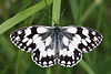 | 63.0 hectares (156 acres)[262] | YES | Murcott 51°49′30″N 1°07′41″W / 51.825°N 1.128°W SP 602 144[262] | BBOWT[263] | Map | Citation | These ancient woods are part of two former royal forests, Shotover and Bernwood. They are crossed by herb-rich and grassy rides, some of which are bordered by ditches, and there is also a pond and a marsh. Twenty-four species of butterfly have been recorded including the nationally rare black hairstreak.[264] | ||
| Whitehill Wood | 3.4 hectares (8.4 acres)[265] | Witney 51°50′10″N 1°26′02″W / 51.836°N 1.434°W SP 391 154[265] | Map | Citation | ||||||
| Whitehorse Hill |  | 99.0 hectares (245 acres)[266] | PP | Faringdon 51°34′41″N 1°34′05″W / 51.578°N 1.568°W SU 300 867[266] | GCR,[267] SM[268] | Map | Citation | This dry valley provides evidence of solifluction (slow sloping downhill due to repeated freezing and thawing) during at least one cold stage of the Pleistocene. The site has unimproved chalk grassland with a rich variety of flora, particularly in former chalk quarries. Grasses include upright brome and sheep’s fescue.[269] | ||
| Wicklesham and Coxwell Pits | 12.6 hectares (31 acres)[270] | Faringdon 51°38′42″N 1°34′44″W / 51.645°N 1.579°W SU 292 941[270] | GCR[271][272] | Map | Citation | |||||
| Wolvercote Meadows |  | 7.1 hectares (18 acres)[273] | PP | Oxford 51°46′59″N 1°17′53″W / 51.783°N 1.298°W SP 485 096[273] | SAC[56] | Map | Citation | These meadows next to the River Thames are traditionally managed for pasture and hay, and they have a rich flora. The largest, which is called Great Baynham's Meadow, is used as pasture, and the other fields are managed for hay with grazing in the autumn. There are also watercourses which have many dragonflies.[274] | ||
| Woodeaton Quarry |  | 7.3 hectares (18 acres)[275] | YES | Oxford 51°48′22″N 1°13′41″W / 51.806°N 1.228°W SP 533 122[275] | GCR[276] | Map | Citation | This site exposes a sequence of rocks dating to the Middle Jurassic around 167 million years ago. It exhibits one of the most complete Bathonian sections in the county, and is described by Natural England as "of great palaeontological and sedimentological interest".[277] | ||
| Woodeaton Wood |  | 14.0 hectares (35 acres)[278] | NO | Oxford 51°47′46″N 1°13′05″W / 51.796°N 1.218°W SP 540 111[278] | Map | Citation | This coppice with standards on calcareous soil is a fragment of the ancient Shotover Forest. The ground layer has plants such as wood anemone, nettle-leaved bellflower, ramsons, goldilocks buttercup, early dog-violet and enchanter's nightshade.[279] | |||
| Wormsley Chalk Banks |  | 14.8 hectares (37 acres)[280] | PP | Stokenchurch 51°38′02″N 0°55′34″W / 51.634°N 0.926°W SU 744 934[280] | Map[d] | Citation | The site has chalk grassland which is rich in both plant and invertebrate species which have sharply declined nationally. Flowers include bee and fly orchids, the latter of which is becoming scarce. Invertebrates include a variety of butterflies, harvest spiders and slowworms.[281] | |||
| Worsham Lane | 0.4 hectares (0.99 acres)[282] | Witney 51°47′02″N 1°33′22″W / 51.784°N 1.556°W SP 307 096[282] | Map | Citation | ||||||
| Wychwood |  | 501.7 hectares (1,240 acres)[283] | PP | Witney 51°51′04″N 1°30′43″W / 51.851°N 1.512°W SP 337 170[283] | NCR,[284] NNR,[285] SM[286] | Map | Citation | This remnant of a large royal hunting forest is the largest area of ancient broadleaved forest in the county, and the site also has limestone grassland and four marl lakes. More than 360 species of flowering plants and ferns have been recorded, together with 85 lichens and 60 mosses and liverworts. The invertebrate fauna is diverse, including 17 rare flies.[287] | ||
| Wytham Ditches and Flushes |  | 2.7 hectares (6.7 acres)[288] | NO | Wytham 51°47′06″N 1°19′37″W / 51.785°N 1.327°W SP 465 098[288] | Map | Citation | These ditches have a rich aquatic and fen flora. Uncommon wetland plants include greater water-parsnip, greater spearwort, water violet, brookweed, narrow-leaved water plantain and creeping jenny. There is also a small tussocky field which is kept partly waterlogged by flushes.[289] | |||
| Wytham Woods |  | 423.8 hectares (1,047 acres)[290] | YES | Wytham 51°46′08″N 1°19′48″W / 51.769°N 1.330°W SP 463 080[290] | NCR[290] | Map | Citation | Habitats in this site, which formerly belonged to Abingdon Abbey, include ancient woodland and limestone grassland. Over 500 species of vascular plant have been recorded, and more data about the bird, mammal and invertebrate fauna, have probably been recorded about this site than any other in the country as a result of studies by Oxford University. More than 900 species of beetles, 580 of flies, 200 of spiders, 700 of bees, wasps and ant, 250 of true bugs and 27 of earthworms have been recorded.[291] |
See also
[edit]- Berkshire, Buckinghamshire and Oxfordshire Wildlife Trust
- List of local nature reserves in Oxfordshire
Notes
[edit]- ^ Jump up to: a b The area and grid reference are taken from the "Details" page for each site on the Natural England database.[2]
- ^ The maps are provided by Natural England on the Magic Map website.
- ^ Citations are provided for each site by Natural England.
- ^ Jump up to: a b c This site is partly in Buckinghamshire.
References
[edit]- ^ Protected or designated areas, Department for Environment, Food & Rural Affairs and Natural England
- ^ Jump up to: a b "Natural England, Sites of Special Scientific Interest, Search results for Oxfordshireshire". Archived from the original on 2014-02-28. Retrieved 2011-12-18.
- ^ Jump up to: a b "Designated Sites View: Alvescot Meadows". Sites of Special Scientific Interest. Natural England. Retrieved 11 February 2020.
- ^ Jump up to: a b "Designated Sites View: Appleton Lower Common". Sites of Special Scientific Interest. Natural England. Retrieved 11 February 2020.
- ^ "Appleton Lower Common citation" (PDF). Sites of Special Scientific Interest. Natural England. Retrieved 4 April 2020.
- ^ Jump up to: a b "Designated Sites View: Ardley Cutting and Quarry". Sites of Special Scientific Interest. Natural England. Retrieved 11 February 2020.
- ^ "Ardley Wood Quarry". Berkshire, Buckinghamshire and Oxfordshire Wildlife Trust. Retrieved 18 February 2016.
- ^ "Ardley Cuttings & Quarries (Bathonian)". Geological Conservation Review. Joint Nature Conservation Committee. Archived from the original on August 8, 2019. Retrieved 26 February 2020.
- ^ "Ardley Wood moated ringwork". Historic England. Retrieved 30 March 2020.
- ^ "Ardley Cutting and Quarry citation" (PDF). Sites of Special Scientific Interest. Natural England. Retrieved 30 March 2020.
- ^ Jump up to: a b "Designated Sites View: Ardley Trackways". Sites of Special Scientific Interest. Natural England. Retrieved 11 February 2020.
- ^ "Ardley Trackways (Jurassic - Cretaceous Reptilia)". Geological Conservation Review. Joint Nature Conservation Committee. Retrieved 26 February 2020.[permanent dead link]
- ^ "Ardley Trackways citation" (PDF). Sites of Special Scientific Interest. Natural England. Retrieved 2 June 2020.
- ^ Jump up to: a b "Designated Sites View: Arncott Bridge Meadows". Sites of Special Scientific Interest. Natural England. Retrieved 11 February 2020.
- ^ "Arncott Bridge Meadows citation" (PDF). Sites of Special Scientific Interest. Natural England. Retrieved 13 February 2020.
- ^ Jump up to: a b "Designated Sites View: Ashdown Park". Sites of Special Scientific Interest. Natural England. Retrieved 11 February 2020.
- ^ "Ashdown Park citation" (PDF). Sites of Special Scientific Interest. Natural England. Retrieved 4 April 2020.
- ^ Jump up to: a b "Designated Sites View: Aston Rowant". Sites of Special Scientific Interest. Natural England. Retrieved 11 February 2020.
- ^ Ratcliffe, Derek A. (1977). A Nature Conservation Review. Vol. 2. Cambridge University Press. p. 121. ISBN 9780521214032.
- ^ "Aston Rowant citation" (PDF). Sites of Special Scientific Interest. Natural England. Archived (PDF) from the original on 4 March 2016. Retrieved 4 January 2016.
- ^ "Aston Rowant". Joint Nature Conservation Committee. Archived from the original on 16 March 2016. Retrieved 25 February 2016.
- ^ "Aston Rowant (SAC)". Natural England. Archived from the original on 5 March 2016. Retrieved 25 February 2016.
- ^ "Aston Rowant citation" (PDF). Sites of Special Scientific Interest. Natural England. Retrieved 13 February 2020.
- ^ Jump up to: a b "Designated Sites View: Aston Rowant Cutting". Sites of Special Scientific Interest. Natural England. Retrieved 11 February 2020.
- ^ "Aston Rowant Cutting (Cenomanian, Turonian, Senonian, Maastrichtian)". Geological Conservation Review. Joint Nature Conservation Committee. Archived from the original on August 8, 2019. Retrieved 26 February 2020.
- ^ "Aston Rowant Cutting citation" (PDF). Sites of Special Scientific Interest. Natural England. Retrieved 5 April 2020.
- ^ Jump up to: a b "Designated Sites View: Aston Rowant Woods". Sites of Special Scientific Interest. Natural England. Retrieved 11 February 2020.
- ^ Ratcliffe, Derek A. (1977). A Nature Conservation Review. Vol. 2. Cambridge University Press. p. 53. ISBN 9780521214032.
- ^ Biodiversity Designations Background Paper. Wycombe District Council. June 2009. pp. 9, 10. Archived from the original on 1 March 2016. Retrieved 19 April 2016.
- ^ "Chilterns Beechwoods". Joint Nature Conservation Committee. Archived from the original on 16 March 2016. Retrieved 25 February 2016.
- ^ "Chilterns Beechwoods (SAC)". Natural England. Archived from the original on 5 March 2016. Retrieved 25 February 2016.
- ^ "Aston Rowant Woods citation" (PDF). Sites of Special Scientific Interest. Natural England. Retrieved 13 February 2020.
- ^ Jump up to: a b "Designated Sites View: Aston Upthorpe Downs". Sites of Special Scientific Interest. Natural England. Retrieved 11 February 2020.
- ^ Ratcliffe, p. 121
- ^ "Aston Upthorpe Downs citation" (PDF). Sites of Special Scientific Interest. Natural England. Retrieved 4 March 2020.
- ^ Jump up to: a b "Designated Sites View: Barrow Farm Fen". Sites of Special Scientific Interest. Natural England. Retrieved 11 February 2020.
- ^ Jump up to: a b "Designated Sites View: Bear, Oveys and Great Bottom Woods". Sites of Special Scientific Interest. Natural England. Retrieved 11 February 2020.
- ^ "Bear, Oveys and Great Bottom Woods citation" (PDF). Sites of Special Scientific Interest. Natural England. Retrieved 5 April 2020.
- ^ Jump up to: a b "Designated Sites View: Berins Hill Bank". Sites of Special Scientific Interest. Natural England. Retrieved 11 February 2020.
- ^ Jump up to: a b "Designated Sites View: Berrick Trench". Sites of Special Scientific Interest. Natural England. Retrieved 11 February 2020.
- ^ "Berrick Trench citation" (PDF). Sites of Special Scientific Interest. Natural England. Retrieved 5 April 2020.
- ^ Jump up to: a b "Designated Sites View: Bestmoor". Sites of Special Scientific Interest. Natural England. Retrieved 11 February 2020.
- ^ Jump up to: a b "Designated Sites View: Bix Bottom". Sites of Special Scientific Interest. Natural England. Retrieved 11 February 2020.
- ^ "Warburg Nature Reserve". Berkshire, Buckinghamshire and Oxfordshire Wildlife Trust. Retrieved 6 March 2020.
- ^ "Bix Bottom citation" (PDF). Sites of Special Scientific Interest. Natural England. Retrieved 10 March 2020.
- ^ Jump up to: a b "Designated Sites View: Blenheim Park". Sites of Special Scientific Interest. Natural England. Retrieved 11 February 2020.
- ^ "Blenheim Park citation" (PDF). Sites of Special Scientific Interest. Natural England. Retrieved 12 March 2020.
- ^ Jump up to: a b "Designated Sites View: Bould Wood". Sites of Special Scientific Interest. Natural England. Retrieved 11 February 2020.
- ^ "Foxholes". Berkshire, Buckinghamshire and Oxfordshire Wildlife Trust. Retrieved 18 February 2016.
- ^ "Bould Wood citation" (PDF). Sites of Special Scientific Interest. Natural England. Retrieved 2 June 2020.
- ^ Jump up to: a b c "Designated Sites View: Brasenose Wood and Shotover Hill". Sites of Special Scientific Interest. Natural England. Retrieved 11 February 2020.
- ^ "Brasenose Wood and Shotover Hill citation" (PDF). Sites of Special Scientific Interest. Natural England. Retrieved 12 March 2020.
- ^ Jump up to: a b "Designated Sites View: Buckland Warren". Sites of Special Scientific Interest. Natural England. Retrieved 11 February 2020.
- ^ "Buckland Warren citation" (PDF). Sites of Special Scientific Interest. Natural England. Retrieved 5 April 2020.
- ^ Jump up to: a b "Designated Sites View: Cassington Meadows". Sites of Special Scientific Interest. Natural England. Retrieved 11 February 2020.
- ^ Jump up to: a b c d "Designated Sites View: Oxford Meadows". Special Areas of Conservation. Natural England. Retrieved 26 February 2020.
- ^ Jump up to: a b "Designated Sites View: Chimney Meadows". Sites of Special Scientific Interest. Natural England. Retrieved 11 February 2020.
- ^ "Chimney Meadows". Berkshire, Buckinghamshire and Oxfordshire Wildlife Trust. Retrieved 18 February 2016.
- ^ "Designated Sites View: Chimney Meadows". National Nature Reserves. Natural England. Retrieved 25 February 2020.
- ^ "Chimney Meadows citation" (PDF). Sites of Special Scientific Interest. Natural England. Retrieved 13 March 2020.
- ^ Jump up to: a b "Designated Sites View: Chinnor Chalk Pit". Sites of Special Scientific Interest. Natural England. Retrieved 11 February 2020.
- ^ "Chinnor Chalk Pit (Cenomanian, Turonian, Senonian, Maastrichtian)". Geological Conservation Review. Joint Nature Conservation Committee. Archived from the original on August 8, 2019. Retrieved 26 February 2020.
- ^ "Chinnor Chalk Pit citation" (PDF). Sites of Special Scientific Interest. Natural England. Retrieved 22 March 2020.
- ^ Jump up to: a b "Designated Sites View: Chinnor Hill". Sites of Special Scientific Interest. Natural England. Retrieved 11 February 2020.
- ^ "Chinnor Hill". Berkshire, Buckinghamshire and Oxfordshire Wildlife Trust. Retrieved 18 February 2016.
- ^ "Chinnor Hill citation" (PDF). Sites of Special Scientific Interest. Natural England. Retrieved 23 March 2020.
- ^ Jump up to: a b "Designated Sites View: Cothill Fen". Sites of Special Scientific Interest. Natural England. Retrieved 11 February 2020.
- ^ "Lashford Lane Fen". Berkshire, Buckinghamshire and Oxfordshire Wildlife Trust. Retrieved 18 February 2016.
- ^ "Parsonage Moor". Berkshire, Buckinghamshire and Oxfordshire Wildlife Trust. Retrieved 18 February 2016.
- ^ "Cothill Fen (Quaternary of South Central England)". Geological Conservation Review. Joint Nature Conservation Committee. Archived from the original on August 8, 2019. Retrieved 26 February 2020.
- ^ Ratcliffe, p. 208
- ^ "Designated Sites View: Cothill". National Nature Reserves. Natural England. Retrieved 26 February 2020.
- ^ "Designated Sites View: Cothill Fen". Special Areas of Conservation. Natural England. Retrieved 26 February 2020.
- ^ "Cothill Fen citation" (PDF). Sites of Special Scientific Interest. Natural England. Retrieved 1 April 2020.
- ^ Day, S. P. (November 1991). "Post‐glacial vegetational history of the Oxford region". New Phytologist. 119 (3): 445–470. doi:10.1111/j.1469-8137.1991.tb00045.x.[permanent dead link]
- ^ Jump up to: a b "Designated Sites View: Culham Brake". Sites of Special Scientific Interest. Natural England. Retrieved 11 February 2020.
- ^ Jump up to: a b "Designated Sites View: Cumnor". Sites of Special Scientific Interest. Natural England. Retrieved 11 February 2020.
- ^ "Cumnor (Oxfordian)". Geological Conservation Review. Joint Nature Conservation Committee. Archived from the original on August 8, 2019. Retrieved 26 February 2020.
- ^ Jump up to: a b "Designated Sites View: Ditchley Road Quarry". Sites of Special Scientific Interest. Natural England. Retrieved 11 February 2020.
- ^ "Ditchley Road Quarry (Bathonian)". Geological Conservation Review. Joint Nature Conservation Committee. Archived from the original on August 8, 2019. Retrieved 26 February 2020.
- ^ Jump up to: a b "Designated Sites View: Dry Sandford Pit". Sites of Special Scientific Interest. Natural England. Retrieved 11 February 2020.
- ^ "Dry Sandford Pit". Berkshire, Buckinghamshire and Oxfordshire Wildlife Trust. Retrieved 18 February 2016.
- ^ "Dry Sandford Pit (Oxfordian)". Geological Conservation Review. Joint Nature Conservation Committee. Archived from the original on August 8, 2019. Retrieved 26 February 2020.
- ^ "Dry Sandford Pit citation" (PDF). Sites of Special Scientific Interest. Natural England. Retrieved 23 March 2020.
- ^ Jump up to: a b "Designated Sites View: Ducklington Mead". Sites of Special Scientific Interest. Natural England. Retrieved 11 February 2020.
- ^ "Ducklington Mead citation" (PDF). Sites of Special Scientific Interest. Natural England. Retrieved 3 June 2020.
- ^ Jump up to: a b "Designated Sites View: Fernham Meadows". Sites of Special Scientific Interest. Natural England. Retrieved 11 February 2020.
- ^ Jump up to: a b "Designated Sites View: Frilford Heath, Ponds and Fens". Sites of Special Scientific Interest. Natural England. Retrieved 11 February 2020.
- ^ "Hitchcopse Pit". Berkshire, Buckinghamshire and Oxfordshire Wildlife Trust. Retrieved 18 February 2016.
- ^ "Frilford Heath, Ponds and Fens citation" (PDF). Sites of Special Scientific Interest. Natural England. Retrieved 13 February 2020.
- ^ Jump up to: a b "Designated Sites View: Glyme Valley". Sites of Special Scientific Interest. Natural England. Retrieved 11 February 2020.
- ^ "Glyme Valley". Berkshire, Buckinghamshire and Oxfordshire Wildlife Trust. Retrieved 18 February 2016.
- ^ "Glyme Valley citation" (PDF). Sites of Special Scientific Interest. Natural England. Retrieved 6 April 2020.
- ^ Jump up to: a b "Designated Sites View: Grafton Lock Meadow". Sites of Special Scientific Interest. Natural England. Retrieved 11 February 2020.
- ^ Jump up to: a b "Designated Sites View: Hackpen, Warren & Gramp's Hill Downs". Sites of Special Scientific Interest. Natural England. Retrieved 11 February 2020.
- ^ "Hackpen Hill bowl barrow 525m south of Sincombe Farm". Historic England. Retrieved 8 April 2020.
- ^ "Hackpen, Warren & Gramp's Hill Downs citation" (PDF). Sites of Special Scientific Interest. Natural England. Retrieved 24 March 2020.
- ^ Jump up to: a b "Designated Sites View: Harpsden Wood". Sites of Special Scientific Interest. Natural England. Retrieved 11 February 2020.
- ^ "Harpsden Wood citation" (PDF). Sites of Special Scientific Interest. Natural England. Retrieved 24 March 2020.
- ^ Jump up to: a b "Designated Sites View: Hartslock". Sites of Special Scientific Interest. Natural England. Retrieved 11 February 2020.
- ^ "Hartslock". Berkshire, Buckinghamshire and Oxfordshire Wildlife Trust. Retrieved 18 February 2016.
- ^ "Designated Sites View: Hartslock Wood". Special Areas of Conservation. Natural England. Retrieved 26 February 2020.
- ^ "Hartslock citation" (PDF). Sites of Special Scientific Interest. Natural England. Retrieved 25 March 2020.
- ^ "The Rothschild Reserves". The Wildlife Trusts. Retrieved 25 March 2020.
- ^ Jump up to: a b "Designated Sites View: Highlands Farm Pit". Sites of Special Scientific Interest. Natural England. Retrieved 11 February 2020.
- ^ "Highlands Farm Pit (Quaternary of the Thames)". Geological Conservation Review. Joint Nature Conservation Committee. Archived from the original on August 8, 2019. Retrieved 26 February 2020.
- ^ "Key geological sites: South Oxfordshire". Oxford Geology Group. Retrieved 10 April 2016.
- ^ "Highlands Farm Pit citation" (PDF). Sites of Special Scientific Interest. Natural England. Retrieved 13 February 2020.
- ^ Jump up to: a b "Designated Sites View: Holly Court Bank". Sites of Special Scientific Interest. Natural England. Retrieved 11 February 2020.
- ^ Jump up to: a b "Designated Sites View: Holly Wood". Sites of Special Scientific Interest. Natural England. Retrieved 11 February 2020.
- ^ "Holly Wood citation" (PDF). Sites of Special Scientific Interest. Natural England. Retrieved 6 April 2020.
- ^ Jump up to: a b "Designated Sites View: Holton Wood". Sites of Special Scientific Interest. Natural England. Retrieved 11 February 2020.
- ^ "Holton Wood citation" (PDF). Sites of Special Scientific Interest. Natural England. Retrieved 6 April 2020.
- ^ Jump up to: a b "Designated Sites View: Hook Meadow and The Trap Grounds". Sites of Special Scientific Interest. Natural England. Retrieved 11 February 2020.
- ^ "Hook Meadow and The Trap Grounds citation" (PDF). Sites of Special Scientific Interest. Natural England. Retrieved 26 March 2020.
- ^ Jump up to: a b "Designated Sites View: Hook Norton Cutting and Banks". Sites of Special Scientific Interest. Natural England. Retrieved 11 February 2020.
- ^ "Hook Norton Cutting". Berkshire, Buckinghamshire and Oxfordshire Wildlife Trust. Retrieved 18 February 2016.
- ^ "Hook Norton (Bathonian)". Geological Conservation Review. Joint Nature Conservation Committee. Archived from the original on August 8, 2019. Retrieved 26 February 2020.
- ^ "Hook Norton Cutting and Banks citation" (PDF). Sites of Special Scientific Interest. Natural England. Retrieved 26 March 2020.
- ^ Jump up to: a b "Designated Sites View: Horsehay Quarries". Sites of Special Scientific Interest. Natural England. Retrieved 11 February 2020.
- ^ "Horsehay Quarry (Bathonian)". Geological Conservation Review. Joint Nature Conservation Committee. Archived from the original on August 8, 2019. Retrieved 26 February 2020.
- ^ "Horsehay Quarries citation" (PDF). Sites of Special Scientific Interest. Natural England. Retrieved 6 April 2020.
- ^ Jump up to: a b "Designated Sites View: Hurst Hill". Sites of Special Scientific Interest. Natural England. Retrieved 11 February 2020.
- ^ "Chawley Brickpits, Cumnor Hurst (Jurassic - Cretaceous Reptilia)". Geological Conservation Review. Joint Nature Conservation Committee. Archived from the original on August 8, 2019. Retrieved 26 February 2020.
- ^ Hopkins, Gerard Manley (2015). The Collected Works of Gerard Manley Hopkins. Oxford University Press. p. 371, n. 625.
- ^ "Dinosaurs in the Museum" (PDF). Oxford University Museum of Natural History. Retrieved 6 April 2020.
- ^ "Hurst Hill citation" (PDF). Sites of Special Scientific Interest. Natural England. Retrieved 6 April 2020.
- ^ Jump up to: a b "Designated Sites View: Iffley Meadows". Sites of Special Scientific Interest. Natural England. Retrieved 11 February 2020.
- ^ Jump up to: a b "Iffley Meadows". Berkshire, Buckinghamshire and Oxfordshire Wildlife Trust. Retrieved 18 February 2016.
- ^ "Iffley Meadows citation" (PDF). Sites of Special Scientific Interest. Natural England. Retrieved 26 March 2020.
- ^ Jump up to: a b "Designated Sites View: Kirtlington Quarry". Sites of Special Scientific Interest. Natural England. Retrieved 11 February 2020.
- ^ "Kirtlington (Jurassic - Cretaceous Reptilia)". Geological Conservation Review. Joint Nature Conservation Committee. Archived from the original on August 8, 2019. Retrieved 26 February 2020.
- ^ "Kirtlington Old Cement Works Quarry (Mesozoic - Tertiary Fish/Amphibia)". Geological Conservation Review. Joint Nature Conservation Committee. Archived from the original on August 8, 2019. Retrieved 26 February 2020.
- ^ "Designated Sites View: Kirtlington Quarry". Local Nature Reserves. Natural England. Retrieved 26 February 2020.
- ^ "Kirtlington Quarry citation" (PDF). Sites of Special Scientific Interest. Natural England. Retrieved 27 March 2020.
- ^ Jump up to: a b "Designated Sites View: Knightsbridge Lane". Sites of Special Scientific Interest. Natural England. Retrieved 11 February 2020.
- ^ "Knightsbridge Lane citation" (PDF). Sites of Special Scientific Interest. Natural England. Retrieved 17 March 2020.
- ^ Jump up to: a b "Designated Sites View: Lamb and Flag Quarry". Sites of Special Scientific Interest. Natural England. Retrieved 11 February 2020.
- ^ "Lamb & Flag (Oxfordian)". Geological Conservation Review. Joint Nature Conservation Committee. Archived from the original on August 8, 2019. Retrieved 26 February 2020.
- ^ Jump up to: a b "Designated Sites View: Lambridge Wood". Sites of Special Scientific Interest. Natural England. Retrieved 11 February 2020.
- ^ "Lambridge Wood citation" (PDF). Sites of Special Scientific Interest. Natural England. Retrieved 13 February 2020.
- ^ Jump up to: a b "Designated Sites View: Langley's Lane Meadow". Sites of Special Scientific Interest. Natural England. Retrieved 11 February 2020.
- ^ Jump up to: a b "Designated Sites View: Little Tew Meadows". Sites of Special Scientific Interest. Natural England. Retrieved 11 February 2020.
- ^ "Little Tew Meadows citation" (PDF). Sites of Special Scientific Interest. Natural England. Retrieved 3 June 2020.
- ^ Jump up to: a b "Designated Sites View: Little Wittenham". Sites of Special Scientific Interest. Natural England. Retrieved 11 February 2020.
- ^ "Designated Sites View: Little Wittenham". Special Areas of Conservation. Natural England. Retrieved 26 February 2020.
- ^ "Little Wittenham citation" (PDF). Sites of Special Scientific Interest. Natural England. Retrieved 6 April 2020.
- ^ Jump up to: a b "Designated Sites View: Littlemore Railway Cutting". Sites of Special Scientific Interest. Natural England. Retrieved 11 February 2020.
- ^ "Littlemore (Oxfordian)". Geological Conservation Review. Joint Nature Conservation Committee. Archived from the original on August 8, 2019. Retrieved 26 February 2020.
- ^ "Littlemore Railway Cutting citation" (PDF). Sites of Special Scientific Interest. Natural England. Retrieved 6 April 2020.
- ^ "Stanford Formation". British Geological Survey. Retrieved 6 April 2020.
- ^ Jump up to: a b "Designated Sites View: Littleworth Brick Pit". Sites of Special Scientific Interest. Natural England. Retrieved 11 February 2020.
- ^ "Littleworth Brick Pit (Kimmeridgian)". Geological Conservation Review. Joint Nature Conservation Committee. Archived from the original on August 8, 2019. Retrieved 26 February 2020.
- ^ Jump up to: a b "Designated Sites View: Long Hanborough Gravel Pit". Sites of Special Scientific Interest. Natural England. Retrieved 11 February 2020.
- ^ "Long Hanborough Gravel Pit (Quaternary of the Thames)". Geological Conservation Review. Joint Nature Conservation Committee. Archived from the original on August 8, 2019. Retrieved 26 February 2020.
- ^ Jump up to: a b "Designated Sites View: Lye Valley". Sites of Special Scientific Interest. Natural England. Retrieved 11 February 2020.
- ^ "Designated Sites View: Lye Valley". Local Nature Reserves. Natural England. Retrieved 26 February 2020.
- ^ "Lye Valley citation" (PDF). Sites of Special Scientific Interest. Natural England. Retrieved 27 March 2020.
- ^ Jump up to: a b "Designated Sites View: Lyehill Quarry". Sites of Special Scientific Interest. Natural England. Retrieved 11 February 2020.
- ^ "Lyehill (Oxfordian)". Geological Conservation Review. Joint Nature Conservation Committee. Archived from the original on August 8, 2019. Retrieved 26 February 2020.
- ^ "Lyehill Quarry citation" (PDF). Sites of Special Scientific Interest. Natural England. Retrieved 6 April 2020.
- ^ Jump up to: a b "Designated Sites View: Magdalen Grove". Sites of Special Scientific Interest. Natural England. Retrieved 11 February 2020.
- ^ "Magdalen Grove Deer Park (Quaternary of the Thames)". Geological Conservation Review. Joint Nature Conservation Committee. Archived from the original on August 8, 2019. Retrieved 26 February 2020.
- ^ Jump up to: a b "Designated Sites View: Magdalen Quarry". Sites of Special Scientific Interest. Natural England. Retrieved 11 February 2020.
- ^ "Magdalen Pit (Oxfordian)". Geological Conservation Review. Joint Nature Conservation Committee. Archived from the original on August 8, 2019. Retrieved 26 February 2020.
- ^ "Designated Sites View: Magdalen Quarry". Local Nature Reserves. Natural England. Retrieved 26 February 2020.
- ^ Jump up to: a b "Designated Sites View: Middle Barton Fen". Sites of Special Scientific Interest. Natural England. Retrieved 11 February 2020.
- ^ Jump up to: a b "Designated Sites View: Moulsford Down". Sites of Special Scientific Interest. Natural England. Retrieved 11 February 2020.
- ^ "Moulsford Downs citation" (PDF). Sites of Special Scientific Interest. Natural England. Retrieved 6 April 2020.
- ^ Jump up to: a b "Designated Sites View: Murcott Meadows". Sites of Special Scientific Interest. Natural England. Retrieved 11 February 2020.
- ^ "Asham Meads". Berkshire, Buckinghamshire and Oxfordshire Wildlife Trust. Retrieved 6 May 2016.
- ^ Jump up to: a b "Designated Sites View: Neithrop Fields Cutting". Sites of Special Scientific Interest. Natural England. Retrieved 11 February 2020.
- ^ "Neithrop Fields Cutting (Hettangian, Sinemurian and Pliensbachian)". Geological Conservation Review. Joint Nature Conservation Committee. Archived from the original on August 8, 2019. Retrieved 26 February 2020.
- ^ "Neithrop Fields Cutting citation" (PDF). Sites of Special Scientific Interest. Natural England. Retrieved 6 April 2020.
- ^ Jump up to: a b "Designated Sites View: New Marston Meadows". Sites of Special Scientific Interest. Natural England. Retrieved 11 February 2020.
- ^ "New Marston Meadows citation" (PDF). Sites of Special Scientific Interest. Natural England. Retrieved 6 April 2020.
- ^ Jump up to: a b "Designated Sites View: Otmoor". Sites of Special Scientific Interest. Natural England. Retrieved 11 February 2020.
- ^ "Otmoor citation" (PDF). Sites of Special Scientific Interest. Natural England. Retrieved 28 March 2020.
- ^ Jump up to: a b "Designated Sites View: Out Wood". Sites of Special Scientific Interest. Natural England. Retrieved 11 February 2020.
- ^ "Out Wood citation" (PDF). Sites of Special Scientific Interest. Natural England. Retrieved 6 April 2020.
- ^ Jump up to: a b "Designated Sites View: Pishill Woods". Sites of Special Scientific Interest. Natural England. Retrieved 11 February 2020.
- ^ "Pishill Woods citation" (PDF). Sites of Special Scientific Interest. Natural England. Retrieved 7 April 2020.
- ^ Jump up to: a b "Designated Sites View: Pixey and Yarnton Meads". Sites of Special Scientific Interest. Natural England. Retrieved 11 February 2020.
- ^ Jump up to: a b Ratcliffe, p. 129
- ^ "Pixey and Yarnton Meads citation" (PDF). Sites of Special Scientific Interest. Natural England. Retrieved 7 April 2020.
- ^ Jump up to: a b "Designated Sites View: Port Meadow with Wolvercote Common and Green". Sites of Special Scientific Interest. Natural England. Retrieved 11 February 2020.
- ^ "Godstow Abbey: a Benedictine nunnery, associated earthworks, leats and bridge, immediately south of Godstow Bridge". Historic England. Retrieved 26 February 2020.
- ^ "Port Meadow with Wolvercote Common and Green citation" (PDF). Sites of Special Scientific Interest. Natural England. Retrieved 7 April 2020.
- ^ Jump up to: a b "Designated Sites View: Priest's Hill". Sites of Special Scientific Interest. Natural England. Retrieved 11 February 2020.
- ^ "Priest's Hill, Nettlebed (Quaternary of the Thames)". Geological Conservation Review. Joint Nature Conservation Committee. Archived from the original on August 8, 2019. Retrieved 26 February 2020.
- ^ Jump up to: a b "Designated Sites View: Reed Hill". Sites of Special Scientific Interest. Natural England. Retrieved 11 February 2020.
- ^ "Reed Hill citation" (PDF). Sites of Special Scientific Interest. Natural England. Retrieved 7 April 2020.
- ^ Jump up to: a b "Designated Sites View: Rock Edge". Sites of Special Scientific Interest. Natural England. Retrieved 11 February 2020.
- ^ "Cross Roads Quarry (Oxfordian)". Geological Conservation Review. Joint Nature Conservation Committee. Archived from the original on August 8, 2019. Retrieved 26 February 2020.
- ^ "Designated Sites View: Rock Edge". Local Nature Reserves. Natural England. Retrieved 26 February 2020.
- ^ "Rock Edge citation" (PDF). Sites of Special Scientific Interest. Natural England. Retrieved 28 March 2020.
- ^ Jump up to: a b "Designated Sites View: Rushy Meadows". Sites of Special Scientific Interest. Natural England. Retrieved 11 February 2020.
- ^ "Rushy Meadows citation" (PDF). Sites of Special Scientific Interest. Natural England. Retrieved 16 March 2020.
- ^ Jump up to: a b "Designated Sites View: Salt Way, Ditchley". Sites of Special Scientific Interest. Natural England. Retrieved 11 February 2020.
- ^ "Designated Sites View: Saltway". Local Nature Reserves. Natural England. Retrieved 26 February 2020.
- ^ "Salt Way, Ditchley citation" (PDF). Sites of Special Scientific Interest. Natural England. Retrieved 7 April 2020.
- ^ Jump up to: a b "Designated Sites View: Sarsgrove Wood". Sites of Special Scientific Interest. Natural England. Retrieved 11 February 2020.
- ^ "Sarsgrove Wood citation" (PDF). Sites of Special Scientific Interest. Natural England. Retrieved 28 March 2020.
- ^ Jump up to: a b "Designated Sites View: Sharp's Hill Quarry". Sites of Special Scientific Interest. Natural England. Retrieved 11 February 2020.
- ^ "Sharps Hill (Bathonian)". Geological Conservation Review. Joint Nature Conservation Committee. Archived from the original on 3 June 2020. Retrieved 26 February 2020.
- ^ "Sharp's Hill Quarry citation" (PDF). Sites of Special Scientific Interest. Natural England. Retrieved 3 June 2020.
- ^ "The BGS Lexicon of Named Rock Units — Result Details: Sharp's Hill Formation". British Geological Survey. Retrieved 26 February 2020.
- ^ Jump up to: a b "Designated Sites View: Sheep's Banks". Sites of Special Scientific Interest. Natural England. Retrieved 11 February 2020.
- ^ "Sheep's Bank citation" (PDF). Sites of Special Scientific Interest. Natural England. Retrieved 16 March 2020.
- ^ Jump up to: a b "Designated Sites View: Shellingford Crossroads Quarry". Sites of Special Scientific Interest. Natural England. Retrieved 11 February 2020.
- ^ "Shellingford Crossroads (Oxfordian)". Geological Conservation Review. Joint Nature Conservation Committee. Archived from the original on August 8, 2019. Retrieved 26 February 2020.
- ^ "Shellingford Crossroads Quarry citation" (PDF). Sites of Special Scientific Interest. Natural England. Retrieved 8 April 2020.
- ^ Jump up to: a b "Designated Sites View: Shipton-on-Cherwell and Whitehill Farm Quarries". Sites of Special Scientific Interest. Natural England. Retrieved 11 February 2020.
- ^ "Shipton on Cherwell Cement Works and Whitehill Farm Quarry, Gibraltar (Bathonian)". Geological Conservation Review. Joint Nature Conservation Committee. Archived from the original on August 8, 2019. Retrieved 26 February 2020.
- ^ "Shipton on Cherwell Quarry (Jurassic - Cretaceous Reptilia)". Geological Conservation Review. Joint Nature Conservation Committee. Archived from the original on August 8, 2019. Retrieved 26 February 2020.
- ^ "Shipton-on-Cherwell and Whitehill Farm Quarries citation" (PDF). Sites of Special Scientific Interest. Natural England. Retrieved 16 March 2020.
- ^ Jump up to: a b "Designated Sites View:Shirburn Hill". Sites of Special Scientific Interest. Natural England. Retrieved 11 February 2020.
- ^ "Shirburn Hill citation" (PDF). Sites of Special Scientific Interest. Natural England. Retrieved 28 March 2020.
- ^ Jump up to: a b "Designated Sites View: Sidling's Copse and College Pond". Sites of Special Scientific Interest. Natural England. Retrieved 11 February 2020.
- ^ "Sydlings Copse". Berkshire, Buckinghamshire and Oxfordshire Wildlife Trust. Retrieved 12 March 2020.
- ^ Jump up to: a b "Designated Sites View:Spartum Fen". Sites of Special Scientific Interest. Natural England. Retrieved 11 February 2020.
- ^ Jump up to: a b "Designated Sites View: Stanton Great Wood". Sites of Special Scientific Interest. Natural England. Retrieved 11 February 2020.
- ^ "Stanton Great Wood citation" (PDF). Sites of Special Scientific Interest. Natural England. Retrieved 29 March 2020.
- ^ Jump up to: a b "Designated Sites View: Stanton Harcourt". Sites of Special Scientific Interest. Natural England. Retrieved 11 February 2020.
- ^ "Stanton Harcourt Pit (Quaternary of the Thames)". Geological Conservation Review. Joint Nature Conservation Committee. Archived from the original on August 8, 2019. Retrieved 26 February 2020.
- ^ Jump up to: a b "Designated Sites View: Stonesfield Common, Bottoms and Banks". Sites of Special Scientific Interest. Natural England. Retrieved 11 February 2020.
- ^ "Stonesfield Common, Bottoms and Banks citation" (PDF). Sites of Special Scientific Interest. Natural England. Retrieved 8 April 2020.
- ^ Jump up to: a b "Designated Sites View: Stonesfield Slate Mines". Sites of Special Scientific Interest. Natural England. Retrieved 11 February 2020.
- ^ "Stonesfield (Jurassic - Cretaceous Reptilia)". Geological Conservation Review. Joint Nature Conservation Committee. Archived from the original on August 8, 2019. Retrieved 26 February 2020.
- ^ "Stonesfield (Palaeoentomology)". Geological Conservation Review. Joint Nature Conservation Committee. Archived from the original on August 8, 2019. Retrieved 26 February 2020.
- ^ "Stonesfield (Mesozoic Palaeobotany)". Geological Conservation Review. Joint Nature Conservation Committee. Archived from the original on August 8, 2019. Retrieved 26 February 2020.
- ^ "Stonesfield (Bathonian)". Geological Conservation Review. Joint Nature Conservation Committee. Archived from the original on August 8, 2019. Retrieved 26 February 2020.
- ^ "Stonesfield Slate Mines (Mesozoic Mammalia)". Geological Conservation Review. Joint Nature Conservation Committee. Archived from the original on August 8, 2019. Retrieved 26 February 2020.
- ^ Jump up to: a b "Designated Sites View: Stratton Audley Quarries". Sites of Special Scientific Interest. Natural England. Retrieved 11 February 2020.
- ^ "Stratton Audley (Bathonian)". Geological Conservation Review. Joint Nature Conservation Committee. Archived from the original on August 8, 2019. Retrieved 26 February 2020.
- ^ Jump up to: a b "Designated Sites View: Sturt Copse". Sites of Special Scientific Interest. Natural England. Retrieved 11 February 2020.
- ^ "Sturt Copse citation" (PDF). Sites of Special Scientific Interest. Natural England. Retrieved 29 March 2020.
- ^ Jump up to: a b "Designated Sites View: Sugworth". Sites of Special Scientific Interest. Natural England. Retrieved 11 February 2020.
- ^ "Sugworth Road Cutting (Quaternary of the Thames)". Geological Conservation Review. Joint Nature Conservation Committee. Archived from the original on 3 June 2020. Retrieved 26 February 2020.
- ^ "Sugworth citation" (PDF). Sites of Special Scientific Interest. Natural England. Retrieved 3 June 2020.
- ^ Jump up to: a b "Designated Sites View: Swyncombe Downs". Sites of Special Scientific Interest. Natural England. Retrieved 11 February 2020.
- ^ "Wyfold Castle". Pastscape. Retrieved 26 February 2020.
- ^ "Swyncombe Downs citation" (PDF). Sites of Special Scientific Interest. Natural England. Retrieved 29 March 2020.
- ^ Jump up to: a b "Designated Sites View: Taynton Quarries". Sites of Special Scientific Interest. Natural England. Retrieved 11 February 2020.
- ^ Jump up to: a b "Designated Sites View: Tuckmill Meadows". Sites of Special Scientific Interest. Natural England. Retrieved 11 February 2020.
- ^ "Designated Sites View: Tuckmill Meadows". Local Nature Reserves. Natural England. Retrieved 26 February 2020.
- ^ Jump up to: a b "Designated Sites View: Warren Bank". Sites of Special Scientific Interest. Natural England. Retrieved 11 February 2020.
- ^ "Warren Bank". Berkshire, Buckinghamshire and Oxfordshire Wildlife Trust. Retrieved 18 February 2016.
- ^ "Warren Bank citation" (PDF). Sites of Special Scientific Interest. Natural England. Retrieved 3 June 2020.
- ^ Jump up to: a b "Designated Sites View: Waterperry Wood". Sites of Special Scientific Interest. Natural England. Retrieved 11 February 2020.
- ^ Ratcliffe, p. 51
- ^ "Waterperry Wood citation" (PDF). Sites of Special Scientific Interest. Natural England. Retrieved 29 March 2020.
- ^ Jump up to: a b "Designated Sites View:Watlington and Pyrton Hills". Sites of Special Scientific Interest. Natural England. Retrieved 11 February 2020.
- ^ "Designated Sites View: Watlington Chalk Pit". Local Nature Reserves. Natural England. Retrieved 26 February 2020.
- ^ "Watlington and Pyrton Hills citation" (PDF). Sites of Special Scientific Interest. Natural England. Retrieved 30 March 2020.
- ^ Jump up to: a b c "Designated Sites View: Wendlebury Meads and Mansmoor Closes". Sites of Special Scientific Interest. Natural England. Retrieved 11 February 2020.
- ^ "Woodsides Meadow". Berkshire, Buckinghamshire and Oxfordshire Wildlife Trust. Retrieved 12 March 2020.
- ^ "Wendlebury Meads and Mansmoor Closes citation" (PDF). Sites of Special Scientific Interest. Natural England. Retrieved 13 February 2020.
- ^ Jump up to: a b "Designated Sites View: Weston Fen". Sites of Special Scientific Interest. Natural England. Retrieved 11 February 2020.
- ^ "Weston Fen citation" (PDF). Sites of Special Scientific Interest. Natural England. Retrieved 16 March 2020.
- ^ Jump up to: a b "Designated Sites View: Westwell Gorse". Sites of Special Scientific Interest. Natural England. Retrieved 11 February 2020.
- ^ Jump up to: a b "Designated Sites View: Whitecross Green and Oriel Woods". Sites of Special Scientific Interest. Natural England. Retrieved 11 February 2020.
- ^ "Whitecross Green Wood". Berkshire, Buckinghamshire and Oxfordshire Wildlife Trust. Retrieved 15 February 2016.
- ^ "Whitecross Green and Oriel Woods citation" (PDF). Sites of Special Scientific Interest. Natural England. Retrieved 29 March 2020.
- ^ Jump up to: a b "Designated Sites View: Whitehill Wood". Sites of Special Scientific Interest. Natural England. Retrieved 11 February 2020.
- ^ Jump up to: a b "Designated Sites View: Whitehorse Hill". Sites of Special Scientific Interest. Natural England. Retrieved 11 February 2020.
- ^ "The Manger (Karst)". Geological Conservation Review. Joint Nature Conservation Committee. Archived from the original on August 8, 2019. Retrieved 26 February 2020.
- ^ "Uffington Castle: a univallate hillfort immediately north of the Ridgeway on Whitehorse Hill". Historic England. Retrieved 26 February 2020.
- ^ "Whitehorse Hill citation" (PDF). Sites of Special Scientific Interest. Natural England. Retrieved 30 March 2020.
- ^ Jump up to: a b "Designated Sites View: Wicklesham and Coxwell Pits". Sites of Special Scientific Interest. Natural England. Retrieved 11 February 2020.
- ^ "Wicklesham and Coxwell Pits (Aptian-Albian)". Geological Conservation Review. Joint Nature Conservation Committee. Archived from the original on August 8, 2019. Retrieved 26 February 2020.
- ^ "Wicklesham Pit, Faringdon (Jurassic - Cretaceous Reptilia)". Geological Conservation Review. Joint Nature Conservation Committee. Archived from the original on August 8, 2019. Retrieved 26 February 2020.
- ^ Jump up to: a b "Designated Sites View: Wolvercote Meadows". Sites of Special Scientific Interest. Natural England. Retrieved 11 February 2020.
- ^ "Wolvercote Meadows citation" (PDF). Sites of Special Scientific Interest. Natural England. Retrieved 8 April 2020.
- ^ Jump up to: a b "Designated Sites View: Woodeaton Quarry". Sites of Special Scientific Interest. Natural England. Retrieved 11 February 2020.
- ^ "Woodeaton (Bathonian)". Geological Conservation Review. Joint Nature Conservation Committee. Archived from the original on August 8, 2019. Retrieved 26 February 2020.
- ^ "Woodeaton Quarry citation" (PDF). Sites of Special Scientific Interest. Natural England. Retrieved 30 March 2020.
- ^ Jump up to: a b "Designated Sites View: Woodeaton Wood". Sites of Special Scientific Interest. Natural England. Retrieved 11 February 2020.
- ^ "Woodeaton Wood citation" (PDF). Sites of Special Scientific Interest. Natural England. Retrieved 8 April 2020.
- ^ Jump up to: a b "Designated Sites View: Wormsley Chalk Banks". Sites of Special Scientific Interest. Natural England. Retrieved 11 February 2020.
- ^ "Wormsley Chalk Banks citation" (PDF). Sites of Special Scientific Interest. Natural England. Archived (PDF) from the original on 15 February 2016. Retrieved 11 February 2016.
- ^ Jump up to: a b "Designated Sites View: Worsham Lane". Sites of Special Scientific Interest. Natural England. Retrieved 11 February 2020.
- ^ Jump up to: a b "Designated Sites View: Wychwood". Sites of Special Scientific Interest. Natural England. Retrieved 11 February 2020.
- ^ Ratcliffe, pp. 51, 170, 302
- ^ "Designated Sites View: Wychwood". National Nature Reserves. Natural England. Retrieved 26 February 2020.
- ^ "Long barrow 150m west of Churchill Copse in Wychwood Forest". Historic England. Retrieved 26 February 2020.
- ^ "Wychwood citation" (PDF). Sites of Special Scientific Interest. Natural England. Retrieved 30 March 2020.
- ^ Jump up to: a b "Designated Sites View: Wytham Ditches and Flushes". Sites of Special Scientific Interest. Natural England. Retrieved 11 February 2020.
- ^ "Wytham Ditches and Flushes citation" (PDF). Sites of Special Scientific Interest. Natural England. Retrieved 3 June 2020.
- ^ Jump up to: a b c "Designated Sites View: Wytham Woods". Sites of Special Scientific Interest. Natural England. Retrieved 11 February 2020.
- ^ "Wytham Woods citation" (PDF). Sites of Special Scientific Interest. Natural England. Retrieved 30 March 2020.
Sources
[edit]- Ratcliffe, Derek, ed. (1977). A Nature Conservation Review. Vol. 2. Cambridge, UK: Cambridge University Press. ISBN 978-0-521-21403-2.