Дороги в зоне 8 схемы нумерации Великобритании
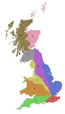
Список дорог в зоне 8 в Великобритании, начинающихся к северу от A8 и запада от A9 (дороги начинаются с 8).
Одно- и двузначные дороги
[ редактировать ]| Дорога | От | К | Примечания |
|---|---|---|---|
| Грилок | Эдинбург | 25-мильный (40-километр) разрыв между Newbridge и Newhouse | |
| Глазго | Moodiesburn | ||
| Глазго | Калландер | ||
| Глазго | Инвернесс | ||
| Привычки | Кэмпбелтаун | ||
| Стирлинг | Lochearnhead | ||
| Обан | Данди | ||
| Мост Spindho | Кингсси | ||
| Invergarry | UIG | Первоначально закончился в Кайле Лохалш; Расширен на часть A850 и всего A856 в 1995 году. | |
| Ларберт | Stenhousemuir | Самая короткая двухзначная дорога в Великобритании. Ранее выделяется по дороге из Инвернесса до Скрабстера; Это стало частью расширенного A9 (секция к северу от Папина, как теперь часть A99), а остальные были перенумерованы A882 (участок к северу от Георгемы теперь является частью A9) | |
| Глазго | Ньюбридж |
Тройные дороги
[ редактировать ]| Дорога | От | К | Примечания |
|---|---|---|---|
| Ванна | Вестфилд | ||
| Восточный Уитберн | Поли | ||
| Неиспользованный | Бег с Бьюкенен -стрит в Глазго до A8 (ныне Уэстмур -стрит) в Паркхеде. Рассекречен в 1970 -х годах. | ||
| Глазго | Шампония, Фолкерк | ||
| Глазго | Дамбартон | В основном включен в A82 и A814 .
Ранее выделяется на улицу Саучихалл и Парламентскую дорогу (в настоящее время ушла из -за джентрификации Центрального Глазго и города в 1960 -х годах) с Аргайл -стрит (тогда A814) до A803; Это было рассекречено, когда M8 начал строительство, а A804 был перемещен на его текущий маршрут. | |
| Неиспользованный | Пробежал с Аргайл -стрит (тогда A82) через Бьюкенен -стрит (южная секция теперь пешеходно; северная секция уже исчезла, замененная Королевским концертным залом Глазго и гаражом) до A81. Стал частью перенаправленного A82 (секция Argyle Street в A82 стала частью A814 ) в 1935 году и была рассекречена в 1960-1970-х годах. | ||
| Киркинтох | Степи | Создан в 2010 году как перенюмеровку и расширение A8006.
Ранее выделяется по дороге от A81 к северу от Аннисленда в Скотстун ; Сейчас это A739 и Unclassicified Anniesland Road. | |
| Торранс | Милнгави | ||
| Медведь | Медведь | ||
| Bearsden | A811 near Croftamie and Drymen | ||
| Bearsden | Duntocher | ||
| Balloch | Stirling | Swapped with the A813 when the A82 bypass was built. | |
| Dennystown | Renton | The original route was on Bank Street and Bridge Street in Alexandria from Main Street (then A82) to A811 (now A813); this became part of a rerouted A82 and the road was reassigned to the old route of the A82; the section from the A82 to Bridge Street became part of the B857 when the A82 was rerouted onto the bypass. | |
| Dumbarton | Balloch | Swapped with the A811 when the A82 bypass was built, and also replaced the old route of the A82 (this section was originally also part of the A811) south of Bridge Street; formerly continued north to Balloch Road. | |
| Glasgow | Arrochar | Incorporates the Clydeside Expressway in Glasgow | |
| Cairndow | Toward | Is the main road through the Cowal peninsula, goes through Dunoon and down the Firth of Clyde coast to Toward Point. | |
| Lochgilphead | Oban | Planned to be replaced by the A85 in the 1935 renumbering, but this never happened. The southern section along Bishopton Road, Oban Road, and Argyll Street was formerly part of the A817. | |
| Loch Lomondside | Garelochhead | Designated 1995, but built in 1987 to connect the Clyde submarine bases to the A82.
Previously allocated to a road from Poltalloch Street to Bishopton Road in Lochgilphead. Became a portion of the A816 between 1981 and 1995. | |
| Arden | Helensburgh | Created in 2005, replacing the B831 and the southern section of the B832.
Originally ran from the A83 in Campbelltown to the pier; now part of the B842. | |
| Inveraray | Lochawe | ||
| Dunblane | Doune | ||
| Braeval (Aberfoyle) |
Kilmahog | ||
| Greenloaning | Inver | ||
| Rosyth | Muthill | Section between Inverkeithing and Rosyth has motorway status as the A823(M). | |
| Muirton (Auchterarder) |
Aberuthven | ||
| Corran | Ardgour | Corran Ferry; the roads on either side are part of the A861. Number assigned by Highland Council in 2014.
First used from A822 to A85 in Crieff. Renumbered as the A822 mainline (not a spur) in 1934; the section along Lodge Street was probably declassified at the same time. Next used on a road from Gourock to Gourock ferry terminal (not shown on a 1976 OS map but does appear on a 1978 version). In 1985, the A8 and A78 were rerouted in the area, creating the A770. The rerouting of the A8 would have put the A825 out of zone, and it was renumbered to A771. | |
| Milton | Aberfeldy | ||
| Ballinluig | Mid Lix | ||
| Connel | Ballachulish | ||
| Unused | Ran from Glen Coe via Kinochlemore to North Ballachulish; became part of the A82 in 1934 when it was rerouted to avoid the ferry across Loch Leven, and then the B863 in 1975 when the A82 was rerouted to the Ballachulish Bridge. One map shows a second A829 on the old route of the A82 from North Ballachulish south to the ferry (now the bridge), but this was likely a misprint for the A828 extension (this section is now part of the A82). | ||
| Fort William | Mallaig | ||
| Drumnadrochit | Beauly Firth | ||
| Cromarty | A835 near Braemore | ||
| Milton | Balchraggan | Formerly the B854 before it was upgraded to Class I status.
Previously allocated to a road from Muir of Ord to Cromarty. This became an extension of the A832 in 1935 because the A833 was put out of zone by the A9 extension over the A88. | |
| Dingwall | Contin | ||
| A9 and A832 near Tore | Ledmore | Primary route to Stornoway car ferry at Ullapool | |
| Tain | John o' Groats | ||
| Inveran | Lochinver | ||
| Lairg | Tongue | ||
| Near Golspie | Rosehall | ||
| Unused | Ran from A882 (now A9) in Thurso to the Thurso railway station. Became a portion of the B874 by 1967. | ||
| Lochranza | Largymore | On the Isle of Arran. Originally circled around the entire island, but now only the northern and eastern sections still exist (but there may still be signage up); the southern and western sections were declassified in the early 2000s. | |
| Unused | Ran from Brodick to Blackwaterfoot. Downgraded to the B880 in the late 1920s, while the western section became part of the A841, now unclassified. | ||
| Unused | Ran from Dippen to A842 (now B880) east of Blackwaterfoot. Became part of the A841 in the late 1920s, and is now unclassified. | ||
| Rothesay | |||
| Unused | Ran from Rothesay to Ambrismore. Downgraded to a northern extension of the B881. | ||
| Lussagiven | Ardbeg, Islay | ||
| Bridgend | Portnahaven | ||
| Mull | Tobermory | ||
| A848 at Salen | Fionnphort | ||
| Dunvegan Castle | A87 | Originally ended at Kyleakin; this is now part of the A87. | |
| Armadale | A87 | ||
| Unused | Ran from the A851 at Isleornsay to the pier. Declassified in the 1980s and now the C1246; there was one sign still showing A852 until 2010. | ||
| Unused | Ran from Armadale to Ardvasar. Declassified in the 1980s and now part of the C1244; there is still one ADS showing A853. | ||
| Unused | Ran from Broadford to Corry Pier. Later declassified, but is now the U5002. | ||
| Portree | Uig | ||
| Unused | Ran from A850 in Borve to Uig. Became an extension of the A87 in 1995 when the Skye Bridge was opened. | ||
| Stornoway, Isle of Lewis | Port Nis, Isle of Lewis | ||
| Stornoway, Isle of Lewis | Barabhas, Isle of Lewis | via Carloway | |
| Stornoway, Isle of Lewis | Rodel, Isle of Harris | Previously allocated to a road from Callanish to Barvas; this became part of the B896 (and is now part of the A858) at the same time the current A859 was created. | |
| Unused | Ran via the Great Cumbrae Island Circle. Downgraded to the B896. | ||
| A830 near Kinlocheil | A830 at Lochailort | direct route along A830 is 14 miles (23 kilometres), this road covers 70 miles (110 kilometres) | |
| Inverness | Ardullie | Previously allocated to a road from Inverness to Fort Augustus (now B862); the number was reused on the old route of the A9 when the A9 bypass was opened | |
| Dunvegan | A87 | ||
| Unused | Ran from A863 east of Lonmore north to A850, with a spur west to the A863. Downgraded in the mid 1980s and is now the C1245. There is still at least one sign showing A864. | ||
| North Uist | Lochboisdale | ||
| Stornoway, Isle of Lewis | Portnaguran, Isle of Lewis | ||
| Clachan na Luib | Sruth Mor | ||
| A859 just outside Tarbert, Isle of Harris | Tarbert car ferry terminal, Isle of Harris | ||
| Unused | Ran from A870 (now B8086) west of Scalasaig to Garvard. Downgraded to Class II status as the B8085 by 1993. | ||
| Unused | Ran from Scalasaig to Kiloran on the western side of the Isle of Colonsay. Downgraded to Class II status as the B8086 by 1993. | ||
| Unused | Ran from Scalasaig to Kiloran on the eastern side of the Isle of Colonsay. Downgraded to Class II status as the B8087 by 1993. | ||
| Dennyloanhead | Stirling | Previously allocated to a road from Corran to Ardgour; this became a spur of the A861, while the actual ferry became the A825 in 2014. | |
| Nyadd | Blairhoyle | ||
| Unused | Was a short road in Balloch along Carrocan road from Miller Road to Balloch Road (became part of the A811 and A813). Previously allocated to another road, but it is unknown where the original road with this number was. | ||
| Baptiston near Killearn | Kepculloch near Balfron | ||
| Airth | Kincardine | Previously incorporated the Kincardine Bridge, but now incorporates the Clackmannanshire Bridge. Previously allocated to a road from Glasgow to Bowling (now part of the A82; the old route of the A82 east of Bowling is now part of the A814) | |
| Renfrew (A741 at Town Hall) | Renfrew (A8) | ||
| Old Kilpatrick | Station Road | ||
| Glasgow | A807 near Bardowie | ||
| A815 near Ardbeg | Blairmore, Argyll | ||
| Unused | Ran from Broadford to Elgol. Downgraded to the B8083 between 1988 and 1993. | ||
| Wick | Georgemas | Section north of Georgemas became part of the A9.
Previously allocated to a road from Wick via John o' Groats to Thurso; this became part of the A9 (now A99) and A836, while the number was reused as a renumbering of the section of the A88 that did not become part of the A9. | |
| Falkirk | Denny | ||
| Achnalea | Lochaline | ||
| Sandbank | Dunoon | Known as the High Road, locally. | |
| Port Bannatyne | Strachur | ||
| Invermoriston | Bun Loyne | ||
| Barra | Road circles around the Isle of Barra | ||
| Dalwhinnie | Laggan | ||
| Эргула | Ageasheen | ||
| Strathblane | Аучинреох | ||
| Неиспользованный | Бег от A81 к югу от Калландера до A821 (теперь Invertrossachs Road); Первоначально B828 до того, как он был обновлен до статуса I класса. Рассекречен к 1981 году; Секция к югу от моста Гартчонзи теперь является велосипедным маршрутом (NCN 7), в то время как весь маршрут теперь является C114. | ||
| Ullaolol : A835 Junction | Ullapool : террический паром паром | Уллапула Шор -стрит , связывающая маршрут A835 от Inverness с паромным терминалом Stornoway | |
| Инчнадамп | Лаксфордский мост | ||
| Неиспользованный | Побежал от Фатерона в Грудж; Первоначально часть B873. Стал частью перенаправленного A9 в 1996 году. | ||
| Strathcarron | Kinlochewe | Ранее выделялся по дороге от A9 (ныне A99) в Вике до Уика -Харбор через Юнион -стрит и Bank Row, первоначально B874. Стал частью A882, вероятно, в 1934 году, когда расширение A9 выставило A896 из зоны и перенумером в A8002 несколько лет спустя. | |
| Хелмсдейл | Мост Халладейл | ||
| Мост Эрскин | Старый Килпатрик | Ранее выделялся на другую дорогу, но неизвестно, где была оригинальная дорога с этим номером. | |
| Броксберн | Ливингстон |
Четырехзначные дороги
[ редактировать ]| Дорога | От | К | Примечания |
|---|---|---|---|
| Бег от Almondhill в Queensferry в качестве обновления B800 , вернувшегося в B800 в 2009 году. Ранее выделялся на другую дорогу, но неизвестно, где была оригинальная дорога с этим номером. | |||
| Бегал по площади Святого Иоанна с A882 до A840 (ныне B874) в Турсо . | |||
| Бывший участок B874 (а затем A896); Пробежал от A9 (ныне A99) в Вике в Харбор Вик через Юнион -стрит и Банк Роу. Эта дорога была вне зоны, потому что она была в зоне 9. | |||
| Ballochandrain | Тигнабуайх | ||
| Кольцевая развязка Checkbar (B903/A883) | Боннибридж | Первоначально показан в качестве отрождения A883 на карте 1969 года; Не показан как A8004 до 1970 -х годов, вероятно, к 1974 году, когда A876 был обновлен до M876. Ранее продолжил север через то, что сейчас является B905 до A876. | |
| Пробежал от моста Орхи в Форест Лодж . Понизился до C63 (старая военная дорога) через время после 1988 года. | |||
| Пробежал от A803 в Киркинтиллох до B757 и B8048. Распространяется на M80 в 2010 году и перенумеруется до A806. | |||
| Эйрдри | Эйрдри | ||
| Камберналд | Камберналд | ||
| Клайдбанк | Дунточер | ||
| Тарберт | Восточный Лох Пирс | ||
| Денни | Денни | Бежит от A872 до A883. Известный как Денни Восточная Доступная дорога. | |
| Inshes | Томнахурих | Inverness Southern Distributor Road; Обновление бывшего B8082. |