США Маршрут 49
 США Маршрут 49 | ||||||||||
|---|---|---|---|---|---|---|---|---|---|---|
США 49 выделены красным | ||||||||||
| Информация о маршруте | ||||||||||
| Длина | 516 миль [ Цитация необходима ] (830 км) | |||||||||
| Existed | 1926[citation needed]–present | |||||||||
| Southern section | ||||||||||
| South end | ||||||||||
| Major intersections |
| |||||||||
| North end | ||||||||||
| Northern section | ||||||||||
| South end | ||||||||||
| Major intersections |
| |||||||||
| North end | ||||||||||
| Location | ||||||||||
| Country | United States | |||||||||
| States | Mississippi, Arkansas | |||||||||
| Highway system | ||||||||||
| ||||||||||

US Route 49 ( US 49 ) - это шоссе с северо -югом США . Северный термин шоссе находится в , штат Арканзас с США Пигготте на пересечении . , Его южный термин находится в Галфпорте, штат Миссисипи , на пересечении с США маршрутом 90 . US 49 составляет около 516 миль (830 км) в длину.
перекрестке США 49 . на и Именно нас Шоссе также является предметом песен Биг Джо Уильямса и Хоулина Вольфа (Честер Артур Бернетт).
Описание маршрута
[ редактировать ]Миссисипи
[ редактировать ]| мне [ 1 ] | км | |
|---|---|---|
| РС | 334 | 538 |
| AR | 182 | 293 |
| Total | 516 | 830 |
US 49 has historically been one of the most important highways in Mississippi. It was the state's first highway to see a significant rural segment four-laned.[2] Today, it is the only four-laned route directly connecting Jackson, the state's capital and largest city, to the Mississippi Gulf Coast.[3] Some urban segments along this portion of the route maintain three or more traffic lanes in each direction. US 49 serves as a primary hurricane evacuation route for Gulf Coast residents.[4]

US 49 begins near the Port of Gulfport, Mississippi at a junction with US 90. It provides a major connection between the port, casinos, beaches and downtown with I-10 (exits 34A-B), where it has its first major junction being a full service cloverleaf interchange on the city's north end. The crossing of these two roads is officially recognized by the state of Mississippi as the Castilgia Interchange.[5] North of I-10, US 49 passes through suburban areas and enters De Soto National Forest. Various state highway interchanges and junctions are encountered before the route passes near Camp Shelby, then through an interchange with US 98 just south of Hattiesburg. At this point, travelers have an option of continuing on US 49 through Hattiesburg or using the I-59/US 98 bypass which reconnects with US 49 in the northern part of the city. Continuing on US 49 brings one to a cloverleaf interchange at US 11, one of very few in the South to lack merging lanes between loop ramps, thus altering the usual weaving patterns which plague many of these interchanges.
US 49 passes Hattiesburg's primary medical facility, Forrest General Hospital, and the campus of the University of Southern Mississippi before arriving at another, more standard cloverleaf interchange with I-59. Those who used the aforementioned bypass, wishing to reconnect with US 49 North to the state capital, must use exit 67B. It is also at I-59, where Mississippi Highway 42 (MS 42) runs with US 49 for a short distance as suburban development is soon encountered as the road returns to rural environs. Eventually, MS 42 departs from the four-laned highway and branches off to the west toward smaller towns, starting with Sumrall. Interchanges between Hattiesburg and Jackson provide access to various state highways, and one at Collins provides access to US 84.

At Jackson, US 49 upgrades to Interstate Highway standards before joining I-20 using a two-lane flyover. About a mile later, I-20/US 49 merges with I-55 at a stack interchange. I-20/I-55/US 49 crosses the Pearl River into Hinds County and bypasses Downtown Jackson, where I-55 departs to the south. US 49/I-20 continue west until US 49 ends its run with I-20 and joins I-220 before turning northwest to Yazoo City. A split in the highway, rare in the U.S. Highway System, begins here; both routes head into the Mississippi Delta, US 49W serving the towns of Belzoni and Indianola, where it junctions with US 82 and its four-lane segment ends, while two-laned US 49E serves Tchula before encountering US 82 at Greenwood. Both routes continue north from US 82 and are linked again at Tutwiler. Continuing northwest, the highway passes through an interchange with US 61 as it enters Clarksdale. It is at Clarksdale that US 49 encounters "The Crossroads", the legendary junction with State Street (an old alignment of US 61) where the great blues musician Robert Johnson is reputed to have sold his soul to the devil.[6]
From Clarksdale, US 49 continues north and crosses the Mississippi River using the Helena Bridge where it enters Arkansas near the town of Helena.


In May 2005 portions of extant US 49E were renamed the "Emmett Till Memorial Highway".[7]
The Mississippi section of US 49 and the routes of US 49E and US 49W are defined at Mississippi Code Annotated § 65-3-3.
Arkansas
[edit]US 49 enters Arkansas near Helena-West Helena in Phillips County. US 49 Business runs around the north part of the city, with the main route meeting AR 242 in the southern portion. US 49 continues west to Walnut Corner where the route meets AR 1 (and briefly AR 316). The US 49/AR 1 concurrency ends in Marvell and US 49 enters Monroe County.
Upon entering Monroe County, US 49 turns north to begin a concurrency with AR 39. US 49 also crosses US 79 before meeting US 70 near Brinkley. The route crosses Interstate 40 north of Brinkley prior to entering Woodruff County. US 49 runs northeast through rural Woodruff County, not crossing of concurring with any important routes before crossing into Cross County.
The route meets US 64 in Fair Oaks and meets AR 42 in southern Hickory Ridge. It then enters Poinsett County, concurring with AR 214 from Fisher until Waldenburg. The route crosses AR 14 in Waldenburg.
US 49 runs along south Jonesboro, with US 49 Business formerly running into town. US 49 concurs with US 63 until again joining AR 1. The two routes angle north through downtown Jonesboro, crossing US 63 Business and passing by ASU Stadium before leaving town. US 49/AR 1 pass around Brookland, with US 49 Business serving the community.
Entering Greene County, US 49/AR 1 intersects US 412 and briefly meets AR 358 before entering Paragould. The routes cross US 412B near Kirk Field in Paragould, also meeting AR 135 north of town. US 49B also rejoins US 49/AR 1 north of Paragould.
Continuing northeast through rural Greene County, US 49/AR 1 meet AR 34 in Marmaduke and AR 90 in Rector. The route turns north to Piggott at Hargrave Corner, terminating at US 62/AR 139. The Arkansas portion of US 49 is mainly two-lane undivided.
History
[edit]One of the original US highways, US 49 was extended north from Clarksdale, Mississippi to US 70 in Brinkley, Arkansas via U.S. Route 61 and Highway 6 in 1963.[8] US 49 was again extended north in 1978, replacing Highway 39 between Brinkley and Jonesboro.[9]: 269–270 Highway 1 between Jonesboro and Piggott was redesignated as US 49 in 1979.[9]: 66
It is notable that for several years during the 1930s, a second split route existed on US 49 in South Mississippi, similar to but shorter than the split that still exists in the Delta region.[10] Between Brooklyn and Hattiesburg, travelers had the option of a 24-mile-long (39 km) direct route via US 49W, or a somewhat shorter but broken route on US 49E, serving the Forrest County Agricultural High School and the small community of McLaurin, Mississippi.
Gallery
[edit]-
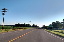
 US 49 in Fair Oaks, AR
 -
 US 49 north of Brinkley, AR
 -
 US 49 south of the US 70 junction in south Brinkley
 -
 US 49 south of Highway 362 junction near Louisiana Purchase State Park
 -
 US 49 and Highway 1 concur in Marvell, AR
 -
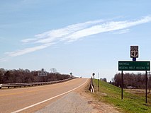
 US 49 in Helena-West Helena, AR
 -
 US 49 with U.S. Routes 61 and 278


Major intersections
[edit]| State | County | Location | mi[11][12] | km | Exit | Destinations | Notes |
|---|---|---|---|---|---|---|---|
| Mississippi | Harrison | Gulfport | 0.00 | 0.00 | Southern terminus; road continues as 25th Street | ||
| 4.4– 4.9 | 7.1– 7.9 | I-10 exit 34 A-B | |||||
| 9.4 | 15.1 | ||||||
| | 20.0– 20.6 | 32.2– 33.2 | Interchange | ||||
| Stone | Wiggins, Stone County | 32.9 | 52.9 | ||||
| 34.2– 34.6 | 55.0– 55.7 | Interchange | |||||
| 36.7 | 59.1 | ||||||
| Forrest | | 41.6 | 66.9 | ||||
| | 54.6 | 87.9 | S Lake Drive – Paul B. Johnson State Park | Access road into park | |||
| Hattiesburg | 62.3– 62.8 | 100.3– 101.1 | Interchange | ||||
| 65.1 | 104.8 | Edwards Street (MS 969 north) | |||||
| 67.5– 67.9 | 108.6– 109.3 | Interchange | |||||
| 69.1 | 111.2 | ||||||
| 70.7 | 113.8 | Old Highway 42 - Petal | Former MS 42 east | ||||
| 71.6– 72.0 | 115.2– 115.9 | I-59 exit 67; south end of MS 42 overlap | |||||
| | 77.5 | 124.7 | North end of MS 42 overlap | ||||
| Covington | | 84.2 | 135.5 | ||||
| Seminary | 88.9 | 143.1 | |||||
| 89.1 | 143.4 | ||||||
| Collins | 95.1– 95.5 | 153.0– 153.7 | Interchange | ||||
| 96.4– 96.7 | 155.1– 155.6 | Interchange | |||||
| | 104.2 | 167.7 | |||||
| Mount Olive | 104.7 | 168.5 | |||||
| 106.6 | 171.6 | ||||||
| Simpson | Magee | 113.4 | 182.5 | ||||
| 114.1 | 183.6 | South end of MS 28 overlap | |||||
| 114.2 | 183.8 | South end of MS 541 overlap | |||||
| 114.6 | 184.4 | North end of MS 28 / MS 541 overlap | |||||
| 117.0 | 188.3 | Interchange via connector roads | |||||
| | 119.3 | 192.0 | |||||
| Mendenhall | 123.8 | 199.2 | |||||
| 124.1 | 199.7 | ||||||
| 126.1– 126.4 | 202.9– 203.4 | Interchange | |||||
| | 134.2 | 216.0 | |||||
| Rankin | Florence | 145.5 | 234.2 | ||||
| Richland | 151.8 | 244.3 | Old Highway 49 | Proposed MS 149 north; northbound exit and southbound entrance | |||
| 152.6– 152.9 | 245.6– 246.1 | East Frontage Road | Interchange; northbound exit and entrance | ||||
| West Frontage Road | Interchange; southbound exit and entrance | ||||||
| Richland–Pearl line | 153.8 | 247.5 | 47 | South end of I-20/I-55 overlap; I-20 eastbound and I-55 northbound exit 47A; I-55 southbound exit 94 | |||
| Hinds | Jackson | 154.3 | 248.3 | 45B | Southbound exit is exit 45 | ||
| 154.6 | 248.8 | 45A | Gallatin Street | Southbound exit is exit 45 | |||
| 155.3 | 249.9 | 44 | North end of I-55 overlap | ||||
| 155.6 | 250.4 | 43 | Terry Road/University Boulevard | Signed as exits 43A (south) and 43B (north) | |||
| 156.4 | 251.7 | 42 | Ellis Avenue | Signed as exits 42A (south) and 42B (north) | |||
| 159.7 | 257.0 | 41 | North end of I-20 overlap; southern terminus of I-220 south end of I-220 overlap | ||||
| 160 | 260 | 1 | Signed as 1A (east) and 1B (west) | ||||
| 161.3 | 259.6 | 2 | Clinton Boulevard/Capitol Street | Signed as 2A (Capitol Street) 2B (Clinton Boulevard) northbound | |||
| 162.7 | 261.8 | 3 | Industrial Drive | Diamond interchange | |||
| 164.7 | 265.1 | 5 (SB) 5 A-B (NB) | North end of I-220 overlap | ||||
| 167.1– 167.3 | 268.9– 269.2 | Natchez Trace Parkway | Interchange | ||||
| Madison | Flora | 179.0 | 288.1 | ||||
| Yazoo | Bentonia | 186.3 | 299.8 | Eastern terminus of MS 830 | |||
| 187.0 | 300.9 | ||||||
| 187.7 | 302.1 | Western terminus of MS 830 | |||||
| | 200.7 | 323.0 | South end of MS 16 overlap | ||||
| Yazoo City | 201.0 | 323.5 | North end of MS 16 overlap | ||||
| 204.2 | 328.6 | Interchange; US 49 north splits into US 49E and US 49W | |||||
| See US 49E and US 49W | |||||||
| Tallahatchie | Tutwiler | 0.0 | 0.0 | South end of MS 3 overlap; US 49 south splits into US 49E and US 49W | |||
| 0.4 | 0.64 | North end of MS 3 overlap | |||||
| 0.6 | 0.97 | ||||||
| Coahoma | Clarksdale | 12.5 | 20.1 | South end of MS 322 overlap | |||
| 13.0 | 20.9 | Interchange; north end of MS 322 overlap; south end of US 61 / US 278 / overlap | |||||
| 116.3– 117.0 | 187.2– 188.3 | North end of US 278 overlap | |||||
| | 118.0 | 189.9 | |||||
| | 27.3 | 43.9 | Friars Point-Highway 61 / Highway 61-Jonestown – Friars Point, Moon Lake | Proposed MS 316 | |||
| | 31.8 | 51.2 | North end of US 61 overlap; south end of Great River Road overlap | ||||
| | 37.9 | 61.0 | North end of Great River Road overlap | ||||
| Mississippi River | 40.9 0.00 | 65.8 0.00 | Helena Bridge | ||||
| Arkansas | Phillips | Helena-West Helena | 0.99 | 1.59 | South end of Great River Road overlap | ||
| 1.35 | 2.17 | North end of Great River Road overlap | |||||
| 3.98 | 6.41 | ||||||
| 6.28 | 10.11 | ||||||
| 6.88 | 11.07 | ||||||
| Walnut Corner | 12.48 | 20.08 | |||||
| Kindall | 15.45 | 24.86 | |||||
| Poplar Grove | 17.58 | 28.29 | |||||
| Marvell | 20.62 | 33.18 | |||||
| 21.52 | 34.63 | ||||||
| | 27.56 | 44.35 | |||||
| | 29.67 | 47.75 | |||||
| Monroe | | 33.56 | 54.01 | ||||
| | 35.60 | 57.29 | |||||
| | 36.70 | 59.06 | |||||
| | 38.67 | 62.23 | |||||
| | 41.30 | 66.47 | |||||
| | 43.55 | 70.09 | |||||
| | 50.67 | 81.55 | |||||
| Brinkley | 51.80 | 83.36 | South end of US 70 overlap | ||||
| 52.55 | 84.57 | ||||||
| 53.39 | 85.92 | North end of US 70 overlap | |||||
| 54.97 | 88.47 | I-40 exit 216, south end of US 63 overlap | |||||
| 56.13 | 90.33 | ||||||
| Woodruff | | 62.47 | 100.54 | ||||
| Hunter | 66.28 | 106.67 | |||||
| | 71.61 | 115.25 | |||||
| Penrose | 76.23 | 122.68 | |||||
| Cross | Fair Oaks | 80.26 | 129.17 | South end of US 64 overlap | |||
| 80.28 | 129.20 | North end of US 64 overlap | |||||
| Tilton | 84.88 | 136.60 | |||||
| Hickory Ridge | 90.44 | 145.55 | |||||
| Poinsett | Fisher | 96.67 | 155.58 | ||||
| Waldenburg | 102.74 | 165.34 | |||||
| 104.9 | 168.8 | ||||||
| 109.34 | 175.97 | ||||||
| Пуансетт - Крейс графство | 113.42 | 182.53 | |||||
| Крэйгхед | Джонсборо | 120.50 | 193.93 | Южный конец США 78/AR 226 Перекрытие | |||
| 122.4 | 197.0 | Северный конец AR 226 перекрывает | |||||
| 125.53 | 202.02 | 45 | Северный конец I-555 перекрытия, северный конец США 63 перекрывает | ||||
| 43.4 | 69.8 | 44 | |||||
| 128.40 | 206.64 | 42 | Южный конец I-555 перекрытия; Южный конец AR 1 перекрывается; Южный конец США 78 Перекрытие | ||||
| 129.53 | 208.46 | ||||||
| 131.74 | 212.01 | AR 91 Southern Terminus | |||||
| 132.31 | 212.93 | Южный конец AR 351 перекрывает | |||||
| 132.75 | 213.64 | Северный конец AR 351 перекрывает | |||||
| 136.7 | 220.0 | ||||||
| 140.60 | 226.27 | ||||||
| Грин | Параг | 144.65 | 232.79 | ||||
| 146.85 | 236.33 | ||||||
| 147.34 | 237.12 | ||||||
| 147.87 | 237.97 | ||||||
| 149.71 | 240.93 | ||||||
| 149.97 | 241.35 | ||||||
| 151.13 | 243.22 | ||||||
| 151.88 | 244.43 | ||||||
| Мармадук | 161.44 | 259.81 | |||||
| Глина | Ректор | 168.86 | 271.75 | Южный конец AR 90 перекрывает | |||
| 169.37 | 272.57 | ||||||
| Харгрейв Корнер | 172.33 | 277.34 | Северный конец AR 90 перекрывает | ||||
| Пигготт | 182.33 | 293.43 | Северный термин; Северный конец AR 1 перекрывается; Дорога продолжается как проспект Торнтон | ||||
1000 миль = 1,609 км; 1000 км = 0,621 миль
| |||||||
US Route 49e
[ редактировать ]US Highway 49e | |
|---|---|
| Расположение | Yazoo City - Tutwiler |
| Длина | 85,862 миль [ 13 ] (138.181 км) |
US Route 49e ( US 49E )-это шоссе США длиной 85,86 мили (138,18 км) США в дельта-регионе Миссисипи . Он путешествует по округам Yazoo , Holmes , Leflore и Tallahatchie .
США Маршрут 49 Вт
[ редактировать ]Шоссе США 49 Вт | |
|---|---|
| Расположение | Yazoo City - Tutwiler |
| Длина | 81.894 MI [ 13 ] (131,796 км) |
US Route 49W ( US 49W длиной 81,89 мили (131,79 км) )-это шоссе США США в регионе Дельта Миссисипи , проходящей через Yazoo , Humphreys , Sunflower и Tallahatchie округа .
Смотрите также
[ редактировать ]Связанные маршруты
[ редактировать ]Специальные маршруты
[ редактировать ]- Американский маршрут 49 бизнес в Брукленде, штат Арканзас
- Американский маршрут 49 бизнес в Хеленке-Вест Хелене, Арканзас
- Американский маршрут 49 Бизнес в Джонсборо, штат Арканзас (выводил из эксплуатации)
- США по маршруту 49 в Парагулде, Арканзас
- US Route 49e Business в Гринвуде, штат Миссисипи (выводил из эксплуатации)
- Американский маршрут 49 бизнес в Хаттисберге, штат Миссисипи (вывода из эксплуатации)
Ссылки
[ редактировать ]- ^ «База данных по номеру маршрута США» (Dec 2009 Ed.). Американская ассоциация государственных должностных лиц и должностных лиц транспорта . Архивировано из оригинала 30 июня 2010 года . Получено 12 февраля 2022 года .
- ^ «Карта шоссе 1960» (PDF) . Архивировано из оригинала (PDF) 3 декабря 2010 года . Получено 12 февраля 2022 года .
- ^ «Официальная карта шоссе Миссисипи» (PDF) . Архивировано из оригинала (PDF) 23 ноября 2009 года . Получено 12 февраля 2022 года .
- ^ «Официальная карта эвакуации урагана Миссисипи» (PDF) . Архивировано из оригинала (PDF) 15 августа 2011 года . Получено 12 февраля 2022 года .
- ^ «2013 Код Миссисипи :: Название 65 - Шоссе, мосты и паромы :: Глава 3 - Государственная система шоссе :: Специальные обозначения участков автомагистрали и мостов :: § 65-3-71.17 -« Кастилья обмен «назначен» . Архивировано из оригинала 8 июня 2019 года . Получено 12 февраля 2022 года .
- ^ «На перекрестке, когда Роберт Джонсон Centennial приближается» . Los Angeles Times . Архивировано из оригинала 3 мая 2011 года . Получено 12 февраля 2022 года .
- ^ "Эммет до музея" . Архивировано из оригинала 11 июля 2011 года . Получено 12 февраля 2022 года .
- ^ «Протокол встречи» (PDF) . Арканзасская государственная комиссия по шоссе. 20 марта 1963 года. С. 903–904. Архивировано из оригинала (PDF) 21 сентября 2010 года . Получено 12 февраля 2022 года .
- ^ Jump up to: а беременный «Протокол встречи» (PDF) . Арканзасская государственная комиссия по шоссе. 26 апреля 1978 года. Архивировано из оригинала (PDF) 21 сентября 2010 года . Получено 12 февраля 2022 года .
- ^ «Официальная карта шоссе Миссисипи 1936 года» (PDF) . Архивировано из оригинала (PDF) 14 мая 2014 года . Получено 12 февраля 2022 года .
- ^ Отдел планирования и исследований (2010). «База данных Arkansas Road Log» . Арканзас Государственный шоссе и транспортный отдел. Архивировано из оригинала (ZIP) 23 июня 2011 года . Получено 12 февраля 2022 года .
- ^ Государственный и транспортный отдел штата Арканзас ; Министерство транспорта США Федеральное администрация шоссе (2015). Генеральная карта шоссе - округ Грин, Арканзас (PDF) (MAP). [1: 62500]. Архивировано из оригинала (PDF) 22 сентября 2010 года . Получено 12 февраля 2022 года .
- ^ Jump up to: а беременный «Общественные дороги Миссисипи - выбранная статистика - степень, путешествия и обозначение» (PDF) . Архивировано из оригинала (PDF) 20 февраля 2014 года . Получено 12 февраля 2022 года .
Внешние ссылки
[ редактировать ]Маршруты в курсиях больше не являются частью системы. Выделенные маршруты считаются основными маршрутами системы. |
| Просмотр пронумерованных маршрутов | ||||
|---|---|---|---|---|
| ← | С | → | ||
| ← | РС | → | ||
- США Маршрут 49
- Соединенные Штаты пронумерованной системы шоссе
- Американские шоссе в Арканзасе
- Американские шоссе в Миссисипи
- Транспорт в округе Харрисон, штат Миссисипи
- Транспорт в графстве Стоун, штат Миссисипи
- Транспорт в округе Форрест, штат Миссисипи
- Транспорт в округе Ковингтон, штат Миссисипи
- Транспорт в округе Симпсон, штат Миссисипи
- Транспорт в округе Ранкин, штат Миссисипи
- Транспорт в округе Мэдисон, штат Миссисипи
- Транспорт в округе Язу, штат Миссисипи
- Транспорт в округе Таллахатчи, штат Миссисипи
- Транспорт в округе Коахома, штат Миссисипи
- Транспорт в округе Филлипс, штат Арканзас
- Транспорт в округе Монро, штат Арканзас
- Транспорт в округе Вудрафф, штат Арканзас
- Транспорт в округе Кросс, штат Арканзас
- Транспорт в округе Пуансетт, штат Арканзас
- Транспорт в округе Крейгхед, штат Арканзас
- Транспорт в графстве Грин, штат Арканзас
- Транспорт в округе Клэй, штат Арканзас