Янпу, Шанхай

Эта статья требует дополнительных цитат для проверки . ( июль 2022 г. ) |
Янпу
Янпурский район | |
|---|---|
 Взгляд на Вудзиачанг ( Вудзиаочанг ) | |
 | |
 Location within Shanghai | |
| Coordinates: 31°15′35″N 121°31′33″E / 31.2598°N 121.5257°EYangpu government | |
| Country | People's Republic of China |
| Municipality | Shanghai |
| Government | |
| • District Governor | Jin Xinming (CCP) |
| Area | |
| • Total | 60.61 km2 (23.40 sq mi) |
| Population (2020)[3] | |
| • Total | 1,242,548 |
| • Density | 21,000/km2 (53,000/sq mi) |
| Time zone | UTC+8 (China Standard Time) |
| Website | www |
| Chinese names | |||
|---|---|---|---|
| Yangpu District | |||
| Traditional Chinese | 楊浦區 | ||
| Simplified Chinese | 杨浦区 | ||
| Literal meaning | Poplar Bank District | ||
| |||
| Yangshupu | |||
| Traditional Chinese | 楊樹浦 | ||
| Simplified Chinese | 杨树浦 | ||
| Postal | Yangtzepoo Yangtszepoo | ||
| Literal meaning | Poplar Tree Bank | ||
| |||
Янпу ( китайский : 杨浦区 ) является одним из 16 районов Шанхая . Он расположен в северо -восточной части центра города Шанхай, граничащий с рекой Хуанпу на востоке и юге, Хонгкоу на западе и Баошан на севере. Южная часть района Янгпу находится в 4 км (2,5 миль) от Бунда , главной туристической достопримечательности. Он в основном состоит из жилых сообществ, общая площадь 60,61 км 2 (23,40 кв. МИ) [ 2 ] и население 1,242 548 по состоянию на 2020 год. [ 4 ] [ 3 ] Район администрирует 12 субрайтов . [ 5 ]
Имя
[ редактировать ]The name Yangshupu, formerly romanized as Yangtzepoo or Yangtszepoo, is Chinese for "poplar bank" and refers to the creek (simplified Chinese: 杨树浦|河; traditional Chinese: 楊樹浦河; pinyin: Yángshùpǔ Hé) running through the area beside present-day Lanzhou Rd (formerly Lay Road)[6][better source needed] from the Qiu River in the north to the Huangpu River in the south. Yangshupu District was established in 1945, but the Shanghai Municipal Government contracted the name to Yangpu in 1950.[7]
History
[edit]As with most of modern Shanghai, the territory of Yangpu has been formed by sediments deposited by the Yangtze River over many centuries.[citation needed] It was probably in the shallows of the East China Sea as late as the Tang dynasty.[citation needed] During the Northern Song, the Wuyu River (simplified Chinese: 吴淤江; traditional Chinese: 吳淤江; pinyin: Wúyū Jiāng) entered the sea somewhere around modern Wujiaochang (simplified Chinese: 五角场; traditional Chinese: 五角場; pinyin: Wǔjiǎochǎng).[citation needed] Daoist and Buddhist temples are known to have been established in the vicinity around this time.[citation needed] In 1404, the Huangpu River shifted to its present course, entering the Yangtze River around Wusong.[citation needed] Toward the end of the Ming dynasty, villages along the river flourished, engaging in agriculture, banking, textiles and water-borne trade.[citation needed]
In 1842, the Treaty of Nanking opened Shanghai as a treaty port,[citation needed] and in 1863, part of present-day Yangpu District was included in the Shanghai Concession.[7] Beginning in the 1880s, the area of contemporary Yangpu District began industrializing, with the Shanghai Machinery and Papermaking Office (Chinese: 上海机器造纸局; pinyin: Shànghǎi Jīqì Zàozhǐ Jú) opening in 1882, and the Yangshupu Waterworks opening in 1883.[8] In 1890, the Shanghai Machine Weaving Office (Chinese: 上海机器织布局; pinyin: Shànghǎi Jīqì Zhībù Jú), one of China's first modern textile weaving factories, was established.[8] In 1899, 10.89 km2 (4.20 sq mi) of what is now the south of modern Yangpu District was partitioned to become part of the International Settlement.[citation needed] Additional factories were constructed soon after in the area, especially along Yangshupu Road.[citation needed] Textile, paper-making, and shipbuilding industries were established by the early 20th century in what was then organized as part of Hongkew (now Hongkou).[citation needed] By the early 1920s, journalist turned revolutionary Chen Duxiu remarked in the New Youth magazine that the area of Yangshupu had become industrialized.[8] By 1927, the area hosted 57 foreign factories, and a thriving textile industry.[8] In 1929, the Wujiaochang farmers' market ("Pentagon Plaza") was constructed in the north.[citation needed] Later, during the Japanese occupation from 1937 to 1945, barracks and houses were built in the area.[citation needed] The inland part of the former International Settlement in the area made up part of the Shanghai Ghetto.[citation needed] In December 1944, Yangshupu District was established with an area of 7.7 km2 (3.0 sq mi).[citation needed]
Following the Communist conquest of Shanghai in 1949, the area was developed.[clarification needed] Yangpu District's boundaries expanded in 1956, 1960, and 1984.[7] The area was especially used for heavy industries.[citation needed] The district's present territory west of the river was formed after the incorporation of Wujiaochang District from Baoshan County in 1984.[citation needed] In 1992, Yangpu's territories south of the Huangpu River were designated part of the Pudong New District.[7]
Education
[edit]
A number of prominent universities are situated in Yangpu District, such as Fudan University, Tongji University, the Shanghai University of Finance and Economics, the Shanghai University of Electric Power, the University of Shanghai for Science and Technology, Second Military Medical University, the Shanghai University of Sport, and Shanghai Ocean University.[9][10]
Both the Lycée Français de Shanghai and German School Shanghai share a "Eurocampus" in Yangpu District, which opened in 2019.[11][12][13]
Economy
[edit]Since the beginning of the 21st century, Yangpu District has increasingly developed away from labor-intensive industry towards commerce and high technology:[citation needed] the area around Wujiaochang now boast ten large commercial centers and the research and development zone on Dalian Road hosts the regional headquarters of Siemens and Continental AG.[14]
Subdistricts
[edit]As of 2020, Yangpu District administers 12 subdistricts.[5]
| Name | Chinese (S)[5] | Hanyu Pinyin | Shanghainese Romanization | Population (2010)[15] | Area (km2) |
|---|---|---|---|---|---|
| Dinghai Road Subdistrict | 定海路街道 | Dìnghǎilù Jiēdào | din he lu ka do | 100,480 | 6.25 |
| Pingliang Road Subdistrict | 平凉路街道 | Píngliánglù Jiēdào | bin lian lu ka do | 85,870 | 3.41 |
| Jiangpu Road Subdistrict | 江浦路街道 | Jiāngpǔlù Jiēdào | kaon phu lu ka do | 95,382 | 2.39 |
| Siping Road Subdistrict | 四平路街道 | Sìpínglù Jiēdào | sy bin lu ka do | 92,505 | 2.64 |
| Kongjiang Road Subdistrict | 控江路街道 | Kòngjiānglù Jiēdào | khon cian kaon lu ka do | 105,613 | 2.15 |
| Changbai Xincun Subdistrict | 长白新村街道 | Chángbái Xīncūn Jiēdào | tzan baq sin tsen ka do | 70,195 | 3.05 |
| Yanji Xincun Subdistrict | 延吉新村街道 | Yánjí Xīncūn Jiēdào | yi ciq sin tsen ka do | 90,334 | 2.04 |
| Yinhang Subdistrict | 殷行街道 | Yīnháng Jiēdào | in raon ka do | 192,554 | 9.52 |
| Daqiao Subdistrict | 大桥街道 | Dàqiáo Jiēdào | da djio ka do | 124,954 | 4.41 |
| Wujiaochang Subdistrict | 五角场街道 | Wǔjiǎochǎng Jiēdào | ng koq dzan ka do | 149,090 | 7.66 |
| Xinjiangwancheng Subdistrict | 新江湾城街道 | Xīnjiāngwānchéng Jiēdào | sin kaon ue zen ka do | 27,251 | 8.68 |
| Changhai Road Subdistrict | 长海路街道 | Zhǎnghǎilù Jiēdào | 178,994 | 8.77 |
Transportation
[edit]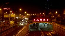
Yangpu District is connected to the neighbouring Pudong New Area across the Huangpu River by one bridge, three tunnels, and six ferry lines. These include the Yangpu Bridge, the Xiangyin Road Tunnel, the Dalian Road Tunnel, and the Jungong Road Tunnel.[16] A fourth tunnel, the Yinhang Road Tunnel is currently under construction.[citation needed]
The Inner Ring Road and Middle Ring Road traverse through Yangpu District.[16]
The industrial wharves along the Huangpu River which service the industrial centres of Yangpu are being phased out by residential developments on the waterfront. Yangpu District has 15.5 kilometers of bank along Huangpu River, which is the longest among all districts in Puxi. As of July 2019, 5.5 kilometers of jogging and cycling lane has been built along the bank.[17]
Metro
[edit]Yangpu is currently served by five metro lines operated by Shanghai Metro: Line 4, Line 8, Line 10, Line 12 and Line 18.[16][18][19]
- Line 4 - Dalian Road 12 , Yangshupu Road
- Line 8 - Shiguang Road, Nenjiang Road, Xiangyin Road, Huangxing Park, Middle Yanji Road, Huangxing Road, Jiangpu Road 18 , Anshan Xincun, Siping Road 10
- Line 10 - Siping Road 8 Tongji University, Guoquan Road 18 , Wujiaochang, Jiangwan Stadium, Sanmen Road, East Yingao Road, Xinjiangwancheng, Guofan Road
- Line 12 - Dalian Road 4 , Jiangpu Park 18 , Ningguo Road, Longchang Road, Aiguo Road, Fuxing Island
- Line 18 - Danyang Road, Pingliang Road, Jiangpu Park 12 , Jiangpu Road 8 , Fushun Road, Guoquan Road 10 , Fudan University, Zhengli Road
Sports
[edit]Jiangwan Stadium is located in Yangpu District along with its associated athletic complex.[16]
Parks and recreation
[edit]Yangpu District is home to Gongqing Forest Park.[16]
The Fudan University Museum (Chinese: 复旦大学博物馆; pinyin: Fùdàn Dàxué Bówùguǎn), a public display of historical artefacts in possession of Fudan University, is located on the university's campus in Yangpu District.[16][20]
See also
[edit]Ссылки
[ редактировать ]- ^ Шанхай Янгпу. «Губернатор округа» . Шанхай Янгпу Правительство . Получено 2001-07-29 .
- ^ Jump up to: а беременный Шанхай Янгпу. «Географическое местоположение» . Шанхай Янгпу Правительство . Получено 2011-07-29 .
- ^ Jump up to: а беременный Народное правительство района Янпу. Основной бюллетень 6 -й национальной переписи населения в 2010 году в районе Янгпу, Шанхай (в упрощенном китайском) . Получено 2011-07-29 .
- ^ «Китай: Shanghăi (районы) - статистика населения, диаграммы и карта» . www.citypopulation.de . Получено 2024-02-09 .
- ^ Jump up to: а беременный в Статистический код зонирования на 2020 год (район Янпу) [2020 Статистические коды разделения (район Янпу)] (на китайском языке). Национальное бюро статистики Китая . 2020. Архивировано из оригинала 2021-05-20 . Получено 2021-05-20 .
- ^ «Улицы Шанхая» . Сказки о Старом Шанхае . Получено 15 января 2015 года .
- ^ Jump up to: а беременный в дюймовый Историческая эволюция района Янпу [История организации Янпу Район]. xzqh.org (на китайском языке). 2014-04-11. Архивировано из оригинала 2021-05-20 . Получено 2021-05-20 .
- ^ Jump up to: а беременный в дюймовый Столетняя индустрия [Сто лет промышленности] (на китайском языке). Народное правительство района Янпу. Архивировано из оригинала 2021-05-20 . Получено 2021-05-20 .
- ^ Столетний университет [Сто лет университета] (на китайском языке). Народное правительство района Янпу. Архивировано из оригинала 2021-05-20 . Получено 2021-05-20 .
- ^ « Дом (китайский). спорта . Шанхайский университет Гай, Китай "
- ^ "Eurocampus Shanghai" . Французская средняя школа в Шанхае . Архивировано из оригинала 2021-05-20 . Получено 2021-05-20 .
- ^ " ПРИЛОЖЕНИЕ ЯНГПУ кампус ". Французская средняя школа в Шанхае . Получено 12 сентября 2017 года.
- ^ « Новая школа для франко-германского сообщества ». Немецкая школа Шанхай . Получено 1 февраля 2018 года. «DS Shanghai [...] далее развил школьное образование в Шанхае».
- ^ , Синьхой ( 16 ) . октября г. 2012 Мао
- ^ Управление переписи государственного совета Китайской Народной Республики; Отдел статистики населения и занятости Национального бюро статистики Китайской Народной Республики (2012). Информация о пере дории травмы, города и улицы в Китае 2010 года. (1 изд.). Пекин: Печать по статистике Китая. ISBN 978-7-5037-6660-2 .
- ^ Jump up to: а беременный в дюймовый и фон Обзорная карта обзора района Янпу [Обзор округа Янпу]. xzqh.org (на китайском языке). 2014-04-11. Архивировано из оригинала 2021-05-20 . Получено 2021-05-20 .
- ^ набережной . » класса Риверсайд : « Янпус мирового ускорение строительства
- ^ «Метро» . Народное правительство района Янпу. 2010-04-13. Архивировано из оригинала 2021-05-20 . Получено 2021-05-20 .
- ^ Строительная площадка второго дня Лунного Нового года - напряженная сцена [Занятая сцена на строительной площадке 18 на второй день Лунного Нового года] (на китайском языке). Народное правительство района Янпу. 2021-02-18. Архивировано из оригинала 2021-05-20 . Получено 2021-05-20 .
- ^ Музей Университета Фудана [Музей Университета Фудана] (на китайском языке). Университет Фудана . Архивировано из оригинала 2021-05-20 . Получено 2021-05-20 .
- «Янпурский район» . Энциклопедия Шанхая . Шанхайское муниципальное правительство . 2010 год.
Внешние ссылки
[ редактировать ] Я путеводитель по округу с полей
 - Официальный английский веб-сайт