Амбала

Эта статья требует дополнительных цитат для проверки . ( декабрь 2011 г. ) |
Амбала | |
|---|---|
Город | |
 Железнодорожная станция Амбала, Харьяна, Индия | |
 Ambala Location in Haryana, India | |
| Coordinates: 30°23′N 76°47′E / 30.38°N 76.78°E | |
| Country | |
| State | Haryana |
| District | Ambala |
| Established | 14th century CE |
| Founded by | Amba Rajput[who?] |
| Named for | Amba Rajput, Bhawani Amba (Goddess) |
| Government | |
| • Type | Municipal Corporation |
| • Body | Ambala Municipal Corporation[2] |
| Elevation | 264 m (866 ft) |
| Population (2011) | |
| • Total | 207,934 (UA)[1] |
| Demonym | Ambalvi |
| Languages[3][4] | |
| • Official | Hindi |
| • Additional official | English, Punjabi |
| • Regional | Haryanvi[5] |
| Time zone | UTC+5:30 (IST) |
| PIN | 1330xx,1340xx |
| Telephone code | 0171 |
| ISO 3166 code | IN-HR |
| Vehicle registration | HR 01 (city), HR 04 (Naraingarh), HR 54 (Barara), HR 85 (Ambala Cantonment), HR37 (commercial) |
| Website | ambala |


Ambala ( / ə m ˈ b ː l ə / ) - город и муниципальная корпорация в районе Амбала в штате Харьяна , Индия , расположенная на границе с индийским штатом Пенджаб и в непосредственной близости от столицы штатов Чандигарх . Политически, у Амбала есть два подпарию: кантонмент Амбала (также известный как Амбала Кантт) и город Амбала , в восемь километров друг от друга, поэтому он также известен как «город-близнец». Он имеет крупную индийскую армию и индийскую военно -воздушную силу в районе кантонмента. Он расположен в 200 км (124 миль) к северу от Нью-Дели , столица Индии, и был идентифицирован как город против магнитов для региона национальной столицы, который будет развиваться в качестве альтернативного центра роста в Дели.
Ambala separates the Ganges river network from the Indus river network and is surrounded by two rivers – Ghaggar and Tangri – to the north and to the south. Due to its geographical location, the Ambala district plays an important role in local tourism, being located 47 km (29 mi) south of Chandigarh, 50 km (31 mi) north of Kurukshetra, 148 km (92 mi) southwest of Shimla, 198 km (123 mi) north of New Delhi and 260 km (160 mi) southeast of Amritsar.
History
[edit]Etymology
[edit]The town is said to derive its name from Amba Rajput who supposedly founded it during the 14th century CE. According to another version, it is named after the goddess "Bhawani Amba," whose Temple still exists in Ambala city.[6][7] The English spelling Umballa has sometimes been used; this spelling was used by Rudyard Kipling in his 1901 novel Kim.[8]
Classical era
[edit]Archaeological Surveyor C.J Rodgers found Indo-Parthian Kingdom coins as well as coins of Hunas, Mihirakula and Toramana which indicated that after the disintegration of the Mauryan empire, the area was taken over by Indo-Parthians and later incorporated into the domain of the Hunas.[6]
Late medieval era
[edit]In 1709, Battle of Ambala was fought, and Sikhs captured Ambala from Mughals.[9] It was under the rule of Gill Jats from 1748 to 1825.[10] It was also the capital of Nishanwalia Misl.[11] For some time it had been under the rule of Jawahir Singh of Mustafabad, a descendant of Desu Singh Randhawa.[12]
British colonial era
[edit]The Ambala Cantonment
[edit]
Ambala Army Base
[edit]Ambala Army Cantonment was established in 1843 after the British were forced to leave its Karnal Cantonment following the malaria epidemic of 1841–42 in as there were not any known effective means to control malaria epidemic in those days. The cantonment houses the '2 Corps', one of the three Strike Corps of the Indian Army.
Ambala Air Force Base
[edit]Ambala Air Force Base is one of the oldest and largest airbases that were inherited from the British by the IAF. It was from this airbase that Spitfires and Harvards flown by Instructors of the Advanced Flying Training School took part in the Indo-Pakistani War of 1947–1948. Subsequently, Ambala was the front line airfield for many years. It was home to various aircraft that were inducted into the Indian Air Force. Vampires, Ouragans, Hunters, etc. all flew from this base. The airbase was briefly attacked in 1965 by B-57 bombers of the Pakistan Air Force. Today, the Airbase houses the '7 Wing' with squadrons of Jaguars and MiG-21 Bisons. A unit of the French-made Dassault Rafale will also be based at Ambala airbase.[13]
European Cemetery
[edit]Ambala Cantonment is the location of historic European Cemetery. It is 200 km north of Delhi and 55 km southwest of Chandigarh.
1857 War Memorial
[edit]
First War of Independence Memorial or 1857 War Memorial, completed in 2023[citation needed] at the cost of Rs300 crore in the honour of Indian rebels of 1857 First War of Independence, is spread over 22 acres on NH-44. The war was started at Ambala on 10 May 1857[14] by the Indian sepoys of 5th & 60th regiments of Bengal Native Infantry stationed at Ambala Cantonment. After the war was over, the execution of Baba Mohar Singh on 5 June 1857 at Ambala Cantonment was the first recorded execution of a captured Indian rebel by the British colonial regime. Ambala rebellion was led by Ananti Mishra, Parmeshwar Pandey, Beni Prasad, Sheikh Faiz Ul-Khan, Bikhan Khan who moved towards Red Fort in Delhi via Bilaspur, Sadhaura, Yamunanagar and Saharanpur. After the war was over, the British authorities burnt the villages of Bilaspur and Sadhaura as punishment for providing aid to the rebels. The 5th & 60th Regiments of the Bengal Native Infantry were also disbanded.[14] The memorial has four sections, an administrative building, second a museum building, third a library and food court, and the fourth is an open air theatre.[15]
Formation of Ambala district
[edit]Ambala was given the status of a district in 1847, formed by the merging of the jagir estates of hitherto independent chieftains whose territories had lapsed or had been confiscated by the British Indian Government. In its 160 years of existence as a district, Ambala has witnessed many changes in its boundaries. Previously, it extended across tehsils of Ambala, Chandigarh, Jagadhri, Pipli, Kharar, Ropar and Nalagarh. Kalka-cum-Kurari State, Pinjore, Mani Majra, Kasauli & Sanawar were also merged later into the district at different times.
1857 rebellion
[edit]For their participation in first war of independence, the Chaudharys and Lambardars of villages who participated in rebellion were also deprived of their land and property, including 368 people of Hisar and Gurugram were hanged or transported for life, and fine was imposed on the people of Thanesar (Rs 235,000), Ambala (Rs. 253,541) and Rohtak (Rs. 63,000 mostly on Ranghars, Shaikhs and Muslim Kasai).[16]
Post-independence
[edit]Hanging of Nathuram Godse
[edit]In November 1949, Mahatma Gandhi's assassin Nathuram Godse was hanged at Ambala Central Jail[17] along with Narayan Apte, a co-conspirator.
Geography
[edit]Climate
[edit]| Climate data for Ambala (1991–2020, extremes 1901–2012) | |||||||||||||
|---|---|---|---|---|---|---|---|---|---|---|---|---|---|
| Month | Jan | Feb | Mar | Apr | May | Jun | Jul | Aug | Sep | Oct | Nov | Dec | Year |
| Record high °C (°F) | 29.1 (84.4) |
33.9 (93.0) |
41.7 (107.1) |
45.0 (113.0) |
47.8 (118.0) |
47.8 (118.0) |
46.7 (116.1) |
43.9 (111.0) |
40.6 (105.1) |
39.4 (102.9) |
35.6 (96.1) |
29.4 (84.9) |
47.8 (118.0) |
| Mean daily maximum °C (°F) | 18.1 (64.6) |
22.5 (72.5) |
27.7 (81.9) |
35.1 (95.2) |
38.4 (101.1) |
37.9 (100.2) |
34.5 (94.1) |
33.5 (92.3) |
33.1 (91.6) |
31.7 (89.1) |
26.9 (80.4) |
21.0 (69.8) |
30.0 (86.0) |
| Mean daily minimum °C (°F) | 6.7 (44.1) |
9.6 (49.3) |
14.3 (57.7) |
19.6 (67.3) |
23.8 (74.8) |
25.5 (77.9) |
25.7 (78.3) |
25.1 (77.2) |
23.3 (73.9) |
17.8 (64.0) |
11.8 (53.2) |
7.5 (45.5) |
17.5 (63.5) |
| Record low °C (°F) | −1.3 (29.7) |
−0.6 (30.9) |
3.7 (38.7) |
9.4 (48.9) |
13.9 (57.0) |
17.8 (64.0) |
19.4 (66.9) |
20.0 (68.0) |
15.6 (60.1) |
8.3 (46.9) |
1.8 (35.2) |
−0.6 (30.9) |
−1.3 (29.7) |
| Average rainfall mm (inches) | 30.7 (1.21) |
35.9 (1.41) |
29.4 (1.16) |
20.1 (0.79) |
35.3 (1.39) |
111.4 (4.39) |
257.0 (10.12) |
228.0 (8.98) |
136.5 (5.37) |
14.3 (0.56) |
6.5 (0.26) |
15.4 (0.61) |
920.5 (36.24) |
| Average rainy days | 2.0 | 2.4 | 2.0 | 1.7 | 3.0 | 5.5 | 8.7 | 8.9 | 5.5 | 0.8 | 0.4 | 0.8 | 41.7 |
| Average relative humidity (%) (at 17:30 IST) | 66 | 55 | 45 | 29 | 30 | 44 | 68 | 72 | 66 | 52 | 53 | 63 | 53 |
| Source: India Meteorological Department[18][19] | |||||||||||||
Demographics
[edit]As of 2011[update] India census, Ambala UA had a population of 207,934 consisting of 112,840 males and 95,094 females, a ratio of 843. There were 20,687 children 0–6 and Ambala had an average literacy rate of 89.31%, with 91.76% of males and 86.41% of females literate.[1]
| Religious group |
1868[22] | 1881[23][24]: 520 | 1891[25]: 68 | 1901[26]: 44 | 1911[27]: 20 | 1921[28]: 23 | 1931[29]: 26 | 1941[21]: 32 | 2011[30] | |||||||||
|---|---|---|---|---|---|---|---|---|---|---|---|---|---|---|---|---|---|---|
| Pop. | % | Pop. | % | Pop. | % | Pop. | % | Pop. | % | Pop. | % | Pop. | % | Pop. | % | Pop. | % | |
| Hinduism |
27,008 | 53.27% | 34,522 | 51.17% | 40,339 | 50.87% | 39,601 | 50.36% | 38,192 | 47.66% | 37,765 | 49.48% | 39,945[b] | 46.13% | 50,679[b] | 47.19% | 159,912 | 81.94% |
| Islam |
19,570 | 38.6% | 27,115 | 40.19% | 30,523 | 38.49% | 32,149 | 40.88% | 31,641 | 39.49% | 31,448 | 41.2% | 38,089 | 43.99% | 47,881 | 44.59% | 2,431 | 1.25% |
| Christianity |
1,362 | 2.69% | — | — | 4,899 | 6.18% | 3,610 | 4.59% | 5,918 | 7.39% | 2,373 | 3.11% | 3,138 | 3.62% | 1,054 | 0.98% | 739 | 0.38% |
| Sikhism |
1,235 | 2.44% | 1,867 | 2.77% | 2,407 | 3.04% | 2,168 | 2.76% | 3,392 | 4.23% | 3,622 | 4.75% | 4,143 | 4.78% | 4,926 | 4.59% | 28,471 | 14.59% |
| Jainism |
— | — | 410 | 0.61% | 1,119 | 1.41% | 1,096 | 1.39% | 957 | 1.19% | 1,083 | 1.42% | 1,269 | 1.47% | 1,814 | 1.69% | 2,816 | 1.44% |
| Zoroastrianism |
— | — | — | — | 6 | 0.01% | 14 | 0.02% | 31 | 0.04% | 30 | 0.04% | 2 | 0% | — | — | — | — |
| Buddhism |
— | — | — | — | 0 | 0% | 0 | 0% | 0 | 0% | 5 | 0.01% | 5 | 0.01% | — | — | 55 | 0.03% |
| Judaism |
— | — | — | — | 0 | 0% | N/A | N/A | 0 | 0% | 0 | 0% | 1 | 0% | — | — | — | — |
| Others | 1,521 | 3% | 3,549 | 5.26% | 1 | 0% | 0 | 0% | 0 | 0% | 0 | 0% | 0 | 0% | 1,008 | 0.94% | 729 | 0.37% |
| Total population | 50,696 | 100% | 67,463 | 100% | 79,294 | 100% | 78,638 | 100% | 80,131 | 100% | 76,326 | 100% | 86,592 | 100% | 107,383 | 100% | 195,153 | 100% |
Economy
[edit]Cloth Market
[edit]The Cloth Market is considered to be the largest textile market in this region. It is located in sector 7, the central part of the city of Ambala. The market is known for catering to wedding related shopping. The most commonly bought items are sarees and silk clothing.[31][better source needed]
Transport
[edit]Ambala is connected to all of the other major cities of north India. It is a big interchange for various commuters for all neighbouring states.[32]
National Highway NH 44 popularly known as GT road earlier known as NH 1 passes through Ambala and connects it to National capital Delhi, Panipat, Ludhiana and Amritsar. NH 152 connects it to state capital Chandigarh, Kaithal. Apart from the Interstate service, Ambala also houses one of the oldest local bus services in Haryana, which is run by both Haryana roadways and private companies. Other means of local transportation include auto rickshaws and cycle rickshaws.
Roadways
[edit]Bus service is the major means of public transport in this district. Ambala depot came into being on 1 August 1950. The office of the General Manager has situated on the premises of the depot workshop at Ambala City. Ambala depot has a sub depot at Naraingarh.
Presently, Haryana Roadways, Ambala has 200 buses, which carry about 34.88 Lac's passengers daily and cover a distance of about 19000 km daily. Out of these, total distance covered on interstate routes is 24,711 km (15,355 mi) and 41.469 km (25.768 mi) are operated within Haryana every day.
New Bus Stand at Ambala Cantt was inaugurated on 12 July 1999 and the total land of bus stand is 6.7 acres (2.7 ha). Bus stands in this district exist at Ambala City, Naraingarh and Barara as well. A sub-depot-level workshop has also been provided at Naraingarh. 'Yatri Niwas' exists on the campus of Ambala Cantt. bus stand for the convenience of the commuters who wish to stay for the night.
Besides, the Haryana Roadways buses, the government has issued permits to private operators on local routes. Presently 60 such buses are plying in Ambala district. The bus stand is very near to Ambala Cantt Jn. (Railway station). Most of the buses plying on GT road (NH1) stop in front of the Railway station.
Railways
[edit]Ambala is a divisional headquarters of the Northern Railway Zone and is an important railway junction. Ambala Cantt station is among the top 100 booking stations in India. The city is served by three railway stations:
- Ambala Cantt [UMB] (Junction on Delhi-Kalka line and Moradabad-Ambala line/Ambala-Attari line)
- Ambala City [UBC] (On Ambala-Attari line)
- Dhulkot [DKT] (on Delhi-Kalka line)
The Ambala Cantonment railway station was founded on the junction of the Delhi-Kalka and Ludhiana-Saharanpur lines. The historic Delhi-Panipat-Ambala-Kalka railway line dates back to 1889 while the Ludhiana-Saharanpur line was built in 1870. Situated 200 km (120 mi) north of Delhi, this town is well connected by the rail and road network.[citation needed]
Ambala cantt railway station is main station of the city and is well connected with major cities of India. Kalka-Shimla Railway, which is a UNESCO World Heritage site, also comes under Ambala division.
Ambala Cantonment railway station serves maximum Shatabdi Express after New Delhi. Ambala railway station was mentioned in the famous story 'The Woman on Platform 8' by Ruskin Bond, although in reality there is no platform 8 in Ambala Cantt.
Education
[edit]Ambala has a large number of schools and colleges. Notable colleges are as follows:
- Convent of Jesus and Mary, Ambala
- D.A.V. College (Lahore), Ambala City
- E-Max School of Engineering and Applied Research
- Government Polytechnic College, Ambala
- Maharishi Markandeshwar University, Mullana
- Maharishi Markandeshwar University, Sadopur
- Philadelphia Hospital & School of Nursing, Ambala
- Sanatan Dharma College (S.D. College)
- Shri Atmanand Jain Institute of Management and Technology
Notable people
[edit]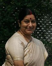
- Zohrabai Ambalewali
- Hansraj Behl
- Urvashi Butalia
- Simi Chahal
- Juhi Chawla
- Parineeti Chopra
- Swadesh Deepak
- Navneet Kaur Dhillon
- Sanjeev Kapoor
- Manpreet Kaur
- Nasir Kazmi
- Sucheta Kripalani
- Shalabh Kumar
- Selja Kumari
- Talib Dehlavi
- Kim Philby
- Ash K. Prakash
- Чистый человек
- Сагар Сиддики
- Санджив Сэм Гамбхир
- Сушма Сварадж
- Финк
Примечания
[ редактировать ]- ^ 1868-1941: Данные за весь город Амбала, который включал муниципалитет Амбала, гражданские линии Амбала, муниципалитет Садар Базар Амбала и кантонмент Амбала. [ 21 ] : 30
- ^ Подпрыгнуть до: а беременный 1931-1941: в том числе ad-dharmis
Ссылки
[ редактировать ]- ^ Подпрыгнуть до: а беременный «Городские агломерации/города с населением 1 лакх и выше» (PDF) . Перепись Индия . Получено 29 декабря 2015 года .
- ^ «Муниципальная корпорация Амбала» . Июнь 2024 года.
- ^ «Отчет Комиссара по лингвистическим меньшинствам: 52 -й отчет (июль 2014 года по июнь 2015 года)» (PDF) . Комиссар по лингвистическим меньшинствам, Министерство по делам меньшинств, правительство Индии. п. 24. Архивировано из оригинала (PDF) 15 ноября 2016 года . Получено 4 февраля 2019 года .
- ^ IANS (28 января 2010 г.). «Харьяна предоставляет статус второго языка пенджаби» . Времена Hindustan . Получено 2 января 2019 года .
- ^ "Харьянви" . Этнолог . Архивировано с оригинала 1 июня 2016 года . Получено 20 февраля 2024 года .
- ^ Подпрыгнуть до: а беременный Haryana Gazateer , Департамент доходов Харьяны, Capter-V.
- ^ Bajwa, JS; Каур Р. (2007). Управление туризмом . Aph Publishing Corporation. ISBN 9788131300473 .
- ^ «Bibliomania: бесплатная онлайн -литература и руководства по изучению» . Получено 2 декабря 2023 года .
- ^ Sagoo, Harbans (2001). Банда Сингх Бахадур и сикхский суверенитет . Глубокие и глубокие публикации.
- ^ Siṅgha, Bhagata (1993). История сикхских спариваний . Бюро публикации, Пенджабский университет . Получено 30 мая 2023 года .
- ^ Сингх, Хазан (1970). История сикхской религии . Департамент языков, Пенджаб . Получено 30 мая 2023 года .
- ^ Шарма, Суреш К. (1 февраля 2006 г.). «Харьяна: прошлое и настоящее» . Миттал публикации. ISBN 9788183240468 Полем Получено 30 мая 2023 года .
- ^ Ани (4 января 2019 г.). «Индийские ВВС для развертывания Jets Rafale в Амбале, Хасимара» . NDTV . Получено 10 марта 2019 года .
- ^ Подпрыгнуть до: а беременный Нагпал, Бхави (12 мая 2023 г.). «Военный мемориал Амбалы 1857 года, вероятно, будет открыт к концу года» . Времена Hindustan . Получено 8 июля 2023 года .
- ^ «Группа историков встречается, чтобы обсудить мемориал 1857 года в Амбале» . Times of India . 12 июня 2022 года . Получено 8 июля 2023 года .
- ^ Сатиш Чандра Миттал, 1986, Харьяна, историческая перспектива , стр. 58.
- ^ The Times (Лондон), стр. 3, 16 ноября 1949 г.
- ^ «Станция: Амбала Климатологическая таблица 1991–2020 гг.» (PDF) . Климатологические нормы 1991–2020 . Индийский метеорологический департамент. Архивировано из оригинала (PDF) 8 апреля 2024 года . Получено 7 июля 2024 года .
- ^ «Экстремальные температуры и количество осадков для индийских станций (до 2012 года)» (PDF) . Индийский метеорологический департамент. Декабрь 2016 г. с. M63. Архивировано из оригинала (PDF) 5 февраля 2020 года . Получено 1 марта 2020 года .
- ^ "Амбала -городская перепись 2011 - Харьяна" . www.census2011.co.in .
- ^ Подпрыгнуть до: а беременный «Перепись Индии, 1941 Том VI Пенджаб» . Получено 17 января 2023 года .
- ^ (Индия), Пенджаб (1868). «Отчет о переписи Пенджаба, взятый 10 января 1868 года» . п. 66. JStor Saoa.crl.25057644 . Получено 7 июля 2024 года .
- ^ «Перепись Индии, 1881 г. Отчет о переписи Панджаба, взятого 17 февраля 1881 года, том I». 1881. Jstor Saoa.crl.25057656 . Получено 14 января 2024 года .
- ^ «Перепись Индии, 1881 г. Отчет о переписи Панджаба, взятого 17 февраля 1881 года, том II» . 1881. Jstor Saoa.crl.25057657 . Получено 14 января 2024 года .
- ^ «Перепись Индии, 1891 г. Общие таблицы Британские провинции и феодальные государства, том I» . Получено 17 января 2023 года .
- ^ «Перепись Индии, 1901 Том IA India Part II Стоки» . Получено 17 января 2023 года .
- ^ «Перепись Индии, 1911 Том XIV Пенджаб, часть II Таблицы» . Получено 17 января 2023 года .
- ^ «Перепись Индии, 1921 г. Том XV Пенджаб и Дели Таблицы части II» . Получено 17 января 2023 года .
- ^ «Перепись Индии, 1931 Том XVII Пенджаб, часть II таблицы» . Получено 17 января 2023 года .
- ^ "Амбала -городская перепись 2011 - Харьяна" . www.census2011.co.in .
- ^ «О рынке ткани» . Yatra.com . Получено 22 июня 2019 года .
- ^ «Как достичь | Районная Амбала, правительство Харьяны | Индия» . Получено 4 сентября 2022 года .
Внешние ссылки
[ редактировать ] Амбала Темы |
|---|
