Lake Elsinore, California

This article needs additional citations for verification. (November 2023) |
City of Lake Elsinore | |
|---|---|
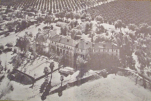
 View of Lake Elsinore | |
 | |
| Motto: "Dream Extreme"[1] | |
 Location of Lake Elsinore in Riverside County, California | |
 City of Lake Elsinore Location in California | |
| Coordinates: 33°40′53″N 117°20′43″W / 33.68139°N 117.34528°W | |
| Country | United States |
| State | California |
| County | |
| Incorporated | April 9, 1888[2] |
| Government | |
| • Type | Council-Manager |
| • Mayor | Steve Manos |
| • Mayor Pro Tem | Brian Tisdale |
| • City Council | Bob Magee Timothy Sheridan Natasha Johnson |
| • Treasurer | Allen P. Baldwin[3] |
| Area | |
| • Total | 43.51 sq mi (112.70 km2) |
| • Land | 38.24 sq mi (99.03 km2) |
| • Water | 5.28 sq mi (13.67 km2) 13.14% |
| Elevation | 1,296 ft (395 m) |
| Population | |
| • Total | 70,265 |
| • Estimate (2022)[7] | 71,898 |
| • Density | 1,880.18/sq mi (726.02/km2) |
| Time zone | UTC−8 (PST) |
| • Summer (DST) | UTC−7 (PDT) |
| ZIP Codes | 92530–92532 |
| Area code | 951 |
| FIPS code | 06-39486 |
| GNIS feature IDs | 1652704, 2411601 |
| Website | www |

Lake Elsinore is a city in western Riverside County, California, United States. Established as a city in 1888, it is on the shore of Lake Elsinore, a natural freshwater lake about 3,000 acres (1,200 ha) in size. The city has grown from a small resort town in the late 19th and early 20th centuries to a suburban city with over 70,000 residents.
History
[edit]
Native Americans have long lived in the Elsinore Valley. The Luiseño people were the earliest known inhabitants. Their pictographs can be found on rocks on the Santa Ana Mountains and in Temescal Valley, and artifacts have been found all around Lake Elsinore and in the local canyons and hills.[8]
Overlooked by the expedition of Juan Bautista de Anza, the largest natural lake in Southern California was first seen by the Spanish Franciscan padre Juan Santiago, exploring eastward from the Mission San Juan Capistrano in 1797. In 1810, the water level of the Laguna Grande was first described by a traveler as being little more than a swamp about a mile long.[9] Later in the early 19th century, the lake grew larger, providing a spot to camp and water their animals for Mexican rancheros, American trappers, the expedition of John C. Frémont, and the immigrants during the California Gold Rush as they traveled along the southern shore of the lake on what later became the Southern Emigrant Trail and the route of the Butterfield Overland Mail.
On January 7, 1844, Julian Manriquez acquired the land grant to Rancho La Laguna, a tract of almost 20,000 acres (8,100 ha) which included the lake and an adobe being built near the lake on its south shore at its western corner that was described by Benjamin Ignatius Hayes, who stayed there overnight January 27, 1850.[10]
In 1851, Abel Stearns acquired the rancho and sold it in 1858 to Augustin Machado. Augustin Machado built a seven-room adobe ranch house and an outbuilding on the southwest side of the lake. Soon after, Rancho La Laguna became a regular stop on the Butterfield Overland Mail route between Temecula 20 mi (32 km) to the southeast and the Temescal station 10 mi (16 km) to the northwest. The old Manriquez adobe was used as the station house. Over the years, a framed addition and a second story were added, and it was used as a post office for the small settlement of Willard from 1898 until September 30, 1902. The building stood until it was razed in 1964, at what is now 32912 Macy Street. Today, three palm trees still grow in front of the site along Macy Street in front of the property.[11][12]
As a result of the Great Flood of 1862, the level of the lake was very high, so the Union Army created a post at the lake to graze and water their horses. In the great 1862–65 drought, most of the cattle in Southern California died and the lake level fell, especially during 1866 and 1867, when practically no rain fell. However, the lake was full again in 1872, when it overflowed down its outlet through Temescal Canyon.[13]
While most of the old California families lost their ranches during the great drought, the La Laguna Rancho remained in the hands of the Machado family until 1873, when most of it was sold to Englishman Charles A. Sumner. Juan Machado retained 500 acres (200 ha) on the northwest corner of the lake, where his adobe still stands near the lake at 15410 Grand Avenue.
After 1872, the lake again evaporated to a very low level, but the great rains in the winter of 1883–84 filled it to overflowing in three weeks. Descriptions of the lake at this time say that large willow trees surrounding the former low-water shore line stood 20 ft (6.1 m) or more below the high-water level and were of such size that they must have been 30 or more years old. This indicated the high water of the 1860s and 1870s must have been of a very short duration.[14]
On October 5, 1883, Franklin H. Heald and his partners Donald Graham and William Collier bought the remaining rancho, intending to start a new town. In 1884, the California Southern Railroad built a line from Colton through the Cañon de Rio San Jacinto (now Railroad Canyon) to link with San Diego, and a rail station La Laguna appeared near the corner of what is now Mission Trail and Diamond Drive. On April 9, 1888, Elsinore became the 73rd city to be incorporated in California, just 38 years after California became a state. Originally, Elsinore was in San Diego County, but the city became part of Riverside County upon its creation in 1893. It was named Elsinore after the Danish city, Helsingør, which is featured in William Shakespeare's play Hamlet. In fact, Helsingør is now a sister city of Lake Elsinore, California. Another source maintains Elsinore is a corruption of "el señor", Spanish for "the gentleman", because the city site had been owned by a don.[15]

The rainfall until 1893 was greater than normal, and the lake remained high and overflowed naturally on three or four occasions during that time. The lake water was purchased by the Temescal Water Company for the irrigation of land in Corona. Its outlet channel was deepened, permitting gravity flow down the natural channel of Temescal Canyon to Corona for a year or more after the water level sank below the natural elevation of its outlet. As the lake surface continued to recede, a pumping plant was installed and pumping was continued a few seasons, but the concentration of salts in the lake, due to the evaporation and lack of rainfall, soon made the water unfit for irrigation and the project was abandoned by the company.[14]

From the beginning, the mineral springs near the lake attracted visitors seeking therapeutic treatments. In 1887, the Crescent Bath House, now known as "The Chimes", was built; it still stands in historic downtown and is a registered national historic site. By 1888, the economy was supported by coal and clay mining at what became the town of Terra Cotta, gold mining in the Pinacate Mining District, ranching, and the agriculture of fruit and nuts. After 1893, the lake's water level sank almost continuously for nearly 10 years, with a slight rise every winter. Heavier precipitation, beginning in 1903, gradually filled the lake to about half the depth above its minimum level since 1883. Then, in January 1916, a flood rapidly raised the level to overflowing.
Lake Elsinore was a popular destination in the first half of the 1900s for celebrities to escape the urban Hollywood scene. Many of their homes still stand on the hills surrounding the lake, including Aimee's Castle, a unique Moorish-style house built by Aimee Semple McPherson. Also, actor Bela Lugosi, known for his lead role in Universal Pictures' film, Dracula, built a home that still exists in the city's Country Club Heights district.
The Riverside Daily Press published this description in December 1919:
- The city of Elsinore nestles snuggly on the west side of the lake, while it is backed by stately foothills through which traverses one of the famous state highways leading to Riverside and Los Angeles to the west and to San Diego to the southwest.
- Its elevation of 1300 feet makes its climate delightful, especially in the cold months of winter. It has school facilities for a city twice its population, including a modern high school, grammar school and kindergarten.
- It is one of few cities of its size in the state that has its own sewer system. It has an ornamental lighting system and five blocks of the city’s business section are paved from curb to curb with concrete. There are yet two and one-half miles of this kind of street to be laid on the streets entering the city from the south and west, connecting up with the inland highway system to San Diego and Riverside and Los Angeles.
- Elsinore has three churches, the Methodist Episcopal, Presbyterian, Roman Catholic, while the Episcopal and Christian Scientists hold regular services in leased property.
- The health record of the city is perhaps one of its greatest features. During the recent epidemic of Spanish influenza, which swept the country and the world, Elsinore escaped with but a few cases. Only three deaths were attributed to the disease.[16]
In 1933, the Elsinore Naval and Military School was established, though it would later close it doors in 1977.[17]
The lake also hosted teams for Olympic training and high-speed boat racing in the 1920s. The lake went dry in the mid-1930s, but refilled by 1938.[14]
During World War II, the lake was used to test seaplanes, and a Douglas Aircraft plant making wing assemblies for Boeing B-17 Flying Fortress bombers was located in the city.[18] The lake ran dry during most of the 1950s and was refilled in the early 1960s.
Despite its relatively small African American population, it has the distinction of electing the first black city councilman in California, Thomas R. Yarborough, in 1948.[19][20][21] Yarborough went on to become one of three African American mayors elected in California in 1966.[21]
In 1972, citizens of the city voted to rename it Lake Elsinore.[22] More than a week of heavy rains in 1980 flooded the lake, destroying surrounding homes and businesses. Since then, a multimillion-dollar project has been put into place to maintain the water supply at a consistent level, allowing for homes to be built close to the lake. Overflow water in the Lake spills out via Alberhill Creek, a tributary of Temescal Creek. In 2007, an aeration system was added to help with the lake's ecosystem.
The city was ranked as the 12th fastest growing city in California between 2000 and 2008.[23] Now, over 70,000 residents as of the 2020 census live there, and formerly open hillsides have been converted into housing tracts.[24]
Geography
[edit]
According to the United States Census Bureau, the city has a total area of 41.7 sq mi (108.0 km2) of which 36.2 sq mi (93.8 km2) of it is land and 5.5 sq mi (14.2 km2), or 13.14%, is covered by water.
Lake Elsinore, originally Laguna Grande, is the largest natural freshwater lake in Southern California and is situated at the lowest point within the 750-square-mile (1,900 km2) San Jacinto River watershed at the terminus of the San Jacinto River, where its headwaters are found on the western slopes of San Jacinto Peak with its North Fork, and Lake Hemet with its South Fork. Lake levels are healthy at 1,244 feet (379 m) above sea level with a volume of 30,000 acre⋅ft (37 Gl)[25] that often fluctuate, although much has been done recently to prevent the lake from drying up, flooding, or becoming stagnant. At 1,255 feet (383 m), the lake would spill into the outflow channel on its northeastern shore, known properly as Temescal Wash, flowing northwest along I-15, which feeds Temescal Creek, which dumps into the Santa Ana River just northwest of the City of Corona. It then flows to Orange County, out to the Pacific Ocean just south of Huntington State Beach.
Lake Elsinore is bordered by the Elsinore Mountains to the west, which are a part of the larger Santa Ana Mountain Range, and receive a few inches of snowfall a few days each year. Included in the Santa Ana Mountains is the Cleveland National Forest and the community of El Cariso. Lake Elsinore is northwest of Wildomar and the northern portion is part of the Temescal Canyon. To the east of the lake are the much older and more eroded slopes of the Temescal Mountains.
Districts
[edit]Lake Elsinore is a city which encompasses a large geographical area. To better distinguish the wide range of neighborhoods, the city is organized into 11 districts. Each district beholds its own unique geography, culture, age, and history which together make Lake Elsinore a very diverse and culturally rich city. They are the Alberhill, Ballpark, Business, Country Club Heights, East Lake, Historic, Lake Edge, Lake Elsinore Hills, Lake View, North Peak, and Riverview Districts.[26]

Alberhill
[edit]The Alberhill District is characterized by rolling terrain, vacant land, and the newly constructed Alberhill Ranch neighborhood. Much of the topography in the central areas, east and west of Lake Street, has been substantially altered as a result of the Alberhill District's long history of extractive/mining activities. Mining operations in the Alberhill District began at Terra Cotta roughly the same time the region's first railroad, the California Southern Railroad, was completed in the 1880s. A spur of the railroad originally built to Terra Cotta was extended into the central portion of the Alberhill District. The Atchison, Topeka, and Santa Fe Railroad built a line up from Corona through Alberhill to Elsinore after the line through Railroad Canyon was washed out in the 1920s. These events helped shape the growth of the District. Mining operations for coal and especially clay have continued to exist since the late 19th century, and occupy a significant portion of the Alberhill District. Through the years, Pacific Clay Products Company has purchased the local mines and has become the sole operating clay mine in the region.[27]
Ballpark
[edit]The Ballpark District takes its name from the Lake Elsinore Diamond Stadium, a first-class minor league baseball stadium constructed in 1994. It is home to the Lake Elsinore Storm professional baseball team, an affiliate of the San Diego Padres. The area was once the site of the first train depot in Lake Elsinore, but no train tracks or structures from that era remain.[28]
Business
[edit]The developed area within the Business District, in Warm Springs Valley, is relatively new and has the strongest concentration of industrial and commercial uses within the city. In addition, it hosts several big-box retailers, the Lake Elsinore Outlets, the lake's outlet channel, Temescal Creek, and marshlands. It is bordered by Country Club Heights to the west and Interstate 15 to the east, with a small portion extending to the east side of I-15. Sections of the Atchison, Topeka, & Santa Fe Railroads that passed through the Business District during the 1800s have been removed. In addition, a historic ranching and homesteading site with previous ranching and homesteading activities is located nearby the route where the railroad once existed.[29]
Country Club Heights
[edit]
The Country Club Heights District is distinctly marked by the steep hillsides of the Clevelin Hills, views of the lake and the city, and is a key part of Lake Elsinore's history. The issues mentioned above have presented development constraints for Country Club Heights since its historic beginnings dating back to 1912. The area was the target of an elaborate land scheme promoted in Los Angeles. The Mutual Benefit and Loan Society of Los Angeles acquired two pieces of dry, "hill-land" within a few miles north of "town-land" that the Press claimed was not worth ten cents an acre. The Mutual Benefit and Loan Society offered to give a 25-by-100-foot (7.6 m × 30.5 m) lot to anyone who asked; however, the person receiving the lot had to pay ten dollars for a membership in the club, and one dollar per month dues for five years. In 1924, the Clevelin Realty Corporation, headed by Abe Corlin (President) and Henry Schultz (Treasurer-Secretary), began selling additional lots in Country Club Heights and launched a real estate sales promotion in the area. The Clevelin Hills took their name from this company.
Noteworthy sites in the Country Club Heights District include: the Schultz Mansion (now Bredlau Castle) and the Corlin Mansion, both built by the Corporation on the Clevelin Hills in 1926 for Henry Schultz and Abe Corlin, respectively, who had originated the Clevelin Realty development. The Bredlau castle is over 9,000 sq ft (840 m2), and includes a hidden room with a sliding bookcase door that was used during Prohibition. These stately homes overlooking the lake were the site for many social gatherings. The winding roads of Country Club Heights are adorned with historic Marbelite lampposts, designed by Henry Barkschat.[30] In 2007, the City of Lake Elsinore restored the historic lampposts along Lakeshore Drive.[31]

In October 1928, Aimee Semple McPherson, a renowned evangelist, commissioned Architect Edwin Dickman to design for her a palatial home in Country Club Heights, which has since won fame as "Aimee's Castle".[32] This is said to be a house born of Hollywood, inspired by Moorish architectural design. This home served as the evangelist's part-time home until 1939, when it passed to new ownership. After changing hands many times, in 2005, International Church of the Foursquare Gospel, the modern incarnation of McPherson's Foursquare Gospel, purchased and restored the property after years of neglect.[33][34]

The Clevelin Country Club (later known as the Lake Elsinore Country Club, The Spa Club and the Casino Del Elsinore) was built to be the main attraction of the Country Club Heights subdivision.[35] Prominent members of the club included Mrs. Wallace Reid, Marie Prevost, Reginald Denny, Jack Dempsey, Bert Lytell, Damon Runyon and Joe Stecher, for whom the streets are so named[36] This Spanish-Mediterranean Moorish accented architectural masterpiece had over 20,000 square feet of floor space and included a ballroom, banquet hall, sleeping quarters, and a tunnel system to hidden rooms. The Country Club closed during the depression, but reopened in 1951. It has closed again before 1981, at which point restoration work was being undertaken, but by 1990 the property was vacant and derelict.[35] The Country Club succumbed to arson in 2001.[37]
East Lake
[edit]The East Lake District is partially developed and contains the newly constructed Summerly neighborhood. It is a generally flat area that does not contain any registered historic structures. However, portions of the East Lake District were used during prehistoric times by Native American Indians as flaking and grinding stations. In addition, a historic ranching and homesteading site is located just outside the East Lake District along the border with Lakeland Village to the southwest. More recently, the East Lake District has also been home to popular motocross, skydiving, glider plane, and hang gliding activities. Throughout the city's history, Lake Elsinore has alternated between severe floods and droughts. Most of the East Lake District lies within a 100-year floodplain adjacent to and southeast of the lake. As a result, the district has been significantly affected during wet seasons and high water levels in the lake. Major floods occurred in 1884 and in 1916. In 1969, 7 in (180 mm) of rain fell in 11 days and severely flooded the lake's shores. The East Lake District's proximity to the lake and flood storage is a key consideration in all planned development and several projects have been implemented to prevent the lake from flooding again.[38]
Historic District
[edit]The Historic District has been the focal point of the city since its incorporation in 1888.
In 1925, W.R. Covington and Associates of Santa Monica purchased 650 ft (200 m) of lake frontage and three blocks of slightly improved land across Poe Street from Warm Springs Park. A clubhouse, swimming pool, and other facilities projected to cost $200,000 (or $3.5 million today) were built on this property. No records have been found to provide the date when a fire destroyed the clubhouse, but remnants of the burned structure and surrounding trees examined in 1942 indicate the fire must have occurred soon after the building was constructed.[39] The Covington resort was built in the Town of Elsinore.
Today, several unregistered historic buildings exist, including the Crescent Bath House, also known as "The Chimes"; The Chamber of Commerce (Santa Fe Train Station); The Cultural Center (The Methodist Church); Armory Hall; The Ambassador Hotel (Elsinore Consolidated Bank); Jean Hayman House; and Elsinore City Park[40] The neighborhoods in this area are the oldest in the city, and its commercial strip along Main Street is considered to be downtown.[41]
Lake Edge District
[edit]The Lake Edge District area has had a long and eventful history, with the lake as a focal point for the Native Americans, Europeans, Mexicans, early founders of the city, and the multitude of visitors and locals who continue to come to its shores for entertainment and recreation. Many developments occurred along or within proximity of the lake's edge during the second half of the 19th and the first half of the 20th centuries.
The Lake Edge District encompasses the ruins of the city's oldest standing structure, the Machado Adobe House, Rancho La Laguna[42][circular reference] This site was the location of the Laguna Grande Butterfield Stage Station. This structure succumbed to arson in 2017.[43]
A structure of historical interest is Meyer & Holler designed Southern California Athletic and Country Club, former Elsinore Naval and Military School building, located along Grand Avenue near the intersection of Ortega Highway.[44]
A newly constructed campground, marina, and boat launch is located on the northwest side of the lake.

Lake Elsinore Hills
[edit]The Lake Elsinore Hills District encompasses a large and varied terrain including broad plains, rolling hills, steep slopes, sensitive habitats, and watercourses, with elevations ranging from 1,300 to 2,170 feet (400 to 660 m) above the sea level. Many areas of the Lake Elsinore Hills District are not readily accessible or able to be developed, so have remained vacant. Two large bodies of water located within close proximity of the Lake Elsinore Hills District are the city's lake to the southwest and Canyon Lake to the east, which is located within the city of Canyon Lake. Some of the higher elevations offer panoramic views of the city's lake and the Santa Ana Mountains. The neighborhoods in this district include Tuscany Hills, Canyon Hills, and Rosetta Canyon.[45]
Lake View
[edit]The northwestern areas of the Lake View District offer beautiful views of the lake and the neighboring mountains, and are characterized by high elevations, steep slopes, and a series of canyons. The remaining areas of the Lake View District are relatively flat in the lower elevations. Historically, the northern portion of the Lake View District has remained mostly undeveloped, with the exception of the La Laguna Estates neighborhood above McVicker Canyon Park. Similar to the areas further north, the Atchison, Topeka, and Santa Fe Railroad and abundant mining opportunities extant in the late 19th century brought both residents and visitors to the area. Historic ranching and homesteading, including Torn Ranch, were generally located to the northwest of Machado Street, which was an important roadway lined with beautiful deodar trees. Most of the lower-lying areas of the Lake View District to the north have been recently developed and primarily include single-family homes. Other neighborhoods in this area include Northshore and Lake Terrace, which were both formerly orange groves. Another area in this district at the intersection of Riverside and Lakeshore Drives has long been to referred to as "Four Corners" by local residents.[46]
Riverview
[edit]The Riverview District is a combination of steep terrain and flat areas nestled between a knoll with steep slopes, a major watercourse, and the lake. Higher elevations and steep slopes are located in the northwest areas of the Riverview District, which function as a physical border with most of the adjacent Historic District. The San Jacinto River floodway, located within the Riverview District along the eastern and southern areas, is the city's major watercourse. The river flows southwest from Canyon Lake through the Lake Elsinore Hills District and the Riverview District, then ultimately empties into the lake.[47]

Climate
[edit]Lake Elsinore has a mild semi-arid climate (Köppen climate classification BSk/BSh), with hot, almost rainless summers and mild, wetter winters. While too dry for this classification, its thermal regime and precipitation distribution resembles that of a hot-summer Mediterranean climate (Köppen Csa), which is present in many surrounding areas.[48] On average, the hottest month is July, and the coolest month is December. The highest recorded temperature was 118 °F (47.8 °C), first recorded on August 12, 1933, and the lowest recorded temperature was 10 °F (−12.2 °C) on December 30, 1974. The maximum average precipitation occurs in February, and the minimum average precipitation in June, although less than half of all Junes, Julies, Augusts, and Septembers record any precipitation whatsoever. The greatest amount of precipitation ever received in one day was 5.28 inches (134 mm), on February 15, 1927.[49]
| Climate data for Lake Elsinore, California (1991–2020 normals, extremes 1897–present) | |||||||||||||
|---|---|---|---|---|---|---|---|---|---|---|---|---|---|
| Month | Jan | Feb | Mar | Apr | May | Jun | Jul | Aug | Sep | Oct | Nov | Dec | Year |
| Record high °F (°C) | 91 (33) | 95 (35) | 103 (39) | 109 (43) | 109 (43) | 114 (46) | 117 (47) | 118 (48) | 117 (47) | 110 (43) | 98 (37) | 90 (32) | 118 (48) |
| Mean maximum °F (°C) | 78.4 (25.8) | 82.2 (27.9) | 87.5 (30.8) | 93.8 (34.3) | 98.5 (36.9) | 103.9 (39.9) | 107.8 (42.1) | 108.3 (42.4) | 105.3 (40.7) | 98.5 (36.9) | 88.4 (31.3) | 78.8 (26.0) | 110.9 (43.8) |
| Mean daily maximum °F (°C) | 65.7 (18.7) | 67.1 (19.5) | 71.5 (21.9) | 76.5 (24.7) | 82.0 (27.8) | 90.2 (32.3) | 96.5 (35.8) | 97.8 (36.6) | 93.2 (34.0) | 83.1 (28.4) | 73.2 (22.9) | 65.0 (18.3) | 80.2 (26.8) |
| Daily mean °F (°C) | 52.8 (11.6) | 54.4 (12.4) | 58.2 (14.6) | 62.1 (16.7) | 67.6 (19.8) | 73.8 (23.2) | 79.8 (26.6) | 80.8 (27.1) | 76.7 (24.8) | 68.0 (20.0) | 58.6 (14.8) | 52.1 (11.2) | 65.4 (18.6) |
| Mean daily minimum °F (°C) | 39.9 (4.4) | 41.7 (5.4) | 44.8 (7.1) | 47.7 (8.7) | 53.3 (11.8) | 57.3 (14.1) | 63.1 (17.3) | 63.8 (17.7) | 60.2 (15.7) | 52.9 (11.6) | 44.9 (7.2) | 39.3 (4.1) | 50.7 (10.4) |
| Mean minimum °F (°C) | 31.0 (−0.6) | 32.8 (0.4) | 35.3 (1.8) | 38.8 (3.8) | 44.8 (7.1) | 50.3 (10.2) | 54.8 (12.7) | 56.2 (13.4) | 51.8 (11.0) | 44.4 (6.9) | 35.7 (2.1) | 29.9 (−1.2) | 27.8 (−2.3) |
| Record low °F (°C) | 15 (−9) | 19 (−7) | 24 (−4) | 24 (−4) | 31 (−1) | 35 (2) | 41 (5) | 40 (4) | 35 (2) | 25 (−4) | 20 (−7) | 17 (−8) | 15 (−9) |
| Average precipitation inches (mm) | 2.97 (75) | 2.85 (72) | 1.49 (38) | 0.54 (14) | 0.21 (5.3) | 0.07 (1.8) | 0.18 (4.6) | 0.06 (1.5) | 0.17 (4.3) | 0.51 (13) | 0.59 (15) | 2.01 (51) | 11.65 (296) |
| Average snowfall inches (cm) | 0.0 (0.0) | 0.0 (0.0) | 0.0 (0.0) | 0.2 (0.51) | 0.0 (0.0) | 0.0 (0.0) | 0.0 (0.0) | 0.0 (0.0) | 0.0 (0.0) | 0.0 (0.0) | 0.0 (0.0) | 0.0 (0.0) | 0.2 (0.51) |
| Average precipitation days (≥ 0.01 in) | 5.6 | 5.8 | 4.7 | 2.5 | 1.4 | 0.1 | 0.6 | 0.5 | 0.6 | 2.0 | 2.8 | 5.3 | 31.9 |
| Average snowy days | 0.0 | 0.1 | 0.0 | 0.0 | 0.0 | 0.0 | 0.0 | 0.0 | 0.0 | 0.0 | 0.0 | 0.0 | 0.1 |
| Source 1: NOAA[50] | |||||||||||||
| Source 2: National Weather Service[51] | |||||||||||||
Demographics
[edit]| Census | Pop. | Note | %± |
|---|---|---|---|
| 1900 | 279 | — | |
| 1910 | 488 | 74.9% | |
| 1920 | 633 | 29.7% | |
| 1930 | 1,350 | 113.3% | |
| 1940 | 1,552 | 15.0% | |
| 1950 | 2,068 | 33.2% | |
| 1960 | 2,432 | 17.6% | |
| 1970 | 3,530 | 45.1% | |
| 1980 | 5,982 | 69.5% | |
| 1990 | 18,285 | 205.7% | |
| 2000 | 28,928 | 58.2% | |
| 2010 | 51,821 | 79.1% | |
| 2020 | 70,265 | 35.6% | |
| 2022 (est.) | 71,898 | [7] | 2.3% |
| U.S. Decennial Census[52] | |||
| Demographic profile | 2020 | 2010 | 2000 | 1990 | 1980 |
|---|---|---|---|---|---|
| White | 39.5% | 60.0% | 65.6% | 76.9% | 80.4% |
| —Non-Hispanic (NH) | 30.2% | 37.8% | 51.4% | 67.7% | 72.4% |
| Black or African American (NH) | 6.4% | 4.8% | 5.0% | 3.8% | 8.1% |
| Hispanic or Latino (of any race) | 51.0% | 48.4% | 38.0% | 25.8% | 18.0% |
| Asian (NH) | 7.0% | 5.6% | 2.0% | 1.7% | - |
| American Indian (NH) | 0.4% | 0.4% | 0.7% | 0.9% | - |
| Other (NH) | 5.0% | 3.0% | 2.9% | 0.1% | 1.6% |
2010
[edit]The 2010 United States Census[53] reported Lake Elsinore to have a population of 51,821. The population density was 1,243.1 inhabitants per square mile (480.0/km2). The racial makeup of Lake Elsinore was 31,067 (60.0%) White (37.8% Non-Hispanic White),[54] 2,738 (5.3%) African American, 483 (0.9%) Native American, 2,996 (5.8%) Asian, 174 (0.3%) Pacific Islander, 11,174 (21.6%) from other races, and 3,189 (6.2%) from two or more races. Hispanics or Latinos of any race were 25,073 persons (48.4%).
The census reported 51,389 people (99.2% of the population) lived in households, 224 (0.4%) lived in non-institutionalized group quarters, and 208 (0.4%) were institutionalized.
Из 14 788 домохозяйств в 8 026 (54,3%) проживали дети в возрасте до 18 лет, в 8 735 (59,1 %) были супружеские пары, живущие вместе, а в 2 071 (14,0 %) проживали женщины без мужа, 1 155 (7,8 %) %) был домовладельцем-мужчиной без присутствующей жены. Было зарегистрировано 1165 (7,9%) не состоящих в браке однополых партнерств и 143 (1,0%) однополых партнерства . Около 1952 домохозяйств (13,2%) состояли из отдельных лиц, а в 521 (3,5%) проживали одни люди в возрасте 65 лет и старше. Средний размер домохозяйства составлял 3,48 человека. Насчитывалось 11 961 семья (80,9% всех домохозяйств); средний размер семьи составлял 3,79 человека.
Население распределилось следующим образом: 16 990 человек (32,8 %) в возрасте до 18 лет, 5 261 человек (10,2 %) в возрасте от 18 до 24 лет, 15 731 человек (30,4 %) в возрасте от 25 до 44 лет, 10 874 человека (21,0 %) в возрасте от 45 до 64 лет, и 2965 человек (5,7%) в возрасте 65 лет и старше. Средний возраст составил 29,8 лет. На каждые 100 женщин приходилось 100,4 мужчины. На каждые 100 женщин в возрасте 18 лет и старше приходилось 98,5 мужчин.
16 253 единицы жилья имели среднюю плотность 389,9 единиц на квадратную милю (150,5 единиц на квадратный километр). 2 ), из которых 9761 (66,0%) занимали собственники, а 5027 (34,0%) занимали арендаторы. Доля вакантных площадей домовладельцев составила 4,6%; уровень вакантных арендных площадей составил 6,8%. Около 32 891 человек (63,5% населения) проживали в собственном жилье, а 18 498 человек (35,7%) - в арендном жилье.
Согласно переписи населения США 2010 года, средний доход семьи озера Эльсинор составлял 62 436 долларов, при этом 13,2% населения жили за федеральной чертой бедности. [54]
Экономика
[ редактировать ]Один из первых аутлет-центров в Калифорнии был открыт на северо-западе озера Эльсинор в конце 1990-х годов на Коллиер-авеню на Николс-роуд, недалеко от межштатной автомагистрали 15. В центре, известном как аутлеты на озере Эльсинор, имеется широкий выбор магазинов розничной торговли, включая одежду. и обувные магазины, закусочные, книжные магазины, парфюмерия, бутики для дома и сада, а также магазины электроники. [55]
Pacific Clay входит в число компаний, базирующихся в озере Эльсинор.
Лучшие работодатели
[ редактировать ]Согласно Комплексному годовому финансовому отчету города за 2023 год, [56] ведущими работодателями города являются:
| # | Работодатель | Кол-во сотрудников |
|---|---|---|
| 1 | Объединенный школьный округ Лейк-Эльсинор | 2,541 |
| 2 | М&М Фрейминг | 471 |
| 3 | Рынки Stater Bros. | 353 |
| 4 | Костко оптом | 306 |
| 5 | Уолмарт | 295 |
| 6 | Лейк Эльсинор Отель & Казино | 243 |
| 7 | Департамент социальных служб округа Риверсайд | 224 |
| 8 | Муниципальный водный округ долины Эльсинор (EVMWD) | 169 |
| 9 | Хоум Депо | 160 |
| 10 | Город на озере Эльсинор | 159 |
Правительство
[ редактировать ]В Законодательном собрании штата Калифорния Лейк-Эльсинор находится в 32-м Сенатском округе , представленном республиканцем Келли Сейярто , и в 63-м Законодательном округе , представленном республиканцем Биллом Эссайли . [57]
В Палате представителей Соединенных Штатов Лейк-Эльсинор находится в 41-м избирательном округе Калифорнии , его представляет республиканец Кен Калверт . [58]
Услуги
[ редактировать ]Общественная безопасность
[ редактировать ]Департамент шерифа округа Риверсайд обслуживает всю долину озера Эльсинор (включая близлежащий поселок Лейкленд-Виллидж и город Вильдомар ) со своей региональной станции в центре города Лейк-Эльсинор. Когда-то в городе было собственное полицейское управление, но оно было расформировано в 1970 году по бюджетным причинам.
Город Лейк-Эльсинор заключает договор на оказание пожарных и парамедицинских услуг с пожарной службой округа Риверсайд на основе соглашения о сотрудничестве с CAL FIRE . [59] На озере Эльсинор в настоящее время на четырех станциях работают три парамедицинских паровоза и одна парамедицинская грузовая компания.
Пожарная часть 10 расположена в центре города рядом с почтовым отделением, где также есть две машины CAL FIRE для дополнительной защиты. Пожарная часть 85 расположена в парке Маквикер, а пожарная часть 94 расположена в восточной части города, недалеко от Рэйлроуд-Каньон-роуд. Пожарная часть 97 Rosetta Canyon расположена на северо-восточной стороне города, охватывая коридор шоссе 74.
Образование
[ редактировать ]Государственное образование на большей части города Лейк-Эльсинор и прилегающих территорий обеспечивается Объединенным школьным округом Лейк-Эльсинор , который обслуживает около 21 500 учащихся. [60] В школьном округе 15 начальных школ, пять средних школ, три средних школы и три альтернативные школы. [61]
Лейксайд , Темескаль-Каньон и Эльсинор являются тремя основными средними школами Объединенного школьного округа Лейк-Эльсинор .Очень небольшая часть северо-восточной части озера Эльсинор в районе Каньон-Хиллз расположена в школьном округе Менифи-Юнион для классов K-8 и в округе средних школ Перрис-Юнион для 9–12 классов.
Кроме того, в городе Лейк-Эльсинор есть три частные школы, в том числе подготовительная академия до 12 лет. [62] [63]
Библиотеки и почта
[ редактировать ]В городе расположены две библиотеки: Библиотека озера Эльсинор на 600 W. Graham Avenue и Библиотека Lakeside на 32593 Riverside Drive. Оба филиала библиотеки принадлежат и управляются Библиотечной системой округа Риверсайд . [64]
Почтовая служба США управляет почтовым отделением по адресу 500 W. Graham Avenue на озере Эльсинор.
Кладбище
[ редактировать ]Кладбищенский район долины Эльсинор [65] содержит общественное кладбище в городе. [66] Кладбище было основано в 1891 году Питером Уоллом. [67] Еврейское кладбище «Дом мира», также известное как Мемориальный парк горы Синай в Эльсиноре, является частью кладбища. [68]
Семейное кладбище Манкер — историческое кладбище, расположенное на территории семейной собственности. Три известных захоронения датируются 1887–1902 годами, есть свидетельства как минимум еще одного захоронения. Четыре деревянных надгробия сгорели в огне. [ нужна ссылка ]
Транспорт
[ редактировать ]Дороги и шоссе
[ редактировать ]Озеро Эльсинор обслуживается межштатной автомагистралью 15 , которая соединяет город с южными точками, такими как Темекула и Сан-Диего , и с северными точками, такими как Корона , Онтарио и Лас-Вегас . Ожидается, что строительство начнется примерно в 2025 году на ряде платных полос посередине межштатной автомагистрали 15, которые будут простираться на юг от Короны до северной части озера Эльсинор. [69] [70] Озеро Эльсинор также обслуживается государственной трассой 74 , которая соединяет город с округом Ориндж на западе, а также с восточными точками, включая Перрис , долину Сан-Хасинто и долину Коачелла . В долгосрочные планы входит перенаправление государственной трассы 74 на новую, более прямую трассу скоростной автомагистрали, известную как Ethanac Expressway. [71]
Помимо автомагистралей, многие главные улицы озера Эльсинор соединяют город с другими близлежащими городами. Гранд-авеню и Мишн-Трейл соединяют озеро Эльсинор с соседним городом Вильдомар, а на востоке Железная дорога Каньон-роуд соединяет озеро Эльсинор с городами Каньон-Лейк и Менифи. Темескаль-Каньон-роуд продолжается от северо-западной части города и проходит через некорпоративный поселок Темескаль-Вэлли, прежде чем добраться до города Корона.
Общественный транспорт
[ редактировать ]Агентство Riverside Transit Agency имеет несколько местных и экспресс-автобусных маршрутов, обслуживающих город Лейк-Эльсинор, включая маршруты 8, 9, 40, 205 и 206. [72]
Спорт
[ редактировать ]Озеро Эльсинор Даймонд
[ редактировать ]
Озеро Эльсинор Даймонд служит площадкой для бейсбольной команды Single A Lake Elsinore Storm , которая является фермерской командой Сан-Диего Падрес и ранее была фермерской командой Лос-Анджелес Энджелс из Анахайма . Кроме того, здесь располагались ныне расформированные полупрофессиональные футбольные команды: « Риверсайд-Эльсинор Дельфинз» из Футбольной лиги Западных штатов действовала в 1996–98 годах. Стадион принимал команду «Бэннинг-Эльсинор Иглз» из Калифорнийской футбольной ассоциации , низшей лиги американского футбола . В 2010-х годах здесь принимала полупрофессиональную футбольную команду Elsinore-Murrieta Bandits. В 2020 году в «Даймонде» не играют ни в футбол, ни в футбол, но там проводятся специальные мероприятия, такие как концерты с такими звездами, как Вилли Нельсон и ZZ Top .
Иск о кресте-памятнике
[ редактировать ]В 2012 году городской совет проголосовал за выделение 50 000 долларов на памятник ветеранам, который будет установлен перед стадионом. В дизайне мемориала изображен солдат, стоящий на коленях перед христианским крестом . После неоднократных предупреждений городского совета от городского прокурора и других лиц о том, что поддержка религии с использованием государственных средств является неконституционным, городской совет единогласно проголосовал за включение Звезды Давида , а также большего количества христианских крестов. В 2013 году Американская гуманистическая ассоциация подала иск о запрете строительства памятника. [73] [74] Тихоокеанский институт юстиции предоставил городу бесплатное юридическое представительство в иске. [75] В июле 2013 года федеральный суд издал предварительный судебный запрет на остановку проекта, а в феврале 2014 года постановил, что проект «нарушает как статью об установлении и отсутствии преференций Конституции США, так и статьи Конституции Калифорнии ». [75] [76] Городской совет отказался обжаловать это решение и согласился выплатить истцам 200 000 долларов в качестве гонорара адвокатов и разработать пересмотренный дизайн мемориала. [77] На заседании в июне 2014 года совет утвердил измененный проект. [78] Мемориал весом 3600 фунтов (1600 кг) без религиозных символов был наконец установлен и отмечен в ноябре 2014 года. [79] [80]
Гран-при Эльсинора
[ редактировать ]Гран-при Эльсинора — это гонка на мотоциклах по бездорожью, которая проходит в районе озера Эльсинор и его окрестностях. Ежегодная гонка обычно проводится в середине ноября. Популярность этого мероприятия достигла своего апогея в конце 1960-х и начале 1970-х годов, когда к нему присоединились такие великие велосипедисты, как Малкольм Смит и Стив МакКуин , и это лишь некоторые из них. Гонка всегда имела «открытый» формат, то есть участвовать мог каждый; обычно только около 200 или около того относятся к этому событию серьезно, тогда как остальные используют его как возможность развлечься. В 1971 году в документальный фильм Брюса Брауна «В любое воскресенье» вошли сцены из Гран-при. [81]
В середине 1970-х годов Гран-при Эльсинора застопорилось: ни один из крупных гонщиков не участвовал в нем, а мероприятие привлекло не ту толпу, в основном жестокие мотоциклетные банды. Вскоре после этого гонка была отменена на неопределенный срок. В 1996 году несколько мотоциклистов с оттенком ностальгии решили лоббировать город на озере Эльсинор с просьбой возродить Гран-при. Пообещав, что агрессивная толпа мотоциклистов, приехавшая на Гран-при 1970-х годов, ушла и что катание на мотоциклах по бездорожью стало скорее семейным мероприятием, город разрешил возобновить мероприятие на временной основе.
В 1973 году Honda назвала свой CR250M Elsinore — первый мотоцикл, разработанный Honda для бездорожья, а не модифицированный уличный мотоцикл. [ нужна ссылка ] — после места проведения гонки Гран-при Эльсинора. [82]
Озеро Эльсинор также является популярным местом для мотоциклистов, едущих на восток от Сан-Хуана Капистрано по шоссе Ортега длиной 33 мили (53 км). [81]
Скейт-парки
[ редактировать ]Озеро Эльсинор предлагает два скейт-парка на севере и юге этого района. McVicker Canyon Park был первым городским скейт-парком, построенным на озере Эльсинор, расположенном между Гранд-авеню и McVicker Canyon Park Road. Serenity Park был построен в июне 2015 года и расположен на Паломар-роуд. Городские власти наняли Spohn Ranch Skateparks, всемирно известную фирму из Лос-Анджелеса, примерно за 400 000 долларов США для проектирования и строительства современной площади под открытым небом площадью 8 500 квадратных футов с чашей в форме арахиса и пандусами. , повышающие и четвертьпайпы. Это второй городской скейтпарк. [83]
Известные люди
[ редактировать ]- Элли Бердсли , актер, комик и писатель
См. также
[ редактировать ]Ссылки
[ редактировать ]- ^ «Веб-сайт города Лейк-Эльсинор, Калифорния» . Веб-сайт города Лейк-Эльсинор, Калифорния . Проверено 14 сентября 2012 г.
- ^ «Города Калифорнии по дате регистрации» . Калифорнийская ассоциация комиссий по формированию местных агентств . Архивировано из оригинала (Word) 3 ноября 2014 года . Проверено 25 августа 2014 г.
- ^ «Городской казначей» . Город на озере Эльсинор. Архивировано из оригинала 10 августа 2014 года . Проверено 22 сентября 2014 г.
- ^ «Файлы справочника США за 2019 год» . Бюро переписи населения США . Проверено 1 июля 2020 г.
- ^ «Озеро Эльсинор» . Информационная система географических названий . Геологическая служба США , Министерство внутренних дел США . Проверено 3 ноября 2014 г.
- ^ «Город на озере Эльсинор, Калифорния» . Бюро переписи населения США . Проверено 13 ноября 2021 г.
- ^ Перейти обратно: а б «Общая численность населения городов и поселков: 2020-2022 гг.» . Бюро переписи населения США . Проверено 13 октября 2023 г.
- ^ Озеро Эльсинор . 2005.
- ^ «Водоснабжающая бумага» . Типография правительства США. 13 марта 1919 года . Проверено 13 марта 2019 г. - через Google Книги.
- ^ «Американская память из Библиотеки Конгресса» . Memory.loc.gov . Проверено 13 марта 2019 г.
- ^ Исторические места в Калифорнии, третье издание . Издательство Стэнфордского университета. 1966. ISBN 9780804740203 . Проверено 13 марта 2019 г. - через Google Книги.
- ^ «Историческая топографическая карта Эльсинора, дата издания: 1901 год, масштаб 1/125000» . Архивировано из оригинала 19 декабря 2002 года . Проверено 19 июня 2011 г.
- ^ Документ о водоснабжении, тома 425–429, Геологическая служба (США), История озера Эльсинор, стр. 255]
- ^ Перейти обратно: а б с Документ о водоснабжении, тома 425–429, Геологическая служба (США), История озера Эльсинор, стр. 255
- ^ Ганнетт, Генри (1905). Происхождение некоторых топонимов в США . Правительство Распечатать. Выключенный. п. 118 .
- ↑ Сотрудники, «Эльсинорская долина и возможности ее разведения», Riverside Daily Press , Риверсайд, Калифорния, субботний вечер, 13 декабря 1919 г., том XXXIV, номер 269, часть 2, стр. 1.
- ^ https://enmsalumni.org/about/the-history-of-elsinore-naval-military-school/
- ^ Том Хадсон, Долина озера Эльсинор, ее история 1776–1977 , 2-е изд., Опубликовано автором, 1988. ISBN 0-931700-01-9
- ^ Форри, Кэти (1 августа 1990 г.). «Более 200 человек отдают дань уважения Ярборо» . Озеро Эльсинор Вэлли Сан-Трибьюн . Проверено 22 июля 2022 г. - через Newspapers.com .
- ^ Джефферсон, Элисон Роуз (2022). Жизнь калифорнийской мечты: места отдыха афроамериканцев в эпоху Джима Кроу . Издательство Университета Небраски. стр. 129–131. ISBN 9781496229069 .
- ^ Перейти обратно: а б «Расовые барьеры падают: города штатов выбирают мэров» . Таймс-Адвокат . Юнайтед Пресс Интернешнл. 20 апреля 1966 г. с. 8 . Проверено 22 июля 2022 г. - через Newspapers.com .
- ^ Историческое общество озера Эльсинор, озеро Эльсинор , Arcadia Publishing, 2008, стр. 10 ISBN 978-0738555881 ОСЛК 176900939
- ^ «Журнал Пасифик Стандарт» . Проверено 27 апреля 2012 г.
- ^ «Город на озере Эльсинор, Калифорния» . Бюро переписи населения США . Проверено 1 апреля 2022 г.
- ^ «Государственный совет по контролю за водными ресурсами» (DOC) . Swrcb.ca.gov . Проверено 24 ноября 2021 г.
- ↑ Генеральный план города Лейк-Эльсинор. Архивировано 15 апреля 2012 г., в Wayback Machine. Отредактировано 13 декабря 2011 г.
- ↑ Генеральный план города Лейк-Эльсинор. Архивировано 13 сентября 2013 г., в Wayback Machine. Принято 13 декабря 2011 г.
- ↑ Генеральный план города Лейк-Эльсинор. Архивировано 13 сентября 2013 г., в Wayback Machine. Принято 13 декабря 2011 г.
- ↑ Генеральный план города Лейк-Эльсинор. Архивировано 13 сентября 2013 г., в Wayback Machine. Принято 13 декабря 2011 г.
- ^ Озеро Эльсинор . 2008. ISBN 9780738555881 .
- ^ «Восстановлены фонарные столбы озера Эльсинор» . Сан-Диего Юнион-Трибьюн . 4 мая 2007 года . Проверено 24 ноября 2021 г.
- ^ «ОЗЕРО ЭЛЬСИНОР: «Замок Эйми» выставлен на продажу» . Сан-Диего Юнион-Трибьюн . 22 марта 2010 года . Проверено 24 ноября 2021 г.
- ^ «Дом недели: замок сестры Эйми на озере Эльсинор» . Лос-Анджелес Таймс . 9 мая 2010 года . Проверено 24 ноября 2021 г.
- ↑ Генеральный план города Лейк-Эльсинор. Архивировано 13 сентября 2013 г., в Wayback Machine. Принято 13 декабря 2011 г.
- ^ Перейти обратно: а б Обзор исторических сооружений и мест Озеро Эльсинор, Калифорния . Корпорация развития сообщества долины Эльсинор. 1991. стр. 51–52.
- ^ Новый загородный клуб растет в Эльсиноре, Сан-Бернардино, Сан, среда, 5 мая 1926 г., стр. 11
- ^ «Пожарные официально называют поджог причиной пожара в загородном клубе» . Сан-Диего Юнион-Трибьюн . 15 февраля 2001 года . Проверено 24 ноября 2021 г.
- ↑ Генеральный план города Лейк-Эльсинор. Архивировано 13 сентября 2013 г., в Wayback Machine. Принято 13 декабря 2011 г.
- ^ Пляжный курорт, Источник: 14 мая 1925 г., Lake Elsinore Valley Press.
- ^ «ИСТОРИЧЕСКИЕ ЗДАНИЯ НА ГЛАВНОЙ УЛИЦЕ ГОРОДА» . Lake-elsinore.org . Проверено 24 ноября 2021 г.
- ↑ Генеральный план города Лейк-Эльсинор. Архивировано 13 сентября 2013 г., в Wayback Machine. Принято 13 декабря 2011 г.
- ^ Ранчо Ла Лагуна
- ^ «Еще одно историческое сооружение на озере Эльсинор, погибшее в результате пожара» . Pe.com . 8 сентября 2017 г. Проверено 24 ноября 2021 г.
- ↑ Генеральный план города Лейк-Эльсинор. Архивировано 13 сентября 2013 г., в Wayback Machine. Принято 13 декабря 2011 г.
- ↑ Генеральный план города Лейк-Эльсинор. Архивировано 13 сентября 2013 г., в Wayback Machine. Принято 13 декабря 2011 г.
- ↑ Генеральный план города Лейк-Эльсинор. Архивировано 13 сентября 2013 г., в Wayback Machine. Принято 13 декабря 2011 г.
- ↑ Генеральный план города Лейк-Эльсинор. Архивировано 13 сентября 2013 г., в Wayback Machine. Принято 13 декабря 2011 г.
- ^ Бек, Х.Э., Циммерманн, Н.Е., Маквикар, Т.Р., Вергополан, Н., Берг, А., и Вуд, Э.Ф. Бек, Хилк Э.; Циммерманн, Никлаус Э.; Маквикар, Тим Р.; Вергополан, Ноэми; Берг, Алексис; Вуд, Эрик Ф. (2018). «Настоящие и будущие карты классификации климата Кеппена-Гейгера с разрешением 1 км» . Научные данные . 5 : 180214. Бибкод : 2018NatSD...580214B . дои : 10.1038/sdata.2018.214 . ПМК 6207062 . ПМИД 30375988 .
- ^ «Средние исторические погодные условия на озере Эльсинор» . Западный региональный климатический центр . Проверено 24 декабря 2012 г.
- ^ «Быстрый доступ к климатическим нормам США - станция: Эльсинор, Калифорния» . Национальное управление океанических и атмосферных исследований . Проверено 24 мая 2023 г.
- ^ «Онлайн-данные о погоде NOAA - NWS Сан-Диего» . Национальная метеорологическая служба . Проверено 24 мая 2023 г.
- ^ «Перепись населения и жилищного фонда» . Census.gov . Проверено 13 ноября 2021 г.
- ^ «Интерактивный поиск населения по переписи населения 2010 года: Калифорния — город на озере Эльсинор» . Бюро переписи населения США . Проверено 12 июля 2014 г.
- ^ Перейти обратно: а б «Озеро Эльсинор (город) Краткие факты» . Бюро переписи населения США. Архивировано из оригинала 26 апреля 2015 года . Проверено 15 апреля 2012 г.
- ^ «Аутлеты на озере Эльсинор» . Аутлеты на озере Эльсинор . Проверено 13 марта 2019 г.
- ^ «Комплексный годовой финансовый отчет города Лейк-Эльсинор, Калифорния, за финансовый год, закончившийся 30 июня 2023 г.» . Проверено 20 апреля 2024 г.
- ^ «Общегосударственная база данных» . Регенты Калифорнийского университета. Архивировано из оригинала 1 февраля 2015 года . Проверено 16 декабря 2014 г.
- ^ «42-й избирательный округ Калифорнии — представители и карта округа» . Гражданский Импульс, ООО.
- ^ «Зона обслуживания» . rvcfire.org . Проверено 13 марта 2019 г.
- ^ «Объединенный школьный округ Лейк-Эльсинор» Школьный округ в Лейк-Эльсиноре, Калифорния» . Greatschools.org . Проверено 13 марта 2019 г.
- ^ «Объединенный школьный округ Лейк-Эльсинор» . Leusd.k12.ca.us . Проверено 13 марта 2019 г.
- ^ «Школы озера Эльсинор | CA — Рейтинги и карта государственных и частных школ» . Localschooldirectory.com . Проверено 13 марта 2019 г.
- ^ «Маунтинсайд Служение, озеро Эльсинор, христианская церковь» . Go2mountainside.com . Проверено 13 марта 2019 г.
- ^ «Библиотечная система округа Риверсайд» . Локации . Библиотечная система округа Риверсайд.
- ^ «Калифорнийская ассоциация общественных кладбищ» . Capc.info . Проверено 13 марта 2019 г.
- ^ «Информационная система географических названий Геологической службы США (GNIS)» . Geonames.usgs.gov . Проверено 13 марта 2019 г.
- ^ Ширли Брукс, «История кладбища долины Эльсинор», Дата доступа Генеалогического общества озера Эльсинор = 30 сентября 2011 г.
- ^ «Озеро Эльсинор: округ Риверсайд» . Проект Международного еврейского кладбища . Международная ассоциация еврейских генеалогических обществ.
- ^ «После того, как избиратели сохранят налог на бензин, планы по строительству 15 платных полос автострады от Короны до озера Эльсинор будут реализованы» . Пресс-предприятие . 9 ноября 2018 года . Проверено 10 февраля 2020 г.
- ^ «Получено финансирование на расширение скоростных полос I-15 от дороги Кахалько до государственной трассы 74» . Транспортная комиссия округа Риверсайд . 23 марта 2018 года . Проверено 10 февраля 2020 г.
- ^ «Ищу информацию о скоростной автомагистрали Этанак, которая свяжет Хемет с озером Эльсинор» . Pe.com . 23 января 2018 года . Проверено 24 ноября 2021 г.
- ^ «Карты и расписания — Транспортное агентство Риверсайд» . Riversidetransit.com . Проверено 24 ноября 2021 г.
- ^ «Озеро Эльсинор: Крест останется на мемориале ветеранам» . Пресс-предприятие . 13 ноября 2012 г.
- ^ «Озеро Эльсинор: Гуманистическая группа подает в суд из-за креста на запланированном памятнике» . Пресс-предприятие . 3 июня 2013 г.
- ^ Перейти обратно: а б Шеридан, Том (27 февраля 2014 г.). «ОЗЕРО ЭЛЬСИНОР: Судья приостанавливает мемориал, запланированный для «Алмаза»» . Пресс-предприятие . Проверено 30 марта 2015 г.
- ↑ Американская гуманистическая ассоциация против города Лейк-Эльсинор , дело № 5:13-cv-00989 (CD, Калифорния, 25 февраля 2014 г.).
- ^ Уильямс, Майкл (29 апреля 2014 г.). «ОЗЕРО ЭЛЬСИНОР: Спор о мемориале ветеранов обходится городу в 200 000 долларов» . Пресс-предприятие . Проверено 31 марта 2015 г.
- ^ Уильямс, Майкл (12 июня 2014 г.). «ОЗЕРО ЭЛЬСИНОР: План мемориала ветеранам одобрен советом» . Пресс-предприятие . Проверено 31 марта 2015 г.
- ^ Уильямс, Майкл (4 ноября 2014 г.). «ОЗЕРО ЭЛЬСИНОР: Юридические баталии окончены, мемориал ветеранам наконец построен» . Пресс-предприятие . Проверено 31 марта 2015 г.
- ^ «Идет подготовка к открытию Мемориала ветеранов» . Город на озере Эльсинор . 8 октября 2014 года . Проверено 31 марта 2015 г.
- ^ Перейти обратно: а б Ричард Бэкус (март – апрель 2007 г.). «Озеро Эльсинор, Калифорния, по шоссе Ортега» . Мотоциклетная классика . Проверено 12 августа 2009 г.
- ^ «CR250M 1973 года от Honda - Музей велосипедов в Bob Logue Motorsports» . Архивировано из оригинала 31 октября 2010 года . Проверено 18 марта 2019 г.
- ^ «ОЗЕРО ЭЛЬСИНОР: скейтборд-парк стал хитом» . 5 июля 2015 года . Проверено 13 марта 2019 г.
Дальнейшее чтение
[ редактировать ]- Грин, Эдит Дж.; Хеплер, Элизабет; Роуден, Мэри Луиза (2005). Озеро Эльсинор . Маунт-Плезант, Южная Каролина : Издательство Arcadia Publishing . ISBN 978-0738530666 .
Внешние ссылки
[ редактировать ]Места рядом с озером Эльсинор, Калифорния |
|---|
Муниципалитеты и сообщества округа Риверсайд, Калифорния , США |
|---|

