US Route 101 в Калифорнии
 US Route 101 | ||||
|---|---|---|---|---|
US 101 highlighted in red | ||||
| Route information | ||||
| Maintained by Caltrans | ||||
| Length | 808.111 mi[1] (1,300.529 km) Portions of US 101 have been relinquished to or are otherwise maintained by local or other governments, and are not included in the length. | |||
| Existed | November 11, 1926[2][3]–present | |||
| Tourist routes |
| |||
| Restrictions | STAA trucks are prohibited through Richardson Grove State Park[6][7] | |||
| Major junctions | ||||
| South end | ||||
| ||||
| North end | ||||
| Location | ||||
| Country | United States | |||
| State | California | |||
| Counties | Los Angeles, Ventura, Santa Barbara, San Luis Obispo, Monterey, San Benito, Santa Clara, San Mateo, San Francisco, Marin, Sonoma, Mendocino, Humboldt, Del Norte | |||
| Highway system | ||||
| ||||

US Route 101 ( US 101 ) - это крупная северная север -южная, пронумерованная шоссе , простирающаяся от Лос -Анджелеса , штат Калифорния, до Тумвотер, штат Вашингтон . Калифорнийская часть США 101 является одним из последних оставшихся и самых длинных американских маршрутов, все еще активных в штате, и самая длинная шоссе в Калифорнии. [ 8 ] US 101 также был одним из первоначальных национальных маршрутов, созданных в 1926 году. Значительные части США 101 между районом Лос -Анджелеса и районом залива Сан -Франциско Следуя El Camino Real , памятному маршруту, соединяющему Альта Калифорнии 21 миссии .
Although the highway has been superseded in overall importance for transportation through the state by Interstate 5 (I-5), US 101 continues to be the major coastal north–south route that links the Greater Los Angeles Area, the Central Coast, the San Francisco Bay Area, and the North Coast (Redwood Empire). Generally referred to as "101" by residents of Northern California, in Southern California it is often called "The 101" (pronounced "the one oh one").[9] Шоссе имеет порции, обозначенные как автострада Санта-Ана , Hollywood Freeway , The Ventura Freeway , автострада South Valley и автострада Bayshore , а также El Camino Real во многих беззаметных сегментах. Шоссе красного дерева , 350 миль (560 км) северный сегмент шоссе, начинается у золотых ворот и проходит через самые высокие и единственные обширные заповедники девственных деревьев из красного деревья старого роста .
Route description
[edit]


US 101 is part of the California Freeway and Expressway System,[10] and is part of the National Highway System,[11] a network of highways that are considered essential to the country's economy, defense, and mobility by the Federal Highway Administration.[12]
Portions of US 101 are eligible to be included in the State Scenic Highway System.[13] It is officially designated as a scenic highway by the California Department of Transportation (Caltrans) from Goleta to Las Cruces in Santa Barbara County,[4] and through Del Norte Coast Redwoods State Park in Del Norte County.[5] This designation means that there are substantial sections of highway passing through a "memorable landscape" with no "visual intrusions", where the potential designation has gained popular favor with the community.[14]
Los Angeles to Ventura
[edit]The south terminus of US 101 is in Los Angeles, about one mile (1.6 km) east of downtown Los Angeles at the East Los Angeles Interchange, also known as the "Commuters' Complex". This southernmost portion is named the Santa Ana Freeway, inheriting that title as the northerly extension of the roadway now known as I-5. US 101 heads north for 2 miles (3.2 km) before merging with the western end of the San Bernardino Freeway (I-10).
After merging with westbound traffic from the San Bernardino Freeway (I-10), US 101 then proceeds northwest via the Downtown Slot under the northern edge of Los Angeles' Civic Center to State Route 110 (SR 110) at the Four Level Interchange. From here, US 101 becomes the Hollywood Freeway. It then passes through the L.A. neighborhoods of Echo Park, Silver Lake, and Los Feliz and heads to Hollywood and up through the Cahuenga Pass before reaching the San Fernando Valley.
US 101 passes right next to the Universal Studios Hollywood and then intersects with SR 134 and SR 170 at the interchange known as the Hollywood Split. Here, the alignment of US 101 shifts to the alignment of SR 134 (i.e. heading northbound, the road's alignment turns left, or westbound) and thereafter is referred to as the Ventura Freeway until it reaches Ventura. Though confusing, the "Hollywood Freeway" name continues northward from this interchange on SR 170, and the "Ventura Freeway" name continues eastward to SR 134.
From the Hollywood Split, US 101 is an east–west highway (until it reaches Gaviota State Park in Santa Barbara County where it shifts back to a north–south alignment). It meets with I-405 in Sherman Oaks. The east–west geographical alignment of the Ventura Freeway and the north–south designation which appears on the freeway signs can be confusing to visitors; the same freeway entrance can often be signed as "101 North" and "101 West"; this is most common in the San Fernando Valley where the local E/W signing does not match the Caltrans' proper statewide N/S designation.[15]
After the Conejo Grade, which is a 7% grade incline, the freeway enters the Oxnard Plain and runs concurrent with SR 1 for the first time. Upon reaching Ventura, there is an interchange with SR 126, which runs east to Santa Clarita.
Central Coast
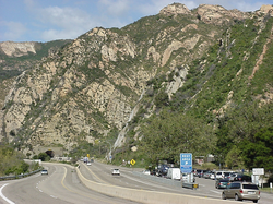
[edit]North of Santa Barbara, US 101 switches intermittently between freeway and expressway status (i.e. there is occasional cross-traffic), but there are no traffic signals until San Francisco. From Ventura and through Santa Barbara, US 101 closely follows the Gaviota Coast (generally no more than one to two miles [1.6 to 3.2 km] from the shore) until Gaviota State Park, about 23 miles (37 km) west of Goleta. At Gaviota State Park, the highway shifts back from an east–west highway to a north–south alignment. About one mile (1.6 km) north of this point, the northbound lanes pass through the Gaviota Tunnel.
A few miles north of the Gaviota Tunnel, SR 1 splits from US 101 and heads northwest, running along the Pacific coastline parallel and to the west of US 101. US 101 passes through Buellton, Los Alamos, Orcutt, Santa Maria, and Nipomo. South of Santa Maria, US 101 widens from a four-lane highway to a six-lane freeway. SR 166 joins US 101 for about 3 miles (4.8 km) before splitting just north of the city limits, while US 101 continues as a four-lane freeway before reverting to expressway status north of Nipomo.
Farther north, SR 1 rejoins US 101 between Pismo Beach and San Luis Obispo. Then US 101 takes an inland route through the Salinas Valley, while Highway 1 heads northwest, running along the Pacific coastline in California, parallel and to the west of US 101.
A steep segment (7% grade) between San Luis Obispo and Atascadero is known as the Cuesta Grade. North of Atascadero, the highway joins SR 46 for about three miles (4.8 km) through Paso Robles.
From Paso Robles to Salinas, US 101 is an expressway known as the Salinas River Valley Highway, since the Salinas River Valley extends from Santa Margarita to the SR 156 junction in Prunedale. US 101 resumes freeway status between San Miguel and King City, bypassing the smaller towns of Camp Roberts, Bradley, and San Ardo, as well as the San Ardo Oil Field about five miles (8.0 km) south of San Ardo. Near this point, the wide agricultural bottomlands of the Salinas Valley begins. North of King City, US 101 once again switches intermittently between freeway and expressway status, passing through Greenfield, Soledad, Gonzales, and Chualar before reaching Salinas. Shortly after leaving Salinas, US 101 joins SR 156 in Prunedale for about eight miles (13 km). After crossing the San Benito County line, SR 156 splits from US 101 near San Juan Bautista while US 101 continues northward mostly as a four-lane highway until it reaches Gilroy.
San Francisco Bay Area
[edit]US 101 crosses the Pajaro River into Santa Clara County as a four-lane highway, with an interchange at SR 25 a few miles later. Upon reaching Gilroy, it becomes the South Valley Freeway (as in South Santa Clara Valley), and at the same time, it expands to three lanes in each direction. It then enters Silicon Valley when reaching Morgan Hill, and shortly afterwards expands to four lanes in each direction, with an HOV lane in the middle, before reaching San Jose. From San Jose to San Francisco, US 101 is known as the Bayshore Freeway as it passes through Palo Alto and the other major communities along the San Francisco Peninsula.
US 101 is called the James Lick Freeway, named for James Lick, a philanthropist, from the San Francisco county/city line, through the interchange with I-280 at the Alemany Maze, until the junction with the San Francisco Skyway (I-80) and the Central Freeway near the city's Civic Center. US 101 continues in a northwestern direction on the Central Freeway, and then leaves the freeway, on Mission Street (northbound) and South Van Ness Avenue (southbound), to run north on Van Ness Avenue. At the intersection of Van Ness Avenue and Lombard Street, US 101 heads west on Lombard Street, and then on Richardson Avenue, entering The Presidio, where it becomes a divided highway again (the Presidio Parkway). It is then joined by Route 1 before approaching and crossing the Golden Gate Bridge.
From San Francisco north the highway is heavily traveled by commuters through to Windsor, just north of Santa Rosa. North of the Golden Gate Bridge, US 101 enters Marin County and is known as the Redwood Highway. After crossing the bridge, US 101 climbs the Waldo Grade and passes through the Robin Williams Tunnel, the only one of its kind in 300 miles (480 km) (the other being the Gaviota Tunnel in Santa Barbara County). Upon exiting the tunnel, it passes above the hillside town of Sausalito and descends to Richardson Bay, where SR 1 splits from the freeway and heads to the coast. US 101 then passes through Mill Valley, Corte Madera, Larkspur, San Rafael and Novato, before entering Sonoma County. The section between Novato in Marin County and Petaluma in Sonoma County changes from its original six or eight lanes through Marin to four lanes, creating a bottleneck, and is thus called the "Novato Narrows" by locals.[16] The Narrows continue up to the county line between Marin and Sonoma Counties. The entire area between Novato and Petaluma is also the voter approved Novato–Petaluma Community Separator, which forbids most development.[17]
Upon entering Sonoma County, the freeway widens again to six lanes from the county line to Windsor, passing through Petaluma, Cotati, Rohnert Park, and Santa Rosa. Upon reaching Windsor, the freeway returns to two lanes in each direction, crossing the Russian River in Healdsburg and then following the river up the Alexander Valley. SR 128 joins US 101 in the town of Geyserville before splitting just north of Cloverdale. US 101 then heads up a steep hill just before leaving Sonoma County and entering Mendocino County.
North Coast
[edit]US 101 crosses into Mendocino County as a freeway for one mile (1.6 km), but then narrows to an expressway through the Russian River canyon and eventually a two-lane road south of Hopland, the first time since leaving San Francisco. Just before reaching Ukiah, US 101 becomes a four-lane freeway. In the community of Calpella, SR 20 merges with US 101 for the next 15.5 miles (24.9 km) to Willits. The freeway portion ends as the combined US 101 and SR 20 ascend the 1,956-foot (596 m) Ridgewood Summit, the highest elevation along the route's 808-mile-long (1,300 km) trek through California.[18] As US 101 resumes freeway status just south of Willits, SR 20 splits from US 101 shortly before it suddenly reverts to a 2-lane undivided freeway and eventually a highway north of Willits.
US 101 then widens to a four-lane expressway until the intersection with the western portion of SR 162, where it reverts to a two-lane road. North of Laytonville, US 101 ascends Rattlesnake summit (1,796 feet or 547 metres) before a descent to follow the South Fork Eel River and Eel River all the way to Fortuna near the mouth of the river. About 12 miles (19 km) northwest of Laytonville, US 101 becomes an undivided freeway near the community of Cummings. SR 271 is the old portion of US 101 through this area. At Leggett, US 101 meets SR 1 for the last time, and from this point until Piercy, US 101 runs along a section of highway with frequent landslides. Caltrans bypassed the most difficult section in 2009 with unique construction of two bridges known collectively as the Confusion Hill Bridges. This project, funded by an emergency act from the State Legislature, moved the highway across the Eel River away from the troubled spots to prevent disruption in commerce and travel from infrequent, but costly, winter closures on the main transportation route to the far North Coast. North of Piercy, the freeway portion again ends and the road narrows down to two lanes, before another stretch of divided highway.
Arriving in Humboldt County, another narrow two-lane portion of US 101 bisects Richardson Grove State Park. Because of the narrow lanes and the redwood trees that tower over this segment of the highway, standard-sized trucks in compliance with the Surface Transportation Assistance Act (STAA) are prohibited through the park.[6][7] Just after the park boundary, the highway switches to a short undivided freeway and then eventually a divided freeway just before reaching Garberville. North of Garberville, US 101 reverts to an undivided freeway, which continuing north by northwest, passes through the 53,000-acre (210 km2) Humboldt Redwoods State Park, California's third largest State Park and the site of the largest remaining Redwood old growth forest in the world. A preserved portion of the original, bypassed highway route, known as the Avenue of the Giants for the huge, centuries-old redwood trees, parallels the highway for over 30 miles (48 km) in southern Humboldt County. US 101 again switches to another stretch of divided freeway near the town Pepperwood before reverting to a short, 2-mile (3 km) expressway just north of Stafford. A short freeway then runs through Rio Dell before another short, 3-mile (5 km) expressway.
Shortly before reaching the western terminus of SR 36, US 101 becomes a freeway again between Fortuna and Eureka. North of Humboldt Hill, the road enters the City of Eureka (a potential new freeway cutting through or bypass of the city was successfully blocked repeatedly). As the route traverses Eureka, the southern portion is known as "Broadway" and then as it bears east along Humboldt Bay, the Highway is aligned on a one-way couplet (4th and 5th streets). Five miles (8.0 km) later the highway leaves Eureka's northern city limit and continues north. The expressway style section between Eureka and Arcata, which is also a safety corridor, is named the "Michael J. Burns Freeway," in honor of the State Senator who was a proponent of California's Highways. The highway becomes an unobstructed freeway south of the center of Arcata. Proceeding north it passes the junction for SR 299 (also the western terminus for that route), in the Valley West (northernmost) part of the college town.
The highway continues north as it skirts westerly around McKinleyville on a high bluff north of the Mad River. As the highway reaches Clam Beach (a county park), motorists get their first magnificent full view of the Pacific Ocean north of the Golden Gate. North of Trinidad, the highway narrows to one lane in each direction after crossing Big Lagoon to pass inland of Stone Lagoon and follow the coastal bar between Freshwater Lagoon and the Pacific Ocean south of Orick. It becomes a 14-mile (23 km) undivided freeway through Redwood National and State Parks running inland east of the Prairie Creek Redwoods State Park boundary. The freeway narrows to one lane in each direction at the Klamath River before losing its freeway designation in Klamath. The original placement of the highway near giant Coast Redwoods led to increased awareness of the destruction of the redwoods after decades of extensive logging, which ultimately led to the establishment of Redwood National Park in 1968. The original highway segment through Prairie Creek Redwoods State Park is now a scenic alternate similar to Avenue of the Giants, named Newton B. Drury Scenic Parkway in honor of the fourth director of the National Park Service and executive director of the Save-the-Redwoods League
North of the town of Klamath just inside Del Norte County, the highway closely follows the Pacific coast again. In Crescent City, US 101 once again separates into a one-way couplet (L and M Streets) for nine blocks. As it leaves Crescent City, US 101 becomes a divided freeway for the last time in California (built slightly to the west of the original two-lane alignment, now called Parkway Drive). As the 3-mile divided freeway portion ends, US 101 intersects the southern terminus of US 199, which heads northeast as the Redwood Highway, passing through the Collier Tunnel and terminating in Grants Pass, Oregon. US 101 (no longer called the "Redwood Highway" at this point) is reduced to two lanes and continues north along the California coast until it reaches the Oregon border.
Tolls
[edit]Express lanes
[edit]High-occupancy toll (HOT) lanes along US 101 between SR 237 in Mountain View and Whipple Avenue in Redwood City opened on February 11, 2022.[19][20] These express lanes were extended to I-380 in San Bruno on March 3, 2023,[21] and are planned to be extended further south to I-880 in San Jose in Fall 2026.[22]
As of August 2022[update], the HOT lanes' hours of operation is weekdays between 5:00 am and 8:00 pm. Solo drivers are tolled using a congestion pricing system based on the real-time levels of traffic. Two-person carpools and clean air vehicles with a solo driver are charged 50 percent of the posted toll. Carpools with three or more people and motorcycles are not charged.[23][24] All tolls are collected using an open road tolling system, and therefore there are no toll booths to receive cash. Each vehicle using the HOT lanes is required to carry either a FasTrak Flex or CAV (Clean Air Vehicle) transponder, with its switch set to indicate the number of the vehicle's occupants (1, 2, or 3 or more). Solo drivers may also use the FasTrak standard tag without the switch.[23][24] Drivers without any FasTrak tag will be assessed a toll violation regardless of whether they qualified for free.[25]
The segment of the express lanes in Santa Clara County is co-administered by the Santa Clara Valley Transportation Authority (VTA) while the segment in San Mateo County is co-administered by the separate San Mateo County Express Lanes Joint Powers Authority, and so drivers will see separate toll charges when using each segment.[23][24]
Golden Gate Bridge
[edit]Tolls are collected only for southbound traffic on the Golden Gate Bridge headed to San Francisco. Fully electronic tolling is also used on the bridge, and they can be paid by either a FasTrak transponder or license plate tolling. The high-occupancy vehicle (HOV) lane leading to the bridge requires a car with three or more people.[26]
History
[edit]This article is missing information about the original construction and history behind this route. (September 2020) |


Juan Bautista de Anza National Historic Trail
[edit]The US 101 Highway is part of the auto tour route of the Juan Bautista de Anza National Historic Trail, a National Park Service unit in the United States National Historic Trail and National Millennium Trail programs.[27] In 2005, Caltrans began posting signs on roads that overlap with the historic 1776 Juan Bautista de Anza trail route, so that California drivers can now follow the trail.
Historic route: San Diego to Los Angeles
[edit]Instead of terminating in Los Angeles, US 101 once continued all the way south through San Diego to the Mexico–United States border in San Ysidro. However, this part was decommissioned on July 1, 1964, in favor of I-5. Though much of U.S. Route 101 has been superseded by I-5, several street segments of former Route 101 exist.
Historic route in San Diego County
[edit]Much of the route in northern San Diego County is County Route S21; this includes Coast Highway in Oceanside, Carlsbad Boulevard in Carlsbad, Coast Highway 101 in Encinitas, Camino del Mar in Del Mar, and Torrey Pines Road in Torrey Pines. In San Diego, one alignment entered La Jolla Village on La Jolla Blvd, while a newer alignment went through Rose Canyon under what is now I-5. Roads followed by US-101 in San Diego included Mission Bay Drive, Pacific Hwy, Harbor Drive and Main Street. It ran along National City Blvd in National City, Broadway in Chula Vista and Beyer Blvd in San Ysidro.
Oceanside–Carlsbad freeway bypass
[edit]By the early 1950s, traffic had become very heavy on US 101 through Oceanside and Carlsbad. The US 101 freeway bypass (Oceanside-Carlsbad freeway bypass) was built in 1953 and completed in 1955 by the California Department of Public Works (now Caltrans) and brought up by the San Diego Highway Development Association on a US 80/US 101 discussion on how to resolve the huge traffic loads on US 101 in Oceanside. Today it is part of I-5 and Palomar Airport Road. It follows I-5 from Coast Highway (former Hill Street exit) in Oceanside to Palomar Airport Road in Carlsbad. From there the US 101 bypass went onto Palomar Airport Road to merge with US 101 Bus. on Carlsbad Boulevard. As it approached the Coast Highway/SR 76 exit on southbound I-5 in Oceanside, US 101 Bus. split off. US 101 Bus. followed the original US 101 through downtown Oceanside and Carlsbad as former Hill Street/Carlsbad Boulevard (CR S-21) while the US 101 freeway followed modern I-5 and Palomar Airport Road. The south end of the freeway bypass is Carlsbad Boulevard and Palomar Airport Road and the north end is I-5 and the Coast Highway/SR 76 exit. The south end was modified after US 101 was decommissioned between the East Los Angeles Interchange in Los Angeles and the Mexican border in San Ysidro. This freeway construction by the California Department of Public Works put US 101 on an all new highway route alignment to relieve Oceanside and Carlsbad of their very heavy bumper-to-bumper burdensome traffic problem. Also before the bypass in the 1950s, US 101 followed North Coast Highway (formerly Hill Street) from San Luis Rey Mission Expressway (SR 76 and north end of the Oceanside–Carlsbad freeway bypass) to Harbor Drive. From there it followed Harbor Drive to Vandergrift Boulevard, San Rafael Drive, and the freeway onramp for I-5 north near the Camp Pendleton north entrance guardhouse gate. It merges with the I-5 northbound onramp to shoot onto the southbound lanes of I-5 to follow the freeway lanes all the way to Las Pulgas Road in Camp Pendleton.
Historic route in Orange and Los Angeles Counties
[edit]An old orphaned alignment of US 101, that ran through the cities of Mission Viejo, Laguna Niguel, San Juan Capistrano, Dana Point, and San Clemente, was located in south Orange County. The old roadway, from a dead end just west of I-5 and east of the railroad tracks in Mission Viejo to Cristianitos Road in San Clemente, followed Camino Capistrano, Doheny Park Road, Coast Highway and El Camino Real. It had interchanges with I-5 and California State Route 1. It was replaced by the San Diego freeway (which US 101 became part of it in 1958) and finally replaced by I-5 in 1968.
In northern Orange County, US 101 followed Harbor Boulevard. U.S. Route 101 left Orange County, traversed southeast Los Angeles County, and entered the City of Los Angeles along Whittier Boulevard.
El Camino Real: Los Angeles to San Francisco
[edit]Significant portions of US 101 from its southern terminus to the San Francisco Bay Area is designated as the Royal Road or El Camino Real. The commemorative route connects the former Alta California's 21 missions.
A former route of the highway over the Gabilan Range on the San Juan Grade to San Juan Bautista was bypassed in a 1932 realignment. Instead, shortly after leaving Salinas, US 101 joins SR 156 in Prunedale for about eight miles (13 km) as it crosses the mountains further north, through the Prunedale Cutoff.
Before the Golden Gate Bridge was completed in 1937, there was regular vehicle ferry service across the Golden Gate strait, running from the Hyde Street Pier to Sausalito. Under the California Streets and Highways Code § 401, the Golden Gate Bridge is legally not part of US 101. The portion of US 101 starting from Los Angeles ends at "the approach to the Golden Gate Bridge" and then resumes at "a point in Marin County opposite San Francisco" to the Oregon state line. The bridge itself is maintained by the Golden Gate Bridge, Highway and Transportation District instead of Caltrans.
From the 1940s to 1991, various segments of US 101 between Los Angeles and San Francisco were upgraded to either a freeway or expressway. In the Los Angeles area, the first segment of the Hollywood Freeway through the Cahuenga Pass opened in 1940, while the segment from the San Fernando Valley to Downtown Los Angeles opened in 1954, replacing Cahuenga Boulevard.[28] The Ventura Freeway then opened in 1960, replacing Ventura Boulevard.[29] The segment of the original two-lane alignment between Emma Wood State Beach north to the Mobil Pier Undercrossing near Sea Cliff, which followed the historic Rincon Sea Level Road, was the re-signed as part of SR 1.
The last traffic signals along the route between the Los Angeles area and the San Francisco Bay Area were removed in 1991 when the section through downtown Santa Barbara was constructed to freeway standards after years of disagreement over the impact that the original elevated design would have on the community.[30]
In the San Francisco Bay Area, US 101 was originally divided. US 101W followed the same general right-of-way of today's US 101 through the region, primarily along what was originally signed as Bayshore Boulevard. US 101E then generally followed the right-of-way taken by today's I-880 from San Jose to Oakland, then across the Carquinez Bridge to follow what is now SR 37, joining US 101W. The US 101E designation was removed by the 1940s and became SR 17 (later designated as I-880 and the westernmost section I-580), running from San Jose to Oakland and then across the Richmond–San Rafael Bridge. Meanwhile, Bayshore Boulevard was later redesignated as the US 101A bypass and then eventually upgraded to what is now the Bayshore Freeway. The first stretch that was completed between Redwood City and South San Francisco was the Bay Area's first freeway when it opened in 1947. After the entire Bayshore Freeway was completed in the early 1960s, the old alignment along the peninsula was renumbered and renamed as SR 82/El Camino Real.
Various other freeway or expressway bypasses along the California Central Coast were also built. In 1991, the last traffic signal along US 101 between Los Angeles and San Francisco was taken down in Santa Barbara.[31] The primary control city that is listed on freeway signs along northbound US 101 through the Central Coast region remains San Francisco.
As the result of freeway revolts in San Francisco in the 1950s, a direct freeway connection through the city to the Golden Gate Bridge has never been built. The Central Freeway was completed to extend from the Bayshore Freeway to Turk Street in 1959,[32][33] before the San Francisco Board of Supervisors voted to remove the remainder of the Central Freeway and most other proposed freeways from the city's highway plan.[34] For decades, southbound traffic on US 101 flowed on the one-way Turk Street from Van Ness Avenue to the Central Freeway, while northbound traffic used the parallel Golden Gate Avenue. After the 1989 Loma Prieta earthquake damaged the structure, the segment of the Central Freeway north of Market Street was replaced with the surface-level Octavia Boulevard; traffic on US 101 was then eventually re-routed to exit south of that at Mission Street/South Van Ness Avenue. With no direct freeway along US 101 through the City of San Francisco, the old US 101E/I-880/I-580 route remains as a faster bypass through the Bay Area.
In the wake of the dot-com bubble expansion, the segment of US 101 between Morgan Hill and San Jose, also known as the Sig Sanchez Freeway, expanded to eight lanes between Cochrane Road and SR 85 exits between 2001 and 2003 and a new interchange at Bailey Avenue, which had been planned since the 1970s, opened in 2004.[35] Originally, the ten-mile segment (16 km) was only four lanes (it was planned to have six lanes when opened in 1984).[36] The rebuilt segment was to alleviate the consistent congestion that had expanded as far south as Masten Avenue coming from Gilroy, and as far north as Bernal Road coming from San Jose.[37][38] Traffic now typically only runs slow between the Bailey Avenue and East Dunne Avenue exits.[citation needed]

The interchange at the beginning of I-280 and I-680 in San Jose was constructed years before its completion. The three flyovers, with no on ramps or off ramps connecting them stood at 110-foot-tall (34 m) over US 101 for years in the 1970s (the SR 87/I-280 interchange also had this at the same time). It became the butt of many local jokes. The highlight prank occurred in January 1976, when a 1960 Chevrolet Impala was placed on the highest bridge overnight, where it obviously would be impossible to drive. The following day, San Jose City Councilman Joe Colla was photographed standing next to the car, a photo which was circulated across many newspapers.[39] It has been suggested this stunt helped lead to funding to complete the freeway. In 2010, the interchange was named the Joe Colla Interchange.[40]
Redwood Highway: Marin County to Del Norte County
[edit]Redwood Highway | |
| Nearest city | Klamath, California |
|---|---|
| Built | 1900–1949 |
| NRHP reference No. | 79000253[41] |
| Added to NRHP | December 17, 1979 |
An abandoned segment of the Redwood Highway, US 101, located in the Redwood National and State Parks near Klamath was added to the National Register of Historic Places in 1979.[41]
Freeway segments along the Redwood Highway portion of US 101 are not as prevalent as along the Los Angeles-San Francisco route. A notable segment of the old US 101 alignment is SR 254, also known as the Avenue of the Giants, in Humboldt Redwoods State Park. The freeway bypassing this scenic route, surrounded by towering Coast Redwoods, was completed in 1960.[42] Several bridges along the segment of highway running along the Eel River were destroyed during the Christmas flood of 1964.
A freeway bypass of Cloverdale was constructed in the early 1990s, requiring the relocation of segments of the Northwestern Pacific Railroad.[43] The new 4-mile-long (6.4 km) roadway along with new frontages and relocated railroad were completed at a cost of $40 million ($82.2 million in 2023 adjusted for inflation).[44] The highway opened over two weeks in March 1994.[45] The old routing through town is on Cloverdale Boulevard.[44]
Construction on a freeway segment bypassing Willits began in 2013.[46] The bypass around Willits remained controversial because the intended route goes through protected wetlands. Construction was halted by US Army Corps of Engineers in June 2014 and work restarted the following month after Caltrans committed to extensive mitigation of the project.[47][48] The 5.9 mi (9.5 km) bypass around Willits opened to traffic in November 2016.[49] The bypass included a 1.1 mi (1.8 km) viaduct going over a flood plain.[50] The freeway segment cost $459 million to complete ($583 million in 2023 adjusted for inflation), 50% more than what Caltrans first reported when it opened.[51]
The city of Eureka has long resisted a freeway through it.[52]
Future
[edit]The Wallis Annenberg Wildlife Crossing is a vegetated overpass spanning the Ventura Freeway and Agoura Road at Liberty Canyon in Agoura Hills. Once built, it will be one of the largest urban wildlife crossings in the United States, connecting the Simi Hills and the Santa Monica Mountains over a busy freeway with ten traffic lanes (including exit lanes).[53][54]
The Richardson Grove section of US 101 has been proposed for a bypass for many years, but Caltrans conducted a study in 2000 which stated that a bypass was not cost effective and recommended realignment of US 101 within the redwood grove instead to accommodate modern-sized trucks in compliance with the Surface Transportation Assistance Act (STAA).[6][7]
Names and memorials
[edit]Urban portions of the route in Southern California are named the Santa Ana Freeway,[55] Hollywood Freeway, and Ventura Freeway at various points between East Los Angeles and Carpinteria, California.[56] In 2008, the portion of US 101 that runs from the Conejo Grade to the Old Town district of Camarillo was dedicated as the Adolfo Camarillo Memorial Highway to honor the city's namesake and extends through the boundaries of the original Camarillo family ranch.[57] In 2003, the portion of US 101 in Ventura County was named Screaming Eagles Highway in honor of the US Army 101st Airborne Division.[58] Urban portions of the route in the Bay Area are called the James Lick Freeway, Bayshore Freeway, and Central Freeway. A portion of the route between Cochrane Road in Morgan Hill and SR 85 in San Jose is named the Sig Sanchez Freeway. The section of highway between SR 85 in Mountain View and Embarcadero Road in Palo Alto is officially known as the Frederick E. Terman Highway. Street routings in San Francisco are more commonly referred to by their street names rather than the route number. Portions of the route between Southern California and the Bay Area are named El Camino Real or El Camino Real Freeway, but such names are rarely used colloquially; the route number is used instead. In Northern California the section of US 101 between Sonoma and Marin counties is often referred to as the Novato Narrows because of the reduction from six lanes to four.
Major intersections
[edit]Except where prefixed with a letter, postmiles were measured on the road as it was in 1964, based on the alignment that existed at the time, and do not necessarily reflect current mileage. R reflects a realignment in the route since then, M indicates a second realignment, L refers to an overlap due to a correction or change, and T indicates postmiles classified as temporary ().[1] Segments that remain unconstructed or have been relinquished to local control may be omitted. The numbers reset at county lines; the start and end postmiles in each county are given in the county column.
| County | Location | Postmile [1][59][60] | Exit [61] | Destinations | Notes |
|---|---|---|---|---|---|
| Los Angeles LA S0.00-38.19 | Los Angeles | | — | No access to I-5 north; southern terminus of US 101; southern end of East Los Angeles Interchange | |
| | — | Euclid Avenue | Southbound exit and northbound entrance | ||
| | — | Southbound exit and northbound entrance; northern end of East Los Angeles Interchange proper; SR 60 west exit 1C | |||
| S0.00 | 1A | Seventh Street | Southbound exit and northbound entrance | ||
| | Whittier Boulevard | Northbound entrance only | |||
| S0.62 | 1A | Fourth Street | No northbound entrance; signed as exit 1B southbound | ||
| S0.91 | 1B | First Street | No southbound entrance; signed as exit 1C southbound | ||
| | 1C | Cesar Chavez Avenue | Northbound exit only; was formerly Brooklyn Avenue | ||
| S1.33 0.00 | 1D | No southbound entrance, was demolished in 1996 due to seismic issues;[62][self-published source?]; San Bernardino Split portion of the East Los Angeles Interchange; access to I-10 via the San Bernardino Freeway spur; left exit southbound; former western terminus of US 60 / US 70; former US 99 south; former I-110 east (1958–1965) | |||
| 0.10 | 1E | Mission Road | No northbound exit | ||
| 0.62 | 2A | Vignes Street | Northbound exit and entrance | ||
| 0.62– 0.82 | 2A-B | Alameda Street – Union Station | Signed as exit 2A southbound, 2B northbound | ||
| 0.82 | 2B | Los Angeles Street | No northbound exit | ||
| 1.10 | 2C | Spring Street | Northbound exit only | ||
| 1.10 | 2C | Broadway | Southbound exit and northbound entrance | ||
| 1.40 | 3A | Temple Street | Southbound exit and entrance | ||
| 1.57 | 3 | Northern end of Santa Ana Freeway; southern end of Hollywood Freeway[63] Four Level Interchange; Grand Avenue not signed southbound; signed as exit 3B southbound; SR 110 exit 24A | |||
| 2.48 | 4A | Glendale Boulevard, Echo Park Avenue, Union Avenue | Union Avenue not signed northbound; Echo Park Avenue not signed southbound | ||
| 2.86 | 4B | Southern end of SR 2 overlap | |||
| 3.34 | 5A | Rampart Boulevard, Benton Way | |||
| 3.76 | 5B | Silver Lake Boulevard | |||
| 4.40 | 6A | Vermont Avenue | |||
| 4.85 | 6B | Melrose Avenue, Normandie Avenue | |||
| 5.55 | 7 | Northern end of SR 2 overlap | |||
| 6.25 | 8A | Sunset Boulevard | No northbound entrance | ||
| 6.52 | 8B | Hollywood Boulevard | |||
| 6.91 | 8C | Gower Street | |||
| 7.06 | 9A | Vine Street | Southbound exit only | ||
| 7.46 | 9B | Cahuenga Boulevard – Hollywood Bowl | Signed as exit 9A northbound | ||
| 7.84 | 9C | Highland Avenue – Hollywood Bowl | Former SR 170 south; signed as exit 9B northbound | ||
| 8.84 | Cahuenga Pass, elevation 745 feet (227 m)[64] | ||||
| 9.22 | 11A | Barham Boulevard – Burbank | No southbound exit, which was permanently closed on October 17, 2015, due to weaving concerns with the construction of the new Universal Studios Boulevard southbound onramp.[65] | ||
| 9.60 | 11B | Universal Studios Boulevard | No southbound exit; serves Universal Studios Hollywood | ||
| 10.34 | 12A | Lankershim Boulevard – Universal City | Serves Universal Studios Hollywood | ||
| 10.56 | 12B | Ventura Boulevard | No southbound exit | ||
| 11.11 | 12C | Signed as exit 12B southbound | |||
| | Moorpark Street | Northbound entrance only | |||
| 11.80 | 13 | Northbound left exit and southbound left entrance; US 101 north transitions onto Ventura Freeway west;[63] southern end of Hollywood Split; SR 170 south exit 5A | |||
| 11.65 | 13B | Southbound exit and northbound entrance; US 101 south transitions onto Hollywood Freeway south;[63] northern end of Hollywood Split; SR 134 west exit 1A | |||
| 11.83 | 13A | Southbound exit and northbound entrance | |||
| 12.85 | 14 | Laurel Canyon Boulevard – Studio City | |||
| 13.88 | 15 | Coldwater Canyon Avenue | |||
| 14.89 | 16 | Woodman Avenue | |||
| 15.91 | 17 | Van Nuys Boulevard | |||
| 16.94 | 18 | Sepulveda Boulevard | Northbound exit and southbound entrance | ||
| 17.17 | 19A | I-405 exit 63B | |||
| 17.50 | 19B | Haskell Avenue | No southbound entrance | ||
| 18.61 | 20 | Hayvenhurst Avenue | Northbound exit and southbound entrance | ||
| 19.22 | 21 | Balboa Boulevard – Encino | |||
| 20.23 | 22 | White Oak Avenue | |||
| 21.25 | 23 | Reseda Boulevard | |||
| 22.25 | 24 | Tampa Avenue | |||
| 23.26 | 25 | Winnetka Avenue – Woodland Hills | |||
| 24.31 | 26A | De Soto Avenue, Serrania Avenue | Signed as exit 26 southbound | ||
| 24.85 | 26B | Canoga Avenue | Northbound exit and southbound entrance | ||
| 25.34 | 27 | Signed as exits 27A (north) and 27B (south) northbound | |||
| 25.76 | 27C | Shoup Avenue | Northbound exit and southbound entrance | ||
| 26.45 | 28 | Fallbrook Avenue | Southbound exit only | ||
| 26.86 | 28 | Woodlake Avenue | Northbound exit and entrance | ||
| 27.36 | 29 | Mulholland Drive, Valley Circle Boulevard | |||
| Calabasas | 28.29 | 30 | Parkway Calabasas | ||
| 31.06 | 32 | Las Virgenes Road (CR N1) – Malibu Canyon | |||
| 31.92 | 33 | Lost Hills Road | |||
| Agoura Hills | 32.79 | 34 | Liberty Canyon Road | ||
| | Wallis Annenberg Wildlife Crossing (planned to open in 2024[66]) | ||||
| 33.69 | 35 | Chesebro Road | |||
| 35.04 | 36 | Kanan Road (CR N9) | |||
| 36.18 | 38 | Reyes Adobe Road | |||
| Westlake Village | 37.54 | 39 | Lindero Canyon Road | ||
| Ventura VEN 0.00-R43.62 | Thousand Oaks | 0.70 | 40 | Southern end of SR 23 overlap | |
| 1.62 | 41 | Hampshire Road | |||
| 3.02 | 43A | Rancho Road | Signed as exit 43B northbound | ||
| 3.11 | 43B | Northern end of SR 23 overlap; signed as exit 43A northbound; SR 23 south exits 12A-B; Simi Valley only seen on northbound side | |||
| 4.06 | 44 | Moorpark Road | |||
| 5.05 | 45 | Lynn Road | |||
| 6.19 | 46 | Ventu Park Road – Newbury Park | |||
| 7.02 | 47A | Rancho Conejo Boulevard, Borchard Road | Signed as exits 47A (Rancho Conejo Boulevard) and 47B (Borchard Road) northbound | ||
| 7.89 | 47B | Wendy Drive – Newbury Park | Signed as exit 47C northbound | ||
| Camarillo | 10.74 | 50 | Camarillo Springs Road – Camarillo Grove County Park | ||
| 12.30 | 52 | Santa Rosa Road, Pleasant Valley Road | |||
| 13.75 | 53A | Flynn Road | Northbound signage | ||
| Dawson Drive | Southbound signage | ||||
| 13.85 | 53B | ||||
| 14.80 | 54 | Carmen Drive | |||
| 15.89 | 55 | Las Posas Road | |||
| 16.79 | 56 | Springville Drive | |||
| 17.75 | 57 | Central Avenue | |||
| Oxnard | 19.17 | 59 | Del Norte Boulevard | ||
| 20.08 | 60 | Southern end of SR 1 overlap | |||
| 21.01 | 61 | Rose Avenue | |||
| 22.01 | 62A | ||||
| 22.73 | 62B | Oxnard Boulevard | Former SR 1 south | ||
| | 63A | Ventura Road | Southbound exit only | ||
| Ventura | R23.45 | 63B | Johnson Drive | Signed as exit 63 northbound | |
| R24.65 | 64 | Victoria Avenue – Channel Islands Harbor | |||
| 25.97 | 65 | Telephone Road | Northbound entrance is via Main Street | ||
| 26.39 | 66A | Signed as exit 66 southbound; southbound entrance is via exit 1C from SR 126 west; SR 126 west exit 1A | |||
| 26.72 | 66B | Main Street (US 101 Bus. north) | No southbound exit | ||
| 28.45 | 68 | Seaward Avenue | |||
| 29.45 | 69 | Vista del Mar Drive, Sanjon Road | Northbound exit and southbound entrance | ||
| 30.15 | 70A | California Street, Ventura Avenue | |||
| 30.91 | 70B | ||||
| 31.50 | 71 | Main Street (US 101 Bus. south) | Southbound exit and northbound entrance | ||
| | R32.70 | 72 | Northern end of SR 1 overlap; northbound exit and southbound entrance | ||
| | R38.98 | 78 | Southern end of SR 1 overlap | ||
| | R39.80 | 79 | Mussel Shoals (Old Pacific Coast Highway) | Southbound exit and entrance | |
| | 41.00 | 81 | La Conchita (West Surfside Street) | Northbound exit and entrance | |
| | R43.57 | 83 | Bates Road | ||
| Ventura–Santa Barbara county line | | | Northwestern end of Ventura Freeway[63] | ||
| Santa Barbara SB R0.00-90.99 | Carpinteria | R0.63 | 84 | ||
| 1.61 | 85 | Bailard Avenue | |||
| 2.64 | 86A | Casitas Pass Road | Signed as exit 86 northbound; former SR 224 | ||
| 3.06 | 86B | Linden Avenue | Southbound exit and northbound entrance | ||
| 3.77 | 87A | Reynolds Avenue, Santa Monica Road | Signed as exit 87 northbound | ||
| 4.34 | 87B | Carpinteria Avenue | Southbound exit only | ||
| Toro Canyon | R5.28 | 88 | Padaro Lane, Santa Claus Lane | ||
| Summerland | R7.14 | 90 | Padaro Lane – Summerland | ||
| R8.26 | 91 | Evans Avenue – Summerland | |||
| Montecito | 9.00 | 92 | Sheffield Drive | ||
| 10.02 | 93 | San Ysidro Road | |||
| 10.54 | 94A | Olive Mill Road, Coast Village Road | No northbound entrance | ||
| Santa Barbara | 11.10 | 94B | Hermosillo Road | Northbound exit only | |
| 11.41 | 94C | Cabrillo Boulevard, Coast Village Road | No southbound entrance; signed as exit 94B southbound | ||
| | 95 | Los Patos Way (unsigned) | Southbound exit only | ||
| 12.10 | 95 | Salinas Street | Northbound exit and entrance | ||
| 12.75 | 96 | Milpas Street | Former SR 144; northbound exit signed as exit 96A; southbound as exits 96B and 96A | ||
| 13.49 | 96 | Laguna Street, Garden Street – Downtown Santa Barbara | Laguna Street/Garden Street northbound exit signed as exit 96B; Garden Street southbound exit signed as exit 96C | ||
| R14.19 | 97 | Bath Street, Castillo Street; Santa Barbara Harbor | |||
| R14.76 | 98A | Carrillo Street – Downtown Santa Barbara | Signed as exit 98 southbound | ||
| 15.26 | 98B | Arrellaga Street | Northbound exit and entrance | ||
| R15.73 | 99A | Mission Street | Signed as exit 99 southbound | ||
| 16.05 | 99B | Pueblo Street | Northbound exit only | ||
| 16.55 | 100 | Las Positas Road | Former SR 225 | ||
| 17.78 | 101A | La Cumbre Road, Hope Avenue | |||
| 18.38 | 101B | ||||
| Eastern Goleta Valley | 18.92 | 102 | El Sueno Road | Northbound exit and entrance | |
| 20.06 | 103 | Turnpike Road | |||
| Goleta | 21.15 | 104A | Patterson Avenue | Signed as exit 104 southbound | |
| 21.41 | 104B | Northbound exit and southbound entrance | |||
| 22.53 | 105 | Fairview Avenue | |||
| 23.72 | 107 | Los Carneros Road | |||
| 24.77 | 108 | Glen Annie Road, Storke Road | |||
| 26.91 | 110 | Winchester Canyon Road, Hollister Avenue | All ramps are via Cathedral Oaks Road | ||
| | | Northern end of freeway | |||
| | | Southern end of freeway | |||
| | 30.06 | 113 | Dos Pueblos Canyon Road | ||
| | | Northern end of freeway | |||
| | | Southern end of freeway | |||
| | 32.84 | 116 | El Capitan Ranch Road | ||
| | 33.85 | 117 | El Capitan State Beach | ||
| | 36.62 | 120 | Refugio Road – Refugio State Beach | ||
| | | Northern end of freeway | |||
| Gaviota | 44.82 | 128 | Mariposa Reina | Interchange | |
| | Gaviota State Beach (Gaviota Beach Road) | At-grade intersection | |||
| Gaviota Pass | 46.30– 46.90 | Gaviota Rest Area | |||
| 47.19 | Gaviota Gorge Tunnel (northbound only) | ||||
| | | Southern end of freeway | |||
| Las Cruces | R48.85 | 132 | Northern end of SR 1 overlap | ||
| | | Northern end of freeway | |||
| | | Southern end of freeway | |||
| Buellton | R56.46 | 139 | Santa Rosa Road | ||
| R57.12 | 140A | ||||
| R57.55 | 140B | McMurray Road, Avenue of the Flags | |||
| | | Northern end of freeway | |||
| | | Southern end of freeway | |||
| | 62.67 | 146 | |||
| | | Northern end of freeway | |||
| | | Southern end of freeway | |||
| Los Alamos | 70.92 | 154 | |||
| | | Northern end of freeway | |||
| | | Southern end of freeway | |||
| | 78.69 | 161 | Solomon Summit Undercrossing | ||
| Orcutt | 82.18 | 164 | Clark Avenue – Orcutt | ||
| 83.42 | 166 | Union Valley Parkway | |||
| Santa Maria | 84.36 | 167 | Santa Maria Way (US 101 Bus. north) | ||
| 86.59 | 169 | Betteravia Road – Sisquoc | |||
| 87.60 | 170 | Stowell Road | |||
| 88.60 | 171 | Southern end of SR 166 overlap | |||
| 89.69 | 172 | Donovan Road | |||
| 90.75 | 173 | ||||
| San Luis Obispo SLO 0.00-R69.32 | | 0.81 | 175 | Northern end of SR 166 overlap | |
| Nipomo | 4.85 | 179 | Tefft Street – Nipomo | ||
| 6.43 | 180 | Willow Road | |||
| 7.84 | 182 | Thompson Road, Los Berros Road | |||
| | | Northern end of freeway | |||
| | | Southern end of freeway | |||
| Arroyo Grande | 12.52 | 186 | Traffic Way (US 101 Bus. north), Fair Oaks Avenue | No northbound entrance | |
| 13.17 | 187A | ||||
| 13.75 | 187B | Brisco Road, Halcyon Drive | |||
| Pismo Beach | 14.61 | 188 | Oak Park Road | ||
| 15.58– 15.88 | 189 | 4th Street, Five Cities Drive | Signed as exits 189 (4th Street) and 190A (Five Cities Drive) southbound | ||
| 16.62 | 190 | Price Street (US 101 Bus. north) | No northbound entrance; northbound signage | ||
| 190B | Hinds Avenue, Price Canyon Road | No northbound entrance; southbound signage | |||
| 16.89 | 191A | Wadsworth Avenue | Northbound signage; northbound entrance via Bello Street, southbound entrance via Price Street | ||
| Southbound signage; north and south entrances via Price Street | |||||
| 17.76 | 191B | Shell Beach Road | Northbound signage | ||
| Price Street (SR 1 south, US 101 Bus. south) | Southern end of SR 1 overlap; southbound signage | ||||
| R19.81 | 193 | Spyglass Drive | Northbound signage | ||
| Shell Beach Road | Southbound signage | ||||
| Avila Beach | R21.11 | 195 | Avila Beach Drive | ||
| R22.29 | 196 | San Luis Bay Drive – See Canyon, Avila Beach | |||
| | R24.30 | 198 | Higuera Street | ||
| San Luis Obispo | 25.91 | 200A | Los Osos Valley Road | Signed as exit 200 southbound | |
| 26.83 | 200B | Prado Road, Elks Lane | Northbound exit and entrance | ||
| 27.50 | 201 | ||||
| 28.07 | 202A | Marsh Street | |||
| 28.81 | 202B | Broad Street | |||
| 29.08 | 203A | Osos Street, Santa Rosa Street | |||
| 29.08 | 203B | Northern end of SR 1 overlap | |||
| 29.40 | 203C | California Boulevard | |||
| 29.77 | 203D | Grand Avenue – Cal Poly | Northbound exit and southbound entrance | ||
| 29.99 | 204 | Monterey Street | No southbound entrance | ||
| | | Northern end of freeway | |||
| | 35.00[67] | Cuesta Pass, elevation 1,522 feet (464 m)[67] | |||
| | | Southern end of freeway | |||
| | 37.85 | 211 | |||
| Atascadero | 42.27 | 216A | Santa Barbara Road | Signed as exit 216 southbound | |
| 42.90 | 216B | San Diego Way | Northbound exit and southbound entrance | ||
| 44.01 | 218A | Santa Rosa Road | |||
| 44.84 | 218B | Curbaril Avenue | |||
| 45.57 | 219 | ||||
| 45.96 | 220A | Traffic Way (US 101 Bus. north) | |||
| 46.87 | 220B | San Anselmo Road | |||
| 48.33 | 222 | Del Rio Road (US 101 Bus. south) | |||
| 49.32 | 223 | San Ramon Road, Santa Cruz Road | |||
| Templeton | 50.64 | 224 | Vineyard Drive (US 101 Bus. north) | ||
| 51.45 | 225 | Las Tablas Road | |||
| 52.44 | 226 | Main Street (US 101 Bus. south) | |||
| Paso Robles | 53.89 | 228 | Southern end of SR 46 overlap | ||
| 55.67 | 229 | Spring Street (US 101 Bus. north) | Northbound exit and southbound entrance; former US 101 | ||
| 56.14 | 230 | Pine Street | Southbound exit and entrance | ||
| | 230 | Paso Robles Street | Northbound exit and entrance | ||
| 56.88 | 231A | 17th Street | Southbound exit and entrance | ||
| 57.92 | 231B | Northern end of SR 46 overlap; signed as exit 231 northbound | |||
| 58.76 | 232 | Spring Street (US 101 Bus. south) | No southbound entrance; former US 101 | ||
| | | Northern end of freeway | |||
| | | Southern end of freeway | |||
| San Miguel | 65.08 | 239A | Mission Street – San Miguel | Northbound exit and southbound left entrance | |
| 65.56 | 239B | 10th Street | Signed as exit 239 southbound | ||
| 67.23 | 241A | Mission Street – San Miguel | Southbound exit and northbound entrance | ||
| | R67.71 | 241B | South Camp Roberts (Frontage Road) | Signed as exit 241 northbound; served the former south entrance to Camp Roberts | |
| Monterey MON R0.00-101.32 | | R0.84 | 244 | Camp Roberts (main gate) | |
| | R2.15 | 245 | East Garrison (Bradley Road) | ||
| | R3.35– R5.10 | Camp Roberts Rest Area | |||
| Bradley | R7.94 | 251 | Bradley (Bradley Road) | ||
| | R9.67 | 252 | |||
| | R15.47 | 258 | Alvarado Road | ||
| | R17.86 | 260 | Los Lobos Road | ||
| | R21.99 | 263 | Paris Valley Road – San Ardo | ||
| | R29.90 | 271 | Paris Valley Road – Lockwood | ||
| San Lucas | R32.02 | 273 | |||
| | R37.31 | 278 | Wild Horse Road | ||
| King City | R39.77 | 281 | First Street (US 101 Bus. north / CR G15 to CR G13) | ||
| R40.72 | 282A | Canal Street | |||
| R41.18 | 282B | Broadway (US 101 Bus. south / CR G13) | |||
| | R41.95 | 283 | |||
| | | Northern end of freeway | |||
| | | Southern end of freeway | |||
| Greenfield | 52.66 | 293 | Espinosa Road (US 101 Bus. north, CR G16) | Former US 101 | |
| 53.36 | 294A | Oak Avenue | |||
| 53.86 | 294B | Walnut Avenue | |||
| 54.79 | 295 | Thorne Road (US 101 Bus. south) | Former US 101 | ||
| | | Northern end of freeway | |||
| | | Southern end of freeway | |||
| Soledad | 60.40 | 301 | Arroyo Seco Road | ||
| 61.59 | 302 | Former US 101 | |||
| 62.70 | 303 | Front Street (US 101 Bus. south) | |||
| | 64.63 | 305 | Camphora Gloria Road | ||
| | 66.40 | 307 | Salinas Valley State Prison | ||
| Gonzales | 69.37 | 310 | Gloria Road (US 101 Bus. north), Alta Street | Former US 101 | |
| 70.86 | 311 | 5th Street | |||
| 72.61 | 313 | Old Stage Road (US 101 Bus. south) | |||
| | | Northern end of freeway | |||
| | | Southern end of freeway | |||
| Chualar | 76.97 | 317 | Chualar (Main Street) | ||
| | | Northern end of freeway | |||
| | 82.47 | 323 | Abbott Street (US 101 Bus. north) – Spreckels | Northbound left exit and southbound left entrance; interchange | |
| | | Southern end of freeway | |||
| Salinas | 85.62 | 326A | Airport Boulevard | ||
| | 326B | Fairview Avenue | Northbound exit only | ||
| 86.12 | 326C | Monterey Peninsula (South Sanborn Road) | Signed as exit 326B southbound | ||
| 86.82 | 327 | ||||
| 87.30 | 328 | ||||
| R88.24 | 329 | Main Street (SR 183, US 101 Bus. south) | |||
| R89.27 | 330 | Laurel Drive | |||
| R91.01 | 331 | Boronda Road (US 101 Bus. south) | |||
| | 92.19 | 333 | Sala Road | ||
| | | Northern end of freeway | |||
| Prunedale | 95.44 | 336 | Southern end of SR 156 overlap; interchange | ||
| 96.14 | 337 | San Miguel Canyon Road (CR G12) | Interchange | ||
| 98.37 | 339 | Crazy Horse Canyon Road, Echo Valley Road | Interchange | ||
| 100.39 | Dunbarton Road to San Juan Road (CR G11) | Closed in 2015 after the construction of the San Juan Road interchange | |||
| San Benito SBT 0.00-R7.52 | | 0.13 | 342 | San Juan Road (CR G11) – Aromas, Watsonville | Interchange |
| | | Southern end of freeway | |||
| | 3.01 | 345 | Northern end of SR 156 overlap | ||
| | R4.90 | 347 | |||
| | R6.49 | 349 | Betabel Road, Y Road | ||
| | | Northern end of freeway | |||
| Santa Clara SCL R0.03-52.55 | | 3.16 | 353 | Interchange | |
| | | Southern end of freeway | |||
| Gilroy | R4.94 | 355 | Monterey Road (US 101 Bus. north) | ||
| R6.08 | 356 | Southern end of SR 152 overlap | |||
| R7.53 | 357 | Northern end of SR 152 overlap | |||
| | R10.27 | 360 | Masten Avenue | ||
| San Martin | R12.46 | 362 | San Martin Avenue | ||
| Morgan Hill | R15.07 | 365 | Tennant Avenue | ||
| R16.01 | 366 | East Dunne Avenue | |||
| R17.82 | 367 | Cochrane Road (US 101 Bus. south) | |||
| San Jose | R21.25 | 371 | Coyote Creek Golf Drive | ||
| R23.10 | 373 | Bailey Avenue | |||
| R26.78 | 377A | No northbound entrance; signed as exit 377B southbound; SR 85 south exit 1A | |||
| | ♦ | HOV access only; northbound exit and southbound entrance | |||
| R27.00 | 377B | Silicon Valley Boulevard, Bernal Road | Signed as exit 377A southbound | ||
| R28.61 | 378 | Southern end of Bayshore Freeway;[63] former SR 82 | |||
| 30.10 | 380 | Hellyer Avenue | |||
| 31.00 | 381 | Yerba Buena Road | Southbound exit was separated from Exit 382 in 2014 | ||
| 31.70 | 382 | Capitol Expressway (CR G21) | |||
| 33.03 | 383 | Tully Road | |||
| 34.11 | 385B | Northbound exit and southbound entrance; southern end of Joe Colla Interchange; ramps extend over the Story Road interchange; I-680 exit 1B | |||
| 34.55 | 385A | Story Road | Signed as exit 385 northbound | ||
| 34.87 | 384 | Southbound exit and northbound entrance; northern end of Joe Colla Interchange; I-680 exit 1B | |||
| R35.76 | 386A | ||||
| R36.14 | 386B | McKee Road, Julian Street | |||
| | 387 | Mabury Road, Taylor Street | Planned interchange | ||
| 37.73 | 388A | Oakland Road, 13th Street | Former SR 238 | ||
| 38.30 | 388 | Signed as exits 388B (north) and 388C (south); I-880 exits 4B-C; former SR 17 | |||
| 38.80 | 389A | Old Bayshore Highway, 4th Street | No southbound exit | ||
| 39.29 | 389B | Brokaw Road, First Street | Signed as exit 389 southbound | ||
| 39.93 | 390 | Southbound exit and northbound entrance; SR 87 north exit 9B | |||
| San Jose–Santa Clara line | 40.70 | 391 | Trimble Road, De la Cruz Boulevard (CR G6) | ||
| Santa Clara | 41.98 | 392 | San Tomas Expressway, Montague Expressway (CR G4) | ||
| 42.73 | 393 | Great America Parkway, Bowers Avenue | |||
| Sunnyvale | 43.85 | 394 | Lawrence Expressway (CR G2) | ||
| 44.83 | 395 | Fair Oaks Avenue | Signed as exits 395A (north) and 395B (south) southbound | ||
| 45.68 | 396A | Former SR 85 | |||
| | — | US 101 Express Lanes | Southern end of Express Lanes | ||
| 46.13 | 396B | Southbound exit and northbound entrance; SR 237 west exit 3A | |||
| 46.13 | 396C | Northbound exit and southbound entrance; SR 237 east exit 3A | |||
| Mountain View | 47.01 | 397 | Ellis Street | ||
| 47.89 | 398A | Moffett Boulevard, NASA Parkway | Signed as exit 398 northbound | ||
| | — | Express Lanes access only; southbound exit and northbound entrance | |||
| 48.10 | 398B | Southbound exit and northbound entrance; northbound exit is via exit 396C; SR 85 north exit 24B | |||
| 48.60 | 399A | Shoreline Boulevard | Signed as exit 399 southbound | ||
| 48.97 | 399B | Old Middlefield Way | Northbound exit and southbound entrance | ||
| 49.61 | 400A | Amphitheatre Parkway, Rengstorff Avenue | Signed as exits 400A (Amphitheatre Parkway) and 400B (Rengstorff Avenue) northbound | ||
| Mountain View–Palo Alto line | 50.32 | 400C | San Antonio Road | Signed as exits 400B (north) and 400C (south) southbound | |
| Palo Alto | 52.01 | 402 | Oregon Expressway (CR G3) | ||
| 52.17 | 402 | Embarcadero Road | |||
| Сан -Матео SM 0,00-26,11 | Восточный Пало Альто | 0.89 | 403 | Университетский проспект (до SR 109 ) | |
| East Palo Alto - Menlo Park Line | 1.87 | 404 | Willow Road ( SR 114 ) | ||
| Менло Парк | 3.59 | 406 | Южный конец SR 84 перекрытия | ||
| Redwood City | 5.39 | 408 | Северный конец SR 84 перекрытия | ||
| 6.62 | 409 | Whipple Avenue | |||
| Сан -Карлос | 411 | Бриттан -авеню | Южный выход и вход | ||
| 8.40 | 411 | Holly Street, Redwood Shores Parkway | |||
| 412 | Гавань бульвар | Южный выход и вход | |||
| Белмонт | 9.55 | 412 | Marine Parkway, Ralston Avenue | Бывший законодательный маршрут 214 | |
| Сан -Матео | 11.15 | 414a | Бульвар Хиллсдейл - Фостер -Сити | ||
| 11.90 | 414b | SR 92 выходит 13А-B | |||
| 11.90 | 414b | Модный остров бульвар | Нет северного выхода | ||
| 12.69 | 415 | Кехо -авеню | Северный выход и вход | ||
| 13.46 | 416 | 3 -я авеню | Бывший SR 92 | ||
| 14.33 | 417а | Дор -авеню | Северный выход и вход | ||
| 14.33 | 417 | Тополь -авеню | Южный выход и вход | ||
| 14.69 | 417b | ПЕРИОНТА -Авеню - Burlingame | Северный выход и вход | ||
| Burlingame | 16.02 | 419а | Анза бульвар | Северный выход и вход | |
| 16.58 | 419b | Бродвей | Подписано как выход 419 на юг | ||
| Millbrae | 17.95 | 421 | Милбрей -авеню | Подписано как выход 420 на юг | |
| Сан Бруно | 19.12 | 422 | Выход на юг является частью выхода 423а | ||
| R20.39 | 423а | Сан -Бруно Авеню | |||
| R20.72 | — | US 101 Express Lanes | Северный конец экспресс -полос | ||
| 423b | I-380 West Exit 6, East выходит 6A-B | ||||
| Южный Сан -Франциско | R20.72 | 423c | North Access Road ( I-380 East)-район Северного груза | Выход на юг является частью выхода 423а | |
| 21.69 | 424 | Южный бульвар аэропорта | |||
| 21.92 | 425а | Гранд -авеню - центр города Южный Сан -Франциско | Нет на юг вход | ||
| 22.71 | 425b | Устричный бульвар | |||
| 425с | Южный Сан -Франциско (бульвар аэропорта) | Южный выход и вход | |||
| Брисбен | 23.39 | 426а | Брисбен , Корововой дворец (бульвар Бэйшор) | Только на север | |
| 23.66 | 426b | Sierra Point Parkway, бульвар Марина | Подписано как выход 426 на юг; Выход и вход на юг расположены в 1,2 милях (1,9 км) к северу от северного выхода и входа | ||
| Город и графство Сан -Франциско SF 0,00-11,18 | 0.03 | 429 | Туннельный авеню - парк подсвечника | ||
| 0.77 | 429b | Третья улица - Корововой дворец | |||
| 1.11 | 429с | Пол Авеню | Нет входа в север; Подписано как выход 430а на юг | ||
| 1.44 | 430а | Северный выход и вход на юг; Южный конец Алемани Мабиринта ; Рампы простираются по развязке Серебряного проспекта; I-280 North Exit 54a, Южный выход 54 | |||
| 1.77 | 430b | Серебряный проспект | Нет входа в север | ||
| 1.98 | 431 | Южный выход и вход на север; Северный конец алиста -лабиринта ; I-280 North Exit 54b | |||
| 2.00 | 431 | Алеманский бульвар , бульвар Бэйшор | |||
| 2.92 | 432 | Стрит Чезар Чавес , проспект Потреро | Улица Сезар Чавес ранее была армейской улицей | ||
| 4.10 | 433а | Вермонт -стрит | Только на север | ||
| R4.24 | 433b | Северный конец автострады Bayshore ; Южный конец центральной автострады ; [ 63 ] Подписано как выход 433 на юг; I-80 выходит 1A-B | |||
| R4.55 | 433c | Девятая улица - Гражданский центр | Выход на север и вход на юг | ||
| T5.20 | 434а | Duboce Avenue | Выход на север и вход на юг | ||
| 5.40 | 434b | Октавия бульвар до Фелл -стрит | Выход на север и вход на юг | ||
| Северный конец центральной автострады | |||||
| Маркет -стрит | Нет поворотов влево | ||||
| Geary Boulevard | Нет левого поворота от северного США 101 | ||||
| Бродвей | Нет левых поворотов от Бродвея; Нет левого поворота от северного США 101 | ||||
| Van Ness Avenue , Lombard Street | Нет левого поворота от южного проспекта Ван Несс; Нет левого поворота от улицы Ломбард на западе | ||||
| Южный конец Presidio Parkway | |||||
| Южный конец автострады | |||||
| 18.59 | 437 | Бульвар Марина, Жирард Роуд - Марина , Президио | |||
| 9.40 | 438 | Южный конец SR 1 перекрытие | |||
| 9.71 | 439 | Линкольн бульвар - зона вида, Президио , Золотые Ворота Нра , Форт -Пойнт | Северный конец Presidio Parkway; Линкольн бульвар не подписан на север | ||
| Золотые ворота | 11.18– L0.01 | Мост Золотых Ворот (Только на юг. | |||
| Марин MRN L0.00-27.63 | Sausalito | 0.10 | Зона отдыха Х. Даны Бауэр и точка Vista (только на север); Южный конец шоссе красного дерева | ||
| 0.32 | 442 | Александр Авеню | |||
| 0.89 | Робин Уильямс Туннель под классом Уолдо | ||||
| 1.52 | 443 | Спенсер Авеню, Монте -Мар Драйв | |||
| 2.48 | 444 | Родео -авеню (восток) | Только для северного выхода и входа | ||
| Родео -авеню (запад; не по дороге) | Только на юг выход и вход; Подключается к тропе Родео у Золотых Ворот NRA | ||||
| 3.33 | 445а | Sausalito (Bridgeway), город Марин (улица Донахью) | |||
| 4.46 | 445b | Северный конец SR 1 перекрывает; Милл -Вэлли не подписана на юг | |||
| Клубника | 4.78 | 446 | Семинарная драйв | ||
| Redwood Highway Frontage Road (без знака) | Только на южном выход | ||||
| 5.70 | 447 | ||||
| Деревянная резка | Хорошая Дома Драйв | Только вход на юг | |||
| 7.37 | 449а | Paradise Drive, Tamalpais Drive | Подписано как выход 449 на север | ||
| 7.66 | 449b | Бульвар Мадера | Южный выход и вход | ||
| 8.02 | 450а | Lucky Drive, Doherty Drive | Доэрти Драйв не подписан на север | ||
| Железное ель | 8.60 | 450b | Сан -Ансельмо , Ричмонд Бридж | Северные вывески | |
| Бульвар сэра Фрэнсиса Дрейка | Вывески на юг | ||||
| Сан Рафаэль | 9.63 | 451a | Андерсен Драйв, бульвар Франциско | Южный выход и вход | |
| 10.00 | 451 | Только на север | |||
| 451b | Южный выход и вход на север; I-580 West Exit 1a; Бывший SR 17 South | ||||
| 10.72 | 452 | Центральный Сан -Рафаэль (Вторая улица, Миссионерский проспект) | |||
| 12.19 | 454а | Линкольн -авеню | Нет северного выхода | ||
| 12.69 | 454b | North San Pedro Road | Подписано как выход 454 на север | ||
| 13.71 | 455 | Freitas Parkway - Land Linda | |||
| 14.71 | 456 | Лукас -Вэлли Роуд, Смит Ранч -роуд | |||
| 15.57 | 457 | Сент -Винсент Драйв, Миллер -Крик Роуд | |||
| Новато | 16.64 | 458 | Неф драйв | Северные вывески | |
| Аламеда дель Прадо | Вывески на юг | ||||
| 18.09 | 459 | Бульвар Игнасио, бульвар Бел Марин, Энтрада Драйв - Гамильтон Филд | Entrada Drive, Гамильтон Филд не подписал на север; Подписано как выходы 459A (бульвар Бел Марин Кейс, Гамильтон Филд) и 459B (бульвар Игнасио, Entrada Drive) на юг | ||
| 18.94 | 460 | Подписано как выходы 460A (SR 37) и 460B (бульвар Южного Новато) | |||
| R20.19 | 462а | Бульвар Роулэнд ( US 101 Bus. Север) | |||
| R21.11 | 462b | Лонг -авеню | Служит центру города Новато | ||
| R22.00 | 463 | Atherton Avenue, Сан -Марин Драйв ( US 101 Bus. Юг) | |||
| 26.90 | 467 | Сан -Антонио Роуд, Сильвейра Ранч -роуд | |||
| Сонома | 2.94 | 472а | Петалума бульвар Юг ( США 101 Автобус. Север), Кастания -роуд | ||
| Петалума | 3.58 | 472b | Южный конец SR 116 перекрытия | ||
| 4.76 | 474 | Ист -Вашингтон -стрит - Центральная Петалума | |||
| 5.76 | 476 | Старое Редвудское шоссе, бульвар Петалума Север ( US 101 Bus. Юг) - Penngrove | |||
| Стоуни Пойнт -роуд | Только вход на юг | ||||
| 10.67 | 479 | Железнодорожный проспект | Только на север | ||
| Должен быть основан на | 12.00 | 481a | West Sierra Avenue | Выход на север и вход на юг | |
| 12.69 | 481b | Северный конец SR 116 перекрытия; Подписано как выход 481 на юг | |||
| РОН-Парк | 13.88 | 483 | Rohn-Up Park скоростная дорога | ||
| 15.02 | 484а | Драйв поля для гольфа, проспект Уилфреда | Подписано как выход 484 на юг | ||
| 15.53 | 484b | Санта -Роза Авеню ( US 101 Bus. Север) | Выход на север и вход на юг | ||
| 16.54 | 485 | Тодд -роуд | |||
| Санта -Роза | 18.49 | 487 | Иоланда -авеню, Хирн -авеню | Иоланда -авеню не подписан на юг | |
| 19.00 | 488а | Бейкер -авеню | Северные вывески | ||
| Corby Avenue, Санта -Роза -авеню | Вывески на юг | ||||
| 19.66 | 488b | SR 12 West выходит 7A-B, East Exit 7 | |||
| 20.09 | 489 | Третья улица - центр города Санта -Роза | Третья улица не подписана на юг | ||
| 20.74 | 490 | Колледж Авеню | |||
| 21.74 | 491a | Steele Lane, Guerneville Road | Подписано как выход 491 на юг | ||
| 22.52 | 491b | Двухсотлетний путь | Выход на север и вход на юг | ||
| 22.81 | 492 | Mendocino Avenue ( US 101 Bus. Юг), Old Redwood Highway, Хоппер -авеню | Хоппер -авеню не подписал на север; Старое Редвудское шоссе не подписано на юг | ||
| 24.86 | 494 | River Road - Герневиль , Калистога | |||
| 25.90 | 495а | Фултон -роуд - Фултон | Закрыто после реконструкции развязки бульвара аэропорта | ||
| 26.33 | 495 | Бульвар аэропорта, Фултон -роуд - Фултон | |||
| Виндзор | 27.62 | 496 | Шило -роуд | ||
| 29.35 | 498 | Старый Редвудский шоссе - Центральный Виндзор | |||
| 30.67 | 499 | Лейн выглядит | Нет входа в север | ||
| Хилдсбург | 33.48 | 502 | Хилдсбург Авеню | Северные вывески | |
| Старое Редвуд Шоссе | Вывески на юг | ||||
| 34.55 | 503 | Центральный Хилдсбург (проспект Хилдсбург) | Выход на север и вход на юг | ||
| 34.88 | 504 | Вестсайд -роуд - Герневиль | Выход на юг и вход на север | ||
| 36.27 | 505 | Сухая ручья дорога | |||
| R38.56 | 507 | Литтон -Спрингс -роуд, Александр -Вэлли -роуд | |||
| R40.03 | 509 | Независимость переулка | |||
| Geyserville | R41.43 | 510 | |||
| R43.37 | 512 | Южный конец SR 128 перекрытия | |||
| R47.85 | 517 | До (до дороги) | |||
| R49.05 | 518 | Dutcher Creek Road - Stewarts Point | |||
| Кловердейл | R50.43 | 519 | Южный Кловердейл Бульвар ( US 101 Bus. North, SR 128 Bus. West) | ||
| R51.62 | 520 | Citrus Fair Drive | |||
| R53.40 | 522 | Северный конец SR 128 перекрытия | |||
| Мендосино Но R0.10-T106.80 | 0.48 | 525 | Гейзерс -роуд | ||
| Северный конец автострады | |||||
| Хопленд | 10.89 | ||||
| Южный конец автострады | |||||
| 19.68 | 544 | Берк Хилл Драйв | |||
| 20.71 | 545 | Кокс-Шрадер-роуд | |||
| R21.59 | 546 | ||||
| UKIAH | R23.45 | 548а | Talmage ( SR 222 ) | ||
| R24.06 | 548b | Гоба -стрит | |||
| R24.53 | 549 | Перкинс -стрит, Виши -Спрингс -роуд - Центральный Укия | |||
| R26.16 | 551 | Норт -Стейт -стрит - Укия | |||
| 27.41 | 552 | Озеро Мендосино Драйв | |||
| 30.43 | 555A | Calpella (Мур -стрит, Центральная авеню) | |||
| 30.83 | 55b | Южный конец SR 20 перекрывает | |||
| R32.63 | 557 | West Road - Redwood Valley | |||
| Северный конец автострады | |||||
| 41.06 [ 67 ] | Саммит Риджвуд , высота 1 956 футов (596 м) [ 67 ] | ||||
| Южный конец автострады | |||||
| 568 | Северный конец SR 20 перекрывает; Бывший север США 101 | ||||
| 573 | Северная главная улица | Бывший юг 101 США | |||
| Северный конец автострады | |||||
| 58.90 | Зона отдыха Мосс -бухта (только на юг) | ||||
| Лонгвал | 59.31 | ||||
| 61.82 | Irvine Lodge Road - зона отдыха Irvine Lodge | Нет левого поворота от США 101 Юг | |||
| 82.50 | Район отдыха империи (только на север) | ||||
| Южный конец автострады | |||||
| R84.69 | 609 | Бывший север США 101 | |||
| Южный Леггетт | R89.57 | 614 | South Leggett ( SR 271 ) | Бывший США 101 | |
| Северный конец автострады | |||||
| Леггетт | T91.25 | Бывший SR 208 South | |||
| Река южного вилки | R99.51 - R100.02 | Путаница холм -мосты | |||
| Южный конец автострады | |||||
| Рейнольдс | R101.89 | 625 | Бывший США 101 | ||
| Пирси | R103.81 | 627 | Пирси ( SR 271 ) | Бывший США 101 | |
| Гумбольдт Hum T0.00-R137.44 | Северный конец автострады | ||||
| Повара долины | T0.08 | Бывший юг 101 США | |||
| Южный конец автострады | |||||
| Бенбоу | R8.60 | 636 | Бенбоу (озеро Бенбоу Драйв) | ||
| Гарбервилль | R11.13 | 639а | Sprowel Creek Road ( US 101 Bus. Север) - Гарбервилль | Нет входа в север | |
| R11.50 | 639b | Гарбервилль , Редвей (Редвуд Драйв) | Нет на юг вход | ||
| R14.31 | 642 | Redwood Drive ( US 101 Bus. Юг) - Redway | |||
| R17.91 | 645 | Avenue of the Giants ( SR 254 ), Hooker Creek Road - Phillipsville | Hooker Creek Road не подписана на север; Авеню Гигантов не подписано на юг | ||
| R22.44 | 650 | Миранда , Филлипсвилль (Maple Hills Road) | |||
| 25.01 | 653 | Salmon Creek Road | |||
| Майерс квартира | 27.94 | 656 | Майерс Флэт ( SR 254 ) | ||
| 33.22 | 661 | Weott (Ньютон -роуд) | |||
| 35.70 | 663 | Южная Форк , Honeydew ( SR 254 ) | |||
| 39.16 | 667а | Авеню Гигантов ( SR 254 ) | Только на южном выход | ||
| R39.67 | 667 | Redcrest , Holmes (Sorenson Road) | |||
| R43.32 | 671 | Пеппервуд , Redcrest , Holmes (Barkdull Road) | |||
| R45.90 | 674 | Авеню Гигантов ( SR 254 ), Джордан -роуд - Пеппервуд | Проспект Гигантов не подписал на север; Jordan Road не подписана на юг | ||
| R47.95 | 676 | Стаффорд -роуд | |||
| Северный конец автострады | |||||
| Южный конец автострады | |||||
| R51.84 | 679 | Рио Делл , Шотландия ( SR 283 , US 101 Bus. Север) | |||
| Рио Делл | R52.60 | 680 | Дэвис -стрит | ||
| R53.38 | 681 | Wildwood Avenue ( US 101 Bus. Юг) - Рио -делл | |||
| Северный конец автострады | |||||
| Южный конец автострады | |||||
| Удача | 57.69 | 685 | |||
| 59.50 | 687 | Kenmar Road ( US 101 Bus. Север), Riverwalk Drive | Riverwalk Drive не подписан на юг | ||
| 60.49 | 688 | 12 -я улица | |||
| 61.53 | 689 | Главная улица ( US 101 Bus. Юг) | |||
| 62.23 | 690 | Палмер бульвар | |||
| Фернбридж | 63.10 | 691 | Фернбридж , Ферндейл (Фернбридж Драйв до SR 211 ) | Выход на север и вход на юг | |
| 64.30 | 692 | Кенди , Фернбридж , Ферндейл ( SR 211 ) | |||
| 65.95 | 694 | Кандидаты | |||
| 68.21 | 696 | Хуктон -роуд - конфеты | |||
| Гумбольдт Хилл | 70.61 | 698 | Колледж Редвудса (Tompkins Hill Road) | ||
| 72.03 | 699 | Посадки поля (Орчард -авеню, Поля посадки на посадку) | |||
| 72.88 | 700 | Королевский лосось Авеню | |||
| 73.72 | 701 | Гумбольдт Хилл Роуд - Гумбольдт Хилл | |||
| Эврика | 74.77 | 702 | Херрик Авеню, Элк Ривер -роуд | ||
| Северный конец автострады | |||||
| 79.17 | |||||
| Архи | Южный конец автострады | ||||
| 85.03 | 712 | Южная Улица Г. | Южный выход и вход | ||
| 85.83 | 713 | ||||
| 86.50 | 714a | 14 -я улица - Государственный университет Гумбольдта | Выход на север и вход на юг | ||
| 86.94 | 714b | Sunset Avenue - Arcata , Государственный университет Гумбольдта | Подписано как выход 714 на юг | ||
| 88.27 | 716а | ||||
| 88.80 | 716b | Джунтоли Лейн, Джейнс -роуд | |||
| МакКинливилль | R90.13 | 718 | Центральная авеню не подписана на юг | ||
| R91.47 | 719 | Школьная дорога | |||
| R93.00 | 721 | Мюррей -роуд | |||
| R93.85 | 722 | ||||
| R95.62 | 723 | авеню ( США 101 Автобус Северный Центральный | |||
| R97.02 | 725 | Крэннелл -роуд | |||
| 98.07 | 726а | Westhaven Drive | Выход на север и вход на юг | ||
| 98.36 | 726b | 6th Avenue - Westhaven | Подписано как выход 726 на юг | ||
| Тринидад | 100.71 | 728 | Тринидад (Северо -Вестхейвен Драйв, Мэйн -стрит) | ||
| R102.90 | Тринидад - зона отдыха на юг | ||||
| R103.37 | 731 | Сивуд Драйв | |||
| R105.14 | Тринидад - зона отдыха на север | ||||
| R106.06 | 734 | Патрикс Пойнт Драйв | |||
| Северный конец автострады | |||||
| Южный конец автострады | |||||
| R126.09 | 753 | Newton B. Drury Scenic Parkway North | Бывший север США 101 | ||
| Северный DN M0.00-46.49 | R0.15 | 765 | Newton B. Drury Scenic Parkway South | Бывший юг 101 США | |
| R3,56 | 768 | Klamath Beach Road ( CR D8 ) | |||
| Кламат | R4.64 | 769 | |||
| Северный конец автострады | |||||
| Reada Road ( CR D7 ) / Minot Creek Road | |||||
| Полумесяц | 25.84 | Каждая долиная дорога ( CR D2 ) - каждая долина ранчерия | |||
| 27.01 | |||||
| Паркуэй Драйв до бульвара Вашингтона | Северный выход и вход; развязка | ||||
| Южный конец автострады | |||||
| R27.87 | 791 | Вашингтонский бульвар ( CR D1 ) | Нет северного выхода | ||
| R30.81 | 794 | Северный выход и вход на юг; US 101 South переходит на Redwood Highway South | |||
| Северный конец автострады | |||||
| Озеро Эрл Драйв ( CR D3 ) - тюрьма штата Пеликан Бэй. | |||||
| 36.26 | |||||
| Фред Д. Хайт Драйв ( CR D4 ) | |||||
| Смит Ривер | 39.83 | Фред Д. Хейт Драйв ( CR D4 ) - река Смит | |||
| Sarina Road, Ocean View Drive ( CR D5 ) | |||||
| Смит Ривер Ранчерия | Roth Smith River Road ( CR D6 ) | ||||
| Ocean View Drive ( CR D5 ) | |||||
| 46.20 | Станция инспекции сельского хозяйства (только на юг) | ||||
| 46.49 | Продолжение в Орегон | ||||
1000 миль = 1,609 км; 1000 км = 0,621 миль
| |||||
Смотрите также
[ редактировать ]Ссылки
[ редактировать ]- ^ Подпрыгнуть до: а беременный в Калифорнийский департамент транспорта. «Список маршрутов государственного грузовика» . Сакраменто: Калифорнийский департамент транспорта. Архивировано из оригинала ( файл XLS ) 5 сентября 2015 года . Получено 30 июня 2015 года .
- ^ McNichol, Dan (2006). Дороги, которые построили Америку: невероятная история межгосударственной системы США . Нью -Йорк: Стерлинг. п. 74. ISBN 1-4027-3468-9 .
- ^ Бюро общественных дорог и Американская ассоциация государственных чиновников шоссе (11 ноября 1926 г.). Система автомагистралей Соединенных Штатов, принятая для единой маркировки Американской ассоциацией чиновников государственной дороги (MAP). 1: 7 000 000. Вашингтон, округ Колумбия: Геологическая служба США . OCLC 32889555 . Получено 7 ноября 2013 г. - Via Wikimedia Commons .
- ^ Подпрыгнуть до: а беременный Флорес, Оскар (19 декабря 2016 г.). «Побережье Гавиоты официально назначено государственное живописное статус шоссе» . Keyt-TV . Получено 12 мая 2019 года .
- ^ Подпрыгнуть до: а беременный Калифорнийский департамент транспорта (август 2019 г.). «Официально назначенные государственные живописные автомагистрали и исторические парковые дорожки» (XLSX) . Сакраменто: Калифорнийский департамент транспорта . Получено 12 мая 2019 года .
- ^ Подпрыгнуть до: а беременный в Трейси, Эрин (21 декабря 2008 г.). «Долгожданное исправление шоссе, которое будет тщательно изучено» . Времена . Получено 16 марта 2012 года .
- ^ Подпрыгнуть до: а беременный в «Уолтерс: Runaround on Coastal Swass дебаты» . Санта -Роза Пресс -демократ . 3 сентября 2014 года . Получено 20 ноября 2021 года .
- ^ Файгин, Даниэль П. "Статистика шоссе" . Калифорнийские автомагистрали . Получено 15 июля 2011 года . [ Самостоятельно опубликованный источник ]
- ^ Мастерс, Натан (10 ноября 2015 г.). «Почему южные калифорнийцы любят говорить« перед номерами автострады » . KCET . Получено 4 августа 2017 года .
- ^ «Статья 2 главы 2 подразделения 1» . Калифорнийские улицы и шоссе код . Сакраменто: Калифорнийский офис законодательного адвоката . Получено 6 февраля 2019 года .
- ^ Федеральное управление шоссе (25 марта 2015 г.). Национальная система шоссе: Калифорния (Юг) (PDF) (MAP). Масштаб не дается. Вашингтон, округ Колумбия: Федеральное управление шоссе . Получено 7 октября 2017 года .
Федеральное управление шоссе (25 марта 2015 г.). Национальная система шоссе: Калифорния (север) (PDF) (карта). Масштаб не дается. Вашингтон, округ Колумбия: Федеральное управление шоссе . Получено 7 октября 2017 года . - ^ Натцке, Стефан; Neathery, Mike & Adderly, Kevin (20 июня 2012 г.). "Что такое национальная система шоссе?" Полем Национальная система автомагистрали . Вашингтон, округ Колумбия: Федеральное управление шоссе . Получено 1 июля 2012 года .
- ^ «Статья 2.5 Главы 2 Дивизиона 1» . Калифорнийские улицы и шоссе код . Сакраменто: Калифорнийский офис законодательного адвоката . Получено 6 февраля 2019 года .
- ^ Калифорнийский департамент транспорта (2012). Сценочные руководящие принципы шоссе (PDF) . Сакраменто: Калифорнийский департамент транспорта. п. 5 Получено 8 июня 2017 года .
- ^ Варчол, Ричард (24 ноября 1997 г.). «Некоторые автострады обратились к путанице» . Los Angeles Times . п. B1 Получено 3 августа 2023 года .
- ^ «Первая фаза ОК для Новато сужается расширение Hwy. 101» . Пресс -демократ . Санта -Роза, Калифорния. 21 января 2011 г. Получено 14 июля 2011 года .
- ^ Графство Сонома. «Генеральный план округа Сонома 2020 открытый космос разделители сообщества» . Графство Сонома . Получено 14 июля 2011 года .
- ^ Информация о саммите по округу, графству, маршруту и постмиле , Калифорнийский департамент транспорта, архивирована из оригинала 1 марта 2017 года , полученная 4 декабря 2019 г.
- ^ "SM 101 Express Lanes Project" . Калифорнийский департамент транспорта . Получено 12 февраля 2022 года .
- ^ «Коллекция Toll Fastrak поступает на новые Hwy 101 Express Lanes в конце 2021 года» . Sfgate . 17 июня 2021 года.
- ^ "US 101 Express Lanes" . 511.org . Столичная транспортная комиссия . Получено 2 марта 2023 года .
- ^ «US 101 Express Lanes Project (этап 5)» . Управление транспорта в долине Санта -Клара. 28 июня 2020 года . Получено 2 марта 2023 года .
- ^ Подпрыгнуть до: а беременный в «101/SR-85 Санта-Клара округа Экспресс полосы» . Калифорнийский департамент транспорта . Получено 14 августа 2022 года .
- ^ Подпрыгнуть до: а беременный в "101 San Mateo Express Lanes" . Калифорнийский департамент транспорта . Получено 14 августа 2022 года .
- ^ «Платить задолженность и нарушения» . www.bayareafastrak.org . Калифорнийский департамент транспорта . Получено 14 августа 2022 года .
Если вы используете Lain Express Lanes, вы должны использовать тег Fastrak Toll, в противном случае вы получите уведомление о нарушении, включая штрафы за уклонение от платы.
- ^ «Мост Золотых Ворот» . www.bayareafastrak.org . Калифорнийский департамент транспорта . Получено 14 августа 2022 года .
- ^ Служба национальных парков . «Планируйте свой визит» . Хуан Баутиста де Анза Национальный исторический след . Служба национальных парков . Получено 9 сентября 2010 года .
- ^ Саймон, Ричард (19 декабря 1994 г.). «Hollywood Freeway охватывает магию и мощность La» Los Angeles Times .
- ^ Старр, Кевин (2009). Золотые мечты: Калифорния в эпоху изобилия, 1950–1963 . Нью -Йорк: издательство Оксфордского университета. п. 3
- ^ Корвин, Майлз (19 апреля 1988 г.). «Удаление сигнала на США 101 получает зеленый свет через 34 года» . Los Angeles Times . Получено 19 декабря 2014 года .
- ^ «Осветитесь в эпоху: дороги: через 40 лет окончательный сигнал дорожного движения в США 101 в Санта -Барбаре приходит вниз. Вдоль побережья между Лос -Анджелесом и Сан -Франциско будет непрерывная автострада» . Los Angeles Times . 19 ноября 1991 года . Получено 17 марта 2015 года .
- ^ Кинг, Джон (3 января 2007 г.). «Городская история успеха: бульвар Октавии-актива в районе пост-центральной автострады» . Сан -Франциско Хроника .
- ^ Синклер, JP (март -апрель 1960). «Автострада в округе IV» . Калифорнийские автомагистрали и общественные работы . Тол. 39, нет. 3–4. С. 13–32. ISSN 0008-1159 . Получено 2 августа 2015 г. - через Archive.org .
- ^ Kuhn, Tillo E. (1962). Проблемы с экономикой общественного предприятия и транспортировки . Калифорнийский университет . п. 200
- ^ «Все дорожки открываются на 101 - на пленку» . Morgan Hill Times . 20 мая 2003 года. Архивировано с оригинала 14 июля 2011 года . Получено 15 июля 2011 года .
- ^ «Hwy 101 Открытие всего через несколько недель» . Morgan Hill Times . 18 февраля 2003 года. Архивировано с оригинала 20 июля 2011 года . Получено 15 июля 2011 года .
- ^ Персонал (7 марта 2003 г.). «US 101 на юг, чтобы открыть в следующую пятницу» . Morgan Hill Times . Архивировано из оригинала 14 июля 2011 года . Получено 15 июля 2011 года .
- ^ "США 101 Спидвей" . Гилройская отправка . 29 мая 2003 года. Архивировано из оригинала 19 июля 2011 года . Получено 15 июля 2011 года .
- ^ «Hershold: История знаменитого шоссе Джо Коллы 1976 года» . Сан -Хосе Меркьюри Новости . Получено 10 октября 2014 года .
- ^ «Текст счета» . Архивировано из оригинала 6 октября 2014 года . Получено 10 октября 2014 года .
- ^ Подпрыгнуть до: а беременный «Информационная система национального регистра» . Национальный реестр исторических мест . Служба национальных парков. 13 марта 2009 г. Получено 19 апреля 2010 года .
- ^ Ястреб, Дайан (2004). Тур по старым красным шоссе: округ Гумбольдт . Arcata, CA: Hawk Hountaintop Publishing. п. 48. ISBN 0-9672162-4-9 .
- ^ «Обходные заклинания в Кловердейле» . Пресс -демократ . Санта -Роза, Калифорния. 3 апреля 1993 г. с. B1 Получено 5 марта 2024 года - через Newspapers.com.

- ^ Подпрыгнуть до: а беременный Харт, Стив (4 апреля 1994 г.). «Кловердейл превращается в« новый город » » . Пресс -демократ . Санта -Роза, Калифорния. С. 1, 9 . Получено 5 марта 2024 года - через Newspapers.com.
- ^ Крамер, Робин (9 марта 1994 г.). «Новый обход автострады открывается в одном направлении» . Кловердейл Рейвей . Кловердейл, Калифорния. Кловердейл Рейвей. С. 1, 10 . Получено 5 марта 2024 года - через Newspapers.com.
- ^ Олни, Дженнифер (8 августа 2013 г.). «Строительство начинается с противоречивого обхода Уиллта» . Сан-Франциско: KGO-TV . Получено 13 июля 2017 года .
- ^ Олни, Дженнифер (20 июня 2014 г.). «Caltrans приказал прекратить работу над обходом Willits» . Сан-Франциско: KGO-TV . Получено 30 июля 2014 года .
- ^ Фрисби, Фил -младший (10 июля 2014 г.). «Корпус лифт разрешает приостановку на проект обхода Willits» . Калифорнийский департамент транспорта . Получено 13 июля 2017 года .
- ^ Андерсон, Гленда (3 ноября 2016 г.). «Willits Highway 101 Boundpass, наконец, открывается для движения» . Пресс -демократ . Санта -Роза, Калифорния . Получено 13 июля 2017 года .
- ^ Кармона, Ариэль младший (3 ноября 2016 г.). Иро Willlits Новости Получено 13 , июля
- ^ Андерсон, Гленда (27 июня 2017 г.). «Окончательная цена Уиллита обходит на 159 миллионов долларов выше, чем сообщалось» . Пресс -демократ . Санта -Роза, Калифорния . Получено 13 июля 2017 года .
- ^ Вайнреб, Элейн. «Большие изменения, рассмотренные для 101 через Эврику» . Северное побережье журнал . Получено 20 ноября 2021 года .
- ^ «Коридор дикой природы автострады осуществимы, говорится в исследовании» . Visalia Times Delta . Ассошиэйтед Пресс. 3 сентября 2015 года . Получено 26 мая 2021 года .
- ^ Гулдиманн, Сюзанна (9 февраля 2015 г.). «Либерти -каньон дикая природа, перекрестка в размере 1 миллиона долларов» SCC » . Малибу Серфсайд новости . Архивировано из оригинала 1 августа 2017 года . Получено 12 сентября 2015 года .
{{cite news}}: Cs1 maint: непредвзятый URL ( ссылка ) - ^ Калифорнийский департамент транспорта (2013). 2013 год назвал автострады, автомагистрали, структуры и другие аппараты в Калифорнии (PDF) . Калифорнийский департамент транспорта. п. 83 . Получено 13 июня 2014 года .
- ^ Калифорнийский департамент транспорта (2008). «2008 год названы автострады, автомагистрали, сооружения и другие аппараты в Калифорнии» (PDF) . Калифорнийский департамент транспорта . Получено 29 января 2013 года .
- ^ Законодательное собрание штата Калифорния (12 марта 2008 г.). «ACR 116: Стрикленд. Мемориальное шоссе Адольфо Камарильо» . Законодательный адвокат . Законодательный адвокат Калифорнии . Получено 11 мая 2014 года .
- ^ Калифорнийский комитет по сбору транспорта. «Сводка законодательства» . Архивировано из оригинала (DOC) 26 марта 2010 года . Получено 29 января 2013 года .
- ^ Калифорнийский департамент транспорта (июль 2007 г.). «Журнал мостов на государственных автомагистралях» . Сакраменто: Калифорнийский департамент транспорта.
- ^ Калифорнийский департамент транспорта (2005–2006). «Все объемы трафика на CSH» . Калифорнийский департамент транспорта.
- ^ Калифорнийский департамент транспорта. «US Route 101 Freeway Interchanges» (PDF) . Калифорния пронумерованная форма униформы . Калифорнийский департамент транспорта . Получено 7 февраля 2009 г.
- ^ «Калифорнийские шоссе: США 101» . www.cahighways.org . Получено 28 декабря 2021 года .
- ^ Подпрыгнуть до: а беременный в дюймовый и фон Калифорнийский департамент транспорта. «2014 год назвал автострады, автомагистрали, структуры и другие аппараты в Калифорнии» (PDF) . Калифорнийский департамент транспорта . Получено 20 июня 2015 года .
- ^ "Cahuenga Pass" . Google Street View . Получено 8 сентября 2022 года .
- ^ Корнфилд, Грегори (14 октября 2014 г.). «Barham Offramp, чтобы навсегда закрыться в эти выходные» . Beverly Press & Park Labrea News . Беверли -Хиллз, Калифорния.
- ^ «US-101-Wallis Annenberg Wildlife Crossing в Liberty Canyon» . Caltrans . Штат Калифорния . Получено 22 ноября 2023 года .
- ^ Подпрыгнуть до: а беременный в дюймовый «Высота и расположение вершин и проходы в Калифорнии» . Калифорнийский департамент транспорта. Архивировано из оригинала 1 марта 2017 года.
Внешние ссылки
[ редактировать ]- Caltrans: US 101 Условия шоссе.
- Карта условий движения Caltrans
- Калифорнийские дорожные инциденты
- Bay Area Fastrak - включает в себя информацию о протяженных возможностях на 101 Express Lanes, «Мост Золотых Ворот» и другие платы за залив.
- Ездить на веб -сайте 101: Историческая информация
- California @ aaroads.com - US Route 101
- Калифорнийские шоссе: США 101
- Американские шоссе в Калифорнии
- Автострадах залива Сан -Франциско
- Дороги на Национальном реестре исторических мест в Калифорнии
- Южная калифорнийская автострада
- Дороги в округе Лос -Анджелес, штат Калифорния
- Дороги в округе Вентура, штат Калифорния
- Дороги в округе Санта -Барбара, штат Калифорния
- Дороги в округе Сан -Луис -Обиспо, штат Калифорния
- Дороги в округе Монтерей, штат Калифорния
- Дороги в округе Сан -Бенито, штат Калифорния
- Дороги в округе Санта -Клара, штат Калифорния
- Дороги в округе Сан -Матео, штат Калифорния
- Улицы в Сан -Франциско
- Дороги в округе Марин, штат Калифорния
- Дороги в округе Сонома, штат Калифорния
- Дороги в округе Мендосино, штат Калифорния
- Дороги в округе Гумбольдт, штат Калифорния
- Дороги в округе Дель -Норте, штат Калифорния
- Автострои в Калифорнии
- Государственная живописная система шоссе (Калифорния)
- US Route 101
- Национальный реестр исторических мест в округе Дель -Норте, штат Калифорния
- Национальный реестр исторических мест в национальных и государственных парках Редвуд