Пашим Мединипурский район

Эта статья имеет несколько вопросов. Пожалуйста, помогите улучшить его или обсудить эти вопросы на странице разговоров . ( Узнайте, как и когда удалить эти сообщения )
|


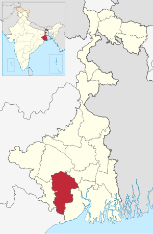
Paschim Medinipur (английский: West Medinipur , Альтернативное правописание в Миднапуре ) - один из районов штата Западная Бенгалия , Индия . Он был сформирован 1 января 2002 года после перегородки Миднапура на Пашим Мединипур и Пурба Мединипур . 4 апреля 2017 года подразделение Jhargram было обновлено до округа. ВВП округа Западного Миднапура составляет 12 миллиардов долларов США.
География
[ редактировать ]Paschim Medinipur, расположенный в юго-западной части Западной Бенгалии, был создан с разделением бывшего района Миднапур , затем крупнейшего района Индии, 1 января 2002 года. Он занимает второе место с точки зрения географического района (9 295,28 км. 2 ) amongst the districts of the state, next to South 24-Parganas (9,960 km2). It ranks third in terms of rural population (4.58 million) following South 24-Parganas (5.82 million) and Murshidabad (5.13 million). It ranked fourth in terms of percentage of tribal population (14.87) following Jalpaiguri (18.87), Purulia (18.27) and Dakshin Dinajpur (16.12) in 2011.[3]
Broadly speaking, there are two natural divisions of the district. NH 14 and NH 16 (old numbering NH 60) from Bankura to Balasore, cuts across the district and roughly is the dividing line between the two natural divisions. To the east of this road, the soil is fertile alluvial and the area is flat. To the west, the Chota Nagpur Plateau gradually slopes down, creating an undulating area with infertile laterite rocks and soil. The landscape changes from dense dry deciduous forests in the west to marshy wetlands in the east.[3]
The alluvial portion may be further subdivided into two divisions. First, it is a strip of purely deltaic country nearer to the Hooghly and the Rupnarayan, intersected by numerous rivers and watercourses subject to tidal influences. Second, it is rest of the eastern half of the district. It is a monotonous rice plain with numerous waterways and tidal creeks intersecting it. The tidal creeks are lined with embankments to prevent flooding of the fields. Much of the area is water-logged.[3]
Floods and drought
[edit]Paschim Medinipur district is subject to both floods and drought. Ghatal and parts of Kharagpur subdivision covering an area of 142,647 hectares (1,426.47 km2) are flood prone. Water logging during the rainy season affects Ghatal and the southern parts of Kharagpur subdivision and results in loss of crops in such areas as Sabang, Pingla and Narayangarh CD Blocks. 335,248 hectares (3,352.48 km2) Medinipur Sadar subdivision is drought prone. Although the district is away from the sea, cyclones hit it frequently in October–November.[3]
Major cities and towns
[edit]Midnapore is the district headquarters. Kharagpur is the largest city in the district. Other important towns and cities in the district include: Salboni, Ghatal, Belda, Chandrakona, Ramjibanpur, Garbeta, Balichak, Dantan, Mohanpur, Keshiari, Keshpur, Narayangarh, Sabang, Daspur, Goaltore and Debra.
Villages
[edit]Paschim Medinipur district is home to the most villages of any district in India. The 2011 census lists Paschim Medinipur as having 8,694 villages, of which 7,600 are populated, and 1,094 uninhabited. The district with the next highest number of villages, Mayurbhanj, in the state of Odisha, has 3,950 villages, 3,751 of which are inhabited.
Economy and politics
[edit]In 2006 the Ministry of Panchayati Raj named Paschim Medinipur one of the country's 250 most backward districts (out of a total of 640).[4] It is one of the eleven districts in West Bengal currently receiving funds from the Backward Regions Grant Fund Programme (BRGF).[4]
106 districts spanning 10 states across India, described as being part of Left Wing Extremism activities, constitute the Red corridor. In West Bengal the districts of Paschim Medinipur, Bankura, Purulia and Birbhum are part of the Red corridor. However, as of July 2016, there has been no reported incidents of Maoist related activities from these districts for the previous 4 years.[5] In the period 2009–2011 LWE violence resulted in more than 500 deaths and a similar number missing in Paschim Medinipur district.[6]
Divisions
[edit]Paschim Medinipur district is divided into the following administrative subdivisions:[7]
| Subdivision | Headquarters | Area km2 |
Population (2011) |
Rural population % (2011) |
Urban population % (2011) |
|---|---|---|---|---|---|
| Medinipur Sadar | Midnapore | 2,441.50 | 1,435,321 | 86.05 | 13.95 |
| Kharagpur | Kharagpur | 2,913.17 | 2,293,909 | 85.67 | 14.33 |
| Ghatal | Ghatal | 953.09 | 1,047,679 | 87.94 | 12.06 |
Administrative subdivisions
[edit]The district comprises three subdivisions: Kharagpur, Medinipur Sadar and Ghatal. Kharagpur subdivision consists of Kharagpur municipality and ten community development blocks: Dantan–I, Dantan–II, Pingla, Kharagpur–I, Kharagpur–II, Sabang, Mohanpur, Narayangarh, Keshiari and Debra. Medinipur Sadar subdivision consists of Midnapore municipality and six community development blocks: Medinipur Sadar, Garhbeta–I, Garhbeta–II, Garhbeta–III, Keshpur and Shalboni. Ghatal subdivision consists of five municipalities (Ramjibanpur, Chandrakona, Khirpai, Kharar and Ghatal) and five community development blocks: Chandrakona–I, Chandrakona–II, Daspur–I, Daspur–II and Ghatal.[8]
Midnapore is the district headquarters. There are 28 police stations, 21 development blocks, 7 municipalities and 290 gram panchayats in this district.[8][9]
Other than municipality area, each subdivision contains community development blocks which in turn are divided into rural areas and census towns. In total there are 11 urban units: 7 municipalities and 4 census towns.
Kharagpur subdivision
[edit]- One municipality: Kharagpur.
- Dantan I community development block consists of rural areas with 9 gram panchayats and one census town: Chaulia
- Dantan II community development block consists of rural areas only with 7 gram panchayats.
- Pingla community development block consists of rural areas only with 10 gram panchayats.
- Kharagpur I community development block consists of rural areas with 7 gram panchayats and two census towns: Kharagpur Railway Settlement and Kalaikunda.
- Kharagpur II community development block consists of rural areas only with 9 gram panchayats.
- Sabang community development block consists of rural areas only with 13 gram panchayats.
- Mohanpur community development block consists of rural areas only with 5 gram panchayats.
- Narayangarh community development block consists of rural areas with 16 gram panchayats and one census town: Deuli.
- Keshiari community development block consists of only rural areas with 9 gram panchayats.
- Debra community development block consists of rural areas with 14 gram panchayats and one census town: Balichak.
Medinipur Sadar subdivision
[edit]- One municipality: Midnapore.
- Midnapore Sadar community development block consists of rural areas only with 9 gram panchayats.
- Garhbeta I community development block consists of rural areas with 12 gram panchayats and two census towns: Garbeta and Amlagora
- Garhbeta II community development block consists of rural areas only with 10 gram panchayats.
- Garhbeta III community development block consists of rural areas with 8 gram panchayats and three census towns: Durllabhganj, Dwari Geria and Naba Kola.
- Keshpur community development block consists of rural areas only with 15 gram panchayats.
- Salboni community development block consists of rural areas only with 10 gram panchayats.
Ghatal subdivision
[edit]- Five municipalities: Ramjibanpur, Chandrakona, Khirpai, Kharar and Ghatal.
- Chandrakona I community development block consists of rural areas only with 6 gram panchayats.
- Chandrakona II community development block consists of rural areas only with 6 gram panchayats.
- Daspur I community development block consists of rural areas only with 10 gram panchayats.
- Daspur II community development block consists of rural areas only with 14 gram panchayats.
- Ghatal community development block consists of rural areas only with 12 gram panchayats.
Assembly Constituencies
[edit]There are 15 assembly constituencies in Paschim Medinipur district. They belong to four Lok Sabha constituencies. Medinipur and Ghatal constituencies both comprise six constituencies of Paschim Medinipur district and one from Purba Medinipur district. Jhargram constituency contains two constituencies of Paschim Medinipur district, while Arambagh contains one constituency.
| No. | Name | Lok Sabha constituency | MLA | Party | |
|---|---|---|---|---|---|
| 219 | Dantan | Medinipur | Bikram Chandra Pradhan | All India Trinamool Congress | |
| 223 | Keshiary (ST) | Paresh Murmu | All India Trinamool Congress | ||
| 224 | Kharagpur Sadar | Hiran Chatterjee | Bharatiya Janata Party | ||
| 225 | Narayangarh | Surja Kanta Atta | All India Trinamool Congress | ||
| 226 | Sabang | Ghatal | Manas Bhunia | All India Trinamool Congress | |
| 227 | Pingla | Ajit Maity | All India Trinamool Congress | ||
| 228 | Kharagpur | Medinipur | Dinen Roy | All India Trinamool Congress | |
| 229 | Debra | Ghatal | Humayun Kabir | All India Trinamool Congress | |
| 230 | Daspur | Mamata Bhunia | All India Trinamool Congress | ||
| 231 | Ghatal (SC) | Sital Kapat | Bharatiya Janata Party | ||
| 232 | Chandrakona (SC) | Arambagh | Arup Dhara | All India Trinamool Congress | |
| 233 | Garbeta | Jhargram | Uttara Singha | All India Trinamool Congress | |
| 234 | Salboni | Srikanta Mahata | All India Trinamool Congress | ||
| 235 | Keshpur (SC) | Ghatal | Seuli Saha | All India Trinamool Congress | |
| 236 | Medinipur | Medinipur | June Malia | All India Trinamool Congress | |
Demographics
[edit]| Year | Pop. | ±% |
|---|---|---|
| 1901 | 1,520,130 | — |
| 1911 | 1,537,618 | +1.2% |
| 1921 | 1,453,390 | −5.5% |
| 1931 | 1,525,569 | +5.0% |
| 1941 | 1,738,975 | +14.0% |
| 1951 | 1,830,743 | +5.3% |
| 1961 | 2,380,446 | +30.0% |
| 1971 | 3,035,385 | +27.5% |
| 1981 | 3,697,899 | +21.8% |
| 1991 | 4,486,279 | +21.3% |
| 2001 | 5,193,411 | +15.8% |
| 2011 | 5,913,457 | +13.9% |
| Source: censusindia.gov.in | ||
According to the 2011 census Paschim Medinipur district has a population of 5,913,457,[10] roughly equal to the nation of Eritrea[11] or the US state of Missouri.[12] This gives it a ranking of 14th in India (out of a total of 640).[10] The district has a population density of 636 inhabitants per square kilometre (1,650/sq mi).[10] Its population growth rate over the decade 2001–2011 was 14.44%.[10] Paschim Medinipur has a sex ratio of 960 females for every 1000 males,[10] and a literacy rate of 79.04%.[10] Scheduled Castes and Scheduled Tribes collectively account for 33.96% (SC: 19.08% and ST: 14.88%) of the district's total population. The prominent communities in this group, in terms of the district's total population, are Santal (9.05%), Bagdi/Duley (6.27%), Bhumij (1.65%), Lohar (1.33%), Namasudra (1.3%), Munda (1.13%), Jalia Kaibartta (1.02%), Lodha/Kharia (0.88%),[a] Dhoba (0.83%), Hari/Mehtar (0.81%), Bauri (0.76%), Mal (0.6%), Dom (0.56%), Chamar (0.53%), Bhuiya (0.53%), Kora (0.49%), Rajbanshi (0.43%), Pan/Sawasi (0.38%), Sunri (excluding Saha) (0.34%), Keot/Keyot (0.33%), Kandra (0.31%), Savar (0.31%), Rajwar (0.26%), Ho (0.25%), Mahar (0.24%), Kadar (0.23%), Baiga (0.22%), Mahali (0.21%), Khaira (0.2%), and Pod/Poundra (0.19%).[13][14]
After bifurcation, the district had a population of 4,776,909, of which 655,250 (13.72%) live in urban areas. The divided district has a sex ratio of 963 females per 1000 males. Scheduled Castes and Scheduled Tribes make up 892,763 (18.69%) and 546,167 (11.43%) of the population, respectively.[10][failed verification]
Religion
[edit]
Language
[edit]At the 2011 census, 87.15% spoke Bengali, 6.29% Santali, 2.49% Hindi and 0.93% Telugu as their first language. Other languages spoken in the district include Odia, Urdu, Kudmali/Kurmali, Mundari and Koda.[16]
Culture
[edit]Tourism
[edit]
There are many tourist attractions in the district:
- Patachitra Village (Naya, Pingla)
- Gopegarh Heritage Park
- Hatibari Forest banglow and Jhilli Pakhiralay
- Gurguripal Heritage Park
- Parimalkanan park, CKT
- Gangani Garhbeta
- Kriya Yoga Ashram, Chaipat Satmatha
- Raj Rajeswar Temple, Chaipat
- Rameshwar Temple, near Rohini (On the bank of Subarnarekha river with nearby green forest called Tapoban)
- Gourya Temple, near Kharagpur
- Bisnu Temple, Kultikri
- Rashikananda Memorial, Rohini
- Birthplace of Iswar Chandra Vidyasagar, Birsingha Village
- Mogolmari Boudhabihar, Mogolmari, Dantan
- Prayag Film City, Midnapore Film City or Chandrakona Film City at Chandrakona Road[17]
Education
[edit]Universities and colleges
[edit]

- Ambigeria Government College
- Belda College
- Bhatter College
- Chaipat S.P.B. Mahavidyalaya
- Debra Thana Sahid Kshudiram Smriti Mahavidyalaya
- Dr B C Roy Institute of Medical Sciences & Research
- Garhbeta College
- Gourav Guin Memorial College
- Government General Degree College, Mohanpur
- Government General Degree College, Keshiary
- Hijli College
- IIT Kharagpur
- Institute of Science & Technology
- K.D. College of Commerce and General Studies
- Kharagpur College
- Keshiary Government College
- Kharagpur Homoeopathic Medical College and Hospital
- Midnapore College (Autonomous) (formerly known as Day college)
- Midnapore City College
- Midnapore Homoeopathic Medical College and Hospital
- Midnapore Law College
- Midnapore Medical College and Hospital
- Oriental Institute of Science and Technology
- Narajole Raj College
- Pingla Thana Mahavidyalaya
- Raja Narendra Lal Khan Women's College
- Sabang Sajanikanta Mahavidyalaya
- Salboni Government College
- Sankrail Anil Biswas Smriti Mahavidyalaya
- Santal Bidroha Sardha Satabarsiki Mahavidyalaya
- Medinipur Sadar Government Polytechnic
- Sukumar Sengupta Mahavidyalaya
- Vidyasagar Teachers' Training College, Midnapore
- Vidyasagar University
- Vivekananda Satavarshiki Mahavidyalaya
Healthcare
[edit]The table below (all data in numbers) presents an overview of the subdivision-wise medical facilities available and patients treated, after the separation of Jhargram, in the hospitals, health centres and sub-centres in 2014 in Paschim Medinipur district.[18]
| Subdivision | Health & Family Welfare Dept, WB | Other state govt depts |
Local bodies |
Central govt depts / PSUs |
NGO / private nursing homes |
Total | Total number of beds |
Total number of doctors |
Indoor patients |
Outdoor patients | |||
|---|---|---|---|---|---|---|---|---|---|---|---|---|---|
| Hospitals |
Rural hospitals |
Block primary health centres |
Primary health centres | ||||||||||
| Medinipur Sadar | 2 | 5 | 1 | 15 | 3 | - | 1 | 26 | 53 | 2,117 | 323 | 121,486 | 1,375,817 |
| Kharagpur | 2 | 8 | 2 | 27 | 2 | 1 | 2 | 54 | 98 | 1841 | 197 | 93,110 | 1,814,309 |
| Ghatal | 1 | 4 | 1 | 15 | - | - | - | 46 | 67 | 988 | 66 | 46,006 | 742,984 |
| Paschim Medinipur district | 5 | 17 | 24 | 77 | 5 | 1 | 3 | 126 | 208 | 4,946 | 586* | 260,602 | 3,933,110 |
- Excluding nursing homes
Notable people
[edit]- Tamal Bandyopadhyay, Indian business journalist
- Rajnarayan Basu, writer and proponent of Young Bengal movement
- Anirban Bhattacharya, actor in Tollywood movies
- Khudiram Bose, one of the youngest martyrs of the Indian Independence Movement.
- Soumya Sankar Bose, Photographer
- Byomkes Chakrabarti, Linguist, writer and poet
- Souhardya De, orientalist and Bal Puraskar recipient
- Mahasweta Devi, writer and Magsaysay Award winner
- Nirmal Jibon Ghosh, revolutionary
- Hemchandra Kanungo, an Indian nationalist and prime organiser of Anushilan Samiti
- Abha Maiti, freedom fighter, former minister of West Bengal and Government of India
- Narayan Chandra Rana, scientist
- Huseyn Shaheed Suhrawardy, Chief Minister of Bengal during British period, Prime Minister of Pakistan and founder of the Awami League
- Ishwar Chandra Vidyasagar, reformer and philanthropist, key figure of the Bengal Renaissance.
Notes
[edit]- ^ Although the Kharia and Lodha are two distinct tribes, they interchangeably utilize their respective names and commonly use the honorific name of Sabar/Savar, which is also a name of another tribe.
References
[edit]- ^ Jump up to: a b "Fact and Figures". Wb.gov.in. Retrieved 5 July 2019.
- ^ "52nd Report of the Commissioner for Linguistic Minorities in India" (PDF). Nclm.nic.in. Ministry of Minority Affairs. p. 85. Archived from the original (PDF) on 25 May 2017. Retrieved 5 July 2019.
- ^ Jump up to: a b c d "District Human Development Report: Paschim Medinipur" (PDF). Chapter I Introduction and Human Development Indices for Paschim Mednipur. Development and Planning Department, Government of West Bengal, 2011. Archived from the original (PDF) on 29 March 2017. Retrieved 25 July 2016.
- ^ Jump up to: a b Ministry of Panchayati Raj (8 September 2009). "A Note on the Backward Regions Grant Fund Programme" (PDF). National Institute of Rural Development. Archived from the original (PDF) on 5 April 2012. Retrieved 27 September 2011.
- ^ Singh, Vijayita (24 July 2016). "Red Corridor to be redrawn". The Hindu. The Hindu, 25 July 2016. Retrieved 1 August 2016.
- ^ "District Human Development Report: Paschim Medinipur" (PDF). May 2011. Page 271. Development & Planning Department, Government of West Bengal. Archived from the original (PDF) on 29 March 2017. Retrieved 31 July 2016.
- ^ "District Statistical Handbook 2014 Paschim Medinipur". Table 2.2, 2.4(a). Department of Statistics and Programme Implementation, Government of West Bengal. Archived from the original on 29 July 2017. Retrieved 23 October 2016.
- ^ Jump up to: a b "Directory of District, Sub division, Panchayat Samiti/ Block and Gram Panchayats in West Bengal, March 2008". West Bengal. National Informatics Centre, India. 19 March 2008. Archived from the original on 25 February 2009. Retrieved 6 December 2008.
- ^ "Administration Setup". Official website of Purba Medinipur district. Archived from the original on 25 April 2008. Retrieved 6 December 2008.
- ^ Jump up to: a b c d e f g "District Census Handbook: Paschim Medinipur" (PDF). censusindia.gov.in. Registrar General and Census Commissioner of India. 2011.
- ^ US Directorate of Intelligence. "Country Comparison:Population". Archived from the original on 13 June 2007. Retrieved 1 October 2011.
Eritrea 5,939,484 July 2011 est.
- ^ «Данные 2010 года населения» . Бюро переписей США . Получено 30 сентября 2011 года .
Миссури 5 988 927
- ^ «A-11 Приложение: окружной мудрый население племен (приложение) [2011]» . Генеральный регистратор и комиссар по переписи, Индия.
- ^ «Приложение A -10: окружной мудрый запланированное кастовое население (Приложение), Западная Бенгалия - 2011» . Генеральный регистратор и комиссар по переписи, Индия.
- ^ «С-1 население религиозной общины» . Перепись . Получено 10 июля 2021 года .
- ^ Jump up to: а беременный «Таблица C-16 Население родного языка: Западная Бенгалия» . www.censusindia.gov.in . Генеральный регистратор и комиссар по переписи Индии .
- ^ «Шахрукх Кхан открывает город Прайг -кино в Чандраконе | ng» . Архивировано из оригинала 25 апреля 2012 года . Получено 4 декабря 2012 года .
- ^ «Статистический справочник района 2014 Paschim Medinipur» . Таблица 3.1, 3.3 . Департамент статистики и реализации программ, правительство Западной Бенгалии. Архивировано с оригинала 29 июля 2017 года . Получено 17 ноября 2016 года .
Внешние ссылки
[ редактировать ]- Официальный сайт
- Карта Старого Мединипурского района (район теперь разделен)
 Midnapore от Wikivoyage Путеводитель
 - Kharagpur от Wikivoyage Гид из
- Firm Firm Distinse Friend Chede Friday
Места рядом с районом Пашим Мединипур |
|---|
Города, города и места в районе Пашим Мединипур , Подразделение Мединипур |
|---|
