Автомагистраль с контролируемым доступом


Автомагистраль с контролируемым доступом — это тип автомагистрали , предназначенный для высокоскоростного движения транспортных средств, на котором регулируются все потоки транспорта — въезд и выезд. Общие английские термины — автострада , [ а ] автомагистраль , [ б ] и скоростная автомагистраль . [ с ] Другие подобные термины включают сквозной или сквозной путь. [ д ] и бульвар . Некоторые из них могут быть автомагистралями с ограниченным доступом , хотя этот термин также может относиться к классу автомагистралей с несколько меньшей изоляцией от другого движения.
В странах, следующих Венской конвенции , квалификация автомагистралей подразумевает, что ходьба и парковка запрещены.
Автомагистраль с полностью контролируемым доступом обеспечивает беспрепятственный поток транспорта без светофоров , перекрестков и доступа к собственности . На них отсутствуют какие-либо пересечения на одном уровне с другими автомобильными, железными дорогами или пешеходными дорожками, которые вместо этого проложены эстакадами и подземными переходами . Въезды и выезды на автомагистраль предусмотрены на развязках по развязкам (съездам), позволяющим осуществлять переключение скоростей между автомагистралью и магистральными и коллекторными дорогами . На автомагистрали с контролируемым доступом противоположные направления движения обычно разделены средней полосой или центральной полосой, содержащей дорожный барьер или траву. Устранение конфликтов с другими направлениями движения резко повышает безопасность, [ 2 ] при одновременном увеличении пропускной способности и скорости движения.
Автомагистрали с контролируемым доступом появились в первой половине 20 века. Италия была первой страной в мире, которая построила автомагистрали с контролируемым доступом, предназначенные только для скоростного движения и только для автомобилей. [ 3 ] [ 4 ] Италия открыла свою первую автостраду в 1924 году, А8 , соединяющую Милан с Варезе . Германия начала строить свой первый автобан с контролируемым доступом без ограничений скорости (30 километров [19 миль] на месте, которое сейчас называется A555 , тогда называемое шоссе с двойным движением ) в 1932 году между Кельном и Бонном . Затем он быстро построил первый [ 5 ] общенациональная система таких дорог. Первые североамериканские автострады (известные как бульвары) открылись в районе Нью-Йорка в 1920-х годах. Великобритания, находящаяся под сильным влиянием железных дорог, не строила свою первую автомагистраль , объездную дорогу Престона ( М6 ), до 1958 года.
В большинстве технологически развитых стран имеется разветвленная сеть автострад или автомагистралей, обеспечивающая высокоскоростное движение по городу или высокоскоростное путешествие по сельской местности, или и то, и другое. национального или даже международного уровня (например, европейский маршрут E ) Многие из них имеют систему нумерации маршрутов .
Стандарты определения
[ редактировать ]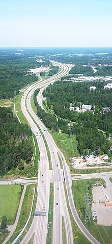

Существует несколько международных стандартов, которые дают некоторые определения таких слов, как автомагистрали, но не существует формального определения слов английского языка, таких как автострада , автомагистраль и скоростная автомагистраль , или эквивалентных слов на других языках, таких как автострада , автобан , автострада. , autocesta, autoput , которые приняты во всем мире — в большинстве случаев эти слова определяются местным законодательством или стандартами проектирования или региональными международными договорами. Широко используемые описания включают в себя:
- «Автомагистраль» означает дорогу, специально спроектированную и построенную для автомобильного движения, которая не обслуживает граничащие с ней объекты и которая:
- Обеспечивается, за исключением специальных пунктов или временно, отдельными проезжими частями для двух направлений движения, отделенными друг от друга либо разделительной полосой, не предназначенной для движения, либо, в исключительных случаях, другими средствами;
- Не пересекается на одном уровне с автомобильными, железнодорожными, трамвайными путями или пешеходными дорожками; и,
- Специально обозначен как автомагистраль; [ 6 ]
Один зеленый или синий символ (например, ![]() ) появляется при въезде на автомагистраль в странах, соблюдающих Венскую конвенцию. Выходы отмечены другим символом:
) появляется при въезде на автомагистраль в странах, соблюдающих Венскую конвенцию. Выходы отмечены другим символом: ![]() .
.
Определения «автомагистрали» от ОЭСР [ 7 ] и ПИАРК [ 8 ] практически идентичны.
- Автомагистраль ограниченным доступом : дорога с двусторонним движением и , не пересекаемая на том же уровне другими полосами движения , предназначенная исключительно для использования определенными классами транспортных средств.
- ITE (включая CITE )
-
- Автострада : разделенная основная дорога с полным контролем доступа и без пересечений на уровне. Это определение применимо как к платным, так и к бесплатным дорогам.
- Автострада А : обозначает дороги с большей визуальной сложностью и высокой интенсивностью движения. Обычно этот тип автострады находится в городских районах в центральной части города или рядом с ней и будет работать большую часть ранних вечерних часов в темное время суток с проектной пропускной способностью или близкой к ней.
- Автострада B : обозначает все остальные разделенные дороги с полным контролем доступа, где необходимо освещение.
- Автострада : разделенная основная дорога с полным контролем доступа и без пересечений на уровне. Это определение применимо как к платным, так и к бесплатным дорогам.
В Европейском Союзе в целях статистики и безопасности можно проводить некоторое различие между автомагистралями и скоростными автомагистралями . Например, главную артерию можно рассматривать как:
Дороги, обслуживающие междугородние и преимущественно междугородние перевозки. Включает автомагистрали (городские или сельские) и скоростные дороги (дороги, которые не обслуживают граничащие с ними объекты и имеют отдельные проезжие части для двух направлений движения). Основные магистрали могут проходить через городские районы, обслуживая пригородные перевозки. Трафик характеризуется высокие скорости и полный или частичный пропускной режим (развязки или перекрестки, контролируемые светофорами). Другие дороги, ведущие к основной магистрали, соединены с ней боковыми коллекторами. [ 9 ]
С этой точки зрения определение CARE состоит в том, что автомагистраль понимается как
дорога общего пользования с двусторонним движением и не менее чем двумя полосами движения в каждую сторону. Все въезды и выезды обозначены указателями, а все развязки разделены по уровням. Центральный барьер или срединная часть дороги. Переход через дорогу запрещен, а остановка разрешена только в случае крайней необходимости. Ограниченный доступ к автотранспортным средствам, запрещен пешеходам, животным, велосипедам, мопедам, сельскохозяйственной технике. Минимальная скорость не ниже 50 км/ч [31 миль в час], а максимальная скорость не выше 130 км/ч [81 миль в час] (кроме Германии , где ограничение скорости не установлено). [ 9 ]
Автомагистрали спроектированы так, чтобы обеспечивать интенсивное движение на высоких скоростях с минимально возможным количеством аварий. Они также предназначены для сбора трафика на дальние расстояния с других дорог, чтобы избежать конфликтов между трафиком на дальние расстояния и местным движением. [ 10 ] Согласно общепринятому европейскому определению, автомагистраль определяется как «дорога, специально спроектированная и построенная для автомобильного движения, которая не обслуживает граничащие с ней объекты и которая: (a) снабжена, за исключением специальных пунктов или временно, отдельные проезжие части для двух направлений движения, отделенные друг от друга либо разделительной полосой, не предназначенной для движения, либо, в исключительных случаях, другими способами, не пересекаются на уровне какой-либо автомобильной дороги, железнодорожного или трамвайного пути или пешеходной дорожки; (c) специально обозначен знаками как автомагистраль и зарезервирована для определенных категорий дорожных транспортных средств». [ 11 ] Городские автомагистрали также включены в это определение. Однако соответствующие национальные определения и типы охваченных дорог могут немного отличаться в разных странах ЕС. [ 12 ]
История
[ редактировать ]

Первая версия современных автомагистралей с контролируемым доступом возникла в первой половине 20 века. Автострада Лонг-Айленд на Лонг-Айленде , штат Нью-Йорк , открытая в 1908 году как частное предприятие, была первой в мире дорогой с ограниченным доступом. Он включал в себя множество современных функций, в том числе повороты с наклоном , ограждения и железобетонное асфальтированное покрытие . [ 21 ] Транспортное средство могло повернуть налево между бульваром и развязками, пересекая встречное движение, поэтому это не было шоссе с контролируемым доступом (или «автострадой», как позже определено в Руководстве федерального правительства по унифицированным устройствам управления движением ).
Современные автомагистрали с контролируемым доступом возникли в начале 1920-х годов в ответ на быстро растущее использование автомобилей , потребность в более быстром передвижении между городами и, как следствие, на усовершенствование процессов, технологий и материалов дорожного покрытия. Эти первоначальные высокоскоростные дороги назывались « двойными шоссе », были модернизированы и используются до сих пор.
Италия была первой страной в мире, которая построила автомагистрали с контролируемым доступом, предназначенные только для скоростного движения и только для автомобилей. [ 3 ] [ 4 ] Autostrada dei Laghi («Озерная автомагистраль»), первая построенная в мире, соединяющая Милан с озерами Комо и Маджоре , а теперь являющаяся частью автомагистралей A8 и A9 , была разработана Пьеро Пуричелли и открыта в 1924 году. [ 4 ] Эта автомагистраль, называемая автострадой , имела только одну полосу движения в каждом направлении и не имела развязок. Бульвар реки Бронкс был первой дорогой в Северной Америке, на которой использовалась срединная полоса для разделения противоположных полос движения, которая должна была быть построена через парк и там, где пересекающиеся улицы пересекались по мостам. [ 22 ] [ 23 ] Южный государственный бульвар открылся в 1927 году, а автомагистраль Лонг-Айленда была закрыта в 1937 году и заменена Северным государственным бульваром (открытым в 1931 году) и прилегающим к нему Гранд-Сентрал-бульваром (открытым в 1936 году). В Германии строительство автобана Бонн-Кёльн началось в 1929 году и был открыт в 1932 году Конрадом Аденауэром , тогдашним мэром Кёльна . [ 24 ] Немецкий автобан стал первой общенациональной системой автомагистралей. [ 25 ]
В Канаде первым предшественником с полуконтролируемым доступом была Миддл-роуд между Гамильтоном и Торонто , которая представляла собой срединный разделитель между встречными транспортными потоками, а также первую в стране развязку в виде клеверного листа . Это шоссе превратилось в Путь Королевы Елизаветы , на котором была развязка клеверного листа и трубы , когда она открылась в 1937 году, и до Второй мировой войны она могла похвастаться самым длинным освещенным участком построенной дороги. [ 26 ] Десять лет спустя был открыт первый участок шоссе 401 , основанный на более ранних проектах. С тех пор она стала самой загруженной автомагистралью в мире.
Слово «автострада» впервые было использовано в феврале 1930 года Эдвардом М. Бассеттом . [ 27 ] [ 28 ] [ 29 ] [ 30 ] Бассетт утверждал, что дороги следует разделить на три основных типа: шоссе, бульвары и автострады. [ 27 ] Бассетта зонирования и собственности В системе , основанной на законе о собственности, владельцы прилегающей собственности имеют права на свет , воздух и доступ к автомагистралям, но не к бульварам и автострадам; последние два отличаются тем, что назначение бульвара - отдых, а назначение автострады - движение. [ 27 ] Таким образом, в первоначальном понимании автострада — это просто полоса общественной земли, предназначенная для движения, к которой примыкающие владельцы собственности не имеют прав на свет, воздух или доступ. [ 27 ]
Дизайн
[ редактировать ]


Автострады по определению не имеют пересечений на одном уровне с другими дорогами, железными дорогами или многоцелевыми тропами . Таким образом, светофоры не нужны, и при движении по автомагистралям обычно не требуется останавливаться перед сигналами светофора. В некоторых странах, например в США, разрешены ограниченные исключения: некоторые разводные мосты , например, межштатный мост на межштатной автомагистрали 5 между Орегоном и Вашингтоном , требуют, чтобы водители останавливались для судов движения .
Пересечение автострад другими маршрутами обычно достигается за счет разделения уровней либо в виде подземных переходов , либо в виде эстакад . Помимо тротуаров (тротуаров), примыкающих к дорогам, пересекающим автостраду, специализированные пешеходные мосты или туннели могут предусматриваться и . Эти конструкции позволяют пешеходам и велосипедистам пересекать автостраду в этом месте, не объезжая ближайший перекресток.
Доступ к автомагистралям обычно предоставляется только на развязках с разделением по уровням , хотя более низкий стандартный доступ направо/направо (левый/налево в странах с левосторонним движением) может использоваться для прямого выезда на второстепенные дороги. . Во многих случаях сложные развязки позволяют обеспечить плавный и непрерывный переход между пересекающимися автострадами и оживленными магистралями . Однако иногда для перехода с одной автострады на другую необходимо выехать на наземную дорогу. Одним из примеров в Соединенных Штатах (известных из-за возникших заторов) является соединение межштатной автомагистрали 70 с автомагистралью Пенсильвании ( межштатной автомагистралью 70 и межштатной автомагистралью 76 ) через город Бризвуд, штат Пенсильвания . [ 31 ]
Ограничения скорости Германии на автомагистралях, как правило, выше, а иногда и вовсе отсутствуют (как и на большей части сети автобанов ). Поскольку более высокие скорости сокращают время принятия решения, автострады обычно оборудуются большим количеством указателей, чем другие дороги, а сами знаки физически больше. Указатели часто устанавливаются на эстакадах или верхних эстакадах , чтобы водители могли видеть, куда идет каждая полоса движения. Номера съездов обычно рассчитываются на основе расстояния съезда в милях или километрах от начала автострады. В некоторых районах на автострадах есть общественные зоны отдыха или зоны обслуживания , а также телефоны экстренной помощи, находятся на обочине которые регулярно .
В Соединенных Штатах вехи обычно начинаются в самой южной или западной точке автострады (либо на ее конечной точке, либо на границе штата). Калифорния , Огайо и Невада используют системы почтовых миль , в которых маркеры указывают пробег через отдельные округа штата. Однако Невада и Огайо также используют стандартную систему почтовых миль одновременно со своими соответствующими системами почтовых миль. Калифорния нумерует съезды с автострад в соответствии с системой вех, но не использует маркеры вех.

В Европе и некоторых других странах автомагистрали обычно имеют схожие характеристики, такие как:
- Типичная расчетная скорость в диапазоне 100–130 км/ч (62–81 миль в час).
- Минимальные значения для горизонтальных радиусов кривых составляют от 750 до 900 м (от 2460 до 2950 футов).
- Максимальные продольные градиенты обычно не превышают 4–5%.
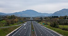
- Поперечные сечения, включающие как минимум две полосы сквозного движения для каждого направления движения, типичной шириной от 3,50 до 3,75 м (от 11 футов 6 дюймов до 12 футов 4 дюйма) каждая, разделенные центральной медианой.
- Зона без препятствий шириной от 4,5 до 10 м (от 15 до 33 футов) или, в качестве альтернативы, установка соответствующих удерживающих систем транспортных средств.
- Надлежащее проектирование развязок с разделением по уровням для обеспечения движения транспорта между двумя или более дорогами на разных уровнях.
- Более частое (по сравнению с другими типами дорог) строительство тоннелей и путепроводов, требующих сложного оборудования и методов эксплуатации.
- Установка высокоэффективного дорожного оборудования и устройств регулирования дорожного движения. [ 32 ]
Поперечные сечения
[ редактировать ]Двухполосные автострады , часто неразделенные, иногда строятся, когда интенсивность движения низкая или полоса отвода ограничена; они могут быть спроектированы так, чтобы их можно было легко переоборудовать на одну сторону четырехполосной автострады. (Например, большая часть бульвара Берт Т. Комбс Маунтин в восточном Кентукки двухполосная, но начались работы по созданию четырехполосной дороги.) Их часто называют супердвумя дорогами. Некоторые из таких дорог печально известны высоким уровнем аварий со смертельным исходом; результат, потому что они были разработаны для коротких расстояний видимости (достаточно для автомагистралей без встречного движения, но недостаточно для многих лет эксплуатации в качестве двухполосной дороги со встречным движением). Примером такого «Дороги в ад» был европейский маршрут E4 от Евле до Аксмартавлана , Швеция. Высокий уровень аварий с тяжелыми травмами на этой (и подобных) дорогах не прекратился до тех пор, пока не был установлен срединный барьер, превративший ДТП со смертельным исходом в ДТП с несмертельным исходом. В противном случае на автострадах обычно есть как минимум две полосы движения в каждом направлении; некоторые загруженные могут иметь до 16 и более полос движения. [ и ] всего.
В Сан-Диего, Калифорния , межштатная автомагистраль 5 имеет аналогичную систему скоростных и местных полос движения с максимальной шириной 21 полосу движения на 2-мильном (3,2 км) участке между межштатной автомагистралью 805 и шоссе штата Калифорния 56 . В Миссиссоге , Онтарио, шоссе 401 использует в общей сложности 18 полос движения через пересечение с шоссе 403 / шоссе 410 и шоссе 427 .
На этих широких автострадах могут использоваться отдельные коллекторные и скоростные полосы для отделения движения от местного движения или специальные полосы для транспортных средств с высокой посещаемостью либо в качестве специального ограничения на самой внутренней полосе, либо в качестве отдельной дороги, чтобы стимулировать совместное использование автомобилей . Эти полосы HOV или дороги, открытые для любого движения, могут быть реверсивными полосами , обеспечивающими большую пропускную способность в направлении интенсивного движения и меняющими направление перед переключением транспорта. Иногда коллекторно-распределительная дорога , более короткая версия местной полосы движения, переносит переплетение между близко расположенными развязками на отдельную проезжую часть или вообще устраняет ее.
В некоторых частях мира, особенно в США , подъездные дороги являются неотъемлемой частью системы автострад. Эти параллельные наземные дороги обеспечивают переход между высокоскоростным «сквозным» движением и местным движением. Частые съезды обеспечивают доступ между автострадой и подъездной дорогой, что, в свою очередь, обеспечивает прямой доступ к местным дорогам и предприятиям. [ 33 ]
За исключением некоторых двухполосных автомагистралей (и очень редко более широких автомагистралей), медиана разделяет противоположные направления движения. Эта полоса может быть такой же простой, как участок с травой, или может включать в себя защитный барьер, такой как « барьер Джерси » или «высокая стена Онтарио», для предотвращения лобовых столкновений . [ 34 ] На некоторых автомагистралях две проезжие части построены по разным направлениям; это может быть сделано для использования имеющихся коридоров в горной местности или для обеспечения более узких коридоров через густонаселенные городские районы . [ нужна ссылка ]
Контроль доступа
[ редактировать ]Контроль доступа связан с правовым статусом, который ограничивает типы транспортных средств, которые могут использовать автомагистраль, а также с конструкцией дороги , которая ограничивает точки, в которых они могут получить к ней доступ.
Основные магистрали часто имеют частичный контроль доступа , что означает, что боковые дороги будут пересекать главную дорогу на уровне, а не использовать развязки, но подъездные пути не могут соединяться напрямую с главной дорогой, и водителям приходится использовать пересекающиеся дороги для доступа к прилегающей территории. На перекрестках магистралей с относительно спокойными боковыми дорогами движение регулируется в основном двусторонними знаками остановки, которые не создают существенных перерывов в движении по основной магистрали. Кольцевые развязки часто используются на наиболее оживленных перекрестках в Европе, поскольку они помогают свести к минимуму перерывы в движении транспорта, в то время как светофоры, которые создают большие помехи движению транспорта, по-прежнему предпочтительны в Северной Америке. Могут быть случайные развязки с другими основными магистралями. Примеры включают US 23 между SR 15 восточной конечной станцией и Делавэром, штат Огайо , а также SR 15 между восточной конечной станцией и I-75 , US 30 , SR 29 / US 33 и US 35 в западном и центральном Огайо. Этот тип дороги иногда называют скоростной автомагистралью .
Безмоторный доступ на автомагистралях
[ редактировать ]На автострадах обычно проезжают автомобили минимальной мощности или веса; знаки могут запрещать движение велосипедистов , пешеходов и наездников и устанавливать минимальную скорость. Для немоторизованного транспорта возможно использование объектов в пределах одной и той же полосы отвода, таких как тротуары, построенные вдоль стандартных мостов для автострад , и многоцелевые пути рядом с автострадами, такие как Suncoast Trail вдоль Suncoast Parkway во Флориде .

В некоторых юрисдикциях США, особенно там, где автострады заменяют существующие дороги, безмоторный доступ на автострады разрешен . В разных штатах США действуют разные законы. Езда на велосипеде по автострадам в Аризоне может быть запрещена только в том случае, если существует альтернативный маршрут, который считается равным или лучшим для езды на велосипеде. [ 35 ] Вайоминг , второй наименее густонаселенный штат, разрешает ездить на велосипеде по всем автострадам. В штате Орегон разрешено использование велосипедов, за исключением определенных городских автомагистралей в Портленде и Медфорде . [ 36 ]
В таких странах, как Соединенное Королевство , для новых автомагистралей требуется парламентский акт, гарантирующий ограничение полосы отвода. Поскольку модернизация существующей дороги («Королевское шоссе») до полноценной автомагистрали приведет к аннулированию права доступа определенных групп, таких как пешеходы, велосипедисты и медленное транспортное средство, многие контролируемые подъездные дороги не являются полноценными автомагистралями. [ 37 ] В некоторых случаях автомагистрали соединены короткими участками дороги, где альтернативные права проезда практически невозможны, например, Дартфорд-Кроссинг (самый дальний общественный переход реки Темзы , расположенный ниже по течению ), или там, где было нерентабельно строить автомагистраль рядом с существующей дорогой, например как бывший Камберленд-Гэп . Автомагистраль A1 является хорошим примером поэтапной модернизации до стандарта автомагистрали: по состоянию на январь 2013 года маршрут длиной 639 километров (397 миль) имел пять участков автомагистрали (обозначаемых как A1 (M)), а в Март 2018 г. с завершением строительства автомагистрали A1 (M) через Северный Йоркшир .
Техника строительства
[ редактировать ]
Наиболее частый способ прокладки автострад - это строительство их с нуля после того, как будут устранены препятствия, такие как лесные массивы или здания. Иногда они истощают сельскохозяйственные угодья, но по экономическим, социальным и даже экологическим причинам были разработаны другие методы.
Полноценные автострады иногда создаются путем преобразования одноуровневых скоростных автомагистралей или замены одноуровневых перекрестков эстакадами; однако в США любой перекресток на одном уровне, заканчивающийся автострадой, часто остается перекрестком на одном уровне. Часто, когда есть двухполосная неделимая автомагистраль или скоростная автомагистраль, ее преобразуют путем строительства параллельного двойного коридора и оставления медианы между двумя направлениями движения. Срединная полоса движения старого коридора с двусторонним движением становится полосой для обгона.
Другие методы включают строительство новой проезжей части на обочине разделенного шоссе, которая имеет много частного доступа с одной стороны, а иногда и длинные подъездные пути с другой стороны, поскольку вводится сервитут для расширения, особенно в сельской местности.
Когда добавляется третья проезжая часть, иногда она может сместить направленную проезжую часть на 20–60 метров (50–200 футов) (или, может быть, больше, в зависимости от наличия земли), чтобы сохранить частный доступ с одной стороны, которая имеет преимущество над другой. Другие методы включают строительство служебной дороги, которая сокращает длинные подъездные пути (обычно менее чем на 100 метров (330 футов)).
Развязки и точки доступа
[ редактировать ]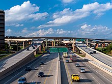
Этот раздел нуждается в дополнительных цитатах для проверки . ( февраль 2019 г. ) |
Развязка или развязка — это схема шоссе, которая позволяет движению транспорта с одной автомагистрали с контролируемым доступом получить доступ к другой и наоборот, тогда как точка доступа — это схема шоссе, где движение от распределительной или местной дороги может присоединиться к автомагистрали с контролируемым доступом. Некоторые страны, такие как Великобритания , не делают различия между ними, но другие проводят различие; например, Германия использует слова Kreuz («крест») или Dreieck («треугольник») для первого и Ausfahrt («выход») для второго. Во всех случаях одна дорога пересекает другую через мост или туннель, а не через одноуровневый переход .
Соединяющиеся дороги или объездные дороги , которые связывают две дороги, могут следовать любому из множества шаблонов. Фактическая схема определяется рядом факторов, включая местную топологию, плотность движения, стоимость земли, затраты на строительство, тип дороги и т. д. В некоторых юрисдикциях подъездные / распределительные полосы являются обычным явлением, особенно для развязок в виде клеверного листа ; в других странах, например в Соединенном Королевстве, где развязки с круговым движением являются обычным явлением, подъездные / распределительные полосы встречаются редко.
Автомагистрали в Европе обычно различаются по съездам и развязкам. Съезд ведет за пределы системы автомагистралей, а развязка представляет собой пересечение автомагистралей или разделение / слияние двух автомагистралей. заканчиваются Правила автомагистралей на съездах, но не на перекрестках. Однако на некоторых мостах автомагистрали, не меняя внешнего вида, временно заканчиваются между двумя ближайшими к мосту (или тоннелю) съездами и продолжаются как проезжие части с двусторонним движением . Это сделано для того, чтобы дать возможность более медленным транспортным средствам использовать мост. мост Королевы Елизаветы II / Дартфордский туннель на лондонской орбитальной станции Примером этого является . London Orbital или M25 — это автомагистраль, окружающая Лондон , но на последнем перекрестке Темзы перед ее устьем правила автомагистралей не применяются. (Вместо этого перекрестка Лондонская орбитальная линия имеет обозначение A282.)
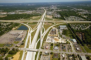
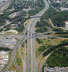
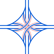
Некоторые из наиболее распространенных типов соединений показаны ниже: [ 38 ] [ 39 ] [ 40 ]
-
 Четырехуровневый стек : используется в качестве основного перекрестка, обычно на развязках автострад.
 -
 Развязка с круговым движением : очень распространена в Соединенном Королевстве как перекресток или выезд.
 -
 Клеверный лист : используется в основном как соединение.
 -
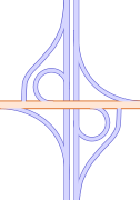 Развязка Parclo (частичный клеверный лист): часто используется для соединения второстепенной дороги с перекрестком.
 -
 Развязка для труб: Т-образный перекресток автомагистрали, используемый там, где развязка представляет собой конечную точку одной из двух дорог; также распространено на платных дорогах, поскольку для этого требуется только одна пункт взимания платы за проезд.
 -
 Разделение или объединение автомагистралей; базовая логика напоминает Т-образный переход
 -
 Единая городская развязка , или СПУИ; используется в густонаселенных городских районах для уменьшения занимаемой площади перекрестка
 -
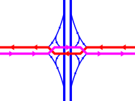 Расходящаяся алмазная развязка ; разработан для улучшения транспортного потока и безопасности за счет минимизации поворотов, которые должны пересекать встречные полосы движения.


Безопасность
[ редактировать ]Между странами существует множество различий в их географии, экономике, росте дорожного движения, размере системы автомагистралей, степени урбанизации и автомобилизации и т. д.; все это необходимо принимать во внимание при проведении сравнений. [ 41 ] Согласно некоторым документам ЕС, прогресс в области безопасности на автомагистралях является результатом ряда изменений, включая безопасность инфраструктуры и поведение участников дорожного движения (скорость или использование ремней безопасности), в то время как другие вопросы, такие как безопасность транспортных средств и модели мобильности, имеют влияние, которое не было количественно оценено. . [ 42 ]
Автомагистрали по сравнению с другими дорогами
[ редактировать ]Автомагистрали являются самыми безопасными дорогами по своей конструкции. Хотя на их долю приходится более четверти всех пройденных километров, на их долю приходится лишь 8% от общего числа смертей на дорогах в Европе в 2006 году. [ 2 ] Федеральный институт автомобильных исследований Германии предоставил Международную базу данных о дорожном движении и происшествиях (IRTAD) за 2010 год, сравнивая общий уровень смертности с показателями на автомагистралях (независимо от интенсивности движения):
| Страна | Все дороги | Автомагистрали | |
|---|---|---|---|
| 2010 | 2010 | 2020 | |
| Австрия | 7.32 | 2.15 | 1.28 |
| Бельгия | 8.51 | 2.87 | |
| Чешская Республика | 16.22 | 3.38 | 2.53 |
| Дания | 5.65 | 1.92 | 0.91 |
| Финляндия | 5.05 | 0.61 | 1.24 |
| Франция | 7.12 | 1.79 | 1.56 |
| Германия | 5.18 | 1.98 | 1.48 |
| Словения | 7.74 | 3.77 | 1.01 |
| Швейцария | 5.25 | 1.04 | 0.85 |
| Соединенные Штаты | 6.87 | 3.62 | 4.19 (предварительный) |
| Источники: ИРТАД-БАСТ-2020. [ 43 ] [ 44 ] | |||
Немецкая сеть автобанов иллюстрирует компромиссы с безопасностью автомагистралей с контролируемым доступом. Уровень аварий с травмами на автобанах очень низок. [ 45 ] в то время как 22 человека погибли на 1000 аварий с травмами - хотя на автобанах показатель ниже, чем 29 смертей на 1000 ДТП с травмами на обычных сельских дорогах, этот показатель выше, чем риск на городских дорогах. Скорость на сельских дорогах и автобанах выше, чем на городских дорогах, что увеличивает вероятность серьезности аварии. [ 46 ]
По данным ETSC, немецкие автомагистрали без ограничения скорости, но с рекомендованной скоростью 130 км/ч (81 миль в час), на 25% более опасны, чем автомагистрали с ограничением скорости. [ 47 ]
Германия также ввела ограничения скорости около 130 км/ч (81 миль в час) на различных участках автомагистралей, которые не были ограничены. Это привело к снижению смертности на этих участках в пределах от 20% до 50%. [ 48 ]
Причины несчастных случаев
[ редактировать ]Скорость в Европе считается одним из основных факторов, способствующих столкновениям. Некоторые страны, такие как Франция и Швейцария, добились снижения смертности за счет лучшего контроля скорости. Инструментами, используемыми для мониторинга скорости, могут быть увеличение плотности трафика; улучшение соблюдения скоростного режима и ужесточение регулирования, ведущее к отзыву водительских прав; камеры наблюдения; штрафной балл; и более высокие штрафы. В некоторых других странах для управления скоростью используются автоматические камеры измерения времени и расстояния (также известные как элементы управления секциями ). [ 42 ]
Усталость считается фактором риска, более специфичным для монотонных дорог, таких как автомагистрали, хотя во многих странах такие данные не отслеживаются и не регистрируются. [ 42 ] По данным Vinci Autoroutes , треть аварий на французских автомагистралях происходит из-за сонного вождения. [ 49 ]
23% людей, погибших на французских автомагистралях, не были пристегнуты ремнями безопасности, в то время как 98% пассажиров на передних сиденьях и 87% пассажиров на задних сиденьях пристегиваются ремнями безопасности. [ 42 ]
Тенденции смертности
[ редактировать ]Хотя показатели безопасности не сильно меняются из года в год, в Европе наблюдаются некоторые изменения: количество смертей на автомагистралях снизилось на 41% в течение десятилетия 2006–2015 годов, но увеличилось на 10% в период с 2014 по 2015 год. Однако, принимая во внимание сеть автомагистралей Данные показывают, что число погибших на тысячу километров сократилось вдвое в период с 2006 по 2015 год. [ 50 ]
| Год | Погибшие | Рассрочка на миллион населения |
Рассрочка на 1000 км автодорог |
|---|---|---|---|
| 2006 | 3,485 | 7.1 | 54.4 |
| 2010 | 2,329 | 4.7 | 32.9 |
| 2015 | 2,048 | 4.1 | 27.3 |
| Источник: Основные факты о безопасности дорожного движения, 2017 г., Автомагистрали. [ 50 ] | |||
Эффект пошлины
[ редактировать ]Исследование Университета Барселоны показывает, что если плата за проезд на автомагистралях с контролируемым доступом взимается , водители могут искать альтернативные маршруты , чтобы не платить за проезд. Это может привести к снижению безопасности на дорогах, не предназначенных для интенсивного движения. [ 51 ]
Безопасность в городских условиях
[ редактировать ]В Соединенном Королевстве очень мало исследований, посвященных влиянию дорожно-транспортных происшествий на существующих и новых городских автомагистралях. [ 52 ] В частности, новые городские автомагистрали не обеспечивают снижения дорожно-транспортных происшествий. [ нужна ссылка ]
В Италии исследование, проведенное на городской автомагистрали A56 Tangenziale di Napoli, показало, что снижение скорости приводит к снижению количества аварий. [ 53 ]
В Марселе , Франция, с июня 2009 года по май 2010 года CEREMA, французский центр исследований рисков, мобильности и окружающей среды, провел исследование Marius сети городских автомагистралей . Это исследование установило связь между авариями и переменными дорожного движения: [ 54 ]
- в случае дорожно-транспортных происшествий с участием одного транспортного средства — 6-минутная средняя скорость на скоростной полосе; и временной интервал (по каждой полосе),
- при множественных дорожно-транспортных происшествиях - занятость и время пробега (для средней полосы).
Сеть Marius длиной 150 километров (93 мили) насчитывает 292 несчастных случая с травмами или смертельным исходом на 1,5 миллиарда транспортных средств-километров, то есть 189 несчастных случаев с травмами или смертельным исходом на 1 миллиард транспортных средств-километров.
Некоторые европейские страны повысили безопасность городских автомагистралей за счет комплекса мер по динамическому управлению транспортным потоком в ответ на изменение объемов, скоростей и происшествий, в том числе:
- Переменные ограничения скорости, управление линией и согласование скорости
- Бег через плечо с местами аварийного убежища
- Предупреждение об очереди и обмен переменными сообщениями
- Круглосуточный мониторинг дорожного движения с помощью камер и/или датчиков на тротуаре (как для обнаружения происшествий, так и для определения момента, когда следует снизить ограничения скорости)
- Управление инцидентами
- Автоматизированное правоприменение
- Специализированные алгоритмы для временного бега по обочинам, изменения ограничений скорости и/или обнаружения и управления инцидентами.
- Линейное измерение (скоординированная или независимая функция) [ 55 ]
В 1994 году предполагалось, что освещение городских автомагистралей будет более безопасным, чем неосвещенные. [ 56 ]
В Калифорнии в 2001 году исследование установило для городских автострад некоторые связи между авариями на городских автомагистралях, транспортным потоком, погодой и условиями освещения: [ 57 ]
- он устанавливает разницу между сухими автострадами при дневном свете и мокрыми автострадами в темноте.
- он установил, что столкновения на левой полосе с большей вероятностью вызваны эффектом объема, в то время как столкновения на правой полосе более тесно связаны с изменениями скорости на соседних полосах (в Калифорнии люди ездят по правой полосе, за исключением случаев обгона).
Воздействие на окружающую среду
[ редактировать ]


Автомагистрали с контролируемым доступом были построены как между крупными городами, так и внутри них, что привело к обширной застройке пригородов, наблюдаемой вблизи большинства современных городов. Шоссе подвергаются резкой критике со стороны экологов, урбанистов и защитников природы за шум, [ 58 ] загрязнение окружающей среды и экономические сдвиги, которые они приносят. [ 59 ] Кроме того, водители критиковали их за неэффективность управления движением в часы пик. [ 60 ] [ 61 ] [ 62 ]
Зачастую сельские автомагистрали открывают обширные территории для экономического развития и муниципальных услуг, что в целом повышает стоимость недвижимости. В отличие от этого, надземные автомагистрали в городских районах часто являются источником снижения стоимости недвижимости, что способствует упадку городов . Даже при наличии эстакад и подземных переходов районы разделены, особенно бедные, жители которых с меньшей вероятностью будут владеть автомобилем или иметь политическое и экономическое влияние, чтобы противостоять строительным работам. [ 63 ] Начиная с начала 1970-х годов Конгресс США определил, что автострады и другие городские магистрали ответственны за большую часть шумового воздействия населения США. [ 64 ] Впоследствии были разработаны компьютерные модели для анализа шума автострад и помощи в их проектировании, чтобы минимизировать воздействие шума. [ 65 ]
Некоторые города ввели политику удаления автострад , в соответствии с которой автострады были снесены и преобразованы в бульвары или парки, особенно в Сеуле ( Чхонгечхон ), Портленде ( Харбор-Драйв ), Нью-Йорке ( Вестсайдское эстакада ), Бостоне ( Центральная артерия ), Сан-Франциско ( шоссе Эмбаркадеро ), Сиэтл ( виадук Аляскинской дороги ) и Милуоки ( автострада Парк-Ист ).
Альтернативой строительству наземных или наземных автострад стало строительство подземных городских автомагистралей с использованием туннельных технологий. Это применялось в Мадриде и Праге , а также в австралийских городах Сидней (где есть пять таких автострад), Брисбен (где их три) и Мельбурн (где их две). Преимущество этого решения заключалось в том, что не создавались наземные дороги с интенсивным движением транспорта, а в случае с автострадой EastLink в Мельбурне предотвращалось разрушение экологически чувствительной зоны.
Other Australian cities face similar problems (lack of available land, cost of home acquisition, aesthetic problems and community opposition). Brisbane, which also has to contend with physical boundaries (the Brisbane River) and rapid population increases, has embraced underground freeways. There are currently three open to traffic (Clem Jones Tunnel (CLEM7), Airport Link and Legacy Way) and one (East-West Link) is currently in planning. All of the tunnels are designed to act as an inner-city ring road or bypass system and include provision for public transport, whether underground or in reclaimed space on the surface.[66] However, freeways are not beneficial for road-based public transport services, because the restricted access to the roadway means that it is awkward for passengers to get to the limited number of boarding points unless they drive to them, largely defeating the purpose.[67]
In Canada, the extension of Highway 401 toward Detroit, known as the Herb Gray Parkway, has been designed with numerous tunnels and underpasses that provide land for parks and recreational uses.
Freeway opponents have found that freeway expansion is often self-defeating: expansion simply generates more traffic. That is, even if traffic congestion is initially shifted from local streets to a new or widened freeway, people will begin to use their cars more and commute from more remote locations. Over time, the freeway and its environs become congested again as both the average number and distance of trips increases. This phenomenon is known as induced demand.[68][69]
Urban planning experts such as Drusilla Van Hengel, Joseph DiMento and Sherry Ryan argue that although properly designed and maintained freeways may be convenient and safe, at least in comparison to uncontrolled roads, they may not expand recreation, employment and education opportunities equally for different ethnic groups, or for people located in certain neighborhoods of any given city.[70] Still, they may open new markets to some small businesses.[71]
Construction of urban freeways for the US Interstate Highway System, which began in the late 1950s, led to the demolition of thousands of city blocks and the dislocation of many more thousands of people. The citizens of many inner city areas responded with the freeway and expressway revolts. Through the study of Washington's response, it can be shown that the most effective changes came not from executive or legislative action, but instead from policy implementation. One of the foremost rationales for the creation of the United States Department of Transportation (USDOT) was that an agency was needed to mediate between the conflicting interests of interstates and cities. Initially, these policies came as regulation of the state highway departments. Over time, USDOT officials re-focused highway building from a national level to the local scale. With this shift of perspective came an encouragement for alternative transportation, and locally based planning agencies.[72]
At present, freeway expansion has largely stalled in the United States, due to a multitude of factors that converged in the 1970s: higher due process requirements prior to taking of private property, increasing land values, increasing costs for construction materials, local opposition to new freeways in urban cores, the passage of the National Environmental Policy Act (which imposed the requirement that each new federally funded project must have an environmental impact statement or report) and falling gas tax revenues as a result of the nature of the flat-cent tax (it is not automatically adjusted for inflation), the tax revolt movement,[73] and growing popular support for high-speed mass transit in lieu of new freeways.[citation needed]
Route numbering
[edit]United Kingdom
[edit]Great Britain
[edit]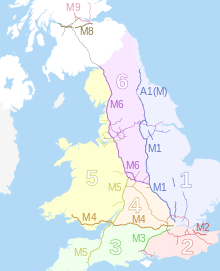
England and Wales
In England and Wales, the numbers of major motorways followed a numbering system separate from that of the A-road network, though based on the same principle of zones.[74] Running clockwise from the M1, the zones were defined for Zones 1 to 4 based on the proposed M2, M3 and M4 motorways. The M5 and M6 numbers were reserved for the other two planned long-distance motorways.[75] The Preston Bypass, the UK's first motorway, should have been numbered A6(M) under the scheme decided upon, but it was decided to keep the number M6 as it had already been applied.[75]
A map Showing Future Pattern of Principal National Routes was issued by the Ministry of War Transport in 1946 shortly before the law that allowed roads to be restricted to specified classes of vehicle (the Special Roads Act 1949) was passed. The first section of motorway, the M6 Preston Bypass, opened in 1958, followed by the first major section of motorway (the M1 between Crick and Berrygrove in Watford), which opened in 1959. From then until the 1980s, motorways opened at frequent intervals; by 1972 the first 1,600 kilometres (1,000 mi) of motorway had been built.
Whilst roads outside of urban areas continued to be built throughout the 1970s, opposition to urban routes became more pronounced. Most notably, plans by the Greater London Council for a series of ringways were cancelled following extensive road protests and a rise in costs. In 1986 the single-ring, M25 motorway was completed as a compromise. In 1996 the total length of motorways reached 3,200 kilometres (2,000 mi).
Motorways in Great Britain, as in numerous European countries, will nearly always have the following characteristics:
- No traffic lights (except occasionally on slip roads before reaching the main carriageway).
- Exit is nearly always via a numbered junction and slip road, with rare minor exceptions.
- Pedestrians, cyclists and vehicles below a specified engine size are banned.
- There is a central reservation separating traffic flowing in opposing directions. (The only exception to this is the A38(M) in Birmingham where the central reservation is replaced by another lane in which the direction of traffic changes depending on the time of day. There was another small spur motorway near Manchester with no solid central reservation, but this was declassified as a motorway in the 2000s.)
- No roundabouts on the main carriageway. This is only the case on motorways beginning with M (so called 'M' class). In the case of upgraded A roads with numbers ending with M (i.e. Ax(M)), roundabouts may exist on the main carriageway where they intersect 'M' class motorways. In all 'M' class motorways bar two, there are no roundabouts except at the point at which the motorway ends or the motorway designation ends. The only exceptions to this in Great Britain are:
- the M271 in Southampton which has a roundabout on the main carriageway where it meets the M27, but then continues as the M271 after the junction.
- on the M60. This came about as a result of renumbering sections of the M62 and M66 motorways near Manchester as the M60, to form a ring around the city. What was formerly the junction between the M62 and M66 now involves the clockwise M60 negotiating a roundabout, while traffic for the eastbound M62 and northbound M66 carries straight on from the M60. This junction, known as Simister Island, has been criticised for the presence of a roundabout and the numbered route turning off.
- the A1(M) between the M62 in North Yorkshire and Washington in Tyne and Wear is built to full 'M' class standards without any roundabouts. It has been suggested that this section of the A1(M) should be reclassified as the northern extension of the M1.[76]
It was proposed in 2013 that the Ax(M) format number would be used for the highest standard of a new classification of road referred to in England as "expressways", which would be roads without normal roundabouts or right turns across the central reservation, and with graded junctions. Such roads would have motorway-style restrictions but emergency reservations rather than standard major motorway-standard hard shoulders.
Scotland
In Scotland, where the Scottish Office (superseded by the Scottish Executive in 1999) rather than the Ministry of Transport and Civil Aviation had the decision, there is no zonal pattern, but rather the A-road rule is strictly enforced. It was decided to reserve the numbers 7, 8 and 9 for Scotland.[77] The M8 follows the route of the A8, and the A90 became part of the M90 when the A90 was re-routed along the path of the A85.
Motorways follow an "M"-format, with two exceptions: the A823(M) near Rosyth joining the A823 to the M90, and the A74(M) between the English M6 at Gretna and the M74 at Abington.
Northern Ireland
[edit]In Northern Ireland a distinct numbering system is used, which is separate from the rest of the United Kingdom, though the classification of roads along the lines of A, B and C is universal throughout the UK and the Isle of Man. According to a written answer to a parliamentary question to the Northern Ireland Minister for Regional Development, there is no known reason as to how Northern Ireland's road numbering system was devised.[78] However motorways, as in the rest of the UK, are numbered M, with the two major motorways coming from Belfast being numbered M1 and M2. The M12 is a short spur of the M1, with the M22 being a short continuation (originally intended to be a spur) of the M2. There are two other motorways, the short M3, the M5 and a motorway section of the A8 road, known as the A8(M).
Republic of Ireland
[edit]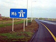
In the Republic of Ireland, motorway and national road numbering is quite different from the UK convention. Since the passage of the Roads Act 1993, all motorways are part of, or form, national primary roads. These routes are numbered in series, (usually, radiating anti-clockwise from Dublin, starting with the N1/M1) using numbers from 1 to 33 (and, separately from the series, 50). Motorways use the number of the route of which they form part, with an M prefix rather than N for national road (or in theory, rather than R for regional road).[79] In most cases, the motorway has been built as a bypass of a road previously forming the national road (e.g. the M7 bypassing roads previously forming the N7)—the bypassed roads are reclassified as regional roads, although updated signposting may not be provided for some time, and adherence to signage colour conventions is lax (regional roads have black-on-white directional signage, national routes use white-on-green).
Under the previous legislation, the Local Government (Roads and Motorways) Act 1974, motorways theoretically existed independently to national roads. However, the short sections of motorway opened during this act, except for the M50, always took their number from the national road that they were bypassing. The older road was not downgraded at this point (indeed, regional roads were not legislated for at this stage). Older signage at certain junctions on the M7 and M11 can be seen reflecting this earlier scheme, where for example N11 and M11 can be seen coexisting.
The M50, an entirely new national road, is an exception to the normal inheritance process, as it does not replace a road previously carrying an N number. The M50 was nevertheless legislated in 1994 as the N50 route (it had only a short section of non-motorway section from the Junction 11 Tallaght to Junction 12 Firhouse until its extension as the Southern Cross Motorway). The M50's designation was chosen as a recognisable number. As of 2010, the N34 is the next unused national primary road designation. In theory, a motorway in Ireland could form part of a regional road.[79]
Australia
[edit]In Australia, highway and motorway (also called freeway or expressway) numbers either use alpha-numeric route markers with M for motorways, freeways and expressways or national/state route markers.
Before the implementation of alpha-numeric route markers, controlled-access highways were marked with a Metroad, National Highway, National Route or State Route Marker. In Sydney, Metroad route markers were used for motorways and freeways, except the Pacific Motorway (then F3 Freeway), which was marked with a National Highway marker. In Brisbane, Metroad, State routes were used for motorways and freeways. In Melbourne, all motorways and freeways used State Route markers. In Western Australia, National Route markers are used for expressways and freeways.
After the implementation of alpha-numeric route markers, all route markers being used for motorways and freeways in Sydney and Melbourne were replaced with a M marker. In Brisbane, all but one motorway had its route marker replaced (Western Fwy). In Western Australia, they have not implemented the new system yet.
-
 Metroad, used in Metropolitan Sydney and Brisbane before the implementation of Alpha Numeric Route markers
 -
 National Route marker, used in Sydney for the Western Freeway and the Princes Motorway (then F6 Freeway). Still in use in Western Australia.
 -
 State Route marker, used for Motorways in Brisbane and Western Australia
 -
 National Highway, used for the Pacific Motorway (then F3 Fwy) and Hume Freeway/Highway
 -
 Alpha Numeric route marker. Replaced all previous route markers in Sydney and Victoria. Partially in Brisbane.


Elsewhere
[edit]
In Hungary, similar to Ireland, motorway numbers can be derived from the original national highway numbers (1–7), with an M prefix attached, e.g. M7 is on the route of the old Highway 7 from Budapest towards Lake Balaton and Croatia. New motorways not following the original Budapest-centred radial highway system get numbers M8, M9, etc., or M0 in the case of the ring road around Budapest.
In the Netherlands, motorway numbers can be derived from the original national highway numbers, but with an A (Autosnelweg) prefix attached, like A9.

In Germany federal motorways have the prefix A (Autobahn). If the following number is odd, the motorway generally follows a north–south direction, while even-numbered motorways generally follow an east–west direction. Other controlled-access roads (dual carriageways) in Germany can be federal highways (Bundesstraßen), state highways (Landesstraßen), district highways (Kreisstraßen) and city highways (Stadtstraßen), each with their own numbering system.

In Italy, motorways follow a single numbering, even if managed by different concessionaire companies: they are all marked with the letter "A" (for autostrada; "RA" in the case of motorway junctions, with the exception of the Bereguardo-Pavia junction numbered on the signs as Autostrada A53, and "T" for the international Alpine tunnels) followed by a number. Therefore a motorway with the same numbering can be managed by different concessionaire companies (for example the Autostrada A23 is managed for a stretch by Società Autostrade Alto Adriatico and for the remaining stretch by Autostrade per l'Italia[80][81]).
In New Zealand, as well as in Brazil, Russia, Finland, and the Scandinavian countries, motorway numbers are derived from the state highway route that they form a part of, but unlike Hungary and Ireland, they are not distinguished from non-motorway sections of the same state highway route. In the cases where a new motorway acts as a bypass of a state highway route, the original state highway is either stripped of that status or renumbered. A low road number means a road suitable for long-distance driving.
In Belgium, motorways but also some dual carriageways have numbers preceded by an A. However, those that also have an E-number are generally referenced with that one. City rings and bypasses have numbers preceded by an R; these also can be either motorways or dual carriageways.
In Croatia, motorway numbering is independent of state route numbering. Motorways are prefixed by an A (for autocesta), as in many other European countries. Some motorways are the result of an upgrade of an older two-lane road, and carry concurrencies with state routes. In some other cases, such as with the A2, following the upgrade, the state route was rerouted onto the frontage road.
By country
[edit]While the design characteristics listed above are generally applicable around the globe, every jurisdiction provides its own specifications and design criteria for controlled-access highways.
Africa
[edit]Algeria
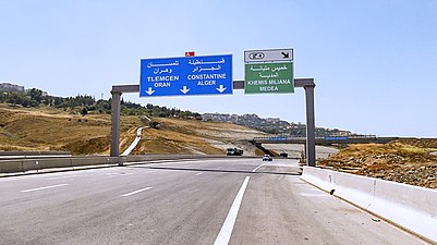
[edit]

In Algeria, the motorway network has about 2,318 km (1,440 mi) in 2x3 lanes. The network is expanding increasingly, along with other kinds of infrastructure, though this is only true for the northern region of the country, where most of its population lives. And this infrastructure is pretty well developed for North African standards.
For the moment, the entire Algerian motorway network is toll-free. The toll stations are being finalized and the launch of the motorway toll is scheduled for early 2021. The maximum speed authorized on the entire network is 120 km/h (75 mph).
-
 East–West Highway near Oran
 -
 Autoroute Est-Ouest, near Ghomri, Relizane Province
 -
 Autoroute A2 near Bouira
 -
 Autoroute Nord-Sud near Médéa


Egypt
[edit]Egypt has many multiple-lane, high-speed motorways. Two routes in the Trans-African Highway network originate in Cairo. Egypt also has multiple highway links with Asia through the Arab Mashreq International Road Network. Egypt has a developing motorway network, connecting Cairo with Alexandria and other cities. Though most of the transport in the country is still done on the national highways, motorways are becoming increasingly an option in road transport within the country. The existing motorways in the country are:
- Cairo–Alexandria Desert Road: Running between Cairo and Alexandria, with an extension of 215 km (134 mi), it is the main motorway in Egypt.
- International Coastal Road: It runs from Alexandria to Port Said, along the northern Nile Delta. It has a length of 280 km (170 mi). Also, amongst other cities, it connects Damietta and Baltim.
- Geish Road: It runs between Helwan and Asyut, along the Nile, also connecting Beni Suef and Minya. Its length is 306 km (190 mi).
- Ring Road: It serves as an inner ring-road for Cairo. It has a length of 103 km (64 mi).
- Regional Ring Road: It serves as an outer ring road for Cairo, also connecting its suburbs like Helwan and 10th of Ramadan City. Its length is 130 km (81 mi).
Ethiopia
[edit]
Much of Ethiopia's highway network is developing. Road projects now represent around a quarter of the annual infrastructure budget of the Ethiopian government. Additionally, through the Road Sector Development Program (RSDP), the government has earmarked $4 billion to construct, repair and upgrade roads over the next decade. Ethiopia has over 100,000 km (62,000 mi) of roads. In 2014, the Addis Ababa–Adama Expressway opened, becoming the first expressway in Ethiopia.
Kenya
[edit]
The Kenya National Highways Authority is responsible for the maintenance, management, development, and rehabilitation of highways. According to the Kenya Roads Board, Kenya has 160,886 kilometres (99,970 mi) of roads. Two routes of the Trans-African Highway network cross Kenya: the Cairo-Cape Town Highway and the Lagos–Mombasa Highway. Roads in Kenya are divided into classes:
- Class S: "A Highway that connects two or more cities and carries safely a large volume of traffic at the highest speed of operation."
- Class A: "A Highway that forms a strategic route and corridor connecting international boundaries at identified immigration entry and exit points and international terminals such as international air or sea ports."
- Class B: "A Highway that forms an important national route linking national trading or economic hubs, County Headquarters and other nationally important centers to each other and to the National Capital or to Class A roads."
Morocco
[edit]
The motorways and expressways of Morocco are a network of multiple-lane, high-speed, controlled-access highways.
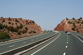
As of November 2016 the total length of Morocco's motorways was 1,808 km (1,123 mi) and 1,093 km (679 mi) expressways. Morocco plans to expand the road network. In the country 3,400 km (2,100 mi) of motorways and 2,100 km (1,300 mi) of expressways are currently under construction in different parts of the country.
In the year 2035 the total length of the motorways will be 5,185 km (3,222 mi) of motorways and 3,700 km (2,300 mi) of expressways. According to the minister of Morocco, this plan also includes a program specific to rural roads for the construction of 30,000 km (19,000 mi) of roads for an investment of 30 billion dirhams.
-
 The first expressway in Morocco - A1 Casablanca–Rabat
 -
 Toll station at Bouznika
 -


Mozambique
[edit]Mozambique's highways are classified as a national or primary road (estrada nacional or estrada primária), or as regional – secondary or tertiary – roads (estradas secundárias and estradas terciárias). National roads are given the prefix "N" or "EN" followed by a one- or two-digit number. The numbers generally increase from the south of the country to the north. Regional roads are given the prefix "R", followed by a three-digit number. Mozambique has over 32,000 kilometres (20,000 mi) of paved roads.
Nigeria
[edit]Nigeria has the largest highway network in West Africa. Although much of the highways are poorly maintained, the Federal Roads Maintenance Agency have drastically improved them. Due to Nigeria's strategic location, four routes of the Trans-African Highway network are situated in the country: the Trans-Sahara Highway to Algeria, the Trans-Sahelian Highway to Dakar, Senegal, the Trans–West African Coastal Highway and the Lagos–Mombasa Highway.
South Africa
[edit]

In South Africa, the term freeway differs from most other parts of the world. A freeway is a road where certain restrictions apply.[84]
The following are forbidden from using a freeway:
- a vehicle drawn by an animal;
- a pedal cycle (such as a bicycle);
- a motorcycle having an engine with a cylinder capacity not exceeding 50 cm3 or that is propelled by electrical power;
- a motor tricycle or motor quadricycle;
- pedestrians
Drivers may not use hand signals on a freeway (except in emergencies) and the minimum speed on a freeway is 60 km/h (37 mph). Drivers in the rightmost lane of multi-carriageway freeways must move to the left if a faster vehicle approaches from behind to overtake.
Despite popular opinion that "freeway" means a road with at least two carriageways, single carriageway freeways exist, as is evidenced by the statement that "[South Africa's] roads include 1,400 km (870 mi) of dual carriageway freeway, 440 km (270 mi) of single carriageway freeway and 5,300 km (3,300 mi) of single carriage main road with unlimited access."[85]
Americas
[edit]
Argentina
[edit]Argentina has a national route system. It is connected to the Pan-American Highway. Argentina has a total of over 82,000 km (51,000 mi) of paved roads.[86]
Brazil
[edit]
Although some 14,000 km (8,700 mi) of Brazilian highway[87] is built to freeway-standard, there is no distinct designation for controlled-access highways in the Brazilian federal and state highway systems. The term autoestrada (Portuguese for "freeway" or "motorway") is not commonly used in Brazil; the terms estrada ("road") and especially rodovia ("highway") are instead preferred. Nevertheless, the most technically advanced freeways in Brazil are defined Class 0 freeways by the National Department of Transport Infrastructure (DNIT). These freeways are built to safely allow for vehicular speeds of up to 130 km/h (81 mph). In mountainous terrain, the maximum allowable gradient is 5%, and the minimum allowable radius of curvature is 665 m (2,182 ft) (with 12% super-elevation).
São Paulo state, with 5,000 km (3,100 mi) of freeway, has the most in the country. It is also the state with more highways conceded to the private sector.
Brazil's first freeway, the Rodovia Anhanguera in São Paulo state, was completed in 1953 as an upgrade of the earlier undivided highway. That same year, construction of the second highway, Rodovia Anchieta, between São Paulo and the Atlantic coast, began. Freeway construction, most of them upgrades of older undivided highways, quickened in the following decades. The current Class 0 freeways include: Rodovia dos Bandeirantes, Rodovia dos Imigrantes, Rodovia Castelo Branco, Rodovia Ayrton Senna/Carvalho Pinto, Rodovia Osvaldo Aranha (also known as "Free-way") and São Paulo's Metropolitan Beltway Rodoanel Mário Covas – all modern, post-1970s highways meeting modern European standards. Other stretches of highway such as the under-construction south BR-101 and Rodovia Régis Bittencourt are of older design standards.
-

-

-
 BR-116 in Ceará


British overseas territories
[edit]
A number of the United Kingdom's overseas territories have controlled-access highways, including the Turks and Caicos Islands and Cayman Islands.
Canada
[edit]
Canada has no current national system for controlled-access highways. All controlled-access freeways, including sections that form part of the Trans-Canada Highway, are under provincial jurisdiction, and have no numeric continuation across provincial boundaries. The largest networks in the country are in Ontario (400-series highways) and Quebec (Autoroutes). Speed limits are not federally set, since provincial governments set speed limits for their respective regions. These roads are influenced by, and have influenced, US standards, but have design innovations and differences. The total length of dual-carriageways with controlled access in Canada is 6,350 km (3,950 mi), of which 564 km (350 mi) are in British Columbia, 642 km (399 mi) in Alberta, 59 km (37 mi) in Saskatchewan, 2,135 km (1,327 mi) in Ontario, 1,941 km (1,206 mi) in Quebec, and 1,000 km (620 mi) in the Maritimes.
El Salvador
[edit]The RN-21 (East–West, Boulevard Monseñor Romero), is the very first freeway to be built in El Salvador and in Central America. The freeway passes the northern area of the city of Santa Tecla, La Libertad. It has a small portion serving Antiguo Cuscatlán, La Libertad, and merges with the RN-5 (East–West, Boulevard de Los Proceres/Autopista del Aeropuerto) in San Salvador. The total length of the RN-21 is 9.35 km (5.81 mi) and is currently working as a traffic reliever in the metropolitan area. Although the RN-21 was to be named in honor of the first mayor of San Salvador, Diego de Holguín, due to political reasons it was renamed Boulevard Monseñor Romero, in honor of Óscar Romero. The first phase of the highway was completed in 2009, and the second phase was completed and opened in November 2012.
Mexico
[edit]

In Mexico, federal highways (Spanish: Carretera Federal) are a series of highways that connect with roads from foreign countries or that link two or more states of the Federation.
-
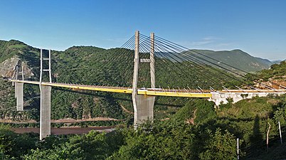 Mezcala Bridge on Highway 95 in Mexico
 -
 Tehuantepec, Baja California
 -
 Mexican Federal Highway 1 Junction in San Ignacio, Baja California Sur
 -
 Eastbound Fed. 2 just outside Altar, Sonora, after a summer rain


United States
[edit]


In the United States, a freeway is defined by the US government's Manual on Uniform Traffic Control Devices as a divided highway with full control of access.[88] This means two things: first, adjoining property owners do not have a legal right of access,[89] meaning all existing driveways must be removed and access to adjacent private lands must be blocked with fences or walls; instead, frontage roads provide access to properties adjacent to a freeway in many places.
Second, traffic on a freeway is "free-flowing". All cross-traffic (and left-turning traffic) is relegated to overpasses or underpasses, so that there are no traffic conflicts on the main line of the highway, which must be regulated by traffic lights, stop signs, or other traffic control devices. Achieving such free flow requires the construction of many overpasses, underpasses, and ramp systems. The advantage of grade-separated interchanges is that freeway drivers can almost always maintain their speed at junctions since they do not need to yield to vehicles crossing perpendicular to mainline traffic.
In contrast, an expressway is defined as a divided highway with partial control of access.[90] Expressways may have driveways and at-grade intersections, though these are usually less numerous than on ordinary arterial roads.
This distinction was apparently[citation needed] first developed in 1949 by the Special Committee on Nomenclature of what is now the American Association of State Highway and Transportation Officials.[91] Prior to that distinction the first freeways were complete in 1940, the Pennsylvania Turnpike and the Arroyo Seco Parkway (Pasadena Freeway).[92]
In turn, the definitions were incorporated into AASHTO's official standards book, the Manual on Uniform Traffic Control Devices, which would become the national standards book of USDOT under a 1966 federal statute. The same distinction has also been codified into the statutory law of eight states: California,[93] Minnesota,[94] Mississippi,[95] Missouri,[96] Nebraska,[97] North Dakota,[98] Ohio,[99] and Wisconsin.[100]
However, each state codified the federal distinction slightly differently. California expressways do not necessarily have to be divided, though they must have at least partial access control. For both terms to apply, in Wisconsin, a divided highway must be at least four lanes wide; and in Missouri, both terms apply only to divided highways at least 16 km (10 mi) long that are not part of the Interstate Highway System. In North Dakota and Mississippi, expressways may have "full or partial" access control and "generally" have grade separations at intersections; a freeway is then defined as an expressway with full access control. Ohio's statute is similar, but instead of the vague word "generally", it imposes a requirement that 50% of an expressway's intersections must be grade-separated for the term to apply.[101] Only Minnesota enacted the exact MUTCD definitions, in May 2008.
The term "expressway" is also used in some areas of the country for what the federal government calls "freeways".[102] Where the terms are distinguished, freeways can be characterized as expressways upgraded to full access control, while not all expressways are freeways.
Examples in the United States of roads that are technically expressways (under the federal definition), but contain the word "freeway" in their names: State Fair Freeway in Kansas, Chino Valley Freeway in California, Rockaway Freeway in New York, and Shenango Valley Freeway (a portion of US 62) in Pennsylvania.
Unlike in some jurisdictions, not all freeways in the US are part of a single national freeway network (although together with non-freeways, they form the National Highway System). For example, many state highways such as California State Route 99 have significant freeway sections. Many sections of the older United States Numbered Highway System have been upgraded to freeways but have kept their existing US Highway numbers.[citation needed]
In Puerto Rico, controlled access highways are named autopista.[103] Autopistas are tolled roads in the island, but toll cabins do exist on other types of roads as well. One of the best known autopistas in Puerto Rico is the Autopista Luis A. Ferré (Luis A. Ferré Expressway), which goes from San Juan, the capital to the north, to Ponce, the island's second largest city, to the south.
-
 I-45 and I-10/US 90 next to Downtown Houston
 -
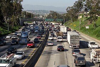 Interstate 5 (I-5) in Los Angeles
 -
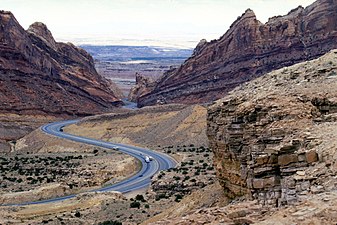 I-70 passes through Spotted Wolf Canyon at the eastern edge of the San Rafael Swell.
 -
 I-90 crossing Lake Washington
 -
 At the Big I in Albuquerque, New Mexico
 -
 Aerial view of I-15 looking south from Sunset Road in the Las Vegas Valley
 -
 Western end of I-10 at the McClure Tunnel in Santa Monica
 -


Asia
[edit]

Afghanistan
[edit]
Many highways of Afghanistan were built in the 1960s with American and Soviet assistance. The Soviets built a road and tunnel through the Salang pass in 1964, connecting northern and eastern Afghanistan. A highway connecting the principal cities of Herat, Kandahar, Ghazni, and Kabul with links to highways in neighboring Pakistan formed the primary highway. The historical Highway 1 currently connects the major cities. Afghanistan has over 42,000 km (26,000 mi) of roads, with 12,000 km (7,500 mi) being paved. The highway infrastructure is currently going through reconstruction and can often be risky due to the instability of the country.
Armenia
[edit]Armenia has about 8,140 km (5,060 mi) of paved roads, of which 96% are asphalted. Armenia is connected to Europe through the International E-road network and Asia through the Asian Highway Network. Armenia is a member of the International Road Transport Union and the TIR Convention.
Azerbaijan
[edit]Azerbaijan has about 29,000 km (18,000 mi) of paved roads; the first paved roads were built during the Russian Empire. The road network, from rural roads to motorways, is today undergoing a rapid modernization with rehabilitations and extensions. For every 1,000 km2 (390 sq mi) of national territory, there are 334 km (208 mi) of roads. Azerbaijan is connected to Europe through the International E-road network and Asia through the Asian Highway Network.
China
[edit]
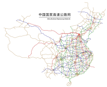
The expressway network of China, with the national-level expressway system officially known as the National Trunk Highway System (Chinese: 中国国家干线公路系统; pinyin: Zhōngguó Guójiā Gànxiàn Gōnglù Xìtǒng; abbreviated as NTHS), is an integrated system of national and provincial-level expressways in China.[104][105]
By the end of 2019, the total length of China's expressway network reached 149,600 km (93,000 mi),[106] the world's largest expressway system by length, having surpassed the overall length of the American Interstate Highway System in 2011.[107] Planned length is 168,478 km (104,687 mi) by 2020.[107]
Expressways in China are a fairly recent addition to a complicated network of roads. According to Chinese government sources, China did not have any expressways before 1988.[108] One of the earliest expressways nationwide was the Jingshi Expressway between Beijing and Shijiazhuang in Hebei province. This expressway now forms part of the Jingzhu Expressway, currently one of the longest expressways nationwide at over 2,000 km (1,200 mi).
-
 The expressway crosses the Yangtze River over the Jiangyin Suspension Bridge
 -
 G106, Jingkai Expressway section in southern Beijing
 -
 G6 expressway at the interchange with the Fifth Ring Road in northern Beijing
 -
 Signs using the new numbering system as seen on China National Expressway 1 in Tianjin


Georgia
[edit]
The road network in Georgia consists of 1,595 km (991 mi) of main or international highways in good condition, of which by 2021 roughly 230 kilometres (140 mi) are controlled-access highway, while further expansion is ongoing. The 7,000 kilometres (4,300 mi) of domestic main roads are of mixed quality, although the conditions are improving. Some 12,400 kilometres (7,700 mi) of local roads are generally in poor condition. Georgia is connected to Europe via the International E-road network and Asia through the Asian Highway Network.
Hong Kong
[edit]
In Hong Kong major motorways are numbered from 1 to 10 in addition to their names. Speed limits on expressways typically range from 70 to 110 km/h (43 to 68 mph).
-
 North Lantau Highway on Lantau Island
 -
 Tolo Highway in Ma Liu Shui
 -
 Fanling Highway in Sheung Shui
 -
 North West Tsing Yi Interchange near Tsing Ma Bridge (Lantau Link)


India
[edit]
Expressways (known as "Gatimarg/गतिमार्ग", or "Speedways" in Hindi and other Indian languages) are the highest class of roads in India's road network and currently make up around 45,890 km (28,510 mi) of the National Highway System, with additional 21,637 km (13,445 mi) under various phases of implementation. They have a minimum of six or eight-lane controlled-access highways where entrance and exit is controlled by the use of slip roads. The expressways are operated and maintained by the Union, through the National Highways Authority of India.
-
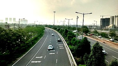
 Section of the Delhi Gurgaon Expressway
 -

-

-
 A section of Noida–Greater Noida Expressway


Indonesia
[edit]


In Indonesia all expressways (Indonesian: Jalan Bebas Hambatan, "obstacle-free road") are tolled, so they are better known as toll road (Jalan Tol). Indonesia has 1,710 km (1,060 mi) expressway length so far, almost 70% of its expressways are in Java island.
In 2009, the Indonesian government had planned to expand more expressway network in Java island by connecting Merak to Banyuwangi which is the total length of Trans-Java toll road including large cities expressway in Java such as Jakarta, Surabaya, Bandung and its complements is more than 1,000 km (620 mi). The Indonesian government also had planned to build the Trans-Sumatra toll road which connects Banda Aceh to Bakauheni spanning 2,700 km (1,700 mi). In 2012, the government allocated 150 trillion rupiah for the construction of the toll roads. There are three stages of construction of Trans-Sumatra toll road which is expected to be connected together in 2025.[109]
The other islands in Indonesia such as Kalimantan, Sulawesi also has begun constructed its expressways including connecting Manado to Makassar in Sulawesi and also Pontianak to Balikpapan in Kalimantan.[110] However, there are still no plans to build an expressway in Western New Guinea due to its slow population growth. Indonesia is expected to have at least 7,000 km (4,300 mi) of expressway in 2030.
Iran
[edit]

The history of freeways in Iran goes back to before the Iranian Revolution. The first freeway in Iran was built at that time, between Tehran and Karaj with additional construction and the studies of many other freeways started as well. Today Iran has about 2,160 km (1,340 mi) of freeway.
Iraq
[edit]
Iraq's network of highways connects it from the inside to neighboring countries such as Syria, Turkey, Kuwait, Saudi Arabia, Jordan and Iran. When Saddam Hussein visited the United States, he was impressed at the highway style and ordered the highways to be built in American form. Freeway 1 is the longest freeway in the country, connecting from Umm Qasr Port in Basra to Ar Rutba in Anbar, spreading to a new freeway connecting it to Syria and Jordan. Iraq has about 45,550 km (28,300 mi) of highways, with 38,400 km (23,900 mi) of them paved.
Israel
[edit]


Controlled-access highways in Israel are designated by a blue color. Blue highways are completely grade-separated but may include bus stops and other elements that may slow down traffic on the right lane. Highway 6 is Israel's longest freeway. It will extend to 260 km (160 mi) in length, from Shlomi in the north to the Negev Junction in the south.[111]
Japan
[edit]


National expressways (高速自動車国道, Kōsoku Jidōsha Kokudō), generally known as 高速道路 (Kōsoku Dōro), make up the majority of controlled-access highways in Japan. The network boasts an uninterrupted link between Aomori Prefecture at the northern part of Honshū and Kagoshima Prefecture at the southern part of Kyūshū, linking Shikoku as well. Additional expressways serve travellers in Hokkaidō and on Okinawa Island, although those are not connected to the Honshū-Kyūshū-Shikoku grid. Expressways have a combined length of 9,429 km (5,859 mi) as of April 2018[update].[112][113][114]
-
 Many Japanese expressways go through the steep mountains.
 -
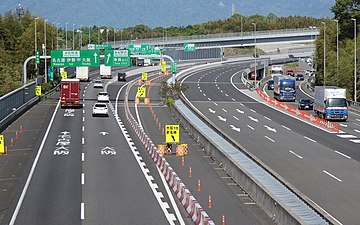 A group of green-colored directional signs on a Japanese expressway
 -
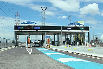 Toll gates are placed at most of the entrances and exits of Japanese expressways.
 -
 Aerial view of Toyota Junction, connecting Tomei Expressway and Ise-Wangan Expressway
 -


Lebanon
[edit]Lebanon has an extensive network of highway that in varying condition throughout the country. Many highways are part of the Arab Mashreq International Road Network. Some highways have been upgraded to 4-lane motorway, including the Beirut-Tripoli highway.
Malaysia
[edit]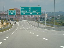

Controlled-access highways in Malaysia are known as expressways (Malay: lebuhraya – this is also the name for highways). However, some expressways, particularly bridges and tunnels such as the Penang Bridge, do not formally use the expressway name; a small number confusingly use the term highway, which is normally the designation for limited-access roads. Route numbers of designated expressways begin with the letter E. All expressways (excluding a section of the South Klang Valley Expressway, which is a two-lane expressway) are built with dual carriageways and at least two lanes in each direction; urban expressways generally have three or more lanes in each direction.
While all expressways are grade separated at major roadways, many urban expressways in the Greater Kuala Lumpur region often have at-grade intersections, including with residential roads and shopfronts, thus do not meet the strict definition of a controlled-access highway. These expressways were previously normal arterial or collector roads that had such intersections, and were not removed when the roads were converted to expressways due to the resulting accessibility and sometimes political issues. Despite this, no expressway allows traffic to cross the median strip (apart from U-turns on a limited number of expressways) and expressways do not have at-grade traffic signals or roundabouts. Expressways have a maximum speed limit of 110 km/h (68 mph), while speed limits of 90 km/h (56 mph) or lower are typical in built-up areas.
As of 2017, expressways have only been designated in Peninsular Malaysia. There are 34 fully or partially open expressways with an approximate total length of 1,821 km (1,132 mi).[115][116] The vast majority of expressways are tolled; the North–South Expressway network, East Coast Expressway and West Coast Expressway predominantly use the ticket system of toll collection, while all other expressways use the barrier system. The construction and operation of expressways in Malaysia are usually privatised via concession agreements with the federal government, using the build–operate–transfer system.
Pakistan
[edit]
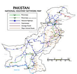

This article needs additional citations for verification. (August 2017) |
The motorways of Pakistan and expressways of Pakistan are a network of multiple-lane, high-speed, limited-access or controlled-access highways in Pakistan, which are owned, maintained and operated federally by Pakistan's National Highway Authority. The total length of Pakistan's motorways and expressways is 1,670 km (1,040 mi) as of November 2016.[117] Around 3,690 km (2,290 mi) of motorways are currently under construction in different parts of the country. Most of these motorway projects will be complete between 2018 and 2020.[118]
Pakistan's motorways are part of Pakistan's National Trade Corridor project that aims to link Pakistan's three Arabian Sea ports of Karachi, Port Qasim and Gwadar to the rest of the country. These would further link with Central Asia and China, as proposed in the China Pakistan Economic Corridor.
Pakistan's first motorway, the M-2, was inaugurated in November 1997; it is a 367-kilometre-long (228 mi), six-lane motorway that links Pakistan's federal capital, Islamabad, with Punjab's provincial capital, Lahore.[119] It is ranked among the world's top five speed highways/motorways. Other completed motorways and expressways are M1 Peshawar–Islamabad Motorway, M4 PindiBhattian–Faisalabad-Multan Motorway, E75 Islamabad-Murree–Kashmir Expressway, M3 Lahore–Multan Motorway, M8 Ratadero–Gawader Motorway, E8 Islamabad Expressway, M5 Multan-Sukkur Motorway, M9 Karachi-Hyderabad, Sindh and few others.[120]
-
 The motorway M-2 passes through the Salt Range mountains.
 -
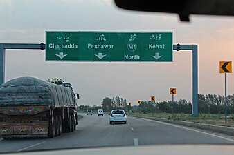 M-1 motorway westbound towards Peshawar
 -
 M-1 Peshawar Toll Plaza
 -
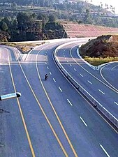
-
 The Makran Coastal Highway (N10) passing through Balochistan


Philippines
[edit]

Full control-access highways in the Philippines are referred to as expressways, which are usually toll roads. The expressway network is concentrated in Luzon, with the North Luzon Expressway and South Luzon Expressway being the most important ones. The expressway network in Luzon do not form an integrated network, but there are ongoing construction projects to interconnect those highways as well as to decongest the existing roads in the areas they serve. Expressways are being introduced to Visayas and Mindanao through the construction of the Cebu–Cordova Link Expressway in Metro Cebu and Davao City Expressway in Davao City.
-
 A portion of North Luzon Expressway in Guiguinto, Bulacan
 -
 South Luzon Expressway in the Philippines


Saudi Arabia
[edit]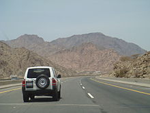
Highways in Saudi Arabia vary from eight-laned roads to small two-lane roads in rural areas. The city highways and other major highways are well maintained, especially the roads in the capital Riyadh. The roads have been constructed to resist the consistently high temperatures and do not reflect the strong sunshine. The other city highways such as the one linking coast to coast are not as great as the inner-city highways but the government is now working on rebuilding those roads. Saudi Arabia is part of the Arab-Mashreq Highway Network and connects to the rest of Asia through the Asian Highway Network.
Singapore
[edit]


The expressways of Singapore are special roads that allow motorists to travel quickly from one urban area to another. All of them are dual carriageways with grade-separated access. They usually have three to four lanes in each direction, although there are two-lane carriageways at many expressway—expressway intersections and five-lane carriageways in some places. There are ten expressways, including the new Marina Coastal Expressway. Studies about the feasibility of additional expressways are ongoing.
Construction on the first expressway, the Pan Island Expressway, started in 1966. As of 2014[update], there are 163 km (101 mi) of expressways in Singapore.[121]
The Singaporean expressway networks are connected with Malaysian expressway networks via Ayer Rajah Expressway (connects with the Second Link Expressway via the Malaysia–Singapore Second Link) and Bukit Timah Expressway (connects with the Eastern Dispersal Link via the Johor–Singapore Causeway).
South Korea
[edit]

Since Gyeongin Expressway linking Seoul and Incheon opened in 1968, national expressway system in South Korea has been expanded into 36 routes, with total length of 4,481 km (2,784 mi) as of 2017. Most of expressways are four-lane roads, while 1,030 km (640 mi) (26%) have six to ten lanes. Speed limit is typically 100 km/h (62 mph) for routes with four or more lanes, while some sections having fewer curves have limit of 110 km/h (68 mph).
Expressways in South Korea were originally numbered in order of construction. Since 24 August 2001, they have been numbered in a scheme somewhat similar to that of the Interstate Highway System in the United States. Furthermore, the symbols of the South Korean highways are similar to the US red, white and blue.
- Arterial routes are designated by two-digit numbers, with north–south routes having odd numbers, and east–west routes having even numbers. Primary routes (i.e. major thoroughfares) have 5 or 0 as their last digit, while secondary routes end in other digits.
- Branch routes have three-digit route numbers, where the first two digits match the route number of an arterial route. This differs from the American system, whose last two digits match the primary route.
- Belt lines have three-digit route numbers where the first digit matches the respective city's postal code. This also differs from American numbering.
- Route numbers in the range 70–99 are not used in South Korea; they are reserved for designations in the event of Korean reunification.
- The Gyeongbu Expressway kept its Route 1 designation, as it is South Korea's first and most important expressway.
-
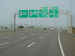 Approaching Seoul from Incheon Airport
 -

-
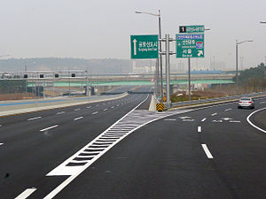 Airport Town Square junction
 -
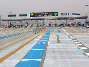 Incheon Bridge Toll Gate


Sri Lanka
[edit]
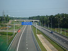

Sri Lanka currently has over 350 km (220 mi) of designated expressways serving the southern part of the country. The first stage of the E01 Expressway (Southern Expressway) which opened in 2011 was Sri Lanka's first expressway spanning a distance of 95.3 km (59.2 mi). The second stage of the Southern Expressway opened in 2014 and extends to Matara. The E03 Expressway (Colombo–Katunayake Expressway) opened in 2013 and connects Sri Lanka's largest city Colombo with the Bandaranaike International Airport covering a distance of 25.8 km (16.0 mi). All E-Grade highways in Sri Lanka are access controlled, toll roads with speeds limits in the range of 80–110 km/h (50–68 mph). The network is to be expanded to 518.5 km (322.2 mi) by 2024.
Operational (fully or partially):
 E01 Kottawa-Hambantota
 E02 Kottawa-Kerawalapitiya
 E03 Colombo-Katunayake
 E04 Enderamulla-Kurunegala-Kandy
 E06 Kahatuduwa-Pelmadulla
Planned:
- Colombo Metropolitan expressway (Colombo Fort to Peliyagoda, connecting Colombo with the E03 expressway (Sri Lanka) Colombo-Katunayaka expressway.)
Syria
[edit]
Syria has a well-developed system of motorways in the western half of the country. As the Eastern part is underpopulated, it only has 2 lanes. Highways have been important in terms of transport for the ongoing civil war. The main motorways are:
- M1 - Runs from Homs to Latakia. It also connects Tartus, Baniyas and Jableh. Its length is 174 km (108 mi).
- M2 - Runs from Damascus to Jdeidat Yabous, on the border with Lebanon. It also connects Al-Sabboura. Its length is 38 km (24 mi).
- M4 - Runs from Latakia to Saraqib. It also connects Arihah and Jisr al-Shughur. Its length is 120 km (75 mi). It continues to the Iraqi border all the way to Mosul.
- M5 - Often describes as the most important highway, it runs through much of the major cities in Syria and runs to the Jordanian border.
Taiwan (Republic of China)
[edit]

Taiwan has an extensive road network that includes two types of controlled-access highway: freeways and expressways. Only cars and trucks are allowed onto freeways, the first of which — Freeway 1 — was completed in 1974. Expressways allow car and truck traffic as well as motorcycles with engines of 250cc or more.
Expressways in Taiwan may be controlled-access highways similar to national freeways or limited-access roads. Most have urban roads and intra-city expressways (as opposed to Highway system) status, although some are built and maintained by cities.
-
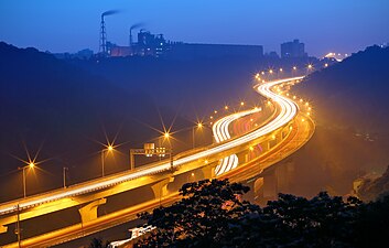
-
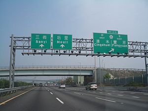 Taichung section
 -
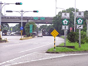 Freeway entrance


Thailand
[edit]

Controlled-access highways in Thailand are separated into urban expressways called expressways, which are operated by the Expressway Authority of Thailand and BEM (except Don Mueang Tollway, which is operated by Don Muang Tollway Public Company Limited) and have a span of 280.4 km (174.2 mi), while intercity expressways are called motorways, which have a span of 187 km (116 mi). The network is to be extended to 4,154.7 km (2,581.6 mi) according to the master plan.
-
 A motorway interchange in Makkasan, Bangkok
 -
 Srinagarindra Interchange head to Rama IX Road


Uzbekistan
[edit]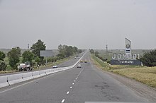
Uzbekistan has 84,400 km (52,400 mi) of roads, about 72,000 km (45,000 mi) of which were paved. Much of the highways are in need of repair, although the condition has been improving. In 2017, the governments of Kazakhstan and Uzbekistan agreed to open a section of the M39 Highway by the Kazakh border.
Vietnam
[edit]

At present, the expressway system of Vietnam is 895 km (556 mi) long. Under the government's plan, the national expressway system will have a total length of 6,411 km (3,984 mi). The expressway system in Vietnam is separate from the national highway system.[122]
Most of the expressways are located in the North, especially around Hanoi. Of the 21 expressways in Vietnam, 8 emanate from Hanoi and 14 are in the north, with a length of 1,368 km (850 mi). The first expressway in Vietnam is the Ho Chi Minh City - Trung Luong Expressway, which is inaugurated and opened for traffic on February 3, 2010.
Currently, most of the expressways in Vietnam are four-lane highways, with some routes like Ha Noi - Haiphong, and Phap Van - Cau Gie being six-lane. The only elevated expressway in Vietnam is Mai Dich - Thanh Tri Bridge (also known as the third beltway in Hanoi). The cost of building Vietnam's highways is one of the most expensive in the world, with an average cost of $12 million per kilometer. Compared with China, where there are similarities, their highway costs only $5 million per kilometer, where in the US and European countries, costs $3–4 million per kilometer.[123]
According to road traffic laws of Vietnam, an expressway is a road for motor vehicles, with a divider separating opposing traffic directions, no at-grade crossings with intersecting roads, fully equipped facilities to ensure continuous traffic flow, safety and short journey times, and access allowed only at interchanges.
-
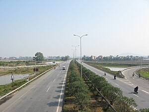 Ha Noi - Bac Giang Expressway in Bac Ninh
 -
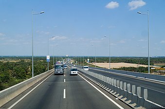 Long Thanh bridge of Ho Chi Minh City - Long Thanh - Dau Giay Expressway
 -
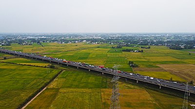 Cho Dem - Ben Luc Viaduct of Ho Chi Minh City - Trung Luong Expressway
 -
 Lien Khuong - Prenn Pass Expressway
 -
 Van Tien bridge of Hai Phong - Mong Cai Expressway


Europe
[edit]Regarding road function, motorways serve exclusively the function of flow. They allow for efficient throughput of, usually long distance, motorized traffic, with unhindered flow of traffic, no traffic signals, at-grade intersections or property access and elimination of conflicts with other directions of traffic, thus, dramatically improving both safety and capacity.[32]
Although roads are under the responsibility of each individual state, including within the European Union, there are some legal conventions (international treaties) and some European directives which give a legal framework for roads of a European importance with the goal to introduce some kind of homogenization between various members. They basically consider, at European level, three types of roads: motorways, express roads, and ordinary roads.[124]
Some European treaties also define aspects such as the range of speed limit, or for some geometric aspects of roads, in particularly for the International E-road network.
According to Eurostat:
A motorway is a road specially designed and built for motor vehicle traffic, which does not directly provide access to the properties bordering on it.
Other characteristics of motorways include:
- two separated carriageways for the opposing directions of traffic, except at special points or, temporarily, due to carriageway repairs etc.;
- carriageways that are not crossed at the level of the carriageway by any other road, railway or tramway track, or footpath; and
- the use of special signposting to indicate the road as a motorway and to exclude specific categories of road vehicles and/ or road users.
In determining the extent of a motorway its entry and exit lanes are included irrespective of the location of the motorway signposts. Urban motorways are also included in this term.
Most of the European countries use the above motorway definition but different national definitions of motorways can be found in some countries.[32]
It is usually[32] considered that:
- Motorways serve exclusively motorised traffic.
- Motorways have separate carriageways for the two directions of traffic.
- Motorways are not crossed at the same level by other roads, footpaths, railways
- Traffic entrance and exit is performed at interchanges only.
- Motorways have no access for traffic between interchanges and do not provide access to adjacent land.
- Motorways are especially sign-posted
Motorways status is signaled at the entry and exit of the motorway by a symbol conforming to international agreements, but specific to each country.[125]
-
 Sweden
 -
 Spain
Spain -
 Germany
 -
 United Kingdom, Ireland
 -
 Switzerland
 -
 France (sometimes used in Portugal)
 -
 Italy and Albania
 -
 Romania
 -
 Slovakia
 -
 Portugal


The peripheral northern and eastern regions of the EU have a lower density motorway network. Within the European Union, there are 26 regions (NUTS level 2) with no motorway network in 2013. Those regions are islands or remote regions, for instance four overseas French regions and Corsica. The Baltic member state of Latvia, as well as four regions from Poland, and two regions from each of Bulgaria and Romania also reported no motorway network; several of these regions bordered onto non-member neighbouring countries to the east of the EU.[126]
European motorways provide reduced accident risks: 50% to 90% lower compared to standard roads, when new motorways only reduce injuries by 7%.[32]
Some of the things which are considered as providing safety in the European motorways are central medians, grade separated interchanges, and access restrictions.[32]
Nonetheless, some specific conditions provide a height risk of a more severe accidents, such as:
- improper use of emergency lane,
- cross-median head-on accidents,
- wrong direction accidents.[32]
Albania
[edit]


Highways in Albania form part of the recent Albanian road system. Following the collapse of communism in 1991, the first highways in Albania started being constructed, The first was SH2, connecting Tirane with Durrës via Vora. Since the 2000s, main roadways have drastically improved, though lacking standards in design and road safety.[127][128] This involved the construction of new roadways and the putting of contemporary signs. However, some state roads continue to deteriorate from lack of maintenance while others remain unfinished.
-
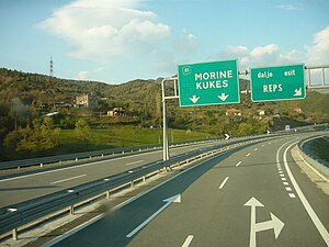 A1 Nation's Highway in Northern Albania connecting Albania with Kosovo
 -
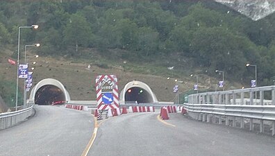 Krraba Tunnel on the A3 Tirana, Elbasan, Albania
 -
 A2 Fier - Vlore known as the Independence Highway


Austria
[edit]


The Austrian autobahns (German: Autobahnen) are controlled-access highways in Austria. They are officially called Bundesstraßen A (Bundesautobahnen) under the authority of the federal government according to the Austrian Federal Road Act (Bundesstraßengesetz),[129] not to be confused with the former Bundesstraßen highways maintained by the Austrian states since 2002.
Austria currently has 18 Autobahnen, since 1982 built and maintained by the self-financed ASFiNAG stock company in Vienna, which is wholly owned by the Austrian republic and earns revenue from road-user charges and tolls. Each route bears a number as well as an official name with local reference, which however is not displayed on road signs. Unusually for European countries, interchanges (between motorways called Knoten, "knots") are numbered by distance in kilometres starting from where the route begins; this arrangement is also used in the Czech Republic, Slovakia, Hungary, Spain, and most provinces of Canada (and in most American states, albeit in miles). The current Austrian Autobahn network has a total length of 1,720 km (1,070 mi).
-
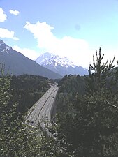 Brenner Autobahn near Innsbruck
 -
 A22 Donauuferautobahn, near the exit Floridsdorfer Brücke


Belgium
[edit]


In 1937, the first motorway between Brussels and Ostend was completed, following the example of neighboring countries such as Germany. It mainly served local industries and tourism as a connection between the capital city and a coastal region. However, the Second World War and the reparation of the complete road network after the war caused a serious delay in the creation of other motorways. In 1949, the first plans were made to build a complete motorway network of 930 km (580 mi) that would be integrated with the neighboring networks. Although the plans were ready, the construction of the motorway network was much slower than in neighboring countries because the project was deemed not to be urgent.
Because of economic growth in the 1960s, more citizens could afford cars, and the call for good-quality roads was higher than ever before. In each year between 1965 and 1973, over 100 km (62 mi) of motorway were built. At the end of the 1970s, the construction of motorways slowed down again due to costs, combined with an economic crisis, more expensive fuel and changing public opinion. In the following years, the only investments done were to complete already started motorway constructions. But most important cities were already connected. In 1981, the responsibilities for construction and maintenance of the motorways shifted from the federal to the regional governments. This sometimes caused tensions between the governments. For example, the part of the ring road around Brussels that crosses Wallonian territory has never been finished, since only Flanders suffers from the unfinished ring.[130]
Belgium today has the longest total motorway length per area unit of any country in the world.[citation needed] Most motorway systems in Belgium have at least three lanes in each direction. Nearly all motorways have overhead lighting including those in rural areas. The dense population of Belgium and the still unfinished state of some motorways, such as the ring roads around Brussels and Antwerp cause major traffic congestion on motorways. On an average Monday morning in 2012, there was a total of 356 km (221 mi)[131] of traffic jams and the longest traffic jam of the year was 1,258 km (782 mi),[132] purely on the motorways.
Bosnia and Herzegovina
[edit]

Bosnia and Herzegovina has more than 208 km (129 mi) of highway, which connects Kakanj-Sarajevo. There is a plan to build highway on Corridor Vc, which will go from river Sava, across Doboj, Sarajevo and Mostar to Adriatic Sea. Next sections are Kakanj-Drivuša 16 km (9.9 mi), Zenica Sjever-Drivuša 11 km (6.8 mi), Svilaj-Odžak 11 km (6.8 mi), Vlakovo-Tarčin 20 km (12 mi), Počitelj-Bijača 21 km (13 mi). The speed limit is 130 km/h (81 mph) or 100 km/h (62 mph) in tunnels.[133]
-

-
 Mahovljanska interchange
 -
 A1 motorway


Bulgaria
[edit]

Legislation in Bulgaria defines two types of highways: motorways (Aвтомагистрала, Avtomagistrala) and expressways (Скоростен път, Skorosten pat). The main differences are that motorways have emergency lanes and the maximum allowed speed limit is 140 km/h (87 mph), while expressways do not have emergency lanes and the speed limit is 120 km/h (75 mph). As of June 2018[update], 777 km (483 mi) of motorways are in service, with another 62 km (39 mi) under various stages of construction. More than 590 km (370 mi) are planned. Also, several expressways are planned.
Croatia
[edit]

The primary high-speed motorways in Croatia are called autoceste (singular: autocesta; Croatian pronunciation: [ˈaʊtotsesta]), and they are defined as roads with at least two lanes in each direction (including hard shoulder) and a speed limit of not less than 80 km/h (50 mph). The typical speed limit is 130 km/h (81 mph). As of 2017, there are 1,313 km (816 mi) of motorways in Croatia. There is also a category known as brza cesta, meaning "expressway". These roads have a speed limit up to 110 km/h (68 mph) and are not legally required to be grade-separated, but nearly all are.
Cyprus
[edit]

Motorways (Greek: αυτοκινητόδρομος, Turkish: Otoyol) connect all cities in Cyprus, although in the territory under de facto Turkish control these do not meet international standards for the definition of motorways. In the areas administered by the Republic of Cyprus, motorway numbers are prefaced with the letter A, and run from A1 to A6, to distinguish them from all other roads, designated B roads. Of the A roads, all are designated motorways, except for the A4, linking Larnaca with Larnaca Airport.
Motorways are also distinguishable by the use of green-backed road signs, with standard international graphics, and text in yellow in Greek and white in English, distinguishable from B road signage, which has signs with blue backgrounds.
Motorway junctions are theoretically designated with junction numbers, but signage is not consistent is indicating the exit numbers.
Czech Republic
[edit]
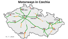

The Czech Republic has currently (2023) 1,363 km (847 mi)[134] of motorways (dálnice) whose speed limit is 130 km/h (81 mph) (or 80 km/h (50 mph) within a town). The total length should be 2,000 km (1,200 mi) around 2030. The number of a motorway (in red) copies the number of the national route (in blue) which has been replaced by the motorway. There are also roads for motorcars (silnice pro motorová vozidla). Those common roads are not subject to a fee (in form of vignette) for vehicles with total weight up to 3.5 t (3.4 long tons; 3.9 short tons) and their speed limit is 110 km/h (68 mph), partially up to 130 km/h (81 mph).
Denmark
[edit]

Denmark has a well covered motorway system today, which has been difficult to build due to the county's geography with many islands. The longest bridges are the Great Belt and the Øresund bridges to Skåne (Scania) in southern Sweden. Both are motorways with dual electrical train tracks added.
Finland
[edit]


Finland has 863 km (536 mi) of motorway, which is only a small proportion of the whole highway network. More than half of the length of the motorway network consists of six radial motorways originating in Helsinki, to Kirkkonummi (Länsiväylä), Turku (Vt1/E18), Tampere (Vt3/E12), Tuusula (Kt45), Heinola (Vt4/E75) and Vaalimaa (Vt7/E18). These roads have a total length of 653 km (406 mi). The other motorways are rather short sections close to the biggest cities, often designed to be bypasses. The motorway section on national roads 4 and 29, between Simo and Tornio, is said to be the northernmost motorway in the world.
Finnish motorways do not have a separate road numbering scheme. Instead, they carry national highway numbers. In addition to signposted motorways, there are also some limited-access two-lane expressways, and other grade-separated four-lane expressways (perhaps the most significant example being Ring III near Helsinki).
-
 Valtatie 1 near Halikko
 -

-


France
[edit]

The autoroute system in France consists largely of toll roads, except around large cities and in parts of the north. It is a network of 11,882 km (7,383 mi) worth of motorways. Autoroute destinations are shown in blue, while destinations reached through a combination of autoroutes are shown with an added autoroute logo. Toll autoroutes are signalled with the word péage (toll).
-
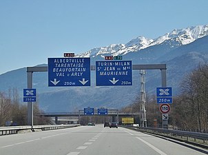 Cross between A430 motorway and A43 motorway
 -
 Toll barrier in Hordain (south of Hordain), on autoroute A2


Germany
[edit]


Germany's network of controlled-access expressways includes all federal Autobahnen and some parts of Bundesstraßen and usually no Landesstraßen (state highways), Kreisstraßen (district highways) nor Gemeindestraßen (municipal highways). The federal Autobahn network has a total length of 13,183 km (8,192 mi) in 2020, making it one of the densest networks in the world. The German autobahns have no general speed limit for some classes of vehicles (though nearly 30% of the total autobahn network is subject to local and/or conditional limits[135]), but the advisory speed limit (Richtgeschwindigkeit) is 130 km/h (81 mph). The lower class expressways usually have speed limits of 120 km/h (75 mph) or lower.
-
 German Motorway (Autobahn) - one of the world's earliest motorways
 -
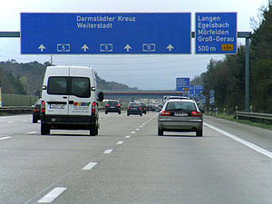 An autobahn with 4 lanes in each direction of travel for 21 km (13 mi). The section between Zeppelinheim and Darmstadt is the oldest Autobahn.
 -
 The A 3 in 1991
 -
 Dynamic traffic signs on an Autobahn


Greece
[edit]

Greece's motorway network has been extensively modernised throughout the 1980s, 1990s and especially the 2000s, while part of it is still under construction. Most of it was completed by mid 2017 numbering around 2,500 km (1,600 mi) of motorways, making it the biggest highway network in Southeastern Europe and the Balkans and one of the most advanced in Europe.[136]
There are a total of 10 main routes throughout the Greek mainland and Crete, from which some feature numerous branches and auxiliary routes. Most important motorways are the A1 Motorway connecting Greece's two largest cities (Athens and Thessaloniki), the A2 motorway (Egnatia Odos), also known as the "horizontal road axis" of Greece, connecting almost all of Northern Greece from west to east and the A8 motorway (Olympia Odos) connecting Athens and Patras. Another important motorway is the A6 motorway (Attiki Odos), the main beltway of the Athens Metropolitan area.


Hungary
[edit]


In Hungary, a controlled-access highway is called an autópálya (plural autópályák).
-
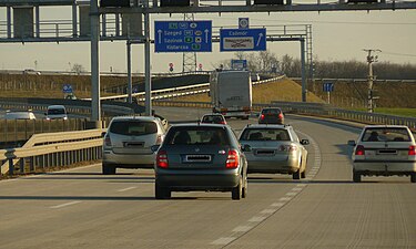 Eastern section of M0
 -
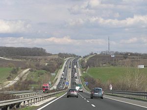
-
 M7 motorway in Köröshegyi völgyhíd
 -
 M1 - M7 common phase, near Budapest


Ireland
[edit]

In Ireland the Local Government (Roads and Motorways) Act 1974 made motorways possible, although the first section, the M7 Naas Bypass, did not open until 1983. The first section of the M50 opened in 1990, a part of which was Ireland's first toll motorway, the West-Link. However it would be the 1990s before substantial sections of motorway were opened in Ireland, with the first completed motorway—the 83-kilometre (52 mi) M1 motorway—being finished in 2005.
Under the Transport 21 infrastructural plan,[137] motorways or high quality dual carriageways were built between Dublin and the major cities of Cork, Galway, Limerick and Waterford by the end of 2010. Other shorter sections of motorway either have been or will be built on some other main routes. In 2007 legislation (the Roads Bill 2007) was created to allow existing roads be designated motorways by order because previously legislation allowed only for newly built roads to be designated motorways.
As a result, most HQDCs nationwide (other than some sections near Dublin on the N4 and N7, which did not fully meet motorway standards) were reclassified as motorways. The first stage in this process occurred when all the HQDC schemes open or under construction on the N7 and N8, and between Kinnegad and Athlone on the N6 and Kilcullen and south of Carlow on the N9, were reclassified motorway on 24 September 2008. Further sections of dual carriageway were reclassified in 2009.
As of December 2011, the Republic of Ireland has around 1,017 km (632 mi) of motorways.
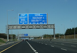

Italy
[edit]


The world's first motorway was the Autostrada dei laghi, inaugurated on 21 September 1924 in Italy. It linked Milan to Varese; it was then extended to Como, near the border with Switzerland, inaugurated on 28 June 1925. Piero Puricelli, the engineer who designed this new type of road, decided to cover the expenses by introducing a toll.[138][139]
Other motorways (or autostrade) built before World War II in Italy were Naples-Pompeii, Florence-Pisa, Padua-Venice, Milan-Turin, Milan-Bergamo-Brescia and Rome-Ostia. The total length of the Italian motorway system is about 7,016 kilometres (4,360 mi), as of 30 July 2022.[140] To these data are added 13 motorway spur routes, which extend for 355 kilometres (221 mi).[141] The density is 22.4 kilometres (13.9 mi) of motorway for every 1,000 square kilometres (390 sq mi) of Italian territory.[142]
Italian motorways (or autostrade) are mostly managed by concessionaire companies. From 1 October 2012 the granting body is the Ministry of Infrastructure and Transport and no longer Anas[143] and the majority (5,773.4 kilometres (3,587.4 mi) in 2009[144]) are subject to toll payments. On Italian motorways, the toll applies to almost all motorways not managed by Anas. The collection of motorway tolls, from a tariff point of view, is managed mainly in two ways: either through the "closed motorway system" (km travelled) or through the "open motorway system" (flat-rate toll).[145]
Italy's motorways (or autostrade) have a standard speed limit of 130 km/h (80 mph) for cars. Limits for other vehicles (or when visibility is poor due to weather) are lower. Legal provisions allow operators to set the limit to 150 km/h (95 mph) on their concessions on a voluntary basis if there are three lanes in each direction and a working SICVE, or Safety Tutor, which is a speed-camera system that measures the average speed over a given distance.
Type B highway (Italian: strada extraurbana principale), commonly but unofficially known as superstrada (Italian equivalent for expressway), is a divided highway with at least two lanes in each direction, paved shoulder on the right, no cross-traffic and no at-grade intersections. Access restrictions on such highways are exactly the same as motorways (or autostrade). The signage at the beginning and the end of the strade extraurbane principali is the same, except the background colour is blue instead of green. The general speed limit on strade extraurbane principali is 110 km/h (70 mph), unless otherwise indicated. Strade extraurbane principali are not tolled.
-

-

-

-
 Autostrada A22 runs through Po Valley and Alps linking Modena to Brenner Pass, a mountain pass which forms the border between Italy and Austria
 -

-


Lithuania
[edit]

There are two categories of controlled-access highways in Lithuania: expressways (Lithuanian: greitkeliai) with maximum speed 120 km/h (75 mph) and motorways (Lithuanian: automagistralės) with maximum speed 130 km/h (81 mph). The first section Vilnius–Kaunas of A1 highway was completed in 1970. Kaunas–Klaipėda section of A1 was completed in 1987.[146] Vilnius-Panevėžys (A2 highway) was completed in stages during the 1980s and finished in the 1990s. Complete length of the motorway network is 310 km (190 mi). Expressway network length - 80 km (50 mi). Motorway section between Kaunas and the Polish border is planned to be completed in the 2020s.
-
 A1 motorway near Kaunas
 -
 A2 motorway near Taujėnai
 -
 Motorway junction with U-turns. A2 motorway near Raguva.


Netherlands
[edit]

Roads in the Netherlands include at least 2,758 km (1,714 mi) of motorways and expressways,[147] and with a motorway density of 64 kilometres per 1,000 km2 (103 mi/1,000 mi2), the country has one of the densest motorway networks in the world.[148] About 2,500 km (1,600 mi) are fully constructed to motorway standards,[149] These are called Autosnelweg or simply snelweg, and numbered and signposted with an A and up to three digits, like A12.
They are consistently built with at least two carriageways, guard rails and interchanges with grade separation. Since September 2012, the nationwide maximum speed has been raised to 130 km/h (81 mph), but on many stretches speed is still limited to 120 or 100 km/h (75 or 62 mph). Dutch motorways may only be used by motor vehicles both capable and legally allowed to go at least 60 km/h (37 mph).
In March 2020, the general speed limit on Dutch motorways was lowered to 100 km/h (62 mph) during the day (6 am until 7 pm). At night, the maximum speed is different per stretch, but 130 km/h (81 mph) remained the upper limit.
Dutch roads are used with a very high intensity in relation to the network length[148] and traffic congestion is common, due to the country's high population density. Therefore, since 1979 large portions of the motorway network have been equipped with variable message signs and dynamic electronic displays, both of which are aspects of intelligent transportation systems. These signs can show a lower speed limit, as low as 50 km/h (31 mph), to optimize the flow of heavy traffic, and a variety of other communications. Additionally there are peak, rushhour or plus lanes, which allow motorists to use the hard shoulder as an extra traffic lane in case of congestion. These extra lanes are observed by CCTV cameras from a traffic control center.
Less common, but increasingly, separate roadways are created for local/regional traffic and long-distance traffic. This way the number of weaving motions across lanes is reduced, and the traffic capacity per lane of the road is optimised. A special feature of Dutch motorways is the use of Porous Asphalt Concrete, which allows water to drain efficiently, and even in heavy rain no water will splash up, in contrast to concrete or other road surfaces. The Netherlands is the only country that uses PAC this extensively, and the goal is to cover 100% of the motorways with PAC, in spite of the high costs of construction and maintenance. All in all the Netherlands has one of the more advanced motorway networks in the world.
-
 Local and express lanes connected using a basketweave
 -
 Dynamic Route Information Panel (DRIP) on Dutch A13 freeway during evening rush hour


North Macedonia
[edit]

The total motorway network length in North Macedonia is 317 km (197 mi) as of Spring 2019. Another 70 km (43 mi) are under construction, 57 km (35 mi) (Ohrid to Kicevo) and 13 km (8.1 mi) (Skopje to Kosovo border). The stretch from Gostivar to Kicevo is planned to start with construction in 2021. The three motorway routes are A1, which is part of the European corridor E-75, A2 (part of E-65) and the recently built A4 corridor that connects Skopje to Stip. A1 connects the northern border (Serbia) with the southern one (Greece), while A2 traverses the country from the East (Bulgaria border) to West (Albania border), but only the stretch from Kumanovo to Gostivar is a divided motorway, while the rest of the length is either an undivided two-way road or in the process of turning into a motorway.[150]
Norway
[edit]This section needs expansion. You can help by adding to it. (May 2023) |

Norway has (2022) 770 km (480 mi) of motorways, in addition to 498 km (309 mi) of limited-access roads (in Norwegian motortrafikkvei) where pedestrians, bicycles, etc. are forbidden, though with a bit lower standard than true motorway. Most of the network serves the big cities, chiefly Oslo, Stavanger and Bergen. Northernmost motorway is, as of 2022, on E6 just south of Trondheim: see also the E6, E18 and the E39. Most motorways use four-ramp Dumbbell interchanges, but also Roundabout interchanges can be found. The first motorway was built in 1964, just outside Oslo. The motorways' road pattern layout is similar to those in the United States and Canada, featuring a yellow stripe towards the median, and white stripes between the lanes and on the edge. The speed limits are 90–110 km/h (56–68 mph).
Poland
[edit]


The highways in Poland are divided into motorways and expressways, both types featuring grade-separated interchanges with all other roads, emergency lanes, feeder lanes, wildlife protection measures and dedicated roadside rest areas. Motorways can be only dual carriageways, while expressways can be dual or, rarely, single carriageways. The start of an expressway in Poland is marked with a sign of white car on blue background, while number sign for an expressway is of red background and white letters, with the letter S preceding a number. Speed limits in Poland are 140 km/h (87 mph) on motorways and 120 km/h (75 mph) on dual-carriageway expressways.
The Regulation of the Council of Ministers defines the network of motorways and expressways in Poland totalling about 7,980 km (4,960 mi) (including about 2,100 km (1,300 mi) of motorways).[151]
As of July 2022, there are 4,688 km (2,913 mi) of motorways and expressways in operation (58% of the intended network), while contracts for construction of further 1,170 km (727 mi) of motorways and expressways (15% of the intended network) are ongoing.[152]
-
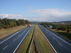 A4 near Zalas, opened in 1983
 -

-

-
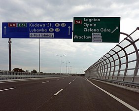 Wrocław Stadion junction
 -
 Expressway S5 near Bydgoszcz


Portugal
[edit]

Portugal was the third country in Europe—after Italy and Germany—to build a motorway (Portuguese: autoestrada, plural: autoestradas), opening, in 1944, the Lisbon-Estádio Nacional section of the present A5 (Autoestrada da Costa do Estoril).[153]
Additional motorway sections were built in the 1960s, 1970s and early 1980s. However, the large-scale building of motorways started only in the late 1980s. Currently, Portugal has a very well-developed network of motorways, with about a 3,000-kilometre (1,900 mi) extension, that connects all the highly populated coastal regions of the country and the main cities of the less populous interior. This means that 87% of the Portuguese population lives at less than 15 minutes' driving time from a motorway access.[154]
Unlike the neighbouring Spanish network, most of Portuguese motorways are tolled, although there are also some non-tolled highways, mostly in urban areas, like those of Greater Lisbon and Greater Oporto. In the late 1990s and early 2000s, the Government of Portugal created seven shadow toll concessions, the SCUT toll (Sem custos para o utilizador, no costs for the user). In those concessions it were included more than 900 km (560 mi) of motorways and highways, some of them already built, others which were built in the following years. However, due to economical and political reasons, the shadow toll concept was abolished between 2010 and 2011, with electronic toll equipment being installed in these motorways, to charge their users. Having only electronic tolls, former SCUT motorways can now only be used by vehicles equipped with electronic payment devices or vehicles registered in the system.
Portuguese motorways form an independent network (Rede Nacional de Autoestradas, National Motorway Network), that overlaps with the Fundamental and Complementary subnetworks of the National Highway Network (Rede Rodoviária Nacional). Each motorway section overlapping with the Fundamental subnetwork is part of an IP (Itinerário principal, Principal route) and each motorway section overlapping with the Complementary subnetwork is part of an IC (Itinerário complementar, Complementary route). Thus, a motorway can overlap with sections of different IP or IC routes and - on the other hand - an IP or IC route can overlap with sections of different motorways. An example is A22 motorway, which overlaps with sections of IP1 and of IC4 routes; another example is IP1 route, which overlaps with sections of the A22, A2, A12, A1 and A3 motorways.
The National Motorway Network has a proper numbering system in which each motorway has a number prefixed by the letter "A". In most cases, a motorway signage indicates only its A number. The number of the IP or IC of which a motorway section is a part is not signed except in some short motorways which lack a proper A number.
-
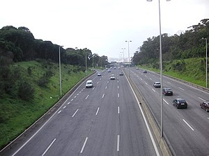 A5 (Lisbon-Cascais) motorway, inaugurated in 1944 as the first motorway in Portugal
 -
 A1 (Lisbon-Oporto) motorway, the main road link between the two largest cities of the country
 -
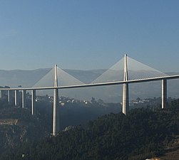 Corgo viaduct, part of the A4 (Oporto-Bragança) motorway
 -
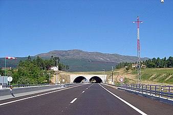 Tunnel at the A27 (Ponte de Lima-Viana do Castelo) motorway


Romania
[edit]
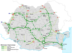

As of 31 July 2024, Romania has 1,115 km (693 mi) of highways in use, with more under construction.[155]
The first motorway in Romania was completed in 1972, linking Bucharest and Pitești.[156] The Romanian Government has adopted a General Master Plan for Transport that was approved by the European Union in July 2015, containing the strategy for expanding the road (including motorway) network until 2040, using EU funding.[157]
-
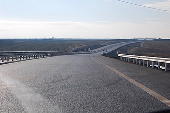 A1 motorway between Arad and Timișoara
 -
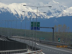 A1 motorway near Sibiu
 -
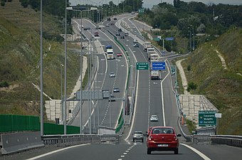 A2 motorway near Cernavodă interchange
 -
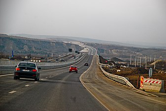 A3 motorway between Gilău and Turda
 -
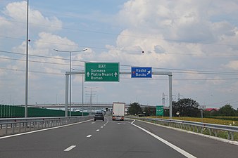 A7 motorway near Bacău Bypass
 -
 A10 motorway and the hills of Transilvania


Serbia
[edit]
Motorways (Serbian: Аутопут, romanized: Autoput) and expressways (Serbian: Брзи пут, romanized: Brzi put) are the backbone of the road system in Serbia. There are around 906 km (563 mi) of motorways in total. Plan is 1,200 km (750 mi) by the end of 2018.
Motorways in Serbia have three lanes (including emergency lane) in each direction, signs are white-on-green, as in the rest of former Yugoslavia and the normal speed limit is 130 km/h (81 mph).
Expressways, unlike motorways, do not have emergency lanes, signs are white-on-blue and the normal speed limit is 100 km/h (62 mph).
As the Serbian word for motorway is autoput, the "A1", "A2" or "A3" road designations are used since November 2013.[158] All state roads categorized as class I, that are motorways currently of in the future, are marked with one-digit numbers and known as class Ia. All other roads, which belong to class I, are marked with two-digit numbers and known as class Ib. Expressways belong to class Ib, too. E-numeration is also widely used on motorways.
The core of the motorways is what was once called during Yugoslav period, the Brotherhood and Unity Highway, which was opened in 1950 and goes from the border with Croatia, through Belgrade, Central Serbia, Niš, and to border with North Macedonia. It was one of the first modern highways in Central-Eastern Europe. It is the most direct link between Central and Western Europe with Greece and Turkey, and subsequently the Middle-East.
-
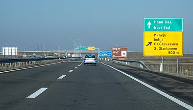
-
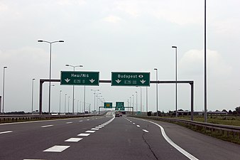
-
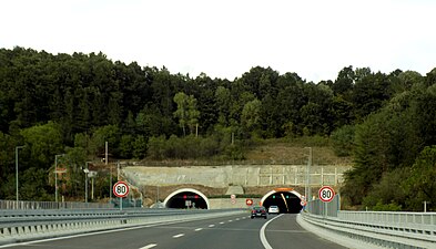 Motorway A2, Tunnel Savinac


Slovakia
[edit]

Slovakia has currently (2022) 854 km (531 mi) of motorways (Slovak: diaľnica, D) and expressways (rýchlostná cesta, R) whose speed limit is 130 km/h (81 mph).They are split into expressways and motorways like Poland with expressways starting with a R, short for "rýchlostná cesta", but from April 2020 all the expressways in Slovakia were known as motorways due to that the expressways are very similar to the motorways in Slovakia. You also pay a e-vignette to use the motorways in Slovakia. Before you used to pay a sticker vignette but from 2016 you pay electronically through the website.

-
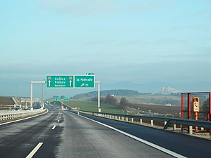
-
 Považský Chlmec Tunnel on D3 before opening
 -
 View of the High Tatras from the D1 near Poprad
 -
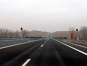
-
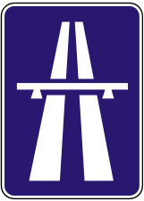 Old sign for motorways
 -
 Old sign for expressways
 -

-
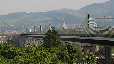 The Považská Bystrica viaduct


Slovenia
[edit]


The highways in Slovenia are the central state roads in Slovenia and are divided into motorways (Slovene: avtocesta, AC) and expressways (hitra cesta, HC). Motorways are dual carriageways with a speed limit of 130 km/h (81 mph). They have white-on-green road signs as in Italy, Croatia and other countries nearby. Expressways are secondary roads, also dual carriageways, but without an emergency lane. They have a speed limit of 110 km/h (68 mph) and have white-on-blue road signs.
-

-
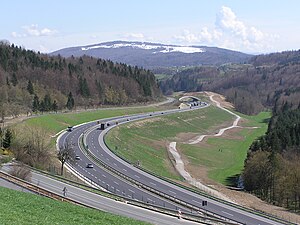 The Medvedjek Slope on the eastern part of the A2 (Lower Carniola)
 -
 The toll station at Log pri Brezovici
 -
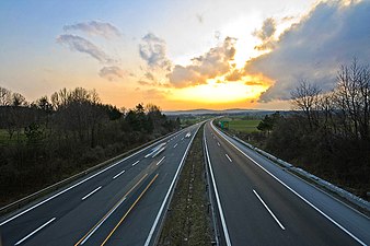 A1 near Postojna


Spain
[edit]


The Spanish network of autopistas and autovias has a length of 17,228 km (10,705 mi), making it the largest in Europe and the third in the world.[159] Autopistas are specifically reserved for automobile travel, so all vehicles not able to sustain at least 60 km/h (37 mph) are banned from them. General speed limits are mandated by the Spanish Traffic Law as 60–120 km/h (37–75 mph). Specific limits may be imposed based on road, meteorological or traffic conditions. Spanish legislation requires an alternate route to be provided for slower vehicles. Many, but not all, autopistas are toll roads, which also mandates an alternate toll-free route under the Spanish laws.
-
 The M-40 autopista (motorway) is one of the beltways serving Madrid. It is one of the few non-toll autopistas of significant length.
 -

-
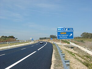 Modern autovías (expressway) such as the A-66 near Guillena, Seville, offer most, if not all, features that are required by an autopista (motorway).


Sweden
[edit]This section needs to be updated. (May 2023) |


Sweden has the largest motorway network in Scandinavia (2,050 kilometres, 1,274 mi).[160] It is, however, unevenly allocated. Most motorways are located in the south of the country, where the population density is the highest.
The first motorway in Sweden opened in 1953, between Lund and Malmö. Four-lane expressways had been built before, an early example is E20 between Gothenburg and Alingsås, built in the early 1940s. Most of the current network was built in the 1970s and 1990s.
E6 starts i Trelleborg in southern Sweden, it then continues along the Swedish western coast, up to the Svinesund bridge which is where Sweden borders to Norway. Its length is close to 600 km (370 mi) on Swedish territory alone, and it connects four of Scandinavia's six largest cities, Copenhagen, Malmö, Gothenburg and Oslo together,[161][162][163] as well as around 20 other more or less notable towns and cities.
A Swedish (partly motorway) route (rather than road) that also has a significant portion of the Swedish motorway network, is European route E4, which runs from the border city of Tornio in northern Finland to Helsingborg in southern Sweden. E4 is the main route that connects the capital Stockholm with Scania. All of E4 south of the city Gävle is of motorway standard, with only the part passing Ljungby (32 kilometres, 20 mi) left, currently in expressway standard. Upgrade to motorway standard will start in 2017.[164] The part of E4 that runs through western Stockholm is called Essingeleden and is the busiest road in Sweden.
Other highways that have a significant portion of motorway standard are E20, E18 and E22. Motorways in Sweden are however not restricted to European routes; so called Riksvägar and other regional road types can also be of motorway standard. An example of this is Riksväg 40. Riksväg 40 is the main link between the largest cities in the country, Stockholm and Gothenburg. Notably, not even the majority of the European route- network in Sweden is motorway or even have expressway standard. All of this is because road numbering and road standard is separate in Sweden, as in the rest of Scandinavia.
-
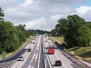 E22 Motorway westbound towards Karlskrona
 -
 The Södra länken Rv-75 ring road in Stockholm


Switzerland
[edit]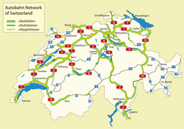

Switzerland has a two-class highway system: motorways with separated roads for oncoming traffic and a standard maximal speed limit of 120 km/h (75 mph), and expressways often with oncoming traffic and a standard maximal speed limit of 100 km/h (62 mph).
In Switzerland as of April 2011, there were 1,763.6 kilometres (1,095.9 mi) of a planned 1,893.5 kilometres (1,176.6 mi) of motorway completed. The country is mountainous with a high proportion of tunnels: there are 220 totaling 200 kilometres (120 mi), which is over 12% of the total motorway length.[165]
-
 Autobahn A2 near the northern portal of the Gotthard tunnel
 -

-
 Autobahn A1/A3 near Birrfeld


Turkey
[edit]


Motorways (Turkish: Otoyol) of Turkey are a network in constant development. All motorways (O coded), except beltways, are toll roads (using only RFID methods for the roads that operated by KGM; cash and credit card payment is also possible for the roads that operated by private companies), mostly six lanes wide, illuminated and with 130 or 140 km/h (81 or 87 mph) speed limit. As of 2024, total length of the motorways is 3,726 km (2,315 mi) long in total.[166]


United Kingdom
[edit]

Great Britain
[edit]
A map Showing Future Pattern of Principal National Routes was issued by the Ministry of War Transport in 1946[167] shortly before the law that allowed roads to be restricted to specified classes of vehicle (the Special Roads Act 1949) was passed.[168] The first section of motorway, the M6 Preston Bypass, opened in 1958[169] followed by the first major section of motorway (the M1 between Crick and Berrygrove in Watford), which opened in 1959.[169] From then until the 1980s, motorways opened at frequent intervals;[170] by 1972 the first 1,600 km (1,000 mi) of motorway had been built.[171]
Whilst roads outside of urban areas continued to be built throughout the 1970s, opposition to urban routes became more pronounced. Most notably, plans by the Greater London Council for a series of ringways were cancelled following extensive road protests and a rise in costs.[172][unreliable source] In 1986 the single-ring, M25 motorway was completed as a compromise.[173] In 1996 the total length of motorways reached 3,200 kilometres (2,000 mi).[174]
Motorways in Great Britain, as in numerous European countries, will nearly always have the following characteristics:
- No traffic lights (except occasionally on slip roads before reaching the main carriageway).
- Exit is nearly always via a numbered junction and slip road, with rare minor exceptions.
- Pedestrians, cyclists and vehicles below a specified engine size are banned.
- There is a central reservation separating traffic flowing in opposing directions (the only exception to this is the A38(M) in Birmingham where the central reservation is replaced by another lane in which the direction of traffic changes depending on the time of day. There was another small spur motorway near Manchester with no solid central reservation, but this was declassified as a motorway in the 2000s.)
- No roundabouts on the main carriageway. (This is only the case on motorways beginning with M (so called M class)). In the case of upgraded A roads with numbers ending with M (i.e. Ax(M)), roundabouts may exist on the main carriageway where they intersect 'M' class motorways. In all M class motorways bar two, there are no roundabouts except at the point at which the motorway ends or the motorway designation ends. The only exceptions to this in Great Britain are:
- the M271 in Southampton which has a roundabout on the main carriageway where it meets the M27, but then continues as the M271 after the junction.
- on the M60. This came about as a result of renumbering sections of the M62 and M66 motorways near Manchester as the M60, to form a ring around the city. What was formerly the junction between the M62 and M66 now involves the clockwise M60 negotiating a roundabout, while traffic for the eastbound M62 and northbound M66 carries straight on from the M60. This junction, known as Simister Island, has also been criticised for the presence of a roundabout and the numbered route turning off.[175][unreliable source]
- the A1(M) between the M62 in North Yorkshire and Washington in Tyne and Wear is built to full 'M' class standards without any roundabouts.
- the A74(M) between Gretna and Abingdon in Scotland is similarly built to full 'M' class standards with no roundabouts.
On motorways in Great Britain there were 99 fatalities in 2017 for 69 billion vehicle miles travelled, a reduction from 183 fatalities in 2007.[176] which is equivalent to 1.43 fatalities per billion vehicle miles traveled.
Northern Ireland
[edit]Legal authority existed in the Special Roads Act (Northern Ireland) 1963 similar to that in the 1949 Act.[177] The first motorway to open was the M1 motorway, though it did so under temporary powers until the Special Roads Act had been passed.[178] Work on the motorways continued until the 1970s when the oil crisis and The Troubles both intervened causing the abandonment of many schemes.[179]
Oceania
[edit]Australia
[edit]

Australia's major cities, Sydney, Melbourne, Brisbane and Perth, feature a network of freeways within their urban areas, while Canberra, Adelaide, Hobart and the regional centres of Newcastle, Geelong, Gold Coast and Wollongong feature a selection of limited-access routes. Outside these areas traffic volumes do not generally demand freeway-standard access, although heavily trafficked regional corridors such as Sydney–Newcastle (M1 Pacific Motorway (F3)), Sydney–Wollongong (M1 Princes Motorway (F6)), Brisbane–Gold Coast (M1 Pacific Motorway), Melbourne–Geelong (M1 Princes Freeway), Perth-Mandurah (SR2 Kwinana Freeway) and that form part of major long-distance routes feature high-standard freeway links.
The M31 Hume Highway/Freeway/Motorway connecting Sydney and Melbourne, the M23 Federal Highway spur route that connects Canberra with Sydney and the A1/M1 Pacific Highway/Motorway connecting Sydney and Brisbane are the only major interstate highways that are completed to a continuous dual carriageway standard. There are also plans to upgrade the A25 Barton Highway, another spur off the M31 that connects Canberra with Melbourne, to a dual carriageway highway. Although these inter-city highways are dual carriageway they are not all controlled access highways. Some of these inter-city highways have driveways to adjacent property and at-grade junctions with smaller roads.
Unlike many other countries, some of Australia's freeways are being opened to cyclists. As the respective state governments upgrade their state's freeways, bicycle lanes are being added and/or shoulders widened alongside the freeways. The state of Queensland is an exception however, as cyclists are banned from all freeways, including the breakdown lane.
Motorways referred to as an expressway in Australia include the Hunter Expressway, which connects the Hunter Valley with Newcastle, and the Southern Expressway, which connects Adelaide's outer southern suburbs to the southwestern suburbs.
-
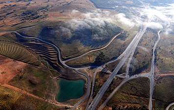 Aerial view of Tuggeranong Parkway in the Australian Capital Territory
 -
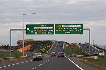 Deer Park Bypass on the Western Freeway
 -
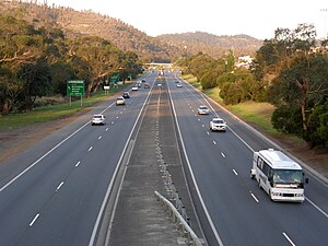 The Tasman Highway in Tasmania
 -


New Zealand
[edit]

The term motorway in New Zealand encompasses multilane divided freeways as well as narrower two- to four-lane undivided expressways with varying degrees of grade separation; the term motorway describes the legal traffic restrictions rather than the type of road.[180]
New Zealand's motorway network is small due to the nation's low population density and low traffic volumes making it uneconomical to build controlled-access highways outside the major urban centres.
New Zealand's first motorway opened in December 1950 near Wellington, running from Johnsonville to Tawa. This five-kilometre (3.1 mi) motorway now forms the southern part of the Johnsonville-Porirua Motorway and part of State Highway 1.[181] Auckland's first stretch of motorway was opened in 1953 between Ellerslie and Mount Wellington (between present-day exit 435 and exit 438), and now forms part of the Southern Motorway.[182]
Most major urban areas in New Zealand feature limited-access highways. Auckland, Wellington, Christchurch, Hamilton, Tauranga, and Dunedin contain motorways, with only Auckland having a substantial motorway network.
See also
[edit]Notes
[edit]- ^ Used in the western part of the United States, parts of Australia, parts of Canada, and South Africa.
- ^ Used in the United Kingdom, Hong Kong, Ireland, Pakistan, New Zealand, and parts of Australia.
- ^ Used in parts of the United States, parts of Canada, Australia, China, India, Japan, the Philippines, South Korea, and an official term in the UK and Hong Kong. In some parts of the United States, this also designates a type of limited-access road of lower class than a freeway. In the UK it officially refers to main roads of a lower class than a motorway.[1]
- ^ Columbia Guide to Standard American English: "Thruway is the Standard spelling of the word meaning a 'high-speed, limited access, multiple-lane highway. [...] Throughway is a variant."
- ^ Portions of the Downtown Connector in Atlanta, Georgia, have eight lanes in each direction.
References
[edit]- ^ Department for Transport. Road Investment Strategy: Strategic Vision (PDF). gov.uk (Report). p. 48.
- ^ Jump up to: a b Jost, Graziella & Pogorelov, Evgueni (19 February 2008). "Fate of EU Motorway Safety in Hands of MEPs" (PDF) (Press release). European Transport Safety Council. Archived (PDF) from the original on 8 April 2014. Retrieved 7 April 2014.
- ^ Jump up to: a b c Lenarduzzi, Thea (30 January 2016). "The motorway that built Italy: Piero Puricelli's masterpiece". The Independent. Retrieved 12 May 2022.
- ^ Jump up to: a b c d "The "Milano-Laghi" by Piero Puricelli, the first motorway in the world". Retrieved 10 May 2022.
- ^ "Avus highway | German expressway | Britannica".
- ^ "Convention on Road Signs and Signals, Done at Vienna on 8 November 1968" (PDF). Archived from the original (PDF) on 4 March 2016. Retrieved 13 May 2016.
- ^ "Glossary of Statistical Terms". OECD. 26 February 2004. Archived from the original on 10 August 2011. Retrieved 3 September 2009.
- ^ Dictionary: PIARC Road Dictionary/ English
- ^ Jump up to: a b "COMMON ACCIDENT DATA SET: Reference Guide" (PDF). Ec.europa.eu. Version. 3.4. April 2015. Archived from the original (PDF) on 4 June 2016. Retrieved 18 July 2017.
- ^ Elvik, Vaa, 2004[full citation needed]
- ^ Eurostat / UNECE / ECMT, 2003[full citation needed]
- ^ NTUA, 2005[full citation needed]
- ^ https://www.stadtmuseum.de/en/article/the-avus [bare URL]
- ^ "AVUS Berlin: A most remarkable street circuit". 28 June 2018.
- ^ "AVUS 100: EIN RASANTES JAHRHUNDERT - by Schulz Ulf, Wedemeyer Sven".
- ^ "AVUS-Tribüne (Automobile Traffic and Practice Road)".
- ^ "Avus highway | German expressway | Britannica".
- ^ Schütz, Erhard; Gruber, Eckhard (1996). Mythos Reichsautobahn: Bau und Inszenierung der 'Straßen des Führers' 1933–1941 (in German). Berlin: Links. pp. 31–32. ISBN 978-386153117-3.
- ^ Kunze, Thomas; Stommer, Rainer (1982). "Geschichte der Reichsautobahn". In Stommer, Rainer; Philipp, Claudia Gabriele (eds.). Reichsautobahn: Pyramiden des Dritten Reichs. Analysen zur Ästhetik eines unbewältigten Mythos (in German). Marburg: Jonas. pp. 22–47. ISBN 9783922561125.
- ^ "Autobahn History - German-Autobahn.eu".
- ^ Patton, Phil (9 October 2008). "A 100-Year-Old Dream: A Road Just for Cars". The New York Times.
- ^ "Built to Meander, Parkway Fights to Keep Measured Pace". The New York Times. 6 June 1995. Archived from the original on 14 May 2013. Retrieved 13 April 2010.
- ^ Hershenson, Roberta (18 June 1995). "Bronx River Parkway on an Endangered List". The New York Times. Archived from the original on 14 May 2013. Retrieved 13 April 2010.
- ^ "German Myth 8: Hitler and the Autobahn". German.about.com. Archived from the original on 8 May 2006.
- ^ "Autobahn | High-Speed, Safety, Efficiency | Britannica".
- ^ Shragge, John & Bagnato, Sharon (1984). From Footpaths to Freeways. Ontario Ministry of Transportation and Communications, Historical Committee. p. 55. ISBN 978-0-7743-9388-1.
- ^ Jump up to: a b c d Bassett, Edward M. (February 1930). "The Freeway: A New Kind of Thoroughfare". American City. 42: 95.
- ^ Korr, Jeremy (2008). "Physical and Social Constructions of the Capital Beltway". In Mauch, Christof & Zeller, Thomas (eds.). The World Beyond the Windshield: Roads and Landscapes in the United States and Europe. Athens: Ohio University Press. p. 195. ISBN 9780821417676.
- ^ Karnes, Thomas L. (2009). Asphalt and Politics: A History of the American Highway System. Jefferson, NC: McFarland & Co. p. 131. ISBN 9780786442829.
- ^ Swift, Earl (2011). The Big Roads: The Untold Story of the Engineers, Visionaries, and Trailblazers Who Created the American Superhighways. Boston: Houghton Mifflin Harcourt. p. 110. ISBN 9780547549132. Retrieved 27 February 2023.
- ^ Roig-Franzia, Manuel (22 November 2001). "The Town That Stops Traffic: Travelers Encounter Way Station as Way of Life in Breezewood". The Washington Post. p. B1.
- ^ Jump up to: a b c d e f g "Motorways 2018" (PDF). European Road Safety Observatory. Archived (PDF) from the original on 8 June 2019. Retrieved 1 September 2021.
- ^ "Chapter 2, Section 5". Access Management Manual. Texas Department of Transportation. Archived from the original on 21 July 2011.
- ^ "Median Barriers Prove Their Worth". Public Works. 123 (3): 72–73. March 1992.
- ^ "Controlled-Access Highways as Bikeways" (PDF). Arizona Department of Transportation. PGP 1030. Archived from the original (PDF) on 24 December 2005.
- ^ "OAR Banning Non-Motorized Travel on Some Interstate Freeways in Oregon" (PDF). Oregon Department of Transportation. Archived from the original (PDF) on 31 May 2010. Retrieved 12 October 2009.
- ^ "Using the Highway". Your Rights: The Liberty Guide to Human Rights. Liberty. 18 August 2008. Archived from the original on 9 February 2013. Retrieved 31 January 2013.
- ^ "Roadway Design Manual". Texas Department of Transportation. March 2010. 6: Freeways. Archived from the original on 14 May 2013. Retrieved 28 March 2013.
- ^ "Woodruff Road Corridor Study" (PDF). 2013. Chapter 4*: Interchange Modifications. Archived from the original (PDF) on 1 June 2013. Retrieved 28 March 2013.
- ^ "13: Motorway Signs, Signals and Road Markings". Road Signs. ukmotorists.com. Archived from the original on 29 May 2012. Retrieved 24 April 2012.
- ^ "Introduction: Highway Statistics 2011, Highway Statistics Series". Federal Highway Administration. Archived from the original on 22 March 2014. Retrieved 21 March 2014.
- ^ Jump up to: a b c d Adminaite, Docile; Allsop, Richard & Jost, Graziella (March 2015). Ranking EE Progress on Improving Motorway Safety (PDF). European Transport Safety Council. PIN Flash Report 28. Retrieved 4 July 2018.[page needed]
- ^ "International Traffic and Accident Data: Selected Risk Values for the Year 2010" (PDF). Bundesanstalt für Straßenwesen (Federal Highway Research Institute). December 2012. Archived (PDF) from the original on 7 April 2014. Retrieved 10 September 2013.
- ^ "Highway Statistics: Table VM-2: Vehicle-miles of travel, by functional system; Table FI-10: Persons fatally injured in motor vehicle crashes, by Federal-aid highways". Federal Highway Administration. December 2012. Archived from the original on 7 September 2013. Retrieved 10 September 2013.
- ^ "Traffic and Accident Data: Summary Statistics: Germany" (PDF). Bundesanstalt für Straßenwesen (Federal Highway Research Institute). December 2012. Archived (PDF) from the original on 8 April 2014. Retrieved 7 April 2014.
- ^ "Unfallentwicklung auf deutschen Straßen 2012" [Crashes on German Roads 2012] (PDF). Statistisches Bundesamt (Federal Statistics Office). 10 July 2013. Archived (PDF) from the original on 14 November 2013. Retrieved 23 September 2013.
- ^ "German minister rules out end to unlimited motorway speeds | ETSC". Etsc.eu. Archived from the original on 25 May 2017. Retrieved 18 July 2017.
- ^ "German Autobahn: The Speed Limit Debate" (PDF). SPEED Fact Sheet. February 2008.
- ^ "Rapport d'activité 2012" (PDF) (in French). Vinci Autoroutes. Archived from the original (PDF) on 5 March 2016. Retrieved 14 May 2016.
- ^ Jump up to: a b European Road Safety Observatory (June 2017). Traffic Safety Basic Facts 2017: Motorways (PDF). European Road Safety Observatory. Retrieved 4 July 2018.[page needed]
- ^ Albalate, Daniel; Bel, Germà (2012). "Motorways, tolls and road safety: Evidence from Europe". SERIEs. 3 (4): 457–473. doi:10.1007/s13209-011-0071-6. hdl:10419/77726.
- ^ Olsen, Jonathan R.; Mitchell, Richard; MacKay, Daniel F.; Humphreys, David K.; Ogilvie, David (2016). "Effects of new urban motorway infrastructure on road traffic accidents in the local area: A retrospective longitudinal study in Scotland". Journal of Epidemiology and Community Health. 70 (11): 1088–1095. doi:10.1136/jech-2016-207378. PMC 5541177. PMID 27279082.
- ^ Montella, Alfonso; Imbriani, Lella Liana; Marzano, Vittorio; Mauriello, Filomena (2015). "Effects on speed and safety of point-to-point speed enforcement systems: Evaluation on the urban motorway A56 Tangenziale di Napoli". Accident Analysis & Prevention. 75: 164–178. doi:10.1016/j.aap.2014.11.022. PMID 25482322.
- ^ Aron, Maurice; Billot, Romain; Faouzi, Nour-Eddin EL; Seidowsky, Régine (2015). "Traffic Indicators, Accidents and Rain: Some Relationships Calibrated on a French Urban Motorway Network". Transportation Research Procedia. 10: 31–40. doi:10.1016/j.trpro.2015.09.053.
- ^ "Freeway Geometric Design for Active Traffic Management in Europe" (PDF). Federal Highway Administration. March 2011. Archived (PDF) from the original on 6 May 2017.
 This article incorporates text from this source, which is in the public domain.
- ^ "Public Roads - Comparison of The Safety of Lighting Options on Urban Freeways, Autumn 1994". Federal Highway Administration. 31 January 2017. Archived from the original on 4 September 2017. Retrieved 18 July 2017.
- ^ Recker, Wilfred W.; Golob, Thomas F. (December 2001). "MOU 3007 report.PDF" (PDF). Path.berkeley.edu. Archived (PDF) from the original on 9 August 2017. Retrieved 18 July 2017.
- ^ Martin, Hugo (20 April 2003). "Sounding Off on Noise: Freeways' Neighbors Struggle to Drown Out Road Racket, Experts Say the Din Creates Mental and Physical Hazards". Los Angeles Times. p. B1.
- ^ Jacobs, Jane. The Death and Life of Great American Cities.[full citation needed]
- ^ McCreery, Sandy (23 July 2001). "Don't just sit there, enjoy it!". New Statesman. p. 23.
- ^ Smilgis, Martha (20 July 1987). "Trapped Behind the Wheel: Clever Commuters Learn to Live in the Slow Lane". Time. pp. 64–65.
- ^ Coulombe, Gerard (6 July 1986). "Doing the Turnpike Crawl". The New York Times. p. CN16.
- ^ Spivak, Jeffrey (27 July 1999). "Today's Road Opening Represents Progress, Pain". Kansas City Star. p. A1.
- ^ Noise Pollution and Abatement Act of 1972. S. Rep. No. 1160, 92nd Cong. 2nd session.
- ^ Hogan, C. Michael & Latshaw, Gary L. (21–23 May 1973). The Relationship between Highway Planning and Urban Noise. Proceedings of the ASCE, Urban Transportation Division Specialty Conference. Chicago: American Society of Civil Engineers, Urban Transportation Division. Archived from the original on 18 May 2007.
- ^ "TransApex - Brisbane City Council". 17 June 2007. Archived from the original on 17 June 2007.
- ^ "Myth: We need big roads anyway, even for sustainable transport". Victoria: Public Transport Users Association. Archived from the original on 22 January 2018. Retrieved 22 January 2018.
- ^ Cervero, Robert (Spring 2003). "Road Expansion, Urban Growth, and Induced Travel: A Path Analysis" (PDF). Journal of the American Planning Association (Submitted manuscript). 69 (2): 145–164. doi:10.1080/01944360308976303. S2CID 18229524.
- ^ Martin, Hugo (10 April 2002). "Will More Freeways Bring More Traffic?". Los Angeles Times. p. B1.
- ^ Van Hengel, Drusilla; Dimento, Joseph; Ryan, Sherry (1999). "Equal Access? Travel Behaviour Change in the Century Freeway Corridor, Los Angeles". Urban Studies. 36 (3): 547–562. Bibcode:1999UrbSt..36..547V. doi:10.1080/0042098993529. S2CID 154924700.
- ^ Borth, Christy (1969). Mankind on the Move: The Story of Highways. Washington, DC: The Automobile Safety Foundation. pp. 248, 264.
- ^ Mohl, Raymond A. (2008). "The Interstates and the Cities: The US Department of Transportation and the Freeway Revolt, 1966–1973". The Journal of Policy History. 20 (2): 193–226. doi:10.1353/jph.0.0014.
- ^ Taylor, Brian D. (Winter 1995). "Public Perceptions, Fiscal Realities, and Freeway Planning: The California Case" (PDF). Journal of the American Planning Association (Submitted manuscript). 61 (1): 43–59. doi:10.1080/01944369508975618.
- ^ "How the Motorways Were Numbered" (Memorandum). Ministry of Transport. November 1961. Archived from the original on 9 November 2007. Retrieved 28 December 2007 – via Pathetic Motorways.
- ^ Jump up to: a b Wykes, C. H. (7 July 1959). "How the Motorways Were Numbered" (Memorandum). Ministry of Transport. Archived from the original on 8 November 2007. Retrieved 28 December 2007 – via Pathetic Motorways.
- ^ M1
- ^ Payne, B. A. (10 July 1959). "How the Motorways Were Numbered" (Memorandum). Ministry of Transport. Archived from the original on 8 November 2007. Retrieved 28 December 2007 – via Pathetic Motorways.
- ^ "The Northern Ireland Assembly". Northern Ireland Assembly. Archived from the original on 23 December 2008. Retrieved 10 August 2009.
- ^ Jump up to: a b "Roads Act 1993 (Classification of National Roads) Order 2006" (PDF). Department of Transport (Republic of Ireland). 2006. Archived from the original (PDF) on 17 December 2008. Retrieved 8 April 2007.
- ^ "CIPE - Esito seduta del 24 luglio 2019" (PDF) (in Italian). Retrieved 27 September 2019.
- ^ "La Società - Società Autostradale Alto Adriatico" (in Italian). Retrieved 21 September 2019.
- ^ KeNHA (3 April 2016). "Kenya National Highway Authority: Who We Are". Nairobi: Kenya National Highway Authority (KeNHA). Retrieved 3 April 2016.
- ^ Muthoni, Sophia (27 January 2016). "How Kenya National Highways Authority plans to deal with vandalism". The Standard (Kenya). Nairobi. Retrieved 3 April 2016.
- ^ "Home - Department-of-Transport". www.transport.gov.za. Archived from the original on 17 June 2011.
- ^ "Transportation: Roads". South Africa: Stats and Facts. Archived from the original on 27 July 2011. Retrieved 15 June 2010.
- ^ "Argentina". Latin America and Caribbean Transport Working Group. Retrieved 13 January 2024.
- ^ "Infraestrutura rodoviária: estradas paulistas têm padrão internacional". Governo do Estado de São Paulo. 14 December 2016.
- ^ "Section 1A.13". Manual on Uniform Traffic Control Devices (Rev 1, 2003 ed.). Federal Highway Administration. para. 29. Archived from the original on 13 May 2006. See also 23 CFR 750.153(k).
- ^ This part of the word's meaning was codified in 1939 at Section 23.5 of the California Streets and Highways Code."California Code". Archived from the original on 27 July 2009. Retrieved 30 May 2011. See also People v. Scheinman, 248 Cal. App. 2d 180, 182, 56 Cal. Rptr. 168, 168–169 (1967) (interpreting Section 23.5 to find that a property owner had deeded to the State just the access from the side of his property directly abutting a future freeway but not the access through a connecting road that the state wished to close in order to upgrade an expressway to a freeway).
- ^ "Section 1A.13". Manual on Uniform Traffic Control Devices (Rev. 1, 2003 ed.). para. 27. Archived from the original on 13 May 2006.
- ^ AASHO Highway Definitions. Washington DC: American Association of State Highway Officials. 1962. pp. 1–3.
- ^ Raitz, Karl B.; Thompson, George F. (1996). The National Road. JHU Press. pp. 34–. ISBN 978-0-8018-5155-1.
Taylor, Craig; Mittler, Elliott; Lund, Le Val (1998). Overcoming Barriers: Lifeline Seismic Improvement Programs. ASCE Publications. pp. 173–174. ISBN 978-0-7844-7460-0.
Schwantes, Carlos A. (2003). Going Places: Transportation Redefines the Twentieth-Century West. Indiana University Press. pp. 272–273. ISBN 978-0-253-34202-7. - ^ California Streets & Highways Code § 257.
- ^ "§ 160.02, subds. 18b & 19". Minnesota Statutes.
- ^ "§ 65-5-3, subds. (b) and (c)". Mississippi Code Annotated.
- ^ "§ 304.010". Missouri Revised Statutes.
- ^ "§§ 60-618.01 and 60-621". Nebraska Revised Statutes.
- ^ "§ 24-01-01.1". North Dakota Century Code. 2006.
- ^ "§ 4511.01, subds. (YY) and (ZZ)". Ohio Revised Code Annotated. Archived from the original on 6 October 2014. Retrieved 4 October 2014.
- ^ "§§ 59.84(1)(b) and 346.57(1)(am)". Wisconsin Statutes.
- ^ "§ 4511.01, subd. (ZZ)". Ohio Revised Code Annotated. Archived from the original on 6 October 2014. Retrieved 4 October 2014.
- ^ "freeway". American Heritage Dictionary. Archived from the original on 24 August 2008 – via bartleby.com.
- ^ "Puerto Rico toll roads - Toll roads - the Group - Abertis".
- ^ Li, Si-ming and Shum, Yi-man. Impacts of the National Trunk Highway System on accessibility in China Archived 22 June 2010 at the Wayback Machine. Journal of Transport Geography.
- ^ 国家高速公路网规划 (National Trunk Highway System Planning) Archived 2014-01-14 at the Wayback Machine. 13 January 2005. (in Chinese)
- ^ "去年交通固定资产投资超3万亿 高速公路里程13.65万公里". 人民网. 30 March 2018. Archived from the original on 6 January 2019.
- ^ Jump up to: a b "我国高速公路通车里程位居世界第一 骨架网络正加快贯通". 第一财经日报. Archived from the original on 3 May 2019. Retrieved 7 December 2019.
- ^ MacLeod, Calum (29 January 2006). "China's Highways Go the Distance". USA Today. Archived from the original on 5 October 2010. Retrieved 2 May 2010.
- ^ "Portal Berita Info Publik - Kementerian Komunikasi dan Informatika". Archived from the original on 22 December 2015. Retrieved 13 October 2015.
- ^ "Manado people ask govt accelerate Trans Sulawesi". Antaranews.com. 22 April 2012. Archived from the original on 29 November 2016. Retrieved 5 September 2016.
- ^ MinistryOfFinance, MinistryOfFinance (11 September 2020). "Highway_6_MinistryOfFinance". Ministry Of Finance. Retrieved 29 December 2020.
- ^ "2014 Roads in Japan" (PDF). Archived from the original (PDF) on 3 April 2015. Retrieved 20 June 2015.
- ^ "Statistics Bureau Home Page/JAPAN STATISTICAL YEARBOOK 2016 - Chapter 12 Information and Communication". Stat.go.jp. Archived from the original on 25 May 2017. Retrieved 18 July 2017.
- ^ "道路:道の相談室:道に関する各種データ集". 国土交通省. Retrieved 16 March 2019.
- ^ "LLM-Senarai FAQ". Archived from the original on 21 March 2012. Retrieved 13 October 2015.
- ^ "TravelSmarter". TravelSmarter.com.my. Archived from the original on 25 June 2017. Retrieved 18 July 2017.
- ^ "National Highways Authority – Committed to Excellence". Retrieved 27 November 2020.
- ^ "Peshawar-Karachi Motorway (Multan-Sukkur Section) | China-Pakistan Economic Corridor (CPEC) Official Website". cpec.gov.pk. Retrieved 27 November 2020.
- ^ "Lahore-Islamabad Motorway (M-2) – National Highways Authority". Retrieved 27 November 2020.
- ^ "Karachi- Hyderabad Motorway (M-9) – National Highways Authority". Retrieved 27 November 2020.
- ^ "Expressways in Singapore: Did you know?". The Highway. Automobile Association of Singapore. July 2001. Archived from the original on 10 March 2006. Retrieved 5 April 2006.
- ^ "Quy hoạch phát triển mạng đường bộ cao tốc Việt Nam đến năm 2020 và định hướng đến năm 2030 ( Planning on development of Vietnam's expressway network up to 2020 and orientation to 2030)". Thư viện Pháp luật (in Vietnamese). 1 March 2016.
- ^ "Đường cao tốc Việt Nam đắt gấp 2-4 lần thế giới?". news.zing.vn (in Vietnamese). 15 June 2017. Archived from the original on 15 June 2017.
- ^ including European main international traffic arteries are defined by ECE/TRANS/SC 1/384
- ^ SitiosArgentina.com.ar. "Señales De Transito". Sitiosargentina.com.ar. Archived from the original on 25 May 2017. Retrieved 18 July 2017.
- ^ "Transport statistics at regional level - Statistics Explained". Ec.europa.eu. 18 January 2012. Archived from the original on 20 July 2017. Retrieved 18 July 2017.
- ^ "Archived copy" (PDF). Archived from the original (PDF) on 20 May 2013. Retrieved 19 June 2015.
{{cite web}}: CS1 maint: archived copy as title (link) - ^ "Albania – National Transport Plan Phase 2 Study Phase" (PDF). September 2004. Archived from the original (PDF) on 3 March 2016. Retrieved 19 June 2015.
- ^ "RIS - Gesamte Rechtsvorschrift für Bundesstraßengesetz 1971 - Bundesrecht konsolidiert, Fassung vom 18.07.2017". Ris.bka.gv.at. 29 November 2008. Archived from the original on 25 May 2017. Retrieved 18 July 2017.
- ^ "Wegen-routes.be". Archived from the original on 18 December 2014.
- ^ "OVERZICHT. Hier staan we het meest in de file - Het Nieuwsblad". Nieuwsblad.be. 22 March 2013. Archived from the original on 22 June 2017. Retrieved 18 July 2017.
- ^ "Nooit gezien: 1.258 km file door sneeuwval - België". Knack.be. 3 February 2012. Archived from the original on 27 June 2017. Retrieved 18 July 2017.
- ^ https://bihamk.ba/bs/vijesti/voznja-autocestom/112 , (на боснийском языке)
- ↑ Длина и другие данные связи (на чешском языке). Архивировано 23 марта 2023 г. в Wayback Machine.
- ^ «БАСт 2017 – Публикации – Ограничения скорости на федеральных трассах 2015» . www.bast.de.
- ^ «Греческие автомагистрали: теперь в стране появилось «дорожное метро» - ypodomes.com» (на греческом языке). Архивировано из оригинала 4 августа 2017 года . Проверено 3 августа 2017 г.
- ^ «План инфраструктуры транспорта 21, Ирландия» . Transport21.ie. Архивировано из оригинала 21 ноября 2010 года . Проверено 15 декабря 2010 г.
- ^ «Немецкий миф 8: автобан Гитлера?» . Архивировано из оригинала 8 мая 2006 года . Проверено 3 апреля 2006 г.
- ^ «Мильные посты 1924 года» . Архивировано из оригинала 12 марта 2008 года . Проверено 3 апреля 2006 г.
- ^ эволюции Европейской директивы по альтернативным видам топлива (DAFI)» [ Обновления об эволюции Европейской директивы по альтернативным видам топлива (DAFI) «Обновления об )] (PDF) (на итальянском языке). АЙСКАТ.
- ^ АВТОМАГИСТРАЛИ
- ^ «Улицы информации» . Проверено 3 марта 2024 г.
- ^ "nas SpA - Компании-концессионеры" . Проверено 3 марта 2024 г.
- ^ «Инспекция по надзору за концессиями автомобильных дорог – Деятельность и задачи» . Проверено 3 марта 2024 г.
- ^ Как рассчитывается плата за проезд - Autostrade per l'Italia SpA. Архивировано 6 апреля 2010 г. в Wayback Machine.
- ^ «Шоссейный юбилей» . Мир транспорта. Архивировано из оригинала 22 июля 2011 года . Проверено 25 марта 2010 г.
- ^ «Всемирный справочник ЦРУ | Список полей: Дороги» . Центральное разведывательное управление. 2012. Архивировано из оригинала 22 мая 2014 года . Проверено 7 июля 2014 г.
- ^ Jump up to: а б «Дорожное движение, транспортные средства и сети | Краткий обзор окружающей среды, 2013 г.: Показатели ОЭСР» (PDF) (пресс-релиз). Париж, Франция: Издательство ОЭСР. 2013 . Проверено 10 июля 2014 г.
- ^ «Автоснельвег» . WegenWiki (на голландском языке). 2012. Архивировано из оригинала 11 июля 2014 года . Проверено 17 июля 2014 г.
- ^ «Стартовая страница | Государственное предприятие государственных дорог» . Roads.org.mk . Архивировано из оригинала 8 августа 2017 года . Проверено 18 июля 2017 г.
- ^ «ПОГЛАШЕНИЕ СОВЕТА МИНИСТРОВ от 15 мая 2004 года о сети автомагистралей и скоростных автомагистралей» .
- ^ «Автомобильные дороги :: Главное управление национальных дорог и автомагистралей - Домашняя страница» . www.gddkia.gov.pl .
- ^ «Португалия» . ИПИМ . Архивировано из оригинала 14 февраля 2015 года.
- ↑ Португалия — одна из стран с наибольшим количеством автомагистралей в Европе Diário de Notícias — по состоянию на 21 апреля 2009 г. [ нужна полная цитата ]
- ^ 1114,74 км (31 июля 2024 г.). «Используются автомагистраль (A) и скоростная автомагистраль (DEx)» (PDF) . www.cnadnr.ro (на румынском языке). Министерство транспорта Румынии (CNAIR) . Проверено 3 августа 2024 г.
{{cite web}}: CS1 maint: числовые имена: список авторов ( ссылка ) - ^ «Иптана, 50 лет проектирования транспортной инфраструктуры» (PDF) (на румынском языке). Иптана 10 сентября 2003 г. Архивировано (PDF) из оригинала 24 сентября 2015 г. . Проверено 8 августа 2015 г.
- ^ «Общий генеральный план транспорта» (на румынском языке). Министерство транспорта Румынии. Архивировано из оригинала 22 марта 2015 года . Проверено 8 августа 2015 г.
- ^ «Положение о категорировании дорог республиканского значения» . Официальный вестник Республики Сербия (105). 29 ноября 2013 г. Архивировано из оригинала 24 сентября 2015 г.
- ^ «Каталог и развитие дорожной сети | Министерство транспорта, мобильности и городской повестки дня» . www.mitma.gob.es . Проверено 10 марта 2021 г.
- ^ «Дорожная сеть Швеции — Трафикверкет» . Trafikverket.se . 28 июня 2016 г. Архивировано из оригинала 18 июля 2015 г. Проверено 18 июля 2017 г.
- ^ «150706 Вся автомагистраль E6 от Копенгагена до Осло –» . E6.se. Архивировано из оригинала 25 мая 2017 года . Проверено 18 июля 2017 г.
- ^ «Сегодня открыт последний этап трассы E 6 | Göteborgs-Posten – Гетеборг» . Gp.se. 6 июля 2015 года. Архивировано из оригинала 25 мая 2017 года . Проверено 18 июля 2017 г.
- ^ Линда Берг (6 июля 2015 г.). «Чтобы закончить строительство шоссе | GT, потребовалось 60 лет» . Expressen.se . Архивировано из оригинала 25 мая 2017 года . Проверено 18 июля 2017 г.
- ^ «E4, Юнгбю – Тофтанес, автомагистраль - Транспортное управление Швеции» . Trafikverket.se . 20 сентября 2016 года. Архивировано из оригинала 9 июля 2017 года . Проверено 18 июля 2017 г.
- ^ «Европейская сеть дорожной полиции (TISPOL)» (PDF) . Архивировано (PDF) из оригинала 2 июня 2013 года . Проверено 7 апреля 2012 г.
- ^ «ЗАВЕРШЕННЫЕ АВТОМАГИИ ПО ГОДАМ (МАРТ 2022 ГОДА)» (PDF) . Kgm.gov.tr (на турецком языке) . Проверено 26 марта 2022 г.
- ^ «Новый способ путешествовать» . Декабрь 2008 г. Архивировано из оригинала 24 ноября 2011 г.
- ^ «Закон о специальных дорогах 1949 года» (PDF) . Управление информации государственного сектора. Архивировано (PDF) из оригинала 29 февраля 2008 г. Проверено 31 декабря 2007 г.
- ^ Jump up to: а б «Статистика» . Архив автострады . Архивный фонд автомагистралей. Архивировано из оригинала 3 октября 2007 года . Проверено 18 ноября 2007 г.
- ^ «Даты открытия автомагистралей в Великобритании в хронологическом порядке» . Архив автострады . Архивный фонд автомагистралей. Архивировано из оригинала 2 декабря 2008 года . Проверено 18 ноября 2007 г.
- ^ Портер, Джон и Брайдл, Рон (2002). Достижение «Автомагистраль» . Томас Телфорд. п. 223. ИСБН 978-0-7277-3196-8 .
- ^ «Послевоенное и не только» . Британский дорожный справочник Криса . Архивировано из оригинала 9 октября 2006 года . Проверено 18 ноября 2007 г.
- ^ «Лондонская орбитальная автомагистраль M25 (развязки с 13 по 30)» . Архив автострады . Архивный фонд автомагистралей. Архивировано из оригинала 22 декабря 2008 года . Проверено 31 декабря 2007 г.
- ^ Портер, Джон и Брайдл, Рон (2002). Достижение «Автомагистраль» . Томас Телфорд. п. 189. ИСБН 978-0-7277-3196-8 .
- ^ «Плохие развязки» . Британский дорожный справочник Криса . Архивировано из оригинала 29 ноября 2014 года.
- ^ «Сообщенные о дорожно-транспортных происшествиях в Великобритании: годовой отчет за 2017 год» (PDF) . Департамент транспорта. 27 сентября 2018 г. Архивировано (PDF) из оригинала 10 ноября 2018 г. . Проверено 1 сентября 2021 г.
- ^ «Концепции и ранняя история автомагистралей в Северной Ирландии» . Архив автострады . Архивный фонд автомагистралей. Архивировано из оригинала 11 октября 2007 года . Проверено 31 декабря 2007 г.
- ^ «М1 от Белфаста до Данганнона и М12 до Крейгавона» . Архив автострады . Архивный фонд автомагистралей. Архивировано из оригинала 9 октября 2007 года . Проверено 31 декабря 2007 г.
- ^ «Вестлинк (от М1 до М2)» . Архив автострады . Архивный фонд автомагистралей. Архивировано из оригинала 13 октября 2007 года . Проверено 31 декабря 2007 г.
- ^ «Часть 3: Автомагистрали и скоростные дороги». Руководство по дорожным знакам и разметке (МОТСАМ) . Транспортное агентство Новой Зеландии . Июнь 2009 года.
- ^ «Часто задаваемые вопросы» . Транзит Новой Зеландии. Архивировано из оригинала 19 июня 2008 года . Проверено 21 марта 2007 г.
- ^ «ЦМИ Транзит» . Архивировано из оригинала 22 февраля 2008 года . Проверено 7 июня 2007 г.
Внешние ссылки
[ редактировать ] СМИ, связанные с автомагистралями с контролируемым доступом, на Викискладе?